What is land redistribution or adding someone else’s land to the main one?
Redistribution of a land plot (in common parlance “Prirezka”) is an increase or decrease in one’s land plot at the expense of the state or the land plot of another owner.
In the Land Code, this norm is enshrined in Art. 39.28 and art. 39.29 of the Land Code of the Russian Federation. However, please note that as a result of land redistribution, the area of the plot cannot exceed the maximum maximum size established by the rules of land use and territory development within the urban planning zone. You can view the urban planning zone, as well as the land use and development rules (PLZ), on the official website of the administration of your municipality. The above norms apply to areas owned by citizens and bordering state and municipal ones. The territory of land at the expense of which redistribution is carried out cannot be a public territory, and it also cannot go beyond the territorial boundaries that denote communications, roads and other linear objects.
I am ready to advise you free of charge by phone (24 hours a day, 7 days a week)
The call is free for all regions of the Russian Federation
- Clause 3 art. 39.28 of the Land Code of the Russian Federation stipulates in relation to which plots the increment is provided - excerpt from the article - redistribution of lands and (or) land plots in state or municipal ownership, and land plots owned by citizens and intended for personal subsidiary farming, vegetable gardening, horticulture , country houses, individual housing construction.
- The procedure for submission and list of documents is specified in Art. 39.29 of the Land Code of the Russian Federation, in addition, clause 9 of Article 39.29 of the Land Code of the Russian Federation contains a list of grounds for refusing to provide an “extra allowance”.
- The procedure for registering the “addition” is carried out on the basis of an agreement between the citizen and the authorized body for a fee, while, with a positive decision of the authorized body, the citizen must organize and pay for the work on cadastral registration of all land plots that are formed as a result of redistribution - clause 11 of Art. . 39.29 of the Land Code of the Russian Federation.
There must be compelling reasons for land redistribution. These include:
- combining plots into a single land mass with a common purpose or land surveying (cutting);
- seizure of land by the state for the implementation of special functions;
- but the most common reason is to clarify boundaries in the event of disputes with neighbors.
Article 11.2 was adopted as the regulation. Land Code of the Russian Federation, which identifies the following options for the formation of land plots:
- chapter;
- Union;
- redistribution;
- allocation from other areas, as well as state lands.
Since, as a result of changes, some units of land law cease to exist, while others appear, the procedure affects the interests of several individuals and legal entities. From this we can conclude that the redistribution of land plots is a legally significant procedure, as a result of which new units are formed from several plots located nearby.
Please note that only land plots with the same type of permitted use and intended purpose can be combined.
Methods for cutting a plot of land to the main one
As a result of cutting land, the area of the original plot should be increased. This can be done in the following ways:
- on the basis of a contract or agreement between the owners of adjacent plots (in fact, this is a type of civil transaction, so land can be transferred free of charge or for a fee);
- on the basis of a judicial act on determining the boundaries of adjacent plots (the court considers disputes when the owners cannot agree on the location of the boundaries, and land surveying is impossible for objective reasons);
- during land surveying carried out to eliminate a registry error (the initiator of land surveying can be not only the owner of the site, but also Rosreestr);
- as a result of cadastral work that established a discrepancy between the actual area of the site and the boundaries under the contract or the Unified State Register of Real Estate (this method was introduced by Federal Law No. 150-FZ, which will come into force on September 16, 2019).
A radically new way of cutting land is the procedure carried out in accordance with Federal Law No. 150-FZ. The purpose of adopting this regulatory act is to streamline cadastral information and secure rights to virtually ownerless lands. According to the provisions of Law No. 150-FZ, a citizen can register rights to an adjacent plot for free if its area does not exceed 10% of the original plot.
Find out more Documents for selling and purchasing an apartment
How to check a plot of land before cutting
In order not to guess whether your land redistribution will be satisfied or denied due to restrictions unknown to you, a new electronic service for preliminary verification of land plots has been launched for the Moscow region. It is designed for tenants who are going to formalize the addition of someone else's land plot to the main one.
The service allows citizens to learn about almost all existing restrictions on the use of land in advance. For this:
- In the “Land and Construction” section on the regional government services portal you need to find;
- Select a municipality and indicate the cadastral number or coordinates of the territory you are interested in.
- After this, information will become available about whether your land plot is included in a forest, security or airfield zone, as well as a short summary, for example: construction on this territory is prohibited. In other words, you are notified of possible problems even before you apply for the transfer of ownership of the site.
We are waiting for such a service to start working all over Russia...
List of documents attached to the application
After the application for cutting has been drawn up, you need to take care of collecting the necessary package of documents for cutting. It includes:
- power of attorney, when the interests of the applicant are represented by a trusted citizen;
- a copy of documents for land (certifying title, establishing title) belonging to the applicant. It is necessary to provide if the right of ownership of the plot is not registered in the State Register of Rights to Real Estate;
- if the applicant is a person with foreign citizenship, then a translation of the documents into Russian is provided. Each copy is certified by a notary.
How to formalize an agreement on the redistribution of land between owners
Step 1 - Assess the chances and risks
First, study the documents on the redistributed plots. Request information from the State Real Estate Cadastre in the form of an extract from the Unified State Register of Real Estate. The main thing is to find out whether the plots belong to the same municipality and confirm the fact of their contiguity. Only in these cases does it make sense to start the procedure.
If, during redistribution, one of the owners receives a reduced plot, he is paid compensation specified in the agreement. I recommend that you agree on this point in advance with all parties to the agreement.
Step 2 - conclude an agreement between the owners
Since several individuals are involved in the procedure for dividing a land plot between owners, all work begins with the conclusion of an agreement. If there is no such document, then this is a slightly different judicial procedure. The number of persons participating in redistribution is not limited by law.
An agreement on the redistribution of land plots between owners must contain the following information:
- Information about the owner of the land plot: full name, passport details, residential address;
- Data on the land plot undergoing redistribution: area, location, cadastral number, category of land, date and place of registration of rights to real estate, identification data of the certificate of registration of ownership;
- Data on new land plots transferred to the owners of previous lands. The same standard characteristics are indicated as for the previous sections. If several land units are transferred, then all information on each of them is provided.
.
I am ready to advise you free of charge by phone (24 hours a day, 7 days a week)
The call is free for all regions of the Russian Federation
How to formalize the redistribution of a land plot with municipal lands
The addition of a land plot is carried out through the purchase of ownership, i.e. you buy part of a neighboring plot and, at the expense of this part, increase your plot (“Redistribution of a land plot, Art. 39.28, 39.29 of the Land Code of the Russian Federation”). The amount of payment for the land plot that you want to add to the existing one is set by the owner of the land - the state, a subject of the federation or a municipal entity, depending on its ownership (Clause 5 of Article 39.28 of the Land Code of the Russian Federation). To calculate the final price of the land plot to be cut, it is enough to know its area, cadastral value and the amount of the fee for the cut, which is set by the owner of the land as a percentage of its value.
As a result of the redistribution of a land plot, a new, enlarged land plot is formed. The maximum dimensions of the area of part of the land plot are determined in accordance with Art. 33 of the Land Code of the Russian Federation, maximum (maximum and minimum) sizes of land plots. If your area's PZZ is approved, the provisions specified in this PZZ apply. I think if there is such a clause in the PZZ, then the maximum size of the extension will be no more than 100 sq.m. (1 hundred square meters).
The agreement is drawn up between the owner of the land (municipalities, entities) and the owner of the plot that is being increased. The latter submits an application to the district administration for redistribution of the land plot. The period for consideration and decision making is 30 days.
The following must be attached to the application:
- Extract from the Unified State Register of Real Estate for your land plot. Please note that in Rosreestr an extract from the Unified State Register costs 350 rubles (700 rubles for legal entities). If you want to get information cheaper, I recommend ordering a certificate through Quick Documents - this way you will receive a document for only 250 rubles. The order is completed within a day, the official data is from the Unified State Register of Russian Registers of Rosreestr.
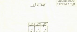
- A diagram of the planned site on the cadastral map. You can order a plot layout diagram without leaving your home. To do this, I recommend the ONLINE CADASTRE service, which sends a document ready for redistribution within 2 days. Cost - 2400 rubles, official data and compiled by a cadastral engineer in accordance with Resolution No. 762 of the Russian Ministry of Economic Development.
Layout of the land plot, which I recently ordered through the ONLINE CADASTRE
When the new layout of the landfill has been agreed upon, land surveying can begin. To choose a competent contractor, I created instructions for land surveying.
Within 14 days after payment, your land plot will begin to appear on the public cadastral map. If everything is done correctly and your intentions do not run counter to the law and the intentions of the state, you become the owner of the new plot.
What to do if they want to reduce the area of your land plot
A new law on land acquisition has been adopted
On June 17, the President of the Russian Federation signed a new law, which, with its provisions, amended the norms of the Law on Cadastral Activities (RF Federal Law No. 221 dated July 24, 2007) and the Law on State Registration of Real Estate (RF Federal Law No. 218 dated July 13, 2015) - RF Federal Law No. 150 (dated 06/17/2019). The text of the document was published on the Central Internet Portal of Legal Information on the same day.
The bill was proposed by representatives of the Ministry of Economic Development. The idea arose after a detailed analysis of the results of cadastral work carried out in 16 regions of the country.
Attention, if you have any questions, you can ask them to a lawyer on social issues by calling 8 804 333 16 88 or ask your question in a chat to the lawyer on duty. Calls are accepted 24 hours a day. The call is free! Call and solve your problem!
According to Rosreestr, since the adoption of laws requiring cadastral work to be carried out for registration, the number of lands registered in the Unified State Register of Land Registers has increased by 20%. Specialists from Rosreestr came to the conclusion that the implementation of cadastral work can significantly reduce the number of litigation on land issues. Plus, they are a guarantor of the protection of property rights of owners and allow local authorities to manage territories more efficiently.
The terms of the new law simplify the procedure for carrying out cadastral work. Now the cadastral engineer can use the data from technical passports and other documents for the land plot to carry them out.
According to the adopted law, if during the cadastral work the engineer discovers that the customer is actually using for his needs an area larger than indicated in the documents, the excess can be officially registered for use.
The regulatory act establishes the rules for carrying out cadastral work depending on the type of land plot and real estate located on it. For example, now they will differ for land allocated for vegetable gardens and gardening farms and for areas on which apartment buildings are located.
Is it possible to trim the same section in several stages?
Let’s say there is a state-owned plot adjacent to the land you own, which is not registered in the cadastral register. Is it possible to make an addition to a state plot within 10%, and then repeat the procedure until the state land plot is completely “exhausted”?
Personally, I don’t see anything illegal in this. However, it is better to resolve this issue specifically on the spot and with a cadastral engineer. The owner of the land plot can determine the fate of this land plot in any way not prohibited by law, namely: increase, decrease, divide, allocate, donate, sell, etc. The only thing that should be taken into account is that the site being formed does not exceed the permissible area limits (see the PZZ of your municipality), and also corresponds to the type of its permitted use.
Cadastral work for cutting off a plot
If the application is satisfied, an agreement will be drawn up between the owner and the local authority. With this document you can contact a cadastral engineer and undergo land surveying. The essence of this procedure is to establish characteristic points of the boundaries of the future single site.
Cadastral work is carried out using high-precision equipment, so the engineer will clearly determine whether the annexed territory does not exceed 10% of the area of the original site . After surveying, an act of coordination of boundaries with the owners of neighboring plots will be prepared. 30 days are given for consideration and signing of this act. If the act is signed without objection, you can contact Rosreestr for cadastral registration and registration of rights.
Problems may arise when agreeing on the boundaries of the act. Owners of adjacent plots may themselves express interest in the disputed territory, or object to the boundary points. To resolve disagreements, the cadastral engineer is obliged to carry out repeated boundary work and re-submit the act for approval. If in this case a refusal of approval is expressed, the boundaries can only be approved through the court.
Grounds for refusal to redistribute land
The grounds for refusal to conclude an agreement on the redistribution of land plots are the inconsistency of the submitted application with cases of redistribution of land plots, which are provided for by law:
- lack of consent of third parties, stated in writing, if the cut-off area is burdened with their rights, for example, a mortgage from a bank that requires approval from it; on the cut-off site there is a building or structure, an object of unfinished construction, owned by the municipality or the state, or owned by citizens or legal entities;
- the cut-off area refers to municipal or state lands withdrawn from circulation or limited in circulation; the cut-off area refers to lands reserved for state or municipal needs;
- for the cut-off area, a decision has been prepared to hold an auction with the publication of a notice of the holding and preliminary approval for its provision has been completed and the validity period of the decision has not yet expired; another application for preliminary approval for its provision has already been submitted for the cut-off area, but decisions have not yet been made either in agreeing and approving the layout scheme, or in refusing (as many like to say, “whoever stood up first, got his slippers”);
- the area of the cut-off plot will increase the area of the one formed by its merger with the main one, exceeding by more than 10% the established size of the maximum areas of land plots; the cut section cannot be considered as an “additive” and must be formed as an independent one;
- the boundaries of the main area to which the extension is planned require clarification, that is, if the main area is not demarcated; inconsistency with the layout of the land plot.