State Budgetary Institution – powers of state cadastral valuation institutions in 2021
So, from January 1, 2021, cadastral valuation of real estate is carried out in accordance with the provisions of the law of July 3, 2016 N 237-FZ (as amended on July 29, 2017) “On State Cadastral Valuation.” It wasn't always like this. Previously, the cadastral value was determined by third-party organizations on a competitive basis. Municipalities made a decision to conduct a state cadastral assessment, and then selected the work performers with whom they entered into a contract. This was provided for by the Law of July 29, 1998 N 135-FZ “On Valuation Activities in Russia”, which is still in force today, with the exception of a number of suspended articles.
What powers does the State Budgetary Institution have for cadastral valuation?
From January 1, 2021, the cadastral value is determined only by government organizations (GBU). The state budgetary institution for determining the cadastral value is created on the basis of an order or instruction from an authorized body of a constituent entity of the Russian Federation.
Thus, in each subject of Russia there is a government structure whose main functions and powers are:
- assessment of the cadastral value of real estate according to Law 237-F3 (in accordance with Article 14);
- determination of the cadastral value of newly created and registered objects;
- cadastral valuation of changed real estate objects (during an extension or demolition of part of a house, changing the area, etc.);
- collecting materials, processing data, as well as recording them on storage devices and storing information used during the cadastral valuation;
- providing Rosreestr with information obtained as a result of its activities.
Legislation on cadastral valuation and cadastral value of land
According to the current legislation, state cadastral valuation (determination of cadastral value) of land plots, revision and challenge of its results can be carried out in accordance with:
- Article 14 “Determination of cadastral value” of the Federal Law of July 3, 2016 No. 237-FZ “On State Cadastral Valuation” (as amended on July 29, 2017),
- Chapter III.1 “State cadastral valuation” of the Federal Law of July 29, 1998 No. 135-FZ (as amended on July 29, 2017) “On Valuation Activities in the Russian Federation” and
- Article 66 “Land Valuation” of the Land Code of the Russian Federation dated October 25, 2001 No. 136-FZ (as amended on December 31, 2017).
State cadastral valuation of a land plot is a set of procedures established by Part 3 of Article 6 of Federal Law No. 237-FZ:
- aimed at determining the cadastral value of a land plot and
- carried out in the manner established by Federal Law No. 237-FZ “On State Cadastral Valuation”.
The cadastral value of a land plot is the value of a land plot, determined in the manner prescribed by Federal Law No. 237-FZ “On State Cadastral Valuation”, as a result of a state cadastral valuation in accordance with the methodological instructions on the state cadastral valuation or in accordance with Articles 16, 20 , 21 or 22 of Federal Law No. 237-FZ.
The cadastral value of a land plot is established:
- in the process of state cadastral assessment of the market value of a land plot, determined by mass valuation methods, or,
- if it is impossible to determine the market value using mass valuation methods, the market value determined individually for a specific land plot in accordance with the legislation on valuation activities.
The cadastral value of land plots serves as the basis for calculating:
- land tax,
- land rent,
- as well as the redemption value of land owned by municipal or state property.
Cadastral value of a land plot as an object of taxation of land plots (land tax)
Since January 1, 2015, tax legislation has adopted their cadastral value as the main criterion for assessing land plots and property of individuals.
Tax base for calculating land tax:
- is determined as the cadastral value of land plots,
- recognized as an object of taxation in accordance with Article 389 “Object of taxation” of the Tax Code of the Russian Federation.
(clause 1 of article 390 “Tax base” of the Tax Code of the Russian Federation).
You can calculate land tax using a special service on the website of the Federal Tax Service of Russia - nalog.ru/rn77/service/nalog_calc .
The cadastral value of a land plot can also be applied:
- to determine the rent for a land plot that is in state or municipal ownership.
clause 5 art. 65 “Payment for land use” of the Land Code of the Russian Federation
Determination of the cadastral value of a land plot
The cadastral value of a land plot is determined in accordance with the land legislation of the Russian Federation:
- paragraph 2 of Article 66 “Land Valuation” of the Land Code of the Russian Federation as amended. dated December 31, 2017, it was determined
- that to establish the cadastral value of land plots
- a state cadastral assessment of land is carried out.
In turn, the state cadastral valuation of land plots is carried out in accordance with the legislation of the Russian Federation on valuation activities.
Chapter III.1 “State cadastral valuation” of the Federal Law of July 29, 1998 No. 135-FZ “On Valuation Activities in the Russian Federation” as amended. dated July 29, 2017, the following were established:
- the concept of state cadastral valuation of land plots;
- the procedure for conducting state cadastral valuation of land plots and forming a list of land plots subject to state cadastral valuation;
- the procedure for selecting a work contractor and concluding an agreement with him to conduct a cadastral valuation of land plots;
- the procedure for determining the cadastral value and drawing up a report on determining the cadastral value of land plots;
- the procedure for examining the report on determining the cadastral value of land plots;
- the procedure for approving the results of determining the cadastral value of land plots and considering disputes about the results of determining the cadastral value of land plots;
- the procedure for entering the results of determining the cadastral value of land plots into the Unified State Register of Real Estate (USRN).
Federal executive body exercising the functions of:
- on state registration of rights to land plots and transactions with them,
- for conducting state cadastral registration of land plots,
- land management, state monitoring of land, as well as functions of state cadastral valuation,
- Federal state supervision in the field of geodesy and cartography,
- state land supervision, supervision of the activities of self-regulatory organizations of appraisers, control of the activities of self-regulatory organizations of arbitration managers
is the Federal Service for State Registration, Cadastre and Cartography ( Rosreestr ).
Thus, issues related to determining the cadastral value of land plots fall within the competence of Rosreestr.
The procedure for conducting state cadastral valuation of land plots and determining their cadastral value
The procedure for conducting state cadastral valuation of land plots is established by Federal Law dated July 3, 2016 No. 237-FZ “On State Cadastral Valuation” and includes a combination of the following actions:
- making a decision to conduct a state cadastral valuation of land plots;
- determining the cadastral value of land plots and drawing up a report on the results of the state cadastral valuation of land plots;
- approval of the results of determining the cadastral value of land plots.
Making a decision to conduct a state cadastral valuation of land plots
State cadastral valuation of land plots is carried out by decision of the executive body of state power of a constituent entity of the Russian Federation no more than once every 3 years (in federal cities - no more than once every 2 years ) and at least once every 5 years , with the exception of extraordinary state cadastral valuation assessments.
The collection and processing of information necessary to determine the cadastral value of land plots is carried out by a budgetary institution created by a constituent entity of the Russian Federation.
Rosreestr compiles a list of land plots subject to state cadastral valuation based on the decision to conduct a state cadastral valuation and provides it to the authorized body of a constituent entity of the Russian Federation upon its request.
The list of land plots includes information from the Unified State Register of Real Estate (USRN) that is current as of January 1 of the year of determining the cadastral value of land plots about all land plots specified in the decision to conduct a state cadastral valuation.
Determination of the cadastral value of land plots and drawing up a report on the results of the state cadastral valuation of land plots
The determination of the cadastral value of land plots is carried out by a budgetary institution created by a constituent entity of the Russian Federation , in accordance with the methodological instructions on the state cadastral valuation of land plots.
Based on the results of determining the cadastral value of land plots, the budgetary institution draws up interim reporting documents in the form of an electronic document, which are a draft report.
The budgetary institution, within 3 working days from the date of preparation of interim reporting documents, posts them on its official website and sends them to Rosreestr on electronic media in the form of an electronic document.
If the interim reporting documents meet the reporting requirements:
- Rosreestr, within 3 working days from the date of completion of their inspection, places in the data fund of the state cadastral valuation of land plots the information and materials contained in the interim reporting documents, for 60 days for the submission of comments related to the determination of the cadastral value, and
- information on the procedure and deadlines for submitting comments on interim reporting documents.
Comments on the results of determining the cadastral value of land plots:
- submitted within 50 days from the date of publication of the specified information and materials by any interested parties
- to a budgetary institution or multifunctional center for the provision of state and municipal services (MFC).
A budgetary institution at least once every 5 days during the period of posting interim reporting documents on the results of determining the cadastral value of land plots publishes on its official website:
- updated interim reporting documents;
- information on cadastral numbers of land plots, the cadastral value of which has been recalculated;
- a description of the recalculation of the cadastral value of each land plot with the rationale for taking into account the comments;
- information about comments that were not taken into account, with appropriate justification for refusing to take them into account.
The budgetary institution makes changes to the interim reporting documents based on the results of consideration of comments to them:
- no later than the end of the period for placing information and materials in the data fund for cadastral valuation of land plots and
- within 10 days after the expiration of the specified period, draws up a report, including a certificate with information about the taken into account and unaccounted comments to the interim reporting documents with the justification for their accounting, refusal to take into account or the absence of comments, as well as the correction of violations of the reporting requirements identified by Rosreestr.
Within 3 working days from the date of drawing up the report, the budgetary institution sends it on electronic media in the form of an electronic document to Rosreestr.
Within 20 working days, Rosreestr checks the report for compliance with the reporting requirements and sends an order to eliminate the identified violations or a notification of the absence of violations to the budgetary institution and the authorized body of the constituent entity of the Russian Federation.
If no violations are detected, the budgetary institution, within 3 working days from the date of receipt of the notification of the absence of violations, sends to the authorized body of the constituent entity of the Russian Federation three copies of the report on the cadastral value of land plots on electronic media in the form of an electronic document and one copy of the report on paper.
Approval of the results of determining the cadastral value of land plots
Authorized body of the constituent entity of the Russian Federation:
- within 20 working days from the date of receipt of the report on the cadastral value of land plots
- approves the results contained in such a report by adopting a corresponding act on approval of the results of determining the cadastral value of land plots and
- within 30 working days from the date of adoption of such an act, ensure its official publication and inform about its adoption.
The act on approval of the results of determining the cadastral value of land plots comes into force on January 1 of the year following the year of the state cadastral valuation of land plots, but not earlier than after one month from the date of its promulgation (official publication).
Authorized body of the constituent entity of the Russian Federation:
- within 3 working days from the date of official publication of the act on approval of the results of determining the cadastral value of land plots,
- but no later than December 1 of the year of the state cadastral valuation of land plots
- sends a copy of it and a copy of the report compiled on electronic media in the form of an electronic document to Rosreestr for entering into the Unified State Register of Real Estate (USRN) information about the cadastral value of land plots and placement in the data fund of the state cadastral valuation of land plots.
How to find out the cadastral value of a land plot
Information on the cadastral value of a land plot contained in the Unified State Register of Real Estate (USRN) can be found by receiving an extract from the USRN on the cadastral value of the land plot.
The extract form was approved by order of the Ministry of Economic Development of Russia dated December 25, 2015 No. 975
Information on the cadastral value of a land plot is provided:
- at the request of any person,
- including through the use of public information and telecommunication networks,
- including the Internet, including a single portal, a unified system of interdepartmental electronic interaction and regional systems of interdepartmental electronic interaction connected to it,
- other technical means of communication, as well as
- by providing access to the federal state information system for maintaining the Unified State Register of Real Estate (USRN) or other means.
Cadastral value of a land plot: using the service “Reference information on real estate objects online”
To obtain reference information on the cadastral value of a land plot online:
- you can use a special service on the Rosreestr website rosreestr.ru in the “Electronic Services” section;
- Using the cadastral number, conditional number or address of the land plot, you can obtain reference information about the land plot, including information about its cadastral value.
Cadastral value of a land plot: using the “Public Cadastral Map” service
The public cadastral map is located at pkk5.rosreestr.ru and contains information from the Unified State Register of Real Estate (USRN).
The required land plot can be found on the public cadastral map:
- by cadastral number of the land plot, as well as
- use advanced search.
For each land plot, the data of which is contained in the Public Cadastral Map, you can find out general information, including the area and cadastral value of the land plot, as well as the characteristics of the land plot and who its owner is. The information in the Public Cadastral Map is for reference only and cannot be used as a legally significant document.
Cadastral value of a land plot: using the service “Obtaining information from the state cadastral valuation data fund”
Using the service on the Rosreestr website “Obtaining information from the state cadastral valuation data fund” ( rosreestr.ru/wps/portal/cc_ib_svedFDGKO ), you can also find out information about the cadastral value of a land plot contained in the state cadastral valuation data fund of land plots.
In this case, you can find out information about the cadastral value of a land plot included in the state cadastral valuation data fund in the following cases:
- determining the cadastral value of a land plot within the framework of the state cadastral valuation;
- determining the cadastral value of a land plot in the amount of its market value.
Searching for information about the cadastral value of a land plot in the service is carried out by its cadastral number in the search field:
- after entering the cadastral number of the land plot, you need to click on the “Find” button;
- a link will open to a tab with information about the requested land plot or
- an inscription indicating the absence of such data (if they are not available in the state cadastral valuation data fund).
You can also download a report on determining the cadastral value of land plots, which contains information about the land plot of interest. Service information is provided free of charge in real time.
How to review the results of determining the cadastral value of a land plot
In accordance with Federal Law No. 135-FZ of July 29, 1998 “On Valuation Activities in the Russian Federation,” the results of determining the cadastral value of a land plot can be revised:
- in court and
- in the commission for the consideration of disputes about the results of determining the cadastral value (commission) of the land plot.
The review of the cadastral value of a land plot in court is carried out in accordance with the procedure established by law for the consideration of judicial disputes.
Moreover, for individuals to review the results of determining the cadastral value of a land plot in court:
- Pre-application to the commission is not mandatory.
The possibility of revising the results of determining the cadastral value of a land plot in the commission is provided for:
- Article 24.18 “Consideration of disputes regarding the results of determining the cadastral value” of the Federal Law of July 29, 1998 No. 135-FZ “On Valuation Activities in the Russian Federation” and
- the procedure for the creation and work of a commission for the consideration of disputes regarding the results of determining the cadastral value, approved by order of the Ministry of Economic Development of Russia dated 05/04/2012 No. 263 “On approval of the Procedure for the creation and work of a commission for the consideration of disputes regarding the results of determining the cadastral value” (as amended on 03/03/2017) .
Commissions for the consideration of disputes regarding the results of determining the cadastral value of land plots have been created and function under each department of Rosreestr in a constituent entity of the Russian Federation.
The basis for revising the results of determining the cadastral value of a land plot in the commission is:
- unreliability of information about the land plot used in determining its cadastral value;
- establishing in relation to a land plot its market value on the date as of which its cadastral value was established.
To review the results of determining the cadastral value of a land plot, the applicant must submit an application to the commission.
The procedure for revising the results of determining the cadastral value of a land plot will be discussed in more detail in the following material.
If you have any questions about the violation of your rights, or you find yourself in a difficult life situation, then an online duty lawyer is ready to advise you on this issue for free.
LAND LAW AND LAND LEGISLATION IN THE RF
Requirements for State Budgetary Institution specialists carrying out cadastral valuation of real estate
GBU employees who determine the cadastral value must meet the following qualification requirements :
- have a higher education in one of the fields: management, economics, mathematics, computer science, geoscience, biology, architecture, technology, applied geology, geodesy, mining, oil and gas, business, agriculture, forestry and fisheries;
- be unconvicted citizens of the Russian Federation;
- have experience in the field of determining cadastral value (from 3 years) - for those who sign the cadastral value report.
Requirements for employees of the State Budgetary Institution for cadastral valuation are prescribed at the federal level in Law 237-FZ, as well as in Order of the Ministry of Economic Development dated July 12, 2017 No. 177.
Center for State Cadastral Valuation
GBU for determining cadastral value is often called the center of state cadastral valuation.
Indeed, on the territory of a subject of the Russian Federation, be it a region, a republic, a district or a region, there is one institution that determines the cadastral value - this is a kind of central apparatus operating in a certain territory. In each subject, these institutions have their own numbers, staffing, additional functions and powers, and also have an individual name.
For example, in the Leningrad region - State Budgetary Institution "LenKadOtsenka", In Crimea - State Budgetary Institution "Land Management [/anchor] and Cadastral Valuation", in Mordovia - State Budgetary Institution "Property Fund" but most often, for example, in Altai, Buryatia, Yakutia, Amur , Belgorod and other regions, the state-authorized institution for determining cadastral value is called the Center for State Cadastral Valuation.
Methods for assessing the cadastral value of a land plot
In addition to the cadastral value of land, there is the concept of market value. The main difference between a cadastral valuation and a market valuation is that in the first case the value of a group of objects is determined, and in the second - one specific object. This allows you to better take into account all the factors affecting the cost. Taking into account supply and demand, seasonality and competitiveness, both cadastral and market values are determined.
An overestimation of the cadastral value during an assessment entails a significant increase in property tax. Order a cadastral valuation
It is important
Ideally, the cadastral and market values of land should be the same. In practice, the first can exceed the second by more than 2–3 times, which is due to the imperfection of the calculation mechanism and the neglect of the demand factor during the cadastral valuation. This circumstance gives rise to discontent among landowners who are not willing to pay increased tax amounts. Therefore, Article 66 of the Land Code of the Russian Federation indicates that in cases where it is possible to determine the market value of a land plot, the cadastral value is accepted as equal to it. Accordingly, there are grounds for challenging the inflated cadastral value in court.
This is a more flexible indicator that reflects factors such as seasonality, competitiveness of the property being assessed, and prices for similar plots. The market value of a land plot cannot exceed the purchase price of a similar property.
Federal Law No. 237-FZ, which entered into force in 2021, provides for the introduction of the institute of state cadastral appraisers and the vesting of powers to determine the cadastral value of state budgetary institutions (GBU). The law assigns responsibility for the work of government agencies to conduct cadastral valuations to regional authorities. According to the new document, assessments according to the new rules in all constituent entities of the Russian Federation will be carried out starting in 2021, but regions, at their discretion, can switch to a new format of work starting in 2021.
The main factors influencing the cadastral value of a land plot are:
- The type of permitted use is established by acts of state authorities and local self-government.
- Land area.
- Location of the land plot.
The assignment of a land plot to a specific type of use is subject to rules. If real estate objects are located on the land, then the purpose of the site must correspond to the use of these objects.
For your information
If there is a building on the land, referred to in the technical passport as an “office”, the site itself will be classified as a group of “land plots intended for the placement of office buildings for business and commercial purposes”. If office and industrial buildings are built on a site, two types of permitted use are assigned to it simultaneously. If a plot of land is not developed, it can be assigned any of 17 types of permitted use, subject to compliance with the requirements of urban planning and sanitary protection norms and rules.
When assessing land, two methods can be used: income and comparative.
Comparative approach
Used to evaluate typical plots of land whose market value is well known. The approach is based on comparison of information on sales prices of similar land plots (substitution principle). For comparison, 3 to 5 analogues are selected. Accordingly, the approach can only be applied in cases where there are offers on the market for the sale of similar plots.
Income approach
Based on determining the amount of expected income (rent) from the commercial exploitation of land. They can be calculated based on data on previously received income. Obviously, the method is applicable only to those objects that bring profit to the owner.
Regardless of the chosen method, the appraiser uses data such as the presence of infrastructure, communications, type of relief, soil condition, etc. His task is to determine the real price of land as objectively as possible.
Some organizations may offer a wide range of services for the valuation of both tangible and intangible assets. Find out more about services
Cadastral Valuation Data Fund
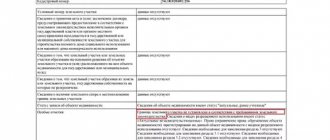
The Federal Cadastre and Cartography Service (Rosreestr) on its official website https://rosreestr.ru/ contains information on the assessment of cadastral value. This section of information is called “Cadastral Valuation Data Fund”. Here you can enter the cadastral number of your property (land plot, house) of interest and find out what the cadastral value of the property is, the date of the assessment, information about the results of the cadastral assessment.
In addition, you can find out when and where valuation activities are planned, as well as find out other information of interest about the cadastral valuation and the possibilities of challenging it. But not all information in the Cadastral Valuation Data Fund is freely available - some is hidden and accessible only to Rosreestr employees.