Cost of 1st expert hour: from 2,082.4 rubles.
You can leave a request by phone: +7 (499) 490-44-30
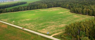
This procedure is one of the most complex and popular types of examinations. This is due to the peculiarities of land relations in Russia, where land ownership appeared relatively recently. Most land plots do not have land surveys and established boundaries, which leads to seizure or illegal seizure of land. The emerging contradictions can be resolved only by conducting a land management examination.
Goals and objectives of land management examination
Land management examination is most often carried out in the interests of land owners, but can also be appointed as part of arbitration or civil proceedings.
Goals and objectives
- determination of the actual boundaries and area of the land plot, followed by checking them for compliance with land management documentation;
- checking the legality of construction of buildings on a land plot;
- determining the possibility of dividing the site or expanding its boundaries;
- elimination of errors in land management documentation or cadastre;
- Determining the condition and quality of the land, whether it is negatively impacted during land use;
- Establishing an easement on a land plot.
Calculate the cost of land management examination online
The procedure for conducting land management examination
An independent land survey may be carried out on the initiative of:
- owner or other legal owner of the land plot (both the one being inspected and adjacent to it);
- authorities: local administrations, supervisory authorities, land committees, etc.;
- courts in cases where they resolve disputes.
Depending on the purpose of the study and the questions posed to the expert, the examination procedure changes. It may be purely documentary in nature or require a specialist to travel to the site to carry out a visual and instrumental examination.
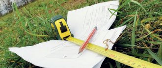
The expert will need the following documents:
- title documents for the research object;
- boundary plan (if available);
- cadastral extract about the land plot;
- acts of authorities on the provision of a site and establishing its size, boundaries and other documents related to the object of study.
Based on the results of the study, the expert draws up an independent opinion.
Objects of study during land management examination
land;
land management objects;
documents containing information about land management objects.
+7 (499) 490-44-30 Free consultation
The most common list of questions for an expert/specialist
What is the actual area of the land?
Does the actual area of the land plot correspond to the area indicated in the documents?
Do the actual boundaries of the site coincide with the data of the cadastral extract and boundary plan?
Has the boundaries of adjacent land plots overlapped?
Were any violations committed during land management work?
Is it allowed to build an object with the specified parameters on the land being inspected?
The expert organization must be accredited to conduct judicial and independent land surveys. Such services are provided by both government and non-government institutions. In this case, the period of state examination is, as a rule, 2 or more months. ANO "MSEB" has all the necessary documents and tools for conducting independent land management examinations and extrajudicial studies. The work time ranges from 15 to 30 days, depending on the complexity of the tasks.
ANO "MSEB" has accreditation with the Ministry of Justice of the Russian Federation. The staff includes more than 50 experts with experience in government agencies. The laboratory is equipped with modern geodetic instruments that provide millimeter measurement accuracy.
We promptly prepare a conclusion and are responsible for the result of the examination.
The cost of conducting a land management examination in Moscow
The final amount depends on the number and content of questions posed to the expert, on the type of object and the availability of mandatory documentation, scale, structural complexity of the building and territorial remoteness.
ANO “MSEB” has established a uniform pricing of expert time (hours); depending on the complexity of the study, categories of complexity have been determined for each type of examination, taking into account the expended expert time. Land management examination, 1st category.
from RUB 2,082.40 for 1 expert hour, 16 hours
Land management examination, 2nd category. from RUB 2,082.40 for 1 expert hour, 32 hours
Land management examination, 3rd category. from RUB 2,082.40 for 1 expert hour, 77 hours
The need to conduct a land management examination arose simultaneously with the opportunity to register a land plot as property. Thanks to the entry into force of Federal Law 136-FZ of October 25, 2001, a new type of right appeared for legal entities and individuals - land ownership.
The active practice of registering land ownership began in the 90s. During this period, land surveying was most often carried out without fixing the boundaries on the ground, which subsequently led to a discrepancy between the actual areas and boundaries of land plots and those specified in the title documents. In addition, at that time the system of maintaining a land cadastre was in its infancy. The result of a haphazard approach to the registration of land rights was the emergence of land disputes. In addition to a land dispute, the basis for an examination may be a court order or the desire of the copyright holder to find out whether the boundaries and area of land use correspond to the property certificate. Also, the reason for conducting a land management examination may be the imposition of boundaries of land plots. The most common reason for conducting an examination is land squatting. Who has the right to conduct a land survey? The right to conduct land management examination currently belongs to the Federal Service for State Registration, Cadastre and Cartography (Rosreestr). An examination of a land plot, carried out by Rosreestr, can be initiated both in accordance with the established inspection plan, and at the request of the land user. In the event of disputes regarding the boundaries of adjacent land plots between their owners, licensed land management organizations that have on their staff qualified specialists and experts in the field of land management work are vested with the authority to conduct an examination as appointed by the court. What types of land management expertise are divided into? The examination of land plots in the event of land disputes can be divided into two main types: •pre-trial examination; •examination ordered by the court. In the first case, expert work can be ordered for the purpose of presenting the results to an adjacent land user as an argument to resolve a territorial dispute. When conducting a land management examination ordered by the court, the results of the expert work serve as irrefutable evidence for making a court decision in favor of one of the participants in the land dispute. How is expert work on land carried out? Before carrying out expert work, the customer-plaintiff selects several, in his opinion, suitable organizations performing such work and submits it to the judge for consideration. By determination of the court, an organization is appointed that will conduct the examination, and the court sets before the experts a list of questions and answers to which must be presented in the examination materials. Based on the results of the examination, a report is drawn up containing the most acceptable, in the opinion of the experts who conducted the examination, options for resolving the conflict situation and the expert’s conclusion. All of the above materials are provided to the court. The specialists who prepared the report and technical conclusion are invited to the court hearing as experts. In the event that the court makes a very controversial decision, the need arises to conduct an independent land management examination. The results of a previously conducted examination are subject to detailed study and analysis by specialists from the organization that conducted the independent examination, and a review of the conclusion on the previous examination is compiled. Thus, the plaintiff has another opportunity to prove his case and win the trial.
In what cases may an examination be required?
Expertise is required in case of legal disputes:
- on refusals of the right to register a land plot in the cadastre (issuing a number);
- on recognition of ownership of the territory;
- on the seizure of land by representatives of the executive branch;
- to recognize the illegality of unauthorized constructions on the territory by the other party;
- on establishing the exact boundaries of the territory in kind;
- to establish the order of land use;
- on combining or dividing plots;
- to determine the location of allocated land from agricultural shares.
What does the examination provide for determining the boundaries of a land plot?
Boundary imposition is a serious problem for property owners involved in various disputes. If you do not deal with this issue, then unpleasant consequences are possible:
- loss of rights to capital construction projects;
- transfer of the area of your plot in favor of the neighboring one;
- inability to sell, buy, donate, officially lease, or divide land.
An examination of the boundaries of a land plot will allow us to determine the reasons for the appearance of overlapping boundaries, identify inconsistencies in the information included in the state cadastre, determine the actual boundaries, and provide options for resolving disputes.
What does the procedure include?
Carrying out an examination to establish the boundaries of a land plot includes :
- activities to study existing cadastral documentation,
- reasons for imposing boundaries;
- analysis of the overlap area and essential characteristics of the sites - what kind of buildings, what is the percentage of development, cartographic survey;
- determination of actual boundaries;
- identifying ways to eliminate non-conformity.
Additionally, we conduct an assessment of the land plot.
An examination to determine the boundaries of a land plot can be carried out during pre-trial proceedings or at the initiative of the court. The interested party can independently contact cadastral engineers.
These issues can be resolved out of court by ordering research from a cadastral engineer and preparing a boundary plan indicating the boundaries of your site. Based on the results, an act of coordination of boundaries with adjacent areas is drawn up. It must be signed with each neighbor, because... Without this approval, it will not be possible to register it in the cadastral register. If the reduction in the total area of the plot did not work out, the neighbors calmly go to sign the act, and the problem will be solved. But often neighbors refuse to sign the acts, especially if there is a need to move fences or their territory should be significantly reduced.
Documents required for the examination
- Title documents: - acts of state authorities or local self-government, - contracts and other transactions in relation to real estate, - acts (certificates) on the privatization of residential premises, - certificates of the right to inheritance, - judicial acts, - acts (certificates) of rights for real estate and others.
- Title documents (certificate, information from the unified state register of real estate).
- Inventory materials, technical passports, technical plans, inspection reports.
- Boundary plans, land management (land survey) files, map plans of the territory, layout of a land plot on a public cadastral map, plan diagrams.
- Cartographic materials (topographic survey, compass maps, forest management materials, land management materials).
Problems to be solved
The main tasks of the examination:
- determining the condition of the soil, including soil studies to understand the reasons for the changes that have occurred (geobotanical studies and tests are carried out);
- soil quality assessment;
- calculation of the cost of laying a pipeline through someone else’s section, channels for drainage of liquids, passage of equipment, etc.;
- identifying the real boundaries of the territory, setting exact coordinates;
- reconciliation of the installation locations of boundary markers with their positions in the legal documentation for the site (detection of the area of overlap with the adjacent land plot);
- establishing the market value of land property;
- checking compliance of site corner markers with standards for such devices;
- identifying cause and effect between the current state of the earth and the influence of external factors on it;
- detection of errors in the cadastre;
- determining the possibility of dividing the territory between owners in proportion to their shares.
When does the concept of “boundary imposition” arise?
Boundary overlap is the mutual intersection of boundary lines in adjacent areas. It turns out that the same plot is defined as belonging simultaneously to two neighboring plots.
There are overlays:
- natural (formal) boundaries, when a private individual or municipality seizes part of the owner’s land;
- actual boundaries determined during land surveying, when the cadastral engineer orders to move the boundaries and add territory that is indicated on the cadastral plan as neighboring.
Sometimes incorrect adjustments were made to a completed plan. It is most difficult to carry out a cadastral examination of the boundaries of a land plot
Types of documentation subject to examination
The examination can be carried out both in relation to documents for private plots and for state lands. For example, land management schemes for state and municipal lands, projects for the use and protection of these lands are subject to examination. The study of these documents can be carried out both routinely and during the investigation of various incidents related, for example, to the misuse of land territories, or to the alienation of state lands into private hands.
Particular attention is traditionally paid to documents regulating the use of agricultural land. Considering that in recent years there have been numerous subsidies to the agricultural sector, such an examination is carried out quite often in relation to certain projects. It is also worth noting the controversial situations that inevitably arise in the process of redistribution of agricultural land. Even within the same district, land can have different properties, and real legal wars can break out over this or that plot. So, only through the examination of title documents for land and projects for its use, it is possible to decide exactly how to distribute plots.
In addition, it is worth remembering that each district has its own list of land management documentation that is subject to examination. One way or another, all regions develop differently, and everywhere the land is used for different purposes. Therefore, the state examination of land management documentation, although it implies a unified procedure, may still involve working with different documents.