All articles
107569
2021-03-13
To accurately determine the amount of property taxation, each property owner needs to understand how to calculate the cadastral value of a property. We will tell you more about this in this article.
Carrying out any transactions with real estate requires calculating the estimated value of the property according to the cadastre. This indicator is the main one when calculating the property tax that is imposed on the real estate of individuals and legal entities.
Cadastral value - what is it?
Cadastral value (price) is a key indicator used in determining the amount of tax collection for the ownership of real estate for individuals and legal entities. According to the provisions of state legislation, the following objects are subject to property tax:
- private houses;
- plots of land;
- apartments;
- rooms.
Each of the objects has its own value according to the extract from the Unified State Register, which directly affects the amount of tax collection.
What does the cadastral value consist of and how is it formed?
So, what does the cadastral value consist of and how is it formed? Since for most people the definition of market value is more familiar and understandable, first it is worth noting the fundamental difference between them (read more about the difference in assessments here), which lies in the purposes of their determination. The market price is determined for the purpose of purchase and sale by a compromise between the buyer and the seller in real market conditions and competition, and it can be formed by a number of factors (up to the “view from the window” and “Euro-quality renovation”). While the cadastral value of an object is calculated by the state for tax purposes, therefore “friendly neighbors” or “decorative items” are not taken into account. And so, the cadastral value is calculated in accordance with Order of the Ministry of Economic Development dated May 12, 2017 No. 226 and is formed by the following factors:
- physical properties of the object (age, material, wear resistance, etc.);
- technical and operational characteristics of the facility;
- presence (or absence) of engineering and transport infrastructure;
- characteristics of nearby territories (their degree of development);
- the presence of relief (land), which can affect the cost;
- integral internal equipment, without which the operation of the facility is impossible or significantly difficult, taking into account the type of its use (for capital construction projects).
Also, to determine the cadastral value of an object, such pricing factors as the external environment of the object (regional economy, ecology, etc.) and the state of the real estate market are taken into account (an approximate list of pricing factors is presented in the guidelines approved by Order of the Ministry of Economic Development dated May 12, 2017 No. 226 (hereinafter - "Instructions")). It is worth noting that such information is taken exclusively from official sources and must be documented. The State Budgetary Institution has the right to request information necessary for calculating the cadastral value from federal executive authorities and organizations subordinate to them. In addition, the appraiser (employee of the State Budgetary Institution) has the right to additionally use and enter into the calculation of the cadastral value correction and other coefficients provided for in the Directions.
What determines the size of the cadastral value of a land plot?
Calculations of the amount of tax collection on land plots are carried out on the basis of the Land Code of the Russian Federation, approved by the municipal authorities. The final amount depends on the parameters of the land plot and includes the category, purpose, number of square meters of plot, etc.
The price of land according to the cadastral passport is a monetary amount that expresses the real value of the territory. Most often, the cadastral price is higher than the market price, so owners have to pay fees at a higher rate.
Cadastral valuation of land: procedure and methods for calculating the value of land plots
For many years, the state used the concept of inventory value of land for tax purposes. It was far from the market price, so the amount of land tax turned out to be extremely insignificant. The situation changed dramatically when the concept of “cadastral value of land” entered legal practice, significantly approaching the market price. And now the size of payments tied to the results of cadastral valuation of land may turn out to be impressive. Let's take a closer look at what the features of cadastral valuation are for different types of land, how it is carried out, and most importantly, why it is important that the information in the Unified Register corresponds to the real value of the site.
What is a cadastral valuation and why is it needed? The State Land Cadastre (register) is a systematized and ordered list of all plots of land in Russia. In other words, it is a database of all territories. Each site has its own description and accompanying documents. Total accounting allows you to evaluate land use, identify trends and avoid violations. In addition, each plot of land is also a piece of real estate that can be sold or bought. In this situation, the question of determining value arises. To avoid disagreements, a cadastral valuation of land is carried out.
Cadastral value is one of the main characteristics of a site. Cadastral valuation of land plots allows this value to be identified and officially recorded. This is necessary to solve a whole range of problems:
- At the state level - to create a unified system of taxation of lands that are state or privately owned, which allows for the most accurate calculation of taxes, filling budgets, and making forecasts regarding tax collections.
- At the level of constituent entities of the Russian Federation - for making decisions on the rational use of land, privatization, distribution and redistribution, issuing construction permits - in a word, for effective land management.
- At the level of private owners - for fair calculation of taxes, for determining market value, for purchasing and selling, leasing, investing in land, etc.
Land plots that have undergone cadastral valuation are entered into the Unified Register indicating not only the identified value, but also the owner. An extract from the register is a direct confirmation of the legality of land use. The specified amount is used to calculate property tax. Cadastral valuation of land and real estate is carried out before any transactions: sale, donation, rental. This indicator is necessary for calculating rent for the use of state lands. Based on it, government subsidies are calculated. The cadastral value becomes the starting price when putting up land for auction.
In Russia, a large number of federal laws, standards and regulations relating to land valuation have been developed and put into practice. Among them:
- Land Code of the Russian Federation;
- Federal Law of July 29, 1998 No. 135-FZ “On Valuation Activities in the Russian Federation”;
- Federal Law of July 3, 2021 No. 237-FZ “On State Cadastral Valuation” (in force from 2021, with the exception of the provisions on conducting an extraordinary state cadastral valuation, which come into force from 2021);
- Federal Law of July 24, 2007 No. 221-FZ “On Cadastral Activities”;
- Federal Law of July 13, 2015 No. 218-FZ “On State Registration of Real Estate” (effective from 2021 with the exception of certain provisions that come into force from 2020);
- Order of the Ministry of Economic Development of Russia dated June 7, 2021 No. 358 “On approval of methodological instructions on state cadastral valuation”;
- Order of the Ministry of Economic Development of Russia dated September 20, 2010 No. 445 “On approval of the Guidelines for the state cadastral valuation of agricultural land”;
- Order of the Ministry of Economic Development of Russia dated February 15, 2007 No. 39 “On approval of Methodological Instructions for the state cadastral valuation of lands in settlements”; Order of the Ministry of Economic Development of Russia dated August 12, 2006 No. 222 “On approval of the Guidelines for determining the cadastral value of newly formed land plots and existing land plots in cases of changing the category of land, the type of permitted use or clarifying the area of the land plot”;
- Order of the Ministry of Economic Development of Russia dated December 8, 2015 No. 921 “On approval of the form and composition of land survey plan information, requirements for its preparation” (valid from 2021);
- Order of the Ministry of Economic Development of Russia dated March 1, 2021 No. 90 “On approval of requirements for accuracy and methods for determining the coordinates of characteristic points of the boundaries of a land plot, requirements for accuracy and methods for determining coordinates of characteristic points of the contour of a building, structure or unfinished construction site on a land plot, as well as requirements to determine the area of a building, structure and premises" (valid from 2021); Decree of the Government of the Russian Federation of August 25, 1999 No. 945 “On the state cadastral valuation of land”;
- Decree of the Government of the Russian Federation of April 8, 2000 No. 316 “On approval of the Rules for conducting state cadastral valuation of land”;
- Federal Assessment Standard (FSO No. 1) “General concepts of assessment, approaches to assessment and requirements for assessment”;
- Federal Valuation Standard (FSO No. 2) “Purpose of Valuation and Types of Value”;
- Federal Assessment Standard (FSO No. 3) “Requirements for an assessment report”;
- Federal Valuation Standard (FSO No. 4) “Determination of the cadastral value of real estate objects.”
Thus, laws and regulations determine who has the right to conduct an assessment, how often, by what methods, according to what algorithm, etc. A serious approach allows us to identify the objective value, prevent violations and facts of illegal use or sale of land.
Procedure
Currently, the function of conducting state cadastral valuation of land plots is assigned to the Federal Service for State Registration, Cadastre and Cartography (Rosreestr), which is under the jurisdiction of the Ministry of Economic Development of Russia. Federal Law No. 237-FZ, which entered into force in 2021, provides for the introduction of the institute of state cadastral appraisers and the vesting of powers to determine the cadastral value of state budgetary institutions (GBU). The law assigns responsibility for the work of government agencies to conduct cadastral valuations to regional authorities. According to the new document, assessments according to the new rules in all constituent entities of the Russian Federation will be carried out starting in 2021, but regions, at their discretion, can switch to a new format of work starting in 2021. State assessment of land should be carried out no more than once every 3 years and at least once every 5 years - at the same time for all land plots located on the territory of an administrative-territorial unit. For Moscow and St. Petersburg, the deadline is set at least once every 3 years. The frequency is determined by the changing situation on the real estate market and the general economic situation. The decision to assess the value of land is made by the authorized body of the constituent entity of the Russian Federation, and it also prepares a list of plots. The territory is then divided into assessment zones. Belonging to a particular zone affects the value of the site, determines the conditions for its use, the amount of property tax, while the objects on the site are not taken into account, that is, the site itself is assessed as “conditionally undeveloped”. The following stages of the procedure can be distinguished:
- preparation of an information base: analysis of the local land market, the price range for land plots of various categories and locations, study of legislation, judicial practice, etc.;
- dividing the territory to be assessed into zones and blocks;
- formation and justification of cost indicators that will be used in cadastral valuation; determining the value of land within each zone;
- registration of cadastral land valuation results, entry into the State Land Register.
To obtain objective information about the value of land, correct calculation of tax, sale (purchase) of land for a fair price, etc. A clearly regulated procedure for conducting cadastral valuation of land is required. However, an absolutely clear methodology has not currently been developed, so conducting an independent assessment in a commercial organization often helps to challenge the established cadastral value. If land owners who do not agree with the cadastral assessment of their property were able to challenge it or the registering authority independently identified errors, a recalculation of the land tax (LT) is made.
Methods for assessing the cadastral value of a land plot
In addition to the cadastral value of land, there is the concept of market value. The main difference between a cadastral valuation and a market valuation is that in the first case the value of a group of objects is determined, and in the second - one specific object. This allows you to better take into account all the factors affecting the cost. Taking into account supply and demand, seasonality and competitiveness, both cadastral and market values are determined.
This is a more flexible indicator that reflects factors such as seasonality, competitiveness of the property being assessed, and prices for similar plots. The market value of a land plot cannot exceed the purchase price of a similar property. An important figure for calculations is the specific indicator of the cadastral value of 1 m² of land. It is determined for different categories of land, types of use or individual cadastral blocks based on methodological recommendations for each category. The final cost of the plot is the result of multiplying the area by the specific cadastral value of 1 m² of land. If an object provides for several types of permitted use, therefore, several specific indicators, the maximum is selected among them.
The main factors influencing the cadastral value of a land plot are:
- The type of permitted use is established by acts of state authorities and local self-government.
- Land area.
- Location of the land plot.
The assignment of a land plot to a specific type of use is subject to rules. If real estate objects are located on the land, then the purpose of the site must correspond to the use of these objects.
When assessing land, two methods can be used: income and comparative.
- The comparative approach is used to evaluate typical plots of land whose market value is well known. The approach is based on comparison of information on sales prices of similar land plots (substitution principle). For comparison, 3 to 5 analogues are selected. Accordingly, the approach can only be applied in cases where there are offers on the market for the sale of similar plots.
- The income approach is based on determining the amounts of expected income (rent) from the commercial exploitation of land. They can be calculated based on data on previously received income. Obviously, the method is applicable only to those objects that bring profit to the owner. Regardless of the chosen method, the appraiser uses data such as the presence of infrastructure, communications, type of relief, soil condition, etc. His task is to determine the real price of land as objectively as possible.
Features of cadastral valuation of lands for various purposes
Calculation of cadastral value depends on the purpose of the land plot. So, if we are talking about the state cadastral valuation of lands of settlements, rural and urban settlements, gardening associations, etc., they use data from statistics of market prices for such objects, as well as data from other methods of land valuation. This means that for such sites a comparative approach prevails. Cadastral valuation of agricultural lands located outside urban and rural settlements, forest lands is carried out according to the income approach - the rental income indicator is taken into account. It, in turn, depends on soil fertility, technological properties, location and other factors. For each factor, their own integral indicators are derived. Cadastral valuation of land plots outside the city limits, belonging to other categories, is carried out on the basis of capitalization of estimated rental income (if the land generates income). This, in particular, applies to recreational facilities, subsoil use, etc.
Rules and conditions for making changes to the Unified State Register of Lands
Information on the cadastral value of a land plot obtained as a result of the assessment is entered into the Unified State Register of Lands. However, data may change over time, sometimes before the next assessment is due. For example, a citizen changed the type of permitted use of land and received the right to reduce the amount of tax. However, there will be no recalculation until the changes are reflected in the Unified Register. In order to avoid contradictions that may hinder purchase and sale transactions and other real estate transactions, the law provides for early amendments to the cadastre.
This can be done in the following cases:
- when the area of the site changes;
- when the address or description of the location of the land changes;
- when forest, water and other natural objects appear (disappear) on the site;
- when transferring land from one category to another;
- when restricting or changing the rights of the owner.
Only the owner of the plot or his representative with a notarized power of attorney can apply for changes to the Unified Register. The applicant must document the changes to be entered into the register. For example, if we are talking about transferring land to a new category, you should obtain an act from local government authorities approving a new method of using the land. The owner applies with this document and application to the Rosreestr office. After the changes have been made, he needs to obtain an extract from the territorial cadastral chamber and make sure that the information entered is true.
In practice, each case is individual, therefore, in order to correctly prepare documentation and carry out any operations related to land, it is recommended to seek the help of qualified specialists. The issues of establishing the objective cadastral value of land should be given priority attention. An incorrect cadastral valuation or out-of-date information in the register leads to the owner paying an increased amount of tax or receiving less money from the commercial use of the land. That is why it is important not only to timely monitor the situation on the land market, but also to use the services of professional appraisers with extensive experience.
Source: Komsomolskaya Pravda
Where to calculate the cadastral value of an apartment
Real estate owners no longer need to look for where to calculate the cadastral value of an apartment, since this can be done directly on our website. The procedure takes literally 1-2 minutes and only requires knowledge of the address or cadastral number of the property. To calculate the cadastral value through Rosreestr, you need to perform two simple steps:
- In the search line, enter the exact address of the object or cadastral number.
- Click the “Find Property” button and view information about the property.
This is the easiest way to obtain information. To obtain a certificate of the value of a passport, which is required for submission to a court or other institutions, you must leave an order in the appropriate section of the site.
Which body determines the cadastral value?
Before calculating the cadastral value of an apartment, it is important to know that the only body that maintains federal records of real estate is Rosreestr. The procedure for state registration of property in the name of the owner follows the following algorithm:
- Municipal authorities submit a request for the need to change the territory that falls under its jurisdiction.
- The list of plots subject to assessment is compiled by the Rosreestr department. The differences and characteristics of the object are stated, including the postal address, the presence of buildings on the territory and their qualities, as well as the total number of square meters of the territory.
- Specific indicators for land for each type of use are calculated. The procedure is carried out by the appraiser.
- Based on the assessment results, municipal authorities draw up an official legislative document.
- Data about the accommodation facility is entered into a unified federal database.
Important! To calculate the cadastral value online, you can simply order a certificate of cadastral value or a certificate from the Unified State Register of Real Estate on our website.
How to calculate the cadastral value of an apartment
Before calculating the specific cadastral value for an apartment, it is necessary to understand what values influence the formation of the price. The price according to the cadastre is influenced by:
- region and area of location;
- technical parameters of the object;
- general condition of the property;
- average income for residents of the locality.
There is no direct need to calculate the cadastral value of a house using a calculator, since government authorities update the estimated data from the Rosreestr database once every 5 years.
How and where to find out the methodology for calculating the cadastral value of a property
In order to become familiar with how and by what methodology the cadastral value of your property is calculated, you need to contact a state budgetary institution (hereinafter referred to as the “GBU”). Each subject of the Russian Federation has its own State Budgetary Institution, which is created by the authorized government body of the subject (for example, in the Moscow Region this is the Ministry of Property of the subject). It is the State Budgetary Institution, in accordance with the new legislation, that has the right to carry out state cadastral valuation; accordingly, all calculations and explanations of the calculation are their competence and area of responsibility. To receive official comments on determining the cadastral value of a particular property, a corresponding application is submitted to the State Budgetary Institution. After thirty days, the State Budgetary Institution will issue you an official explanation containing a description of the methodology, a list of pricing factors and other data used to calculate the cadastral value of your property.
How is the cadastral value of a land plot calculated?
You don’t know how to calculate the cadastral value, the formula is quite simple:
Sk = P * (Ki + Kl) * Kp, where:
Ck – cadastral value
P – land area
Ki – availability of infrastructure (in rubles per square meter)
Kl – specific factor (in rubles per square meter)
Кп – transition coefficient
Before calculating the cadastral value of a plot, one of the approaches (or a combination of them) is selected:
- income method - the amount of profit received from the operation of the site is determined, and its further income is predicted;
- comparative method - an analysis of the information available on the plot is carried out;
- cost method - an expert assessment of the plot is carried out to determine its value.
To determine the value from the cadastre, you will first need to evaluate the land. Data on each of the real estate objects that belong to a citizen must be entered into the state register. Property assessment is carried out by specialists from authorized government agencies.
Formation of groups of real estate objects
As a rule, to calculate the cadastral value, the method of mass valuation is used and only occasionally is it forced to be individual. A single valuation model is selected for a group of similar objects. For these purposes, real estate objects are differentiated into groups (subgroups) depending on their type (land plot, capital construction project, etc.), use, category, location and other characteristics. The grouping is carried out taking into account the existing segments of the real estate market. Each group (subgroup) is assigned specific codes, a list of which is also presented in the Guidelines. Taking into account these codes, a method and approach (a set of formulas and applied coefficients) for calculating the cadastral value of an object is determined.
Why is it necessary to establish a cadastral valuation, and what does it affect?
Cadastral valuation of property is one of the most important indicators among the characteristics of a land plot. Determining this indicator is necessary to solve the following problems:
- fair calculation of tax fees for owners of private real estate, accurate determination of the market value of property for rent, purchase and sale and investment in land plots;
- for the rational distribution of land plots by municipal authorities: privatization, redistribution, registration of construction permits and other management issues;
- at the level of state authorities, this makes it possible to create and maintain the functioning of a unified system for taxing lands in private and federal ownership, thanks to which it is possible to accurately calculate taxes, replenish the state treasury, and also predict changes in tax collections.
Important! There is no need to look for how to calculate the cadastral value using the formula; you just need to buy an extract from the Unified State Register of Real Estate on our website.
The result of the cadastral valuation of the property
Upon completion of all calculations, the State Budgetary Institution draws up a report on the results of the state cadastral valuation, which is the result of the cadastral valuation of the property. The report, consisting of the main part (explanatory and calculation) and appendices (initial data, calculation results), is sent to Rosreestr for review and further approval. Despite the fact that they strive to bring the cadastral value as close as possible to the conditions of the real market, its final value should not exceed the market price of the property.
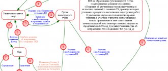
Is it possible to challenge or reduce
If the owner of the property believes that the assessment of the property according to the cadastre was carried out incorrectly, then he can rightfully go to court or Rosreestr to challenge it. If the owner proves erroneous calculations, the new cadastral price is applied to all previous periods when the tax was calculated at the erroneous price.
Having received a positive response, the property owner can receive a recalculation and compensation. However, you can only receive compensation for claims that are filed before January 1, 2021.
In what cases can the real price of an allotment be inflated?
There are only two cases when the real price of a land plot can be overestimated:
- Quite often, the price according to the cadastre increases for areas of certain types of use. This is due to the fact that the owner incorrectly indicated information about the operation of the allotment. Inaccuracies can be identified by examining the technical data sheet. You can correct the error by contacting Rosreestr.
- The value according to the cadastre may exceed the market value. In such a situation, a special commission is involved in the work, studying the documents on the property.