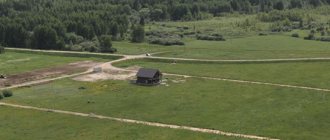
Problems with land surveying and house registration often arise due to cadastral errors. So, often, after a few years, such absurdities become clear that your house, which was successfully registered, turns out to be located on a neighbor’s property. Or even worse, part of the house goes beyond the boundaries of the site and is located where it is not allowed to be at all. And even if you are a conscientious taxpayer and at the time when you became the owner of the land you formalized all the rights as expected, having gone through many authorities, you are not immune from paperwork. These are the kind of sticks that the state sometimes puts in our wheels when it passes its abstruse laws. So, let’s look at what a cadastral error is and what it can mean.
A cadastral error is information entered into the Rosreestr database that does not correspond to the actual data. It arises due to incorrect calculations or negligence and is identified when comparing actual data and information already entered into the database. It turns out that someone was dishonest about their responsibilities - and what should we do to clean up the mess? Yes, unfortunately, this is actually what happens. After merging the databases and combining them into the Unified State Register of Real Estate (USRN), errors began to pop up and show themselves.
Causes of cadastral errors
The real estate cadastre is built on two fundamental principles:
- geodetic basis (state geodetic networks, coordinate system, geodetic measurements and mathematical processing of their results);
- cartographic basis (topographic maps and plans to be updated).
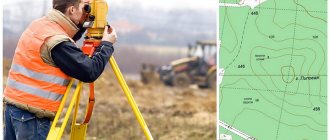
In geodesy, it is impossible to achieve the true value of a real value, since measurements are influenced by many factors. You can only get very close to this value. Therefore, random errors for geodetic measurements are the norm. The main thing is not to go beyond acceptable limits. Due to the introduction of new technologies, all geodetic and cartographic measurements have stepped forward. Modern, improved equipment makes it possible to carry out measurements more and more accurately. Ground-based geodetic measurement methods (triangulation, polygonometry) are being replaced by new space methods (trilateration). The speed of obtaining and processing accurate geodetic information is increasing, and state coordinate systems are being updated. New opportunities arise, compared to previous years, for updating data from global reference systems. Local coordinate systems appear in each administrative region. However, most of the plots are included in the Rosreestr database based on available approximate and unspecified information, without carrying out a survey procedure, which leads to the identification of cadastral errors.
Along with this, surveyors (cadastral engineers), having made a mistake when setting up a measuring device or making erroneous calculations, can also make cadastral errors such as crossing the boundaries of adjacent plots, overlapping one plot on another, shifting plots, etc. Therefore, not only cadastral information based on data from previous years entered into the electronic register, but also errors due to inability to use modern equipment are stored in databases until they are accidentally detected. Technical errors in geodetic and cadastral work, careless attitude, and low qualifications of specialists in the field of geodesy and cadastre lead to the occurrence of such errors.
Cadastral errors occur most often when:
- carrying out measuring work on faulty or outdated equipment;
- indicating inaccurate coordinates that do not correspond to reality;
- operating geodetic equipment without skills and knowledge;
- incorrect mathematical calculations;
- inattention and irresponsibility;
- using unverified information without visiting the site.
Types of cadastral errors
Article 61 of the Federal Law of July 13, 2015 N 218-FZ “On State Registration of Real Estate” designates two types of errors:
A technical error. These are typos, distortions of names, errors in numbers and letters. Such errors arise due to the inattention of the registrar or due to the fact that the Rosreestr database picked up incorrect information when merging data from other databases. Most often these are errors in street names and house numbers.
Registry error . This is a mistake that a cadastral engineer made when preparing documents on land surveying, technical plans, and acts. As a result of a registry error, your house may end up on the territory of a completely different plot, or the boundaries of the land plot may overlap with the boundaries of your neighbor. The area of the building according to the documents does not correspond to the actual area. The list can be endless. There are quite a lot of incidents. After all, land surveying was previously treated more simply and approximate coordinates were often indicated without surveyors visiting. These are the “invariable” errors that pop up most often.
The correct algorithm of actions to eliminate a cadastral error on a land plot
The sequence of actions when correcting a cadastral error if the boundaries of an adjacent land plot are entered into the State Property Register with incorrect coordinates. Preparation of a boundary plan.
The procedure for correcting a cadastral error (CR) is regulated by the Federal Law of July 24, 2007 No. 221-FZ “On the State Real Estate Cadastre” (hereinafter referred to as the Cadastre Law).
However, two situations should be distinguished:
1. An interested party in correcting a cadastral error (CR) is the land user (owner) of the plot himself
2. The owner of the adjacent plot (the boundaries of which were determined with an error) does not recognize the cadastral error and (or) refuses to take action to eliminate it, thereby creating an obstacle to the registration of land plots for other land users - the case of the author of the question .
In the first case, the Law provides for the following procedure:
- The interested party contacts the cadastral engineer and concludes a contract for cadastral work.
- The cadastral engineer carries out cadastral work, as a result of which a boundary plan is prepared in connection with clarifying the location of the border and (or) the area of the land plot (in connection with the elimination of the cadastral error).
If a cadastral error is made by a cadastral engineer in accordance with Part 1 of Article 44 No. 221-FZ dated July 24, 2007 when performing cadastral work in relation to a land plot, the cadastral registration of which was carried out after the entry into force of the Cadastre Law , such an error must be corrected in the procedure established by Article 28 of the Cadastre Law to take into account changes in the relevant property.
As a result of carrying out cadastral work in this case, the following documents are submitted to the cadastral registration authority:
- application for state cadastral registration of changes to a land plot in connection with the correction of a cadastral error;
- boundary plan;
- a document confirming the relevant powers of the applicant’s representative (if the application is submitted by the applicant’s representative);
- a copy of the document establishing or certifying the applicant’s right to the relevant land plot (if there is no information in the state real estate cadastre about the registered right of the applicant to such a property).
If a cadastral error is made by a cadastral engineer in accordance with Part 1 of Article 44 of the Cadastre Law in relation to a land plot, cadastral registration of which was carried out before the entry into force of the Cadastral Law , such an error can be corrected by the cadastral registration authority using procedures in accordance with part 14 of article 45 of the Cadastre Law.
In this case, the following documents are submitted to the cadastral registration authority:
- an application for state cadastral registration of a land plot or an application for state cadastral registration of changes to a land plot;
- boundary plan, in the form of one document containing information regarding the land plot being formed or being updated, and information regarding the previously registered land plot, in the location of the border of which an error was identified;
- a statement from the owner, land user or landowner of the previously registered land plot regarding the state cadastral registration of changes in this land plot (if, when correcting a cadastral error in the location of the border of the previously registered land plot, its area and configuration have changed).
The cadastral registration authority makes a decision on registering a land plot with the state cadastral register (on taking into account changes to the land plot) and a decision on clarifying the location of the border of a previously registered land plot.
After completing the cadastral registration procedure, the cadastral registration body sends the cadastral passport of the previously registered land plot to its legal owner and the body carrying out state registration of rights (if, when correcting an error in the location of the border of the previously registered land plot, information about the changed area and configuration of such land plot).
Let’s take a closer look at the second situation and consider it in the form of a block diagram:
Initial data: The interested party entered into a contract to carry out cadastral work in relation to his site. During the land surveying process, an intersection of borders with the Soseda_1 site was identified. But to fix this section, you need to move another section of Neighbor_2. The boundaries of both plots are established in accordance with the law, and the rights are registered.
In such a situation, there are 2 options:
- “Neighbor_1” admits the cadastral error and agrees to submit an application to make changes to the State Property Committee information about its site and (or) sign a new boundary approval act;
- “Neighbor_2” does not admit the error, refuses to correct it or do anything (or is it not possible to find “Neighbor_2”?)
We proceed from the fact that the interested party - the customer of cadastral work - duly notified the subcontractors about the overlap of boundaries identified during the land surveying process and took steps to resolve the intersections during pre-trial negotiations.
A step-by-step algorithm for eliminating a cadastral error in this case:
- The interested party contacts the cadastral engineer and enters into a contract for carrying out cadastral work in relation to his site;
- CI informs the Customer about the detected error in the location of the boundaries of the adjacent landfill;
- An interested person or CI, or any other person contacts the cadastral registration authority (CCA) with an Application for the need to correct an error in the information of the State Property Committee;
- The cadastral registration authority (CCA) qualifies the error as a cadastral one , makes a “Decision on the need to correct the CR and clarify the location of the border of the previously registered land plot” and sends the said decision to all adjacent parties - part 5 of Article 28 221-FZ.
- Neighbor_1 agrees with the identified error and signs a new act of border approval with updated coordinates. Neighbor_2 does not admit the mistake;
- The interested party applies to the Court with a Statement of Claim on the need to correct the CO in the information of the State Property Committee. Neighbor_2 is involved by the defendant;
- The court appoints a land management examination;
- Based on the court ruling, a forensic examination is carried out;
- The court issues a “Court decision on the correction of the CO in the information of the State Committee for Taxation”;
- The cadastral engineer carries out cadastral work, as a result of which he prepares a boundary plan for the formation (clarification) of the Claimant’s land plot with the inclusion in detail “6” of the section “Information about the updated land plots and their parts” information about adjacent land plots, the boundaries of which are clarified as a result of the implementation of cadastral works - (Part 3.1 of Article 25 of the Cadastre Law No. 221-FZ). In this case, the location of the boundaries of land plots is considered agreed upon only if the act of approval contains the personal signatures of all interested parties or their representatives (“Neighbor_1”) and (or) the specified Court Decision on correcting the KO in the information of the State Property Committee (“Neighbor_2”).
The described procedure corresponds to the position of the Ministry of Economic Development reflected in Letter No. D23i-2144 dated June 23, 2014 “On the preparation of a boundary plan and correction of a cadastral error.”
How to identify registry and technical errors
Errors are identified and surfaced when real estate is registered in the cadastral register. Sometimes a neighbor of an adjacent plot, legitimizing his possessions, finds out that his house is located, for example, on your plot, or the boundaries indicated on the papers do not correspond to reality. Sometimes inaccurate information is discovered when ordering an extract from Rosreestr. A cadastral error is far from uncommon, but it becomes unpleasant and unexpected news. Incurs additional costs and difficulties. But if you don’t take care of correcting it in time, the consequences can become even worse.
Who is obliged to correct the cadastral error?
Is it necessary to correct the cadastral error at all? We can live for decades and not know about the existence of an error. Pay taxes correctly. Sometimes, erroneous information even becomes a plus (for example, according to documents, the area of the plot is smaller than in reality, which entails a reduction in the tax rate). But the consequences of not correcting a known cadastral error can turn into trouble. Thus, the tax authorities will oblige you to pay all unpaid contributions and penalties. Or, for example, a cadastral error may prevent the sale of a plot, since it will be necessary to quickly re-register documents.
So the most interested person in correcting errors and putting things in order in documents will be the owner of the property, who is directly affected by these errors. The burden of expenses falls on him. After all, depending on the type of error, an examination or trial may be required.
Time frame for fixing the error
The law sets deadlines for eliminating technical and registry errors, depending on the type of error: a technical error is corrected in three days, a registry error in five. But not everything is as fast as it seems at first glance. There are a number of exceptions in which it is impossible to solve the problem not only in a week, but also in a month. Thus, if a cadastral error affects the legitimate interests of other persons, then its correction is possible only through a series of actions. For example, in order to get rid of the overlap of the territory of one plot with another, you need to order a new boundary plan (you can calculate the cost of a boundary plan in your region here), or obtain a court decision - and this still requires additional time. That's why everyone in the district is urging us to register real estate on time! After all, if something happens, you don’t know where you might stumble.
To correct errors in the Rosreestr of the UO, it is necessary to conduct an OSS and submit an application
If errors are detected in the data about the house contained in the Unified State Register of Real Estate, the management organization or owners can submit an application for their correction in accordance with Part. 1, 4 tbsp. 15 No. 218-FZ. The application form and recommendations for filling out such an application are set out in Order No. 920 of the Ministry of Economic Development of the Russian Federation dated December 8, 2015.
Of course, the MA can invite the owners to contact Rosreestr themselves. But the application is quite large in volume and each position must be filled out. Owners are unlikely to want to do this, especially if there are errors in the data for several apartments in an apartment building.
If the MA still considers it necessary to update the information in Rosreestr, then it will have to be done independently. The algorithm of actions of a management entity that has decided to submit an application to Rosreestr to correct any errors found in the data about the house is as follows:
- Conduct an OAS on the issue of delegating to the MA the rights to correct errors in the USRN information.
- Fill out an application to correct the error in accordance with Order No. 920.
- Attach documents confirming the presence of the error, for example, certified copies of technical documentation.
- Attach documents confirming the authority of the MA to act on behalf of the owners of the premises in the house:
- a certified copy of the OSS protocol, in which the owners have vested the management organization with the authority to represent their interests on this issue;
- a certified copy of the management agreement.
Below you can download the application form and recommendations for filling it out, as well as detailed instructions for checking information about the house on the Rosreestr website.
Where to go to correct a cadastral error?
To correct a cadastral error, you need to contact the nearest MFC with a corresponding application. The application must be accompanied by documents justifying the presence of a technical error (sale and purchase agreements, donations, exchanges and other documents containing correct information). The law does not impose a state duty on the correction of cadastral errors.
If it is possible to correct the error only through the court, then you need to file a claim to correct the technical or registry error. Any interested person, as well as representatives of the rights registration authority, have the right to apply to the court.
How much does it cost to fix a registry error?
The minimum cost for correcting a cadastral error by our specialists is indeed 5,000 rubles . In what cases do we work at these prices?
- in the case of surveying public land in your village, if a cadastral error is detected, we will correct it for 5,000 rubles;
- If, during the survey of a plot adjacent to yours, we discovered a cadastral error, we can correct it without opening a new cadastral file, in this case, correcting the cadastral error will cost you 5,000 rubles.
Separately, we note that Rosreestr is very reluctant to correct a cadastral error initiated by the owner himself. Most often, such a case is refused, and the change in boundaries is considered unfounded. The cost of correcting the error in this case is equal to the cost of land surveying - from 10,000 rubles for one plot. At the same time, our specialists will warn about a possible suspension of the case and recommend correcting the error when surveying your neighbors or public land, or going to court.
If it is necessary not only to shift the boundaries, but also to change the area of the site, no matter up or down, the suspension of the case is almost guaranteed. Such a request can only be resolved through court, and even there it is very rare to achieve a positive decision.
It happens that part of a village is placed on the cadastre incorrectly and a large number of areas need to be corrected. Then you can draw up a land surveying project. This is a fairly expensive undertaking, requiring the consent of a large number of participants, but sometimes this is the only way to correctly correct all boundaries on the cadastre, without moving fences installed many years ago.
Our specialists are ready to answer your questions, call us: +7
How to avoid cadastral errors
As they say, if I knew where to fall, I would have laid out some straw. Unfortunately, at the stage of registering documents, cadastral errors cannot be avoided. However, if, after receiving an extract from the Unified State Register of Real Estate, having discovered inaccuracies (in the address, number, etc.), “hot on the heels” you submit the documentation for re-registration, the data will be corrected immediately.
And in order to prevent cadastral errors at the stage of document preparation, you need to contact only trusted cadastral companies. For convenience, we have created a catalog of verified cadastral organizations - performers who provide high-quality cadastral and geodetic services.
You can check the compliance of the data in the Unified State Register with the fact online on the Rosreestr website
To avoid a situation where the MA discovers a discrepancy between Rosreestr data on cadastral numbers and other information on the house/premises when filling out the GIS Housing and Communal Services, it is better to first check them on the website of the registry itself.
To do this, go to the Rosreestr website and find the “Electronic Services” section at the bottom of the page. Click the “Online reference information on real estate” icon:
Choose a method to search for a house or premises by its address or cadastral number, then fill out the fields provided and enter the control code from the picture offered by the service. After clicking the “Generate request” button, information on this house/premises will appear:
If in this window you click on the address of the house, highlighted in blue, all open information that is available in Rosreestr for the object will be displayed. Our instructions describe in detail how the MA can formulate a request and what data should be checked to ensure compliance with the actual data.