Why is it necessary to demarcate the boundaries of the PDO?
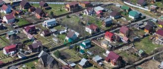
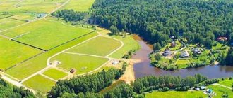
Land surveying of public lands of the SNT is understood as a cadastral procedure carried out to establish the boundaries of a site, determining its area, indicating its location and orientation in space. PDOs also include:
- Roads and passage area;
- The area under the building of a store, gas exchange point, guard booths and similar objects;
- Territories with a similar nature of use.
Public land is considered to be any territory in the SNT that is not delimited as a separate land plot.
Public lands of SNT in the cadastre
Why does SNT need to survey PDOs?
- The need for official registration of structures, as well as licensing and obtaining permission to put into operation;
- To reduce the risk of disputes when determining adjacent boundaries;
- To eliminate possible charges of unauthorized land seizure;
- As a protection of the rights of SNT, if there is an act of encroachment on the integrity of the boundaries of the site.
Without surveying public lands, it is impossible to increase the plots of owners at the expense of the common territory.
SNT meeting during surveying of PDOs
The boundary plan of SNT plots with documented boundaries allows owners of adjacent territories to freely carry out legitimate legal actions. Cadastral engineers are engaged in land surveying.
Documents for land surveying of PDO sites
The procedure for surveying PDOs is mandatory from January 2021. Without carrying out cadastral work, owners cannot take legal actions with the site. Therefore, it is worth knowing in advance what documents are collected in order to carry out land surveying of the common use territory of SNT, the list is below:
- General plan of SNT
- Original and copy of the real estate or land lease agreement;
- A valid cadastral passport for the land;
- Prepared land demarcation project;
- Technical documents for this SNT territory;
- A copy of the applicant's passport;
- Documents on the appointment of the chairman;
Example of a general plan for SNT.
The chairman of SNT or the tenant can initiate the land surveying procedure.
detailed instructions
So, in order to carry out the surveying procedure, you need to go through the following stages when contacting a company that provides geodesy services. The financial cost of the work will depend on the company’s prices, but usually the price is set on an individual basis.
After contacting the company’s employees, they will offer to conclude an agreement with them, for which the following documents will be needed:
- If another person is involved in the registration procedure, he needs to have a pre-certified power of attorney and a passport.
- A document indicating receipt of ownership rights to a specific plot of land within the SNT. Such documents may include a certificate of ownership or a contract for a purchase and sale transaction, etc.
- Some companies may ask for a foundation agreement.
- Identification document of the applying owner.
Sometimes the owner of the site provides the company with:
- A certificate confirming the absence of communications belonging to the public. Such a document can be obtained by contacting the administration of the district where the dacha plot is located. A special technician will check the plot and draw his conclusions, refuting or confirming the presence of equipment.
- Certificate from the mountains. light, where it is stated that no electrical cables are laid on the territory of the land plot.
The second stage of work consists of notifying neighbors in the gardening community about the upcoming land survey. This must be done no later than a week before the proposed work. They must personally be at the survey site and monitor the progress of work.
In self-notification you must adhere to the following scheme:
- Write the text by hand and send it to each of your neighbors by mail.
- Go around the neighboring gardening plots and tell them about the upcoming event, while handing them a notification to sign.
- The engineer receives notices from the owner of the site with the signatures of the neighbors.
Notification work can be ordered from a company; the approximate cost of notifying one person will be 250 rubles. Those who have free time can do their own search for the owners of a plot in the neighborhood.
It is important to note that neighbors must be warned about upcoming work, but if for some reason they do not show up for land surveying, surveyors will begin work without them. This is not considered a valid factor for refusing land surveying
The next stage will consist of measuring the boundaries of the entire garden plot and recording the results in a special land surveying act
This is not considered a fundamental factor for refusing land surveying. The next stage will consist of measuring the boundaries of the entire garden plot and recording the results in a special land surveying act.
With each marking, neighbors will be asked whether they agree with the measurements taken or not. After the land surveying process, the act is signed by the following persons:
- the owner of the measured plot or his chosen representative;
- neighbors from adjacent SNT lands, if they participated in the measurements;
- the engineer who carried out the measuring work;
- a representative from the administration, upon notification of the company.
The last step is to visit the company on the day that will be appointed. The owner will be given a land surveying certificate after the surveying company has carried out the work.
If the boundaries of the measured area have changed after measurements, you need to proceed as follows:
- The owner needs to take the act to the District Committee responsible for land resources. There it must be signed and on the day that is chosen, it can be picked up.
- After this, you need to take care of including the site in Rosreestr, and to do this you need to go to the MFC or a branch of Rosreestr.
- Pay the state fee of 1000 rubles.
- Sign the application filled out by the registrar.
- After this, the registrar will take all the documents except the identity card and issue a special certificate confirming their acceptance. On the day written in the certificate, you will need to appear to receive documents.
Features of land surveying of SNT territory
After the papers have been prepared and an engineer has been found to demarcate the PDO, the procedure is as follows:
- A cadastral engineer goes to SNT to survey the boundaries of a public territory.
- A boundary survey scheme is prepared, agreed upon with neighboring lands, and a boundary approval act is signed.
- The boundary plan is drawn up according to standards, and documents are submitted for registration in the cadastre.
There are no obvious difficulties in cadastral surveying, but there are some nuances. The first thing to remember is that it is better to discuss the nuances of the procedure with the engineer in advance, how much and what you will have to pay for, and what services are not included in the service.
Marking the boundaries of the site for land surveying
Secondly, the initiator of defining and consolidating the boundaries of a site on the common territory of the SNT must be prepared for the manifestation of disagreement on the part of other participants. Before delimitation of plot boundaries begins, the owners of neighboring lands are informed. Even in the event of a dispute, the neighbors will not prevent the procedure, but have every right to go to court within 15 years. Disagreement on the part of neighbors regarding the procedure and the provision of necessary documents can hinder land surveying, so obtaining the consent of the participants is the main thing for the initiator.
Third, it is better to be personally present when determining the boundaries of the plots. This is not a mandatory measure, but it will save the applicant from unnecessary worry and allow him to independently assess the situation.
The boundaries of PDOs are clarified within 60 days. This period is needed for complete processing - from the day of application to receipt of the finished result.
The cost of surveying SNT land depends on the size of the territory and averages 30-60 thousand rubles. For a separate cost, they offer coordination of boundaries with other areas and submission of documents to the MFC.
detailed instructions
So, in order to carry out the surveying procedure, you need to go through the following stages when contacting a company that provides geodesy services. The financial cost of the work will depend on the company’s prices, but usually the price is set on an individual basis.
After contacting the company’s employees, they will offer to conclude an agreement with them, for which the following documents will be needed:
- If another person is involved in the registration procedure, he needs to have a pre-certified power of attorney and a passport.
- A document indicating receipt of ownership rights to a specific plot of land within the SNT. Such documents may include a certificate of ownership or a contract for a purchase and sale transaction, etc.
- Some companies may ask for a foundation agreement.
- Identification document of the applying owner.
Sometimes the owner of the site provides the company with:
- A certificate confirming the absence of communications belonging to the public. Such a document can be obtained by contacting the administration of the district where the dacha plot is located. A special technician will check the plot and draw his conclusions, refuting or confirming the presence of equipment.
- Certificate from the mountains. light, where it is stated that no electrical cables are laid on the territory of the land plot.
The second stage of work consists of notifying neighbors in the gardening community about the upcoming land survey. This must be done no later than a week before the proposed work. They must personally be at the survey site and monitor the progress of work.
In self-notification you must adhere to the following scheme:
- Write the text by hand and send it to each of your neighbors by mail.
- Go around the neighboring gardening plots and tell them about the upcoming event, while handing them a notification to sign.
- The engineer receives notices from the owner of the site with the signatures of the neighbors.
Form of notification of the land surveying procedure.
Notification work can be ordered from a company; the approximate cost of notifying one person will be 250 rubles. Those who have free time can do their own search for the owners of a plot in the neighborhood.
It is important to note that neighbors must be warned about upcoming work, but if for some reason they do not show up for land surveying, surveyors will begin work without them. This is not considered a valid factor for refusing land surveying
The next stage will consist of measuring the boundaries of the entire garden plot and recording the results in a special land surveying act
This is not considered a fundamental factor for refusing land surveying. The next stage will consist of measuring the boundaries of the entire garden plot and recording the results in a special land surveying act.
With each marking, neighbors will be asked whether they agree with the measurements taken or not. After the land surveying process, the act is signed by the following persons:
- the owner of the measured plot or his chosen representative;
- neighbors from adjacent SNT lands, if they participated in the measurements;
- the engineer who carried out the measuring work;
- a representative from the administration, upon notification of the company.
The last step is to visit the company on the day that will be appointed. The owner will be given a land surveying certificate after the surveying company has carried out the work.
If the boundaries of the measured area have changed after measurements, you need to proceed as follows:
- The owner needs to take the act to the District Committee responsible for land resources. There it must be signed and on the day that is chosen, it can be picked up.
- After this, you need to take care of including the site in Rosreestr, and to do this you need to go to the MFC or a branch of Rosreestr.
- Pay the state fee of 1000 rubles.
- Sign the application filled out by the registrar.
- After this, the registrar will take all the documents except the identity card and issue a special certificate confirming their acceptance. On the day written in the certificate, you will need to appear to receive documents.
Are SNT obligated to demarcate PDOs?
Carrying out cadastral work to clarify the boundaries of land plots on the territory of SNT is mandatory. However, this is only relevant in a number of cases:
- It is planned to conclude a transaction with land - purchase and sale, will, etc.;
- Proceedings in which it is necessary to provide proof of rights to the site;
- There is a need to unite or divide the territory;
- A plot of land in a particular SNT is of high value;
- The owner needs to determine the exact area of his plot;
- Correction of errors in cadastral registers is required.
The management of SNT does not have the legal right to independently initiate measures to survey the territory. All land is not the property of gardening, so nothing will happen without the consent of the owners to the procedure. However, it is in the interests of land owners to entrust land surveying to the management of the partnership.
The owner will receive a lot of restrictions on the disposal of property if the site is not demarcated. The land plot cannot be sold, donated, etc. Regarding territories that are considered common, demarcation can only occur if there is the consent of the majority of owners of plots in the SNT.
Northern summer resident - News, Catalog, Consultations
In 1956, the Model Charter of the Gardening Partnership of Workers and Employees was developed and adopted, approved by Resolution of the Council of Ministers of the RSFSR dated October 15, 1956 No. 678. Citizens could choose - individual gardening or a gardening partnership.
". At the same time, for citizens conducting gardening, vegetable gardening or dacha farming individually on the territory of a horticultural, vegetable gardening or dacha non-profit association, the procedure and terms of payment for the use of infrastructure facilities and other common property of the horticultural, vegetable gardening or dacha non-profit association are determined by the parties to the agreement, the conclusion of which is provided for in paragraph 1 of paragraph 2 of Article 8 of the Law. »
16 Apr 2021 klasterlaw 267
Share this post
- Related Posts
- Penalty for failure to conduct an audit in 2021
- Application for license to the traffic police sample 2021
- How much do they pay for a second child in 2021?
- What's booming in St. Petersburg now 2021
Legal issues and disputes regarding land surveying
One question that most often arises is boundary disputes between the owner of a plot of land and his neighbors. The reason for this may be predominantly the procedure being carried out without permission and without warning. The consent of neighboring land owners is not necessary, but it is the responsibility of the initiator to inform.
If there are disagreements regarding the delineation of plot boundaries on the territory of the gardening partnership, the party who disagrees with the results of the work has the right to go to court. If there are legal grounds, the court may order the re-delimitation of the site.
act of agreeing on the boundaries of the site with neighbors
The court is not the only authority where people turn to resolve boundary conflicts. The application can be submitted to the land control authorities. If there is an administrative violation, you can contact the Federal State Registration Service.
If you need to carry out cadastral work or have questions, you can leave a request on our website.
Court decisions
In the process of establishing the boundaries of land plots, SNT often has to resort to recourse to a judicial authority.
The need for this may arise due to the presence of disputes regarding the boundaries .
Such disputes may consist of the fact that the owners of adjacent plots have different opinions regarding how the boundary between their plots is drawn, or one of the users does not agree with how the boundary is established.
In the process of considering such cases, the following decisions may be made :
- Refusal to consider the case due to the lack of legal authority by the user of the site to protest the passage of borders in this way;
- Refusal to initiate proceedings due to lack of evidence to challenge boundaries. In fact, this means that a person has the opportunity to protest against this particular location of the site, having any documents or data (including witness testimony) indicating that the coordinates of the turning points should be installed in a different location;
- Acceptance of the appeal and rendering a decision in favor of the plaintiff. In such a situation, the court considers all the documents provided, analyzes data that may indicate that the plaintiff is right and makes a decision in his favor;
- Acceptance of an appeal and, on the basis of the considered data, making a decision partially in favor of the plaintiff or in favor of the defendant.
In such a situation it is possible to go to court again if the plaintiff still does not agree with the decision made or considers it unfair.


