Until recently, a boundary plan was not a mandatory document in the process of land transactions.
Some owners of plots believe that in order to alienate property, it is enough to provide a cadastral passport (CP), and there is no need for the procedure for conducting a geodetic survey.
But land surveying and a cadastral passport are not the same thing.
Let's take a closer look at what land surveying and cadastral passport are and how they are interconnected.
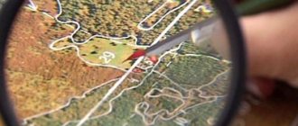
In the first case, the territorial boundaries of the land plot (LZ) are determined and fixed in graphic format on the cadastral map).
In the second case, there is a document containing information about the allotment (issued by the state real estate cadastre).
If the owner of the land has not drawn up a boundary plan, then his property will not be registered in the cadastral register, which automatically makes it impossible to obtain a cadastral passport. The absence of these documents created an obstacle to the purchase and sale and donation of the plot.
In 2021, amendments to the law came into force, which reduced the need for “cadastral passports”. All necessary information about the land is now contained in an extract from the Unified State Register of Real Estate, which must be ordered upon alienation of property.
Previously, it was not prohibited to issue a cadastral passport without a land survey procedure, and to register such a transaction it was not necessary to establish the coordinates of turning points and the exact area of the object.
Documentation
Preparatory steps for the procedure include:
- identifying the boundaries of the site, taking into account title documents;
- request for data from the State Property Committee for plots (certificate of restrictions, copy from the General Plan);
- verification/analysis of information from the land registry;
- informing neighbors about land surveying (in writing).
In order to determine the exact coordinates of the site , the owner provides:
- identification document/power of attorney for the person representing his interests;
- documents of a title nature (certificate of ownership, agreement on purchase and sale, donation, court decision, will, acts of municipal authorities on the allocation (provision) of land);
- documentation of a technical nature (cadastral plan/extract, certificate from the BTI, copy of a plot, cadastral plan of a property located on the land or a certificate of absence of buildings);
- a document confirming the presence/absence of encumbrances;
- application of the established form.
- extract from the Unified State Register of Individual Entrepreneurs.
The cadastral passport is not attached to this list.
All documents must be submitted in originals . If the specified information is inconsistent/contradictory, it is necessary to make adjustments, after which you can begin the land surveying procedure.
It is recommended to order technical documentation in advance from the territorial divisions of the BTI in order to speed up the process of obtaining a boundary plan.
If the applicant is a legal entity, then an additional list of documents will be required (power of attorney to represent interests from a company/institution, certificate of state registration/tax registration, charter of a commercial structure).
Pros and cons of land surveying
If you can do without additional costs, then why is it worth inviting a cadastral engineer? Speaking about the disadvantages of land surveying, only a few can be noted.
- Financial expenses. With relatively low incomes of Russians, the price of 10 thousand or more for an engineer’s services can make a hole in the budget.
- Time consumption. It will not be possible to carry out land surveying in a day. And the point is not only that, on average, measurements will take about 5 days. It is first necessary to inform neighbors about the upcoming meeting, conclude an agreement and agree on boundaries.
- The price of a declared plot for sale is often lower in order to lure a buyer. How much you have to discount depends on the site and the patience of the seller.
Otherwise, land surveying is a complete plus for the owner:
- It is easier to sell a measured plot. Not wanting to face the risks of land disputes or fraud, buyers prefer to deal with plots that have already been surveyed.
- Reflection on the cadastral map. In 2015, the implementation of complex cadastral works began. All surveyed areas began to be marked electronically. Cadastral map of the country. On the Rosreestr website, everyone can not only see the boundaries of the site and its area, but also the category and purpose of the land.
- Possibility to annex land. If the land actually used is larger, then metering would be an excellent way to legalize this state of affairs without additional fines. The main thing is that neighbors do not lay claim to these territories.
- Tax optimization. If the owner actually uses the declared land, then the tax calculation may be incorrect. It is quite possible that he has to pay a little more than he would have after the land survey.
- Resolution of disputes. Land surveying allows you to secure the boundaries of plots once and for all. If a judicial sport arises, then usually the judge takes the side of the one who was the first to conduct a correct and legal survey.
So, the difference between the declared and surveyed area is obvious in terms of transactions. Moreover, both of them can be registered in the cadastral register and not even differ in size. Taking measurements is not at all necessary to use such an allotment.
However, carrying out cadastral work will benefit both the owner himself and the surrounding neighbors.
Land plan
The size, boundaries, area and size of the plot are determined by specialized organizations that have a license to carry out land management and geodetic work .
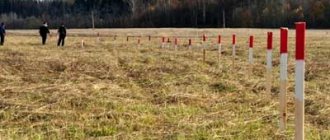
At the final stage of land surveying, the plot is assigned coordinates through which the exact location of the object can be established. Information about determining the boundaries of the plot is entered into the boundary file: the results of the procedure are the basis for the delivery of the plot to cadastral registration .
Upon completion of the work, a boundary plan is developed (in text and graphic format). The document is drawn up based on the results of determining the size, area, boundaries of the site, as well as data from the cadastral extract.
The survey results are described in detail in a separate article.
The object is assigned an individual cadastral number, and data on it is recorded in the state register.
At the final stage, the owner receives a document indicating the boundaries of the allotment.
How to coordinate the boundaries of the site with the neighbors?
The cadastral engineer will also help in coordinating new boundaries with the owners of adjacent plots: he must send them notifications by postal or e-mail; individual approval is also allowed.
If they cannot be found, the cadastral engineer publishes a notice in the local press. The addressee will be considered notified even if he does not read this announcement.
Rights holders of adjacent plots must confirm their consent by signing an agreement document. If they do not agree, they can forward their objections to the cadastral engineer. Objections must be recorded in the act of approving the location of the boundaries of the land plot, and also attached to the boundary plan.
Next, the documents must be submitted to Rosreestr. If there are justified objections, registration and registration activities will be suspended, and neighbors will have to resolve disagreements in court.
Information in the cadastral passport
The cadastral passport is issued by employees of the state real estate cadastre and contains the main characteristics of the land plot.
The passport reflects the following information :
- who is the owner of the property;
- dimensions, location, area;
- category of land;
- special purpose;
- date of registration in Rosreestr;
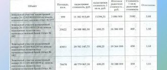
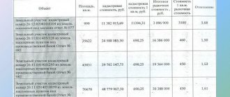
- cadastral value;
- coordinates on the map;
- diagram and satellite view;
- presence of encumbrances (easements);
- data of title documents;
- boundary lines and turning points.
The specified information is contained in the new sample document . In the “old” CP only some points are included.
Information about the contents of the document is described in detail here.
Structurally, the CP consists of 5 sections :
- B1 (general data: cadastral number, owner, date of registration in the Unified State Register of Real Estate);
- B2 (graphic component: diagram (plan) of the facility, drawings of structures and buildings located on the land plot);
- B3 (information about encumbrances);
- B4 (borders indicating dimensions and angles);
- B5 (detailing of turning points within the boundaries of the object).
New law on USRN
When conducting transactions with land plots, it is necessary to take into account that in accordance with Law No. 218-FZ of July 13, 2015, a new Unified Real Estate Register is being created from January 1, 2017, which will include data from the Unified State Register and the State Property Committee.
In this case, one extract from the Unified State Register will be issued, containing comprehensive information about the real estate, including the land plot.
Intentional deterioration of living conditions can lead to very disastrous consequences. In some cases, a land plot may be provided without bidding. Read more about this in our article. A plot for individual housing construction can be purchased not only from a private individual, but also from the state. How to do this, read our article.
Relevance of the procedure if you have a passport
There is no mandatory procedure for land surveying yet.
Exceptions include cases where there is a need :
- registration of registration documents for the object;
- sale, lease, donation of an object;
- selection (delimitation) of an object from the array of neighboring territories;
- organization of capital construction at the site;
- combining several objects into one/dividing one object into several separate sections;
- enter into disputes over the ownership of objects.
How long will it take to survey a land plot in 2022?
At the legislative level, the timing of land surveying is not established.
If we take into account practice, the entire process, from submitting documents to registering property rights, takes approximately one month to six months.
The duration of work is influenced by many circumstances.
When should it be done?
Land surveying is carried out when it is necessary to clarify the boundaries of the plot. This may be needed in several cases:
- Formation of a new site. Transfer of land for use from the state reserve.
- The existing site does not have established exact boundaries.
- There is a division, merger or change in the boundaries of existing areas.
Important! Land surveying is only possible for owned land. Leased land cannot be demarcated.
Cost of services
It is impossible to name the exact cost of land surveying, since it is not regulated by the state and is determined by the companies themselves that provide this service. This means that it will depend on many factors, among which are:
- Region – depending on the standard of living in the region, the price may also fluctuate; in large cities and districts it is higher. The cost of land surveying is especially high near Moscow and St. Petersburg.
- The level and demands of the company - the more qualified engineers the company works for, and the better their track record, the higher the tariffs usually set for it.
- The complexity of land surveying - is it only necessary to clarify the boundaries, or are we talking about a completely new plot, what category the land belongs to, what shape the plot is - all these factors will also affect the average cost per unit area.
- Area - it is clear that it is more profitable to make one trip to a large area than five by five, in total occupying the same territory as the first. Accordingly, if you own a large plot, the price of work for each hundred square meters will be lower.
If you set price guidelines, then on average land surveying will cost approximately 5,000 – 7,000 rubles, but in reality the price may differ significantly from this, depending on the parameters listed above.


