Many plots to date do not have clear boundaries. But without them there is no land.
Article 7, Part 1, Clause 3, Law 221-FZ of 2007 “On State Accounting of Real Estate,” initializes allotments as an object.
Due to imperfect legislation, land disputes are a rather complex issue. To resolve numerous disagreements in the field of land control, cadastral work is required to determine the boundaries of private territory.
Regulations and Land Code
The procedure for establishing boundaries is reflected in Art.
39 and Law 221-FZ. Determination of the limits of land plots under the jurisdiction of cadastral engineers by order of government authorities and through the signing of an agreement.
According to the Land Code, when an allotment is formed, its boundaries are established in the process of land surveying, on the basis of which a plan is drawn up.
The passport contains cartographic images of the boundaries of a private territory with reference to adjacent real estate, as well as a description of its coordinates.
Determining the size of the territory may be necessary when crossing the lines of neighboring plots, as well as their overlap with lands previously registered with the state. The procedure for coordinating the coordinates of neighboring plots is established by Order of the Ministry of Economy and Development dated November 24, 2008 No. 412.
Based on the results of cadastral surveys, the final identification of the boundaries of a plot of land is carried out by Rosreestr employees, who place the property on state registration .
The location of allotment points is described by their rectangular limits in the manner prescribed by Order of the Ministry of Economic Development dated August 17, 2012 No. 518, clause 2.
How to challenge a land survey?
Let's talk about land disputes. About how neighbors argue over the boundaries of a land plot, how to determine the order of land use, how to transfer the category of land from one to another.
Disputes over land boundaries
Boundary disputes between neighbors are the largest category of problems with which people most often turn to lawyers for help. It happens that they own a plot of land that occupies certain boundaries and has a fence. But when the preparation of land documents begins, a cadastral engineer is invited.
And it turns out that the fence is not where it should be. It often happens that neighbors have already drawn up boundaries that have been transferred to your territory. That is, the area where you previously planted potatoes, where your garden bush is located.
Now it turns out that it is the property of a neighbor. What to do in such a situation? First, let's start to figure out how this happened. We request all land management documents. Everything that was done by the neighbor so that he essentially became the owner of part of your site.
He may have forged your signature. Perhaps the cadastral engineers made some kind of cadastral error. Perhaps there were other reasons for this. You need to directly request everything, analyze and make a decision.
Often, after analyzing, we come to the conclusion that we cannot cope with this without a trial. Why does this happen? Because land disputes most often arise not only due to cadastral errors, but also because people do not understand where their borders used to be.
The neighbor thinks that his border was here, and you think that the border was here. And this dispute between you, except for a judicial arbitrator, in the form of a court panel based on your statement of claim, will not be resolved by anyone.
We draw up a statement of claim identifying the points that you consider to be your boundaries. We indicate their coordinates and present the evidence base of your case. These may be any plans that have been used previously.
These can be photographs that show how the fence stands in relation to buildings and other landmarks. And which will be, albeit indirect, proof that the border was exactly where you think.
In addition to the plans you have at your disposal, testimony also plays a huge role. If you have any neighboring land users who saw how the fence was previously standing, came to your land plot, or to a neighbor’s plot, and can explain to the court how the boundaries between you were located, then be sure to invite these witnesses.
The court will take into account, analyze their testimony and give an assessment in the court decision. And if, having picked up the documents and requested them, you see that your signature is being forged. then of course there are few witnesses here. This requires the involvement of a handwriting expert.
As part of the process, a forensic examination is ordered, where a handwriting expert determines whether it is your signature or not. Did you agree with these boundaries, or is document falsification going on? And this, in principle, is punishable by law and is unacceptable.
The court decision will be the basis for entering data into the state register. Everything will fall into place. And your right will be restored.
Determination of the order of use
As for determining the procedure for using a land plot, disputes here no longer arise with neighbors. Here, disputes arise within one plot of land between co-owners. How did it happen that the land plot began to belong to several persons?
This happens by inheritance. That is, the heirs became co-shareholders of the land plot. Or, when dividing jointly acquired property, the spouses determined a share in the land plot, which must now be used jointly. And it can be very difficult to agree on where and whose garden bed.
In this situation, you need to contact a cadastral engineer. The cadastral engineer will draw up a plan. And it often happens that several options are offered. It is drawn which part of the land plot you will use, and which part your co-owner will use.
And as part of the settlement, you try to agree on which option the parties will approach and what consensus they will reach. If no agreement is reached between you, you will have to go to court.
The court's decision will be binding on both parties to this conflict. And in fact, the owners will resolve their problem when the court makes a decision.
Seizure of a land plot
It often happens, especially this situation is associated with the city limits, when you do your planting, tend to your garden, no one bothers you and you are happy with everything. You love your garden, you love your vegetable garden. Then a certain developer comes and says that it is necessary to build an apartment building on this plot of land.
And that’s it, your gardening should be completed. What to do in this situation? Yes indeed. Unfortunately, such a procedure exists. And nothing can be done for you here.
You really have to agree that the land plot will be confiscated. If the developer's procedure is followed. If, indeed, the land plot was allocated to him by law, then one can argue only on the price.
At the price, at the cost that you must be paid for the seizure of your garden. The developer, in order to sell his apartments profitably to his buyers, naturally tries to reduce his costs. And make as little payment as possible for the seizure of the land on your part.
Therefore, be careful. Look at the assessment provided by the developer. Spend your independent. Argue with the developer over the price he will have to pay for your plot of land. In particular, if an agreement is not reached between you, you have the right to a judicial resolution of your conflict.
Land category translation
Transferring land is a rather complicated procedure. Even a land lawyer often encounters some bureaucratic delays, some obstacles that prevent the owner from transferring land from one category to another.
If you decide to change the category of land, for example, from gardening to housing construction, or you come to the conclusion that there is a certain plot of land belonging to the forest fund, and at the same time you would like to build a house there, then all these points need to be analyzed very carefully .
Here, without turning to a professional, you won’t be able to do the translation and carry it out quickly. It is necessary to analyze everything, put everything together, and contact government authorities directly about the preliminary possibility of this procedure.
And only after that start the whole process. And if there are any obstacles, then resolve them in the course of resolving this procedure.
When is it necessary to set boundaries?
The procedure for establishing the coordinates of a plot of land and their reflection in the cadastral register is necessary when local authorities receive a request from the owner of the property to change its location or a request to clarify the limits .
Determination of control points is required if boundaries were not previously identified with accuracy or if data on boundaries is not available in Rosreestr .
Land surveying is necessary for transactions with land :
- purchase and sale of real estate;
- registration of a lease agreement;
- exchange, donation;
- obtaining documents on the ownership of the plot;
- division of a plot of land;
- merging individual real estate properties or forming new ones.
Without clearly defined boundaries, it is impossible to carry out operations with land . All actions of the owner in relation to his property will be illegal. In the absence of a land survey plan, rights to the allotment cannot be formalized.
Based on Art. 38.7 221-FZ, the determination of points on the ground is carried out in accordance with the requirements and rules specified by law. Establishing the correct coordinates of an allotment is a mandatory procedure when resolving cadastral issues or the need to identify the boundaries of the territory of artificial objects or nature reserves.
Deadlines for land surveying
Now about the timing. Where does the month come from? As always, everyone needs it quickly, urgently, yesterday. Can it be done in 2 weeks? Of course you can. Even necessary. But at what stages is time usually lost? Let's figure it out.
A surveyor will visit and measure the site. Usually departure is planned in the next 3-4 days. If you are given a departure date in a week or two or even in a month, as is usually the case, no one will deal with your issue. This is understandable further.
Processing of field materials. The actual survey is superimposed with the cadastre of neighbors. The situation is being analyzed. If there are no overlapping boundaries, intersections of areas and other problems, the boundaries of the area are formed. The dimensions of the plot are agreed upon with you and an approval document is prepared.
If the state real estate cadastre, as usual, has not frozen, the neighbors’ statements arrived quickly and there are no problems with the neighbors’ boundaries, then you can receive the approval act in your hands in 3-4 days. And this is where the fun begins.
Coordination of boundaries with neighbors. Everything here is very individual and a lot depends on you. The ideal case is when the act was handed over to you, and in the evening the completed, signed and agreed upon act was handed back.
Such cases make up 2-3% of the total. On average, approval takes a week. There are more. There is much more. Well, if you do it through a newspaper, then immediately add a month. You will need to submit a minimum of 3 advertisements in 1 week increments.
As soon as the cadastral engineer receives the signed act back, collect all the materials into a common document, prepare a boundary plan, write it to disk and deliver it to you - 4-5 working days.
A faster option is possible - sending a file signed with an electronic digital signature by a cadastral engineer by email. You download it, burn it to disk yourself and submit it to the MFC. Again, saving time.
You hand it in at the window. They consider 1-2 weeks, depending on the workload of the registrars themselves or it’s not clear why. Sometimes land surveying takes place instantly, in 1-2 days. And sometimes you have to wait weeks for an answer.
Suspensions. In fact, this is also part of land surveying. As a rule, suspensions occur when the owner lacks any documents. For example, there is no document confirming the location relative to neighboring areas. Therefore, when surveying land plots in SNT, it is imperative to obtain a copy from the general plan from the chairman.
Or, when agreeing on boundaries, a neighbor signed, but turned out to be not the owner. Or the plot is in common shared ownership. In this case, the deed must collect the signatures of all owners.
So, let's summarize. If your site currently has no coordinates, it simply exists virtually somewhere. And only you know where. You will not be able to prove its exact location without land surveying.
Again. Land surveying is the preservation of the configuration and location of the boundaries of your site with an accuracy of 10 cm relative to the state geodetic network. In other words, if you bring in a bulldozer and level everything to the ground, then by removing the boundaries into nature, all cadastral points can be restored back.
If the survey is done, your data is stored in Rosreestr, then changing this is not so easy. Also, without land surveying, you will not be able to carry out legal transactions with land - sale, lease. donation. Plus, you will not be able to register the house - from March 1, 2021. We've talked about this before.
Or the situation is even worse if a neighbor finds unscrupulous cadastral engineers and simply comes to an agreement with them. The idea is simple - a neighbor can put his plot on the cadastre with a spade on your plot. Whether it was intentional or due to the crookedness of the surveyors, it doesn’t matter.
Correcting the situation will not be so easy. We'll have to go to court. Legal costs are about 100,000 rubles, and the time is six months. The losing party pays. Whether you win the trial or not is unknown.
If you have completed land surveying, your plot is listed on the cadastre. The points are stored in Rosreestr. None of the neighbors will be able to violate the cadastral line of your plot.
And for those who have already done land surveying, we advise you to remove the boundaries. For control, just in case, you never know. What if there is a mistake? And you don’t even know.
Approval based on actual use
Some neighbors may, without involving cadastral specialists, agree to establish the coordinates of the site.
To determine the size of the territory based on actual use, all interested owners should be notified of the procedure and the conditional boundaries of the plots should be identified.
Next, the process of establishing the boundaries of real estate objects looks like this :
- secure the boundaries of the plots using boundary signs, fences or pegs;
- if everyone is satisfied with certain boundaries, the owners should contact a specialized organization and order a boundary plan from an engineer;
- On site, the specialist will fix the coordinates of the plots and enter the information into the documents;
- After the act of determining the coordinates has been endorsed, a land surveying plan is drawn up, indicating the exact limits and dimensions of the site.
Owners of real estate will only have to submit the appropriate package of papers to Rosreestr for state registration according to the sample.
The use of this land surveying option is possible only if all neighbors agree with the boundaries of adjacent plots . In other situations, unauthorized seizure of land threatens litigation and significant financial costs.
How does a cadastral engineer do land surveying?
Let's look at the stages of how a cadastral engineer does land surveying.
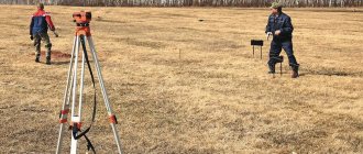
Measurement of your site by a surveyor
That is, determining the coordinates of the actual boundaries in the state geodetic coordinate system. Surveyors arrive, measure the site, put marks on each corner and determine the coordinates of the boundaries. All this is saved in a special file. And then processing of field materials, drawing, analysis of the situation as a whole.
What it is. The cadastre of previously demarcated plots from neighbors is applied to the actual survey. The boundaries are checked for the presence of edges and cadastral errors in the areas of your neighbors. And if everything is in order, the area of the site is calculated, the configuration and dimensions of the boundaries of your site are formed.
Based on these data, the preparation and drawing up of an act of approval of the boundaries of the site is carried out. This act is submitted to the customer for approval of boundaries and signature by your neighbors.
The act displays the layout of the boundaries of your plot, its address, cadastral number, information about the owners of adjacent plots and their agreement with the actual location of the boundaries between the plots.
Who should approve the boundaries of the site?
And here the question immediately arises - who should coordinate the boundaries of the plots with the neighbors. The answer is simple. The approval is carried out by the owner personally, or by the owner’s representative under a general power of attorney.
If you cannot sign the boundaries with all the subcontractors, cannot find the owner, the owner is abroad and the plot is between relatives, then you can make an agreement through a newspaper.
But this is a bad way of coordination, even though it is legal. In the future, land surveying with such approval can be challenged in court and your site will be removed from the cadastre.
After the boundary approval act is ready, hand it over to the cadastral engineer. And the cadastral engineer creates a boundary plan. Writes the disc and hands it over to you for transfer to Rosreestr.
You take this disk to the MFC and hand it in at the window. Within 1-2 weeks, Rosreestr checks all the data and enters information about your site into the state real estate cadastre. The plot is included in the cadastre.
Anyone who has already done land surveying knows that this is not a quick process. Therefore, it is better to launch it early in order to move through the stages systematically. And then don’t jump into the last carriage at the moment when you urgently need land surveying.
For example, you decide to quickly sell the plot, or re-register it, or something happens. Most likely you will be looking for someone who will do everything for you in a week. And such people will most likely exist. They will take the money, but they will not meet the deadline. It is a fact.
Land surveying lasts about a month and this is the minimum.
Methods and procedure for determining the location of an allotment
There are several ways and methods that can be used to identify the coordinates of an allotment. All of them are interconnected with the work of cadastral specialists or the independent establishment of boundaries using documents.
If the boundaries of the territory were identified earlier, but the owner does not know them, they can be determined on the ground or “taken out into nature.”
Establishing coordinates by cadastral number
All officially registered real estate has clear boundaries, which most often run between adjacent plots.
If you have a cadastral number, you can find out the location of real estate in several ways :
- obtain information from Rosreestr online – rosreestr.ru;
- order an extract from the unified register on the website kadastrmap.ru.
More details about clarifying the boundaries of a land plot by cadastral number can be found in the article on this topic presented on the website.
On the ground
Procedure
To identify the coordinates of the plot, land surveying will be required.
Interested parties should contact Rosreestr :
- to write an application;
- attach land title certificates to the request;
- pay the mandatory fee (the amount of payment depends on the area of the plot and characteristics).
Receiving this service requires land surveying.
At the end of the procedure, the engineer will issue a conclusion , which is sent in electronic form to Rosreestr, and on paper is provided to the owner of the property.
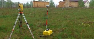
Land surveying is carried out by employees of a geodetic organization using satellite imagery and GPS equipment.
Measurement
The land plot will be measured in stages :
- temporary fences and stakes are installed;
- lines are drawn between the limiters, deviations are permissible - 20 cm (the surveyor is responsible for the correctness of the boundaries);
- coordinates on the ground and plan are checked.
The customer of the work can be the owner of the property or his representative . When taking measurements, you must be present
- surveyor,
- cadastral specialist
- and the owner of the storage unit.
Before carrying out land surveying, it is necessary to check with the organization whether it has a valid license to perform cadastral work.
Shooting boundaries
Topographic survey is a map-scheme of the site, which is issued to the customer based on the results of the land surveying procedure.
Plan scale – 1:1 200 or 1:1 500.
The map indicates the boundaries of the land plot and its area.
Taking into account the specifics of the application for topographic survey, the form of the diagram may change (if this does not contradict the regulations).
Documentation
Documents for identifying the boundaries of a site on the ground are submitted in the form of originals and duplicates :
- passport of a citizen of the Russian Federation of the owner of the land plot (the representative will need to provide a power of attorney certified by a notary);
- document on the form of title to the plot from Rosreestr;
- object number according to the cadastre (if available);
- when allocating part of the plot, an agreement on allotment and the consent of all owners will be required.
When the cadastral number and certificate are missing, the request should indicate the need to register the land plot with the state upon completion of the land surveying procedure.
If there are several owners, documents from all interested parties will be required .
Based on the results of the topographic survey, the engineer draws up a plan of the plot , notes its configuration, between the red line. All interested parties should familiarize themselves with the land surveying scheme. The cadastral specialist provides a plan for signature, reflecting this in the act of agreeing on the points of the land plot with the owners of the bordering plots.
By coordinates
Based on the survey results, the dimensions of the land plot must be clarified by the engineer who enters the object data into Rosreestr.
If all the calculations were carried out correctly, then there will be no differences between the points on the ground and the boundaries on the cadastral plan.
Defining boundaries - finding out their territorial location on the map.
Carrying out this procedure is the main task of the engineer.
There are several ways to select the coordinates of a land plot:
- If land surveying has not been carried out, the boundaries of the allotment are checked using established signs. The procedure will require the consent of the owners of neighboring properties. Based on the survey results, the boundaries of the plot are agreed upon with all interested parties.
- If land surveying has been completed, all data is available in Rosreestr. Determining the boundaries of a site on the ground is carried out on the basis of cadastral data.
Read about ways to search for a site in the Rosreestr database using available coordinates in the feature article.
None of the options for land surveying by coordinates allows us to eliminate controversial issues between the owners of neighboring properties.
To avoid this, the results of the work must be agreed upon with all interested parties .
According to the land passport
Documentation
To obtain information regarding a land plot, certain documents will be required.
The list of necessary papers to establish the coordinates of the allotment includes:
- identification;
- document on the right of ownership of the plot;
- appeal to the UGRCC;
- photocopy of the cadastral passport;
- an act of agreement between the owners of adjacent plots (or a judge’s decision);
- technical documentation for the property, endorsed by the city administration;
- information from the technical plan and a photocopy of the allotment diagram;
- request to the Federal State Registration Service.
Procedure
The procedure for identifying the location of a land plot according to the cadastral plan is carried out sequentially.
The algorithm of actions is quite simple:
- submitting an application to the UGRCC;
- obtaining from the administration a photocopy of the cadastral diagram of the district land plot (the cadastral engineer will need it);
- gathering of all owners of adjacent plots;
- drawing up an approval act;
- certification of the collected package of documents by the administration;
- appeal to the Arbitration Court in case of refusal to sign the act;
- submission of the court order to the UGRCC;
- assigning a vehicle registration number and issuing a registration certificate;
- contacting the Federal State Registration Service with a photocopy of the plan and an extract from the certificates received.
If all the papers are available, the owner will be able to receive a formalized certificate of ownership of the property within the time frame established by law - within 30 days .
Work carried out by surveyors
- Research and study of the terrain.
- Determination of boundary boundaries of a plot of land.
- Identifying the locations of turning points.
- Calculation of allotment area.
- Analysis of the above-ground and underground communications available on the site, both operational and not maintained.
- Photographing buildings present in a given area.
For their work, surveyors use professional equipment - a total station, a level, GPS devices, a pole, a cable and pipe detector.
How to determine the boundaries of a land plot without land surveying
You can establish the coordinates of a plot of land in various ways - use the services of an engineer, via the Internet, or coordinate your plot with your neighbors.
Contact a specialist
You will have to pay for the services of an engineer, but the result will be more accurate . To set boundaries with it you will need :
- submit a request to the chamber at the address of the property;
- the engineer, based on the documentation received from the cadastre, will demarcate and mark the points;
- the boundaries of the allotment are marked with pegs (permissible discrepancy 20 cm).
Only organizations that have a valid license to carry out such types of work can carry out land surveying.
Using the Internet
If the land plot is registered with Rosreestr, the information will be posted on the organization’s official website. To obtain information, you must go to the institution’s portal, fill out the required fields and request data.
Read more about this procedure in our separate article.
Coordination with neighbors
To determine the boundaries of the allotment, the consent of the owners of adjacent plots will be required .
To carry out the procedure you need:
- call a meeting (send out written notices);
- invite surveyors for land surveying;
- draw up an agreement.
Documents must be endorsed by all interested parties . This is the only way the procedure for establishing coordinates will be legal.
Documentation
According to clauses 7.8 of Art. 38 of Law 221-FZ, the boundaries of a land plot are specified using points and coordinates. Information can be obtained from title documentation.
If they are missing, then the information
can be easily checked using the papers describing the location of the allotment in which they are indicated:
- registration certificate;
- agreement of purchase and sale, exchange;
- deed of gift;
- evidence.
If there is no evidence, the boundaries of the site will be objects located on the site for more than 15 years .
Area determination error
When determining the areas of plots, inaccuracies arise, which are characterized by errors. The error is the difference between the calculated area of the site and its true value.
For different methods of determining area, such errors may be different.
For the analytical method, the accuracy of area calculation depends solely on the errors associated with measuring the coordinates of turning points. In this case, the root mean square error (RMSE) of the analytical calculation method (mp) is determined by the formula:
mp= mt*√ P, where:
- mt — UCP location of turning points;
- P is the area of the plot.
As an example, we can take the accuracies mt acceptable for land surveying, which are determined by the relevant regulations (for example, the Appendix to the Order of the Ministry of Economic Development No. 518). These accuracies depend on the type of land.
So, for settlements this figure is 10 cm, and for summer cottages and gardening - 20 cm. Thus, for a garden plot of 600 sq. m, the accuracy of determining the area using the analytical method can be:
mpс= 0.2*√600=4.89 m.
When implementing the graphical method, its accuracy is affected by measurement errors, errors in drawing up a plan, and paper deformation. The relative error of this method ranges from 1:500 to 1:1000.
The accuracy of the mechanical method also depends on the errors in drawing up the plan (or map), and the condition of the paper on which the site plan is drawn. In addition, the accuracy of this method is affected by the size of the area. This method is not recommended for areas smaller than 10-12 cm2.
Under favorable conditions, the relative error in area measurements using a planimeter can reach 1:400.
We will tell you about how to lease a plot of land with the right to purchase. When buying an apartment you can get a tax deduction. Read more about this in our article.
Do you want to take ownership of a plot leased for 49 years? There are detailed instructions here.
Is it possible to specify only part of an adjacent plot?
Based on the results of cadastral surveys regarding the determination of the size of several land plots, the number of approval certificates must correspond to the number of real estate objects being specified.
If, at the end of the procedure, only part of the boundaries of the adjacent plot were established, coinciding with the boundary of the site - the object of work, on the basis of Part 2 of Art. 43 221-FZ, a separate approval act will not be required .
Such norms are also correct when correcting errors in Rosreestr regarding the location of the border adjacent to the identified real estate - the object of work.
If deficiencies are identified in coordinates that are not adjacent to the plot being checked, then you will need to provide an additional request and include a separate approval document in the boundary plan.
Why is land surveying needed?
So do land surveying? Or not? If 5-6 years ago there was no clear answer to this question, then from March 1, 2021, the registration of country houses under the simplified system was canceled. If previously it was possible to register a house on a site without notification of the start of construction, now notification is mandatory.
Moreover, this situation often occurs. Some citizen turns to a cadastral engineer and begins to tell a sad story about how bad his neighbor is, who took away 40 cm and moved the fence onto someone else’s territory.
The citizen is asked the question - how was the spade determined and was land surveying done? The answer is negative. Here is the answer - there is no land survey, there is no border. And what kind of intercessions can we even talk about?
In general, do the land surveying and there will be no issues regarding boundaries with your neighbors. We have saved data about the location of your pages in Rosreestr - that’s it, it’s yours. You can sleep peacefully.
Previously recorded area without defining boundaries
Plots registered before 03/01/08 are not included in the state real estate register. There is no data on the area or boundaries of previously recorded plots. If land surveying has been carried out, the land is displayed in the cadastre without indicating boundaries. To coordinate the boundaries of such land plots, the assistance of engineers is required.
If there are documents for previously registered plots, but there is no information about them in the cadastre, you will need to indicate and approve this data.
The owner must submit a request to the chamber, which will make the appropriate changes.
Basics of measuring area of a plot
1. When to do it
Determining the size of a plot of land is required in different situations: when buying or selling real estate, when resolving disputes with neighbors, dividing a single plot into several parts, donating, inheriting. You can measure the area of the territory yourself or with the help of specialists, if you need special accuracy and official certification from surveyors. Setting a price for a land plot will also require determining its total area.
If you do not need to provide a site plan to the authority, for personal use the dimensions are taken independently. For example, to clarify the boundaries or mark out the area for beds and flower beds, you need to know how to measure the area with your own hands. When disagreements arise with neighbors, during purchase and sale, or when planning development, such data will not be valid, so it is necessary to call professional surveyors.
They work with special equipment that allows them to accurately record the dimensions of the area. Surveyors also draw up a document that serves as evidence in resolving disputes. The site plan can be submitted to the court and other authorities.
2. Units of measurement of plot area
To display the size of a land plot, different units are used: square meters, acres, acres, hectares. Depending on the size of the territory, one or another unit of area is chosen. Usually, weave (ar) is used to indicate the size of private plots in the CIS countries. For large areas, a hectare is used. As a rule, such areas include agricultural lands, settlements, etc. The unit of measurement acre is not used in Russia; its use is typical for the territories of North America.
| 1 weave | 10 m x 10 m | 100 m2 |
| 1 hectare (ha) | 100 m x 100 m | 100 acres = 10,000 m2 |
| 1 km2 | 1,000 m x 1,000 m | 100 hectares = 10,000 acres = 1,000,000 m2 |
| 1 m2 | 1 m x 1 m | 0.01 hundred parts |
3. Features of correct measurement of land area
Before measuring the boundaries of the site, it is necessary to establish the shape of the territory. It's easier to deal with regular shapes than with areas with corners, curves and bevels. When measuring, all depressions, irregularities and hills are indicated. What matters is not so much the extent over the surface of the earth as the projection of the perimeter of the land plot onto a horizontal plane.
Visually, the area may seem flat, but this can be determined accurately by measuring. First, stakes are installed in the corners of the site. The area must be cleared of large obstacles. Check the level relative to the ground and put a mark on the peg. Similar marks are drawn along all pegs. Then a rope is tied in the marked places, stretching along the perimeter sequentially from one peg to another.
When calculating the area, you need to write down the obtained lengths of the sides of the section parameter. A perfectly level plot is rare. It is recommended to repeat the steps of measuring the contour of the territory only to determine the diagonals with the installation of stakes every 2-4 meters.
To determine the total area of an irregularly shaped plot, you need to divide it into several geometrically simple figures, calculate their area and add up all the values. Most of the plot will be rectangular, the size of which can be found by multiplying the length by the width, other parts of the plot will be rectangular triangles, the parameters of which are calculated by multiplying the two sides of the right angle and dividing by 2.
Tips for measuring the area of a non-standard shaped area
It happens that a piece of land has an irregular shape. The area of such a territory is more difficult to calculate. If you studied geometry at school, then you probably remember how to measure a plot, as well as determine the area of a rectangle and triangle. You need to proceed as follows:
- Measure the dimensions of the sides of the plot of land using a tape measure.
- On a piece of paper, draw a plot of land with its existing dimensions to scale.
- Divide the area into several rectangles. The remaining parts should be triangular in shape.
- Using the formulas from the school geometry curriculum, calculate the area of each part of your plot.
- Add the resulting numbers and divide the sum by 100. As a result, you have the area of the land in acres.
For a family with a normal income, a plot with an area of 10 acres is suitable. This is 100 meters square. Such parameters allow you to position the house and other buildings, as well as arrange the territory comfortably. In the real estate market, a plot area of 10 acres is in great demand. Such an area is suitable not only for living, but also for growing a garden, as well as other entertainment.
Now you know all the ways to measure land plots, as well as what instruments and devices may be needed for this. In each specific case, use the methods that suit you.
How to level an area with your own hands
On a large area, it is better to level the site using equipment: a walk-behind tractor, cultivator, tractor or bulldozer. But you can level a plot of 4-6 acres with your own hands, without the use of special equipment, although you will have to spend time and effort.
To work you will need:
- shovel,
- rake,
- wheelbarrow,
- wooden pegs, long cord and tape measure,
- level,
- manual roller.
Stages of site leveling
Let's look at the main stages of leveling a summer cottage with our own hands.
Preparation
Before starting the main work, the area should be completely cleaned.
- remove all rubbish from the site;
- remove unnecessary vegetation: roots of large plants, dried and diseased trees, old bushes, etc., mow down weeds;
- uproot the stumps;
- Eliminate all buildings that you don't need.
For convenience, divide the entire area into squares of 1.5 × 1.5 m or 2 × 2 m. For this you will need pegs and a cord. Drive the pegs into the ground at a distance of 1.5 or 2 m from each other. Pull the cord over them so that it is strictly horizontal. When pulling, check the position of the rope using a building level. It is the cord that will become a guideline that will help you make the area absolutely level.
Creating an even terrain
Using a shovel, remove the high spots and fill the holes with the excavated soil. While working, constantly focus on the markings made.
If the unevenness is very small, then simply dig up the area, trying to evenly distribute the soil throughout the area.
If you are leveling an area for a vegetable garden, then carefully remove the top - fertile - layer of soil to a depth of about 30 cm, take it to the boundaries of the site, and return it to its place after finishing the work.
Final surface leveling
When the entire area is leveled in this way, remove the markings. At this stage, your goal is to completely level the ground. A rake or hand cultivator is suitable for this. Walk the tool over the entire area, removing the roots.
Compacting the area
The last stage of work when leveling the site is soil compaction. Take a roller (you can make it yourself from a barrel and pipes of different diameters) or tie boards to your shoes and walk across the entire area, compacting the earth. Then pour it thoroughly with water and leave for 2-3 weeks. During this time, the earth will settle and it will be possible to use it.
When building a house, it is better to level the territory in the fall, and start work only in the spring of next year.
Some summer residents prefer not to level the site, but to use the unevenness to give it uniqueness.
- Plot on a slope - 5 original ideas on how to develop an area with difficult terrain
Have you found yourself the happy owner of a plot that is located on a slope? Or still unhappy? Let's understand the pros and cons of such a place.
Instructions for measuring a site by coordinates
Using the analytical method and knowledge of the coordinates of characteristic points, it is possible to determine the area of the territory. Formulas of analytical geometry are used for calculations.
The area of the polygon S is calculated by the formula:
S= 0.5*∑(Xi*(Yi+1-Yi-1), where:
- Xi and Yi are the coordinates of the characteristic point of the i-territory, which has the form of a polygon;
- i – serial number of the characteristic point of the memory. This value ranges from 1 to n;
- n – number of characteristic points.
If the territory is a quadrangle, then the area is determined by the formula written above with the value n = 4.
If the shape of the terrain is a trapezoid, the lengths of the sides of which are known, the area of such a site can be derived using the formula:
St = 0.5 * (a + b) * h , where:
- a and b – the bases of the figure;
- h – height of the trapezoid.
When determining the dimensions of an irregularly shaped quadrilateral, knowing the lengths of its sides, first calculate the value of the semi-perimeter p:
P = 0.5 (a + B + c + d), where:
a, b, c, d – side lengths.
The plot area Su is determined as follows:
Sy = √ (p - a) * (p - b) * (p - c) * (p - d).
In complex cases, when determining the area of a site with many turning points, parameter calculations are carried out using information about azimuth angles.
It is necessary to measure the azimuth of each characteristic point of a specific area. Then measure the distance from one mark to another. The obtained data must be entered into a special computer program, which will independently calculate the area of the land.