A person may be allocated a plot of land from the general territory.
Most often this is associated with agricultural areas. This part is called a land share. According to the requirements established by current legislation, the specified territory must have its own borders. This is done to ensure that the shareholder does not use someone else’s land, but only exploits his own. The interested person will need to send an appeal, after which he will be given permission by the general meeting of other land owners, then draw up and agree on a site plan, and finally register his right with the Rosreestr authorities.
Formation of the site by decision of the general meeting
In 1991, a reorganization of collective and state farms was carried out, as a result of which each of the members of the above-mentioned organizations received the right to become the owner of an agricultural land share.
A citizen could dispose of the share allotment (share) at his own discretion, for example, by making a contribution to the cooperative as a founding contribution or by creating a farm. Owners of land on this basis, as a rule, are organizations engaged in the production of agricultural products, but there may also be non-profit associations, for example, partnerships of gardeners.
However, without allocating a plot, the owner cannot bequeath or gift it to anyone other than another participant in the shared ownership. The rules of law provide the opportunity to allocate a share from agricultural land to account for your share.
The body with the competence to make such decisions will be the general meeting.
The initiators may be:
- Participants in shared ownership.
- Persons using a share owned by them by such right.
- The authority on whose territory the land is located.
The initiator publishes a notice of the upcoming event in the media, reports the event via the Internet, as well as on boards intended for posting information within the district where the plot is located. The period established for the notification procedure is at least 40 days before the general meeting.
The advertisement contains the following information:
- Where and when the event will take place.
- Issues included in the agenda.
- The location of the room where documents related to the issues brought up for discussion can be viewed, and the time period provided for this.
The representative of the government body is responsible for checking the eligibility of those present and ensuring that all persons whose interests are affected are allowed to vote.
Questions to be considered:
- Making a decision on preparing a land surveying project.
- Concluding an agreement with a specialist (organization, individual entrepreneur).
- Establishment of maximum allowable prices for cadastral works.
- Compiling a list of owners for newly created plots.
- Determination of the share of each of them and its size in the common property in the area being formed.
- Granting a person the competence that gives him the right to act without a power of attorney on behalf of the members of the association when agreeing on the location of the boundaries of adjacent landholdings.
Why is it profitable to cooperate with us?
- Providing turnkey services.
- Affordable prices. The cost of surveying one plot is from 30 thousand rubles.
- Short deadlines for producing tasks of any complexity.
- A huge amount of work completed.
- Licenses and certificates for conducting surveys.
- Own laboratory for field research of soils and waters. Modern software.
- Cash and non-cash payments.
- Free consultations.
FROM 30,000 RUBLES PER PLOT Order
You can get advice and order survey services by calling +7-495-777-65-35 or WhatsApp.
Land survey plan
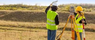
In order to carry out land surveying, the company enters into a contract agreement with a cadastre engineer, defining the scope of work and agreeing on the price by drawing up an estimate. Based on the results of the activities carried out, a draft boundary plan is prepared.
The document consists of two parts:
- graphic, where the boundaries of the plot are determined and access to it is indicated (paths, paths for vehicle access, etc.);
- text, indicating that the work was carried out using state geodetic networks or support boundary lines, etc.
Boundaries are determined by setting the coordinates of characteristic points. The area of the plot is a geometric figure obtained by projecting the boundaries of the plot onto a horizontal surface. To clarify the perimeter, data is taken from documents establishing the right to land ownership, or information from an approved project for land surveying. If neither one nor the other is available, the outlines formed over the past fifteen or more years will be used as the basis.
The cadastral engineer provides each participant with the opportunity to familiarize themselves with the project before its approval. This must happen no less than 30 days before the general meeting. The place and regulations for familiarization are contained in the notices that the engineer sends to members of the organization or publishes in the media.
We recommend that you read:
Land surveying in SNT
The notice contains the following:
- who is the customer and the contractor, their location and contacts;
- cadastral number and location of the original plots;
- where, when and how acquaintance with the project can take place.
If there are objections to the passage of borders, the person who expressed disagreement provides the cadastre engineer with a written justification for the reasons for this, indicating the passport details and attaching copies of papers confirming ownership of the land.
Land surveying goals: why is it necessary?
When it comes to common shared ownership, it is more legitimate to speak not about land surveying, but about the delimitation of land. Land surveying is a procedure during which the exact boundaries of a land plot are determined and a detailed description of its characteristic features is formed. In turn, the main purpose of demarcating a site is to divide it into several parts , with each of which it will subsequently be possible to carry out separate legal operations (transactions).
So, after demarcation, each of the parts of the once common allotment can:
- transfer to another owner by donation;
- change hands by sale;
- move to another owner in the process of dividing property (for example, during the divorce of former spouses);
- change your target purpose, etc.
The boundaries of the main area within which the demarcation is carried out remain unchanged. The allocation of parts occurs on the basis of those parameters that are indicated in official documents on the right to own shares of a plot . At the same time, engineers carrying out land surveying may deviate slightly from the given values, because they need to take into account the properties and characteristics of the soil.
Approval of the project by the general meeting
The counting of votes is related to the size of a person's land share. The area of the plot corresponds to that indicated in the Rosreestr extract.
To ensure quorum, the following must be present at the meeting:
- At least 20% of owners from the entire list.
- If it is possible to compare the size of the share to shares in common property, participants who collectively have more than 50% of land shares.
Citizens are allowed to vote upon presentation of a passport, documents confirming the right to own land, and representatives must have a power of attorney executed in compliance with the requirements of the law.
Voting on this issue is open. To make a decision, it is necessary that participants who collectively own 50% of the shares or more, if comparison is possible, or more than half of the meeting participants, must vote for it.
When a land surveying project is approved by the general meeting, there is no need for additional approval of the locations of the boundaries.
The decision made by the participants must be documented in a protocol. A mandatory appendix includes a list of members of the organization who attended, as well as the details of documents confirming the right to own land. The minutes are signed by the chairman, secretary of the meeting and a representative from the authority present. The document is drawn up in two pieces. The storage location of the first copy will be the address of the person who initiated the meeting. The second is transferred to the local authority, and the approved land surveying project is also provided there.
Duly certified copies of the protocol, land surveying project, as well as extracts from them are issued within 3 days upon request of a citizen or organization whose interests are affected.
Registering a new address
The person who initiates the demarcation process (i.e. the customer of geodetic work) actually becomes the legal owner of the new land plot . He automatically ceases to be a shared owner and becomes an individual owner.
The new plot will need to be assigned a separate address. To do this, the individual owner will need to contact the local municipal service in person or through his representative (if he has a notarized power of attorney). An application containing the following information must be submitted here:
- Full name and position of the recipient employee;
- Full name, residential address and contact telephone number of the applicant;
- request to assign an address to the land plot;
- list of attached documents;
- date of compilation and signature.
The application will need to be supplemented with copies of procedural materials - these are:
- the applicant's civil passport;
- boundary plan;
- an extract from Rosreestr containing a description of the original plot and an indication of its owners;
- an agreement between shareholders or a court order on the delimitation of land and division of the allotment.
Assigning an address to a land plot is a procedure that is not subject to state duty. The period for consideration of the submitted application should not exceed 18 days.
Education allotment participant
To form an allotment without a decision of the general meeting, the owner will also have to contact a cadastral engineer to carry out land management work. Then the surveying of agricultural land requires coordination of the location of the boundaries of adjacent plots. This procedure is carried out by the engineer in two ways: through a meeting of those whose interests are affected or through agreement with each individual. The venue will be where the property is located. Notifications are sent out in advance; for this purpose, Russian postal services or electronic resources are used. Provided that there are no addresses of those who need to be notified or the plot being formed is located on the lands of a non-profit organization, information about the upcoming meeting is communicated through publication in periodicals.
The advertisement contains the following information:
- address and cadastre number of the plot being formed and those bordering it;
- information about the person who ordered the work and the performer of the work;
- the day and exact time chosen for the meeting;
- period for making comments.
All interested parties are notified no later than one month before the meeting takes place.
When choosing an individual approval method, it is not necessary to notify each of the involved persons.
We recommend that you read:
How to carry out land surveying without the consent of neighbors and him
The result of the work will be the preparation of an Act, located on the reverse side of the sheet where the part of the boundary plan, made graphically, is located. This document will be recognized as agreed upon, provided that it bears the signatures of everyone whose interests it affects. On the paper, each signature is confirmed by indicating the passport details or by a power of attorney executed in accordance with all the rules.
If within the established period the owner of the adjacent plot has not submitted formalized objections and has not signed the Act, the document will be considered approved.
Registration
Since the land share is a separate piece of real estate, it must be registered. To do this, a person will need to contact an authorized official body. This is Rosreestr. A person must submit an application, his passport, a survey plan, a receipt for payment of the state fee, and a power of attorney from the legal representative if he is taking part in the procedure. The initiator can transfer materials in several ways.
Most often, people provide information in person. This allows you not to bother filling out the application yourself, which will help you avoid mistakes. A person will also be able to make sure that his request has been registered and accepted for execution.
You can send your application by mail. In this case, the information should be sent by registered mail, with notification of delivery to the recipient. At the same time, this method involves filing an application independently.
The law also allows sending data over the Internet. To implement this option, you will need to have email at your disposal, as well as digitize all documentation.
Perhaps the easiest way is to contact the multifunctional center. In this case, the interested person will only need to pay the state fee and submit the available documents. Next, with the help of specialists, he will fill out an application. They will forward the information to its destination.
After reviewing the documents, the applicant will receive a cadastral passport.
It must contain the following data:
- Location of the property.
- Its type and purpose.
- Total area.
- Cadastral number.
- Registration date.
- Information about the authority that issued the document.
- Graphic plan of the object.
The cadastral passport cannot be issued in any order. To do this, it is necessary to use a standard approved by current legislation.
Dimensions of formed areas
Relevant acts establish the maximum size of plots obtained by allotment on account of the share. The permissible minimum size is determined by the regulatory framework of the subject. Thus, in the Krasnoyarsk Territory it is identical to the area indicated in the document, which is confirmation of the right to own land, taking into account the quality of farmland (ballo-hectares).
For the maximum size, the law defines the permissible area of such an allotment and it is no less than 10% of the area of all agricultural land in the specified territory. In the Krasnoyarsk Territory, for example, it is 25%.


