Each land plot has its own boundaries, reflecting its position among other neighboring plots and public areas.
Such boundaries are reflected in red lines on the graphic technical documentation of the land. The red development line not only fixes the boundaries of the site, but also establishes the minimum permissible distances between objects and promising areas for land development in the future.
If you build a building on your site in violation of the established red lines, it will not be possible to legitimize it and register ownership of it.
Information about the location of the red building lines is available to all interested users; if desired, it can even be moved by decision of local authorities.
What is the red line
The first article of the Town Planning Code (hereinafter referred to as the RF GRK) defines red lines (hereinafter referred to as RL).
It is important that the legislator marks with red lines not only existing borders, but also planned ones. In other words, the CL separates the areas on which public facilities will be or are already located from the rest of the plots for individual use
Public facilities are streets, roads, squares, parks, power lines, pipelines and other similar structures
In other words, the KL separates the areas on which public facilities will be or are already located from the rest of the plots for individual use. Public facilities are streets, roads, squares, parks, power lines, pipelines and other similar structures.
In addition to the Civil Code of the Russian Federation, when defining the concept of a red line, it is worth relying on RDS 30-201-98 “Instructions on the procedure for designing and installing red lines in cities and other settlements of the Russian Federation.” It states that CLs are delimited by blocks, microdistricts and other elements of the planning structure from streets, driveways, and squares.
On maps, these lines often cross both public and private land. This phenomenon is called boundary overlap.
Boundary overlap occurs when two adjacent areas intersect. In this case, a dispute may arise between neighbors (read: what to do if a neighbor has seized part of the land?). If the actual boundaries of your plot do not correspond to the data on the cadastral plan, write to our lawyer in the chat on the right. He will tell you how to solve the problem quickly without financial costs.
An example of the location of the red lines is provided in the photo below, where you can see that the cable line has a separate area for engineering infrastructure, and in the second picture there is a section for individual development.
As mentioned above, CL highlights not only existing objects, but also those that are only in the planning process. That is, in fact, they exist only on paper. Owners who legalize buildings through the court should remember this. After all, authorities are not obliged to notify citizens about the planned installation of electrical networks, water supply or gas. Therefore, when considering petitions and applications from the Administration, the judge relies on the fact that the owners must independently monitor such changes, and leaves the claim without satisfaction.
Remember, every case is unique. Before going to court to legalize a building and starting disputes with local authorities, consult with a lawyer. To do this, write to the chat on the right. A land specialist will answer your questions free of charge and help you find the right solution to your problem.
Regarding the issue of the influence of cable lines, the law states that within these lines it is prohibited to erect capital construction projects, except for those specified in local regulations (for example, monuments). Also, houses or other buildings must be located at a certain distance from the location of the cable line. The distance is set in accordance with the Code of Urban Planning Rules and depends on many factors:
- type of construction project;
- wall material;
- type of object behind the red lines (driveway, street, park, water supply, gas, etc.).
There are other calculation features that affect the distance
Therefore, before starting construction, it is important to familiarize yourself with the passage of the cable line and obtain permission “in accordance with all the rules”
You can see the red lines in almost any document containing a schematic representation of the area. These include:
- general plan;
- development projects, planning, engineering and transport communications;
- land surveying project;
- cadastral plan.
These documents can be obtained from Rosreestr or from the architecture department of the Administration. An online version of the cadastral map is also available on the Rosreestr website.
Definition in other legislations
Let's consider how such a term is defined in the urban planning documentation of other states. For example, countries of the former Soviet Union.
The red line of the street is:
- The boundaries of both designed and existing streets, squares, roads, etc., defined in urban planning documents regarding points of geodetic networks, are intended to delimit building areas and other land plots (Ukraine).
- Conventional lines provided for in urban planning documents of detailed planning. Their purpose is to separate public spaces in populated areas from areas intended for development or other uses (Belarus).
- Borders that separate the territories of blocks, microdistricts and other objects of the planning structure of settlements from squares, streets, driveways, etc. (Kazakhstan).
- Conditional lines provided for in urban planning documents for separating roads, streets, squares, engineering and technological equipment, railways, communication and power lines from territories whose purpose is private development (Tajikistan).
Red Line Standards
To determine the calculated indicators, you need to correctly draw up regulatory documents. These include the following:
- SPOSU is a diagram of a piece of land. It has boundaries drawn before permission is received for the construction of a building, structure or any other object. Allows you to further determine the zone permitted for construction. In other words, this is a drawing without which construction cannot begin.
- GPZU is an urban planning plan. It shows the red lines and overall layout in detail. Serves to carry out work on its site. Most often, a detailed plan of a land plot serves as a source of information about what restrictions there are in this area.
The plan indicates high-rise buildings, parks, large complexes, squares and streets. The new object must be correctly included in this plan.
The red line, like other restrictions, makes adjustments to construction conditions:
- brick houses should be 6 meters apart from each other;
- between a wooden and a brick house a distance of 10 meters is determined;
- log houses should be 15 meters apart from each other;
- sheds and garages can be built 1 meter from the property line.
Such requirements are determined by fire safety rules. In the event of fires at individual facilities, the risk of fire in neighboring structures will be minimized. Such distances are also justified when extinguishing fires. The need for fire trucks to approach and turn around between buildings requires certain standards.
At the start of construction
Before building any structure, be it a house or a bathhouse, a barn or a garage, it is necessary to complete all the paperwork. Without them, the building will be considered unauthorized, and in case of gross violation of standards, it will be subject to demolition.
You will definitely need:
- A housing project that will show in detail the plan of each floor, foundation, and roof. An explanatory note with a detailed description should be attached to it.
- A permit to build a house or other structure issued by the local administration.
- A situational plan, which will reflect the nearest objects, roads, plantings, sources of electricity, water, gas and heat.
- General plan.
By starting to build a house without these documents, the owner of the site exposes himself and his construction to a certain risk. If during the construction of a structure the norms for the distance from the red lines are not met, then in the future this may lead to the demolition of the construction site.
To avoid such troubles, you need to familiarize yourself with SNiP. It spells out the basic rules for the proper placement of objects.
Norms
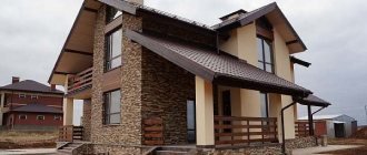
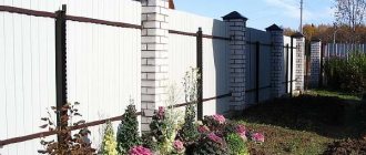
If the owner plans to build a residential building, then according to SNiP it must be located at a distance of at least 5 meters from the road and 3 meters from the street. Housing cannot be located in the center of the site. This has a practical explanation: to fully service the building, it must be located close to the border, but no less than a meter from the fence.
Outbuildings should be located deep in the plot. When building a garage, you need to measure the distance to the red line with the doors open so as not to violate the boundaries. The fence, which is located on the street side, must be marked on the project.
To comply with fire safety measures, the distance between houses should be from 6 to 15 meters. Buildings for poultry and animals should not be higher than 2.4 meters in height. They can be attached to housing, but separated by three utility rooms.
In the video about the indentations from the boundaries of the site during construction
All these standards are observed by the owners on a voluntary basis. Otherwise, a fine will be imposed on the owners of incorrectly located buildings. A decision may follow to demolish such structures.
Problem situations
Often, even the existing contours of public areas become the object of problems.
However, in each case, a solution can be found and difficulties encountered in determining the location of red lines or other difficulties can be overcome.
Absence of design solutions in the history
Before the introduction of such a concept as the red line, the development of public areas was indicated differently on the plans.
Therefore, it may be absent from the history of design decisions in some urban areas, despite the presence of actual boundaries of public areas.
In such a case, the issue of establishing red lines on the plan can be resolved by developing a special project .
Difficulties with territory planning usually do not arise, since the boundaries of streets and private households are actually reflected on the ground. It is only necessary to transfer them to the plan and highlight the outline of public lands.
It is pointless to draw design lines at the stage of considering a development scheme , since there are actually already significant ones on the ground.
Inconsistency with what actually exists
If the plan shows contours that do not actually correspond to the boundaries of the actual building, changes should be made to the existing scheme .
To do this, coordinates are determined in kind, and in accordance with the information received, changes are made to the cadastral documentation.
Lack of planning documentation
The loss of plans or partial availability of planning schemes, which due to historical prescription are not recognized as legally significant, does not entail the obligation to draw up new documentation and make changes to the design contours.
In fact, building lines exist on the ground and can be reflected in various cadastral registration materials after they have been studied.
Parts of buildings cross the boundaries of public territory
If the facade or other part of the building protrudes beyond the boundaries of public lands, you should refer to the Land Use Rules. The regulations indicate the dimensions of permitted projections of façade parts.
However, it is worth remembering that if the red lines stop buildings that were erected on privatized territories, then based on a court decision, the owners may be forced to demolish the building .
Red building lines: what are they?
Red lines are needed to indicate the boundaries of land plots. According to the Town Planning Code of the Russian Federation, they mean the boundaries separating blocks and microdistricts from streets, squares and passages in populated areas. The names of the lines are given by the color with which they are usually designated on project maps. Red lines in construction are determined, among other things, taking into account the development prospects of the settlement.
According to the law, when constructing facilities, it is important to comply with a number of conditions:
- Buildings on the site must be located within the red lines;
- The object should be at a distance of 2 to 3 meters from the lines.
However, there is an exception for buildings with premises for public needs located on the first level. They can be built directly along the building line. If the object goes beyond the red lines into public territory (such lands cannot be privatized - Article 85 of the Land Code of the Russian Federation, clause 12), the building may be demolished by court decision.
Boundaries of red building lines
Separate “islands” can be identified on a plot of land, outlined with red lines.
This is possible if the building site has:
- telecommunication lines;
- pipelines and other utilities.
Thus, even on a privatized site there may be areas where construction is prohibited.
At first glance, it can be difficult to determine exactly where the red line is: there are no marks on the area.
You can obtain information in two ways:
- By contacting the cadastral chamber and requesting a general development plan or a situational plan of the land plot;
- By inviting land management specialists who will determine the boundaries of the site.
Red lines and other lines of urban planning regulation are required to be taken into account and reflected in the following documents:
- General plans, development projects and detailed planning;
- Highway planning projects, locations of squares and streets and engineering/transport communications;
- In the land and urban planning cadastres.
The red line project is subject to mandatory coordination and approval as part of the urban planning documentation.
Distance between the red line and the building line
The distance from the red line to the building line is regulated:
- town planning code;
- SNiPs.
For example, according to clause 2.14 of SNiP 2.07.01-89, residential buildings with apartments on the first levels are located indented from the red line. In homestead development areas, it is allowed to place residential buildings along the red line, if this is the tradition of local housing construction.
When building houses on personal plots, the recommended distance between the house and the red line (sidewalk border) is 4-5 m.
This distance allows:
- Separate a residential building from a dusty and noisy street;
- Organize the space as conveniently as possible.
Monitoring compliance with the standards is quite simple: to obtain permission to construct a capital facility, you must provide a layout plan for the site. It must indicate the boundaries of the site, the location of the red lines and the designed object.
Here you will find the answer to the question - where to get a town planning plan for a land plot.
Minimum fire clearances
This parameter depends on several factors. If we are talking about residential buildings, the distance is determined based on the material of the walls and ceilings of the house.
| MATERIALS OF WALLS/COLORS OF THE HOUSE | Distance to buildings, m | ||
| I | II | III | |
| I Houses made of concrete and brick with concrete floors | 6 | 8 | 10 |
| II Houses made of concrete and brick with wooden floors | 8 | 8 | 10 |
| III Wooden houses | 10 | 10 | 15 |
In addition, the minimum distances between objects must be taken into account:
- From the house and outbuildings to the red line of the street - from 3 to 5 m. In this case, an equipped place for a vehicle can be adjacent to the fence on the street side;
- There is at least 3 m between the house and the neighboring plot. It is also necessary to take into account the distances between houses given in the table above.
Before approval of urban planning plans and entering them into documentation, the locations of the lines are subject to approval. The approval procedure is regulated by the town planning code and SNiPs. The location of the lines can be adjusted. This is a difficult and slow procedure, the result of which depends on the policies of state and municipal authorities. The document approving the red lines relates to regulatory legal acts and is publicly available.
Fulfillment of conditions
The information system for supporting urban planning activities also provides information about the red line. You need to know about such boundaries before constructing an object. Neither private buildings nor public buildings should be located in any random order.
In particular, Russian state construction standards recommend locating capital construction projects within the exact boundaries of red lines. The distance to such a line should not be less than 2-3 meters. An exception is introduced only for those buildings on the ground floors of which institutions are located to meet public needs. It is permissible to build such houses close to the red line.
If other buildings come too close to it (or even go beyond the red line), then they are demolished by court decision. In addition, the privatization of real estate constructed with such violations is prohibited. This is regulated by Art. 85, ch. 12 of the Land Code.
Fire safety requirements
To comply with fire safety rules, the minimum distances between buildings of both your own and adjacent plots should be taken into account in accordance with the material that serves as the basis of the structure:
- between buildings made of completely combustible materials (wood) a distance of at least 15 meters must be maintained;
- between buildings made of fireproof materials (stone, brick, concrete) a distance of at least 6 meters must be maintained;
- between buildings that have a fireproof base, but one of them uses wooden floors or insulation made from combustible materials, a distance of at least 8 meters must be maintained;
- between buildings that have a fireproof base, but each of them uses wooden floors or insulation made of combustible materials, a distance of at least 10 meters must be maintained.
In any case, to assess the fire resistance of structures, you should contact special authorities.
How to correctly measure the coolant temperature?
rong>In the heating system, the coolant is hot water, heated to the required temperature. Current legislation has established temperature standards for coolant in an apartment building. According to regulatory documents (SNiP 2.04.05), the following parameters are considered the norm:
- 96 degrees with a two-pipe system;
- 116 degrees with a one-pipe system;
- The average heating temperature of the batteries is 78 – 92 degrees.
To measure the coolant, you need to place an alcohol thermometer on the radiator. After a few minutes, check the result, to which one degree should be added. For a more accurate measurement, you can use a room infrared thermometer.
You can also take the temperature of the coolant in the apartment using an electric meter, which is fixed to the battery using a thermocouple wire.
Application mechanism
Based on the Town Planning Code and various SNiPs (building codes and regulations), various kinds of standards have been established that determine the places where a residential building or various types of outbuildings can be built. That is, you cannot build on your site absolutely freely, in any place you like. What kind of requirements are we talking about here?
In the past, until 2015, there was a dacha amnesty, within the framework of which it was possible to first carry out development, and only then legalize it in local authorities. At the same time, those in charge were often lenient in situations where the rules associated with the use of the red line were violated. In recent years the situation has changed. If construction was first carried out, and then, in fact, they tried to legitimize it, then this may not work out except through going to court. However, a positive decision is by no means guaranteed. And an illegally erected building can be demolished, regardless of the fact that we are talking about one’s own plot of land.
What is the correct sequence of actions?
Necessary:
- Draw up all the necessary documents indicating the location where the residential building and outbuildings will be erected.
- Contact your local authorities and get permission from them.
- Carry out construction in full accordance with the executed documents.
The legal requirements are that the distances between the red line and the place where construction will take place are established.
In this case, it is also necessary to take into account fire safety standards, which relate to the distance between houses in neighboring areas.
Differences from site boundaries
In essence, the red line and the extreme points of the site are used to achieve one goal - to separate the plots from each other .
However, there are significant differences :
- Land intended for public use is marked with red outlines. The boundaries of a land plot indicate the extreme points of ownership owned by a specific person or state.
- Property boundary lines are established during the land surveying procedure, and red lines are established by adopting a regulatory act, for example, a Decision or Decree of the regional or city government.
- The size of the plot changes quite simply, for example, after annexing a neighboring property, or when dividing an existing plot. Red lines, established legally, are indicated on the development plan, and it is difficult to change their location.
- Public lands may be located inside a privatized site, for example, when laying power lines, or cross it. The boundaries of the land plot cannot extend beyond the boundaries of the red lines.
- The establishment of red lines is entirely within the competence of the authorities; they represent a completely independent object of cadastral registration. And the extreme points of the allotment are determined at the request of the owner of the land plot.
What are the red lines on the cadastral plan?
When turning to a public map of the Russian Federation or ordering information from the State Cadastre, many see atypical graphic images in the drawing, such as colored outlines. Let's figure out what these red lines are on the cadastral plan for documents and for the owner of property rights? Let us explain that the red lines themselves on the cadastral plan are lines that are intended for urban planning, along which the boundary of the site is determined where construction of a specific legal object or engineering structure can be carried out.
In general, red lines indicate the boundaries of the site, both by territorial characteristics and by districts, districts, etc. According to the regulations of both the Town Planning and Land Codes, there are two types of graphic line designs:
- Design or conditional graphic line.
- The actual boundary of the site.
On the public cadastral map you can see these red lines in real time when searching for a specific object of law.
Features and characteristics of red lines on the cadastral plan
Let's get back to the actual terms and meanings of the red lines. Thus, the draft red line has no legally significant force. Conventionally, this is a recommended boundary that allows owners of the right to clarify the boundaries, conduct construction and carry out the process of legitimizing the boundaries of the land plot. At this stage, it is possible to determine the exact boundaries of the allotment before the trial.
The existing boundaries of a land plot have legal coordinate points, that is, legally significant boundaries that cannot be changed without certain actions on the part of government agencies or the owner of the property right. In general, the existing boundaries of the red lines delimit certain territories and areas:
- Motorways.
- Railways.
- Territories of active water areas.
- Territories of land plots.
- Outlines of buildings and structures.
- Engineering communications of power lines, pipelines, etc.
What to do if the red lines do not match the real boundaries?
Considering that the cadastral system became fully operational relatively recently, only in 1998, there are inconsistencies with the real and actual position of the boundaries of the site. In this case, you will need to issue an official extract from the Unified State Register, provide title documents and clearly define the real boundaries of a particular site. Otherwise, for example, in case of unauthorized possession of a plot, the state has the right to fine in accordance with the current legislation of the Russian Federation. To avoid troubles, you can order the required document on our resource and challenge or clarify the current boundaries of the plots. Having officially recorded legally significant red lines on the site, you can legally use your property rights in the future. Documents have an electronic or paper version, and both blocks of information have equal legal force for presentation upon request.
Public cadastral map of Russia online
Cadastral map of three cities of federal significance: Moscow (Moscow region) St. Petersburg (Leningrad region, “Peter”) Sevastopol Public cadastral maps include 22 republics: Adygea Altai Bashkortostan Buryatia Dagestan Ingushetia Kabardino-Balkaria Kalmykia Karachay-Cherkessia Karelia Komi Crimea Mari El Mordovia Sakha (Yakutia) North Ossetia - Alania Tatarstan Tyva Udmurtia Khakassia Chechnya Chuvashia
At the same time, it is possible to find the necessary information about land plots that are included in Rosreestr at any time.
Public cadastral map of Russia (read more...)
Cadastral maps of the Rosreestra of all Russia and all 85 constituent entities of the Russian Federation are presented in online format:
Requirements for location relative to the red line
Location of buildings relative to the road, taking into account the requirements
In construction, such a concept as the “red line” is used. The exact definition is given in paragraphs. 11th century 1 of the Town Planning Code of the Russian Federation. It serves to separate public areas, as well as areas on which cable lines, pipelines, roads, railways and similar structures are located, from private land plots. Such lines are indicated on maps of territory planning projects in the corresponding color.
A residential building should be located no closer than 5 meters from the street line and no closer than 3 meters from the driveway line. It is not difficult to distinguish a street from a driveway: streets on topographic maps have names, driveways do not.
Tall trees are located no closer than 4 meters from the red line.
Shrubs located closer than 5 meters from the road should not exceed 0.5 m in height.
All tall plants should not interfere with the passage of fire fighting equipment or reduce the required illumination of residential premises.
Definition
The red line of the street is a line indicating the existing, changing, planned, newly formed boundaries of territories and public areas. They may contain the following:
- Car roads.
- Pedestrian sidewalks.
- Power lines.
- Engineering structures.
- Communication lines.
- Tram rails.
- Other linear objects.
The red development line separates public, public areas from those areas that are already being developed by private individuals.
Why red? The name is given by the color of this designation on the project maps of the territory layout.