To build a house or any other object, you must obtain permission from the Administration. This even applies to land owners. It would seem that everyone builds wherever they want on their own land. And after construction is completed, they file a lawsuit to legalize the construction. This method is much simpler than visiting various authorities to obtain permission.
If the construction does not interfere with anyone, the neighbors, utility services, or the Administration have no complaints, then the court, of course, will satisfy the claim. But in practice, it happens that the court refuses to legitimize and makes a decision on the demolition or relocation of buildings due to the red lines located.
In the article we will look at what the red line of a land plot means on projects and territory plans, what it affects and what the consequences of violating these lines are.
General concept
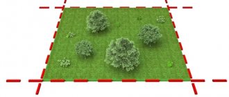
Turning to the Town Planning Code of the Russian Federation, we can define that red lines are symbols, the purpose of which is to clarify the boundaries of a land plot between public areas , as well as areas on which communication lines, pipelines, etc. are located.
Public areas may include streets, roads, beaches, embankments and all those places to which every citizen of our country has access.
Also, following the fifth chapter of the Town Planning Code, red lines should be displayed in the cadastral plan, in the planning plan and on various maps and diagrams.
For a land plot, when determining the red lines, not only the Town Planning Code, but also the Land Code are taken into account.
What are they needed for?
The key function of red lines is to delimit public and private areas. It is for this purpose that they were invented.
In what cases do they appear?
There are several reasons for their appearance:
- A case when an error is made when creating a project, which becomes apparent only after its registration.
- If the structures do not comply with the documents. This often happens due to illegal redevelopment.
- The emergence of new elements. This could be a railway or road, etc.
Are you afraid of mistakes that may occur during the land surveying process? Are you interested in existing error standards?
Find out how much is the permissible error when delimiting land!
Red building line
Residential and non-residential premises, streets and squares of populated areas are not installed randomly. They fit into the master plan developed by the architects and approved by the head of the local administration.
In technical documentation, the concept of “red line” is used. It is well known to the average person, but not every owner of a land plot (LP) has a reliable idea of what it is.
What is the “red development line” (RDL)
The designated concept in all situations of application is based on a single meaning - a border that is not crossed during the construction of buildings and transport connections.
The concept is used in the following cases:
- Determining the boundaries of the line of structures being built in a populated area, street, square, district, etc.
- Dividing the storage area into zones when drawing up design documentation or reading drawings.
- Conditional division of territory with different types of permitted use among themselves.
- Conditional separation of highways, roads, areas from other territories used for development.
In addition, it can mean the structure of the construction of a street or block and act as an organizing principle - a feature that building designers do not interfere with.
The red line concerns not only the conditions of the context of a settlement, in which the municipality and the architectural department allocate zones for the construction of high-rise buildings, two-story, three-story houses or transfer land to owners for individual housing construction (IHC).
Such storage facilities are subject to standards defining the intended uses:
- To ensure the order of public use of land property, and also to preserve the right to use land plots by each owner, without external negative influences.
- Ensure fire (and other) safety for dacha rights holders.
Red line building standards
To establish regulations and standards, regulatory documentation is required.
This includes:
SPOZU – scheme of planning organization of a land plot. A red line is drawn on it, prior to the construction of the facility, separating the area where the buildings will be installed.
GPZU is an urban planning plan for a land plot, which defines the red building lines in detail. In accordance with them, it is permitted to begin, conduct and continue further work.
GPZU of a specific territory is carried out on the basis of an interactive map: after copying a snapshot of the projected area from it, topographic signs are applied on it, placing in their places the multi-storey buildings, sports and cultural complexes, parks, squares, streets and neighborhoods located in the area of the projected territory.
The task of the architectural department is to fit a new property into the existing context of the locality, harmoniously adapting it to the landscape of the zone of permitted use of the land plot.
The red line narrows the user capabilities of the memory, following the established regulations:
- between brick houses - 6 m.,
- brick and wooden house - 10 m.,
- two log houses – 15 m.,
- sheds, garages - 1 m to the boundary.
Inside the site, capital and utility facilities are located at the discretion of the owners. The listed standards are determined by compliance with fire safety.
Regarding the distance between the red line and boundary boundaries, the following regulations were established:
- between the house and the boundary - at least 3 m.,
- between the garage and the boundary - at least 1 m.
Boundary strips are placed between areas, separating them with a fence.
The listed conditions are observed voluntarily by the owners, otherwise - by administrative decree or through the court (see Disputes during land surveying).
How to determine the red building line
The definition of red lines is under the jurisdiction of urban planning departments of municipalities or architectural departments, as, for example, in Moscow.
Citizens who acquire ownership of land plots, before starting to organize work on land plots, are included in the urban planning plan of the region and receive a building permit with an approved project.
Varieties
There are only 2 types of such symbols:
- Project red line.
- Existing red line.
The project red line is an element that does not yet have legal force and is conditional. This symbol corresponds to the boundaries of the land plot.
This variety is used to transfer the allotment diagram in order to indicate to the owner where to put the fence and where to make a small indentation.
The existing red line implies a legally binding element that is used to record and delimit a plot of land from:
- highways and highways;
- pipelines;
- railway;
- public areas;
- neighboring area;
- communication wires and power transmission.
The existing red line can separate both private and public property.
If there is an intersection with buildings
Quite often this situation occurs: there is a building built decades ago that is crossed by that same red line. Basically, such situations occur when streets are widened .
If you need to form the boundaries of the land in order to be able to operate the building, you will not be refused, since this is not a valid reason for purchasing this land.
From this we can conclude that if the red line does cross the building, this will not cause any problems .
How do they affect the site?
Previously, it was clarified that the boundaries of the site should not extend beyond the red lines .
Attention! If the rule is broken, your land will become public land.
This will lead to the fact that you simply will not be able to privatize it. The most unpleasant thing is that even the court will not help in this situation.
Other nuances and problems
- Lack of planning papers , which were the reason for the establishment of red lines.
This problem is most often associated with the fact that the development took place a long time ago, so these lines are not included in the boundary registration system. - The planning paper is present in parts , but its legal force is not recognized.
Because of this, we can assume that there is no red line on such objects. - The lines do not correspond to reality .
Those. the red lines that have been established and have legal force have no relation to real life at all. At such objects, the red line is also not taken into account; the main thing is to find its correct location and enter all this information into the cadastral plan. - The case when the line actually exists, but it is not in the cadastral plan . It needs to be converted into an existing one and all changes reflected in the cadastre.
Determining the location of symbols
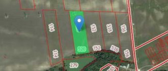
Before we determine the location of the red lines, let's clarify where the boundaries of the land plot are. Information regarding this is described in detail in the cadastral plan.
Making it possible to define red lines is the task of local government. They publish the procedure for determining red lines that relate to:
- highways and highways;
- pipelines;
- railway;
- public areas;
- neighboring area;
- communication wires and power lines.
Also mandatory, after receiving a positive answer to the construction issue, is a construction plan with all the red lines of the site drawn.
This condition will protect you from possible problems associated with the intersection of your structure with red lines.
Do you want to check information about your cadastral plan without leaving home? Looking to get data from the Internet? Then our articles on checking the plan by cadastral number and address will help you!
Distance from power lines and magnetic radiation
When electrons pass through wires, they create an electromagnetic field around their carrier. Depending on the type of current, the radiation value is constant or variable. A continuous change in the current value from plus to minus and vice versa causes the field to change its value 2 times more often.
In the evening
Exposure to magnetic radiation negatively affects a person’s physical condition, just like exposure to radiation.
Research on the effects of electromagnetic radiation on humans and wildlife began to be carried out at the end of the 70s. Based on the results of a survey of people in different countries, the WHO - World Health Organization determined the maximum permissible radiation levels in hertz per unit of time. In the Russian Federation and other countries, regulations have been developed prohibiting industrial and civil construction at close distances from power lines.
Secured territory
People who spent a long time in a strong field zone were diagnosed with cancer and heart disease. Women suffered from infertility. Men were plagued by pathologies of the genitourinary system. General weakness appeared. Life expectancy was reduced.
Cheap land near the protected zone
Based on SanPiN standards, construction rules were developed and sanitary zones were created under high-voltage lines. Children's institutions located in the danger zone must be closed. It is prohibited to build residential buildings for permanent and temporary residence closer than the distance indicated to high-voltage lines in SanPiN 2971-84.
It is impossible to sell a house located in a dangerous area. Sanitary and fire safety organizations will not approve such a document. When developing individual housing construction sites, it is necessary to take into account the distance to the power lines located nearby.
Electromagnetic wave propagation diagram
How dangerous the radiation from high-voltage lines is is demonstrated by land prices. The cost of plots near power lines is low. As you move away, it rises every 50 m. You shouldn’t be tempted by the cheapness. You need to think about the health of your family.


