When clarifying the boundaries of a land plot, it is possible that cases may result in deviations from the original dimensions of the plot. In this regard, the data available in the documents for the site may differ significantly from the actual ones.
In such a situation, it is necessary to officially approve the newly emerged boundaries with changed parameters. Here it is impossible to do without carrying out a special type of work on the site. It is about changing the boundaries of a plot of land and what needs to be done for this that will be discussed in this article.
When is it necessary to change the boundaries of a land plot?
There are several cases when it is necessary to carry out land surveying. These include:
- Erroneous initial change of site boundaries. This happens if the surveying company made mistakes and inaccuracies. Usually such manipulation is carried out again free of charge. The land owner only makes a second request.
- Natural blurring of boundaries. Over time, boundaries may disappear. A neighbor has moved the fence to your property a couple of centimeters, or the outdated documentation does not clearly show the area of the property.
- In connection with the statement of neighbors. If the neighbors filed a statement that they doubt the correctness of the measurement or noticed that you have taken over the area of someone else's plot. If there is an unauthorized increase in the plot by one of the neighbors, this must be proven.
- An application was received from the owner of the site. This issue is resolved if there is a need to separate or combine two adjacent areas. This is possible when buying or selling.
- In order to clarify the boundaries. If there is a discrepancy in land surveying: the documents indicate one thing, but on the ground it is actually another.
When they can refuse
Almost no one is refused at the time of receiving documents, so it is important to monitor the process of the registrar’s work and be ready to provide additional documents. Refusal is possible in the following cases:
- The information from the application and documents does not correspond;
- There is no written consent of third parties if the redistribution of land affects their interests;
- The annexed plot is withdrawn from land circulation or limited;
- Bidding has been announced for the plot;
- The site contains real estate objects owned by citizens, state or municipal bodies;
- The area of the plot is 10% larger than the main one;
- The annexed land is subject to independent formation;
- There is at least one discrepancy in the layout.
There is no provision for refusal due to the lack of information about the plot in the unified real estate register. It is important to identify such a situation in advance in order to carry out cadastral work in a timely manner and apply for registration of the cut-off plot. Only after completing this procedure can you annex the territory to your land. In most cases, a documented refusal is issued with a precise indication of the reason. If it can be corrected, resubmission of the application is allowed.
Registration of extensions is an ideal solution not only for the owner, but also for the authorities. But this will lead to an increase in the cadastral value of the site and a slight increase in land tax.
Thus, increasing the plot is possible by adding additional area. But it is important to comply with the maximum permissible magnification rates in force in a particular region. Having collected all the documents and knowing the procedure, you can unite the plot in a short period and obtain legal ownership.
Basic Concepts
Changing the boundaries of a land plot is a set of measures aimed at clarifying the size of the territory and, if necessary, making changes to the current documentation. This is documented only if the territorial zone actually shifts in one direction or another.
Simply entering updated data is not enough; it is necessary for the government agency to record the declared changes. To do this, the document with adjustments is submitted to the state body - Rosreestr, which directly records the changes made and approves the declared data with a seal.
A document with measured boundaries is submitted to the branch of Rosreestr at the location of the limited territory.
Important! Despite the fact that Russian legislation provides permission to reduce and increase the boundaries of the allotment, it must be taken into account that if the margin of error is allowed to be exaggerated, then the entered information must be correctly documented.
When changing the boundaries of a land plot, all data must be entered immediately onto a paper plan Source ndv.ru
Why is this needed and how does it happen?
All data in the state register is collected in a specific file cabinet. And if you need to change any information about the territory, this information also needs to be entered into the cadastre. When changes are made, the documents that reflect these changes are taken as a basis. There are also certain paper requirements.
So, in what cases do you need to contact the cadastre:
- The plot was divided into shares. Consequently, the address of the territory that belongs to a specific person has also changed.
- The settlement was renamed, which means the land found a new location.
There are also many other situations when information in Rosreestr needs to be updated. For example, the category of the plot was changed, the cadastral value was updated, neighboring buildings changed, and so on.
If the address changes, you will need an updated boundary plan of the territory, as well as an updated cadastral passport. Regardless of what category the land belongs to. This also applies to parts/shares of plots. If the characteristics of buildings located on the territory have been changed, this must also be entered into the cadastre.
To begin with, land surveying is carried out and new boundaries of the territory are determined. Next, a site plan is drawn up. It may also be necessary to prepare a technical plan, which is also drawn up by a cadastral engineer.
Important in the procedure for changing boundaries
Changing the boundaries of a land plot has its own characteristics, which consist in the following two ways:
- Without making adjustments to the area of the territory. It involves drawing boundary lines on the ground with clarification of all turning angles without shifting the sides of the site. There may be some redistribution of land plots with a shift, during which the area of the plot remains the same. In this case, the boundaries can move both in length and width.
- With a change in area. This is possible when merging, dividing, or allocating a separate share of the plot. As a result, after the boundaries are changed, a new area of the territory will appear. In some cases, one area is divided into two or three parts. This usually happens when controversial issues arise between the heirs of a share or local area. In the case of the allocation of a certain share, the plot from which a certain area was removed remains the main one, and the new one (share) is considered secondary.
Please note that a change in the boundaries of a land plot can be ordered by the direct owner or a person who is dissatisfied with the seizure of the area. This can be either an individual or a legal entity.
Boundary measurements should be carried out exclusively by professionals in the field of geodesy Source 2gis.ru
How to change the boundaries of a site?
Changing (clarifying) the contour of a land plot is a procedure for documenting deviations from a previously drawn up boundary plan, which can be carried out in two ways.
The first is a revision of the configuration of the contour line that defines the site, but while maintaining its area. Thus, in one place part of the area decreases, in another, accordingly, it increases. But the total area indicated in the cadastral passport remains unchanged. The second option is a procedure for changing (clarifying) the boundary with a change in both the configuration of the boundaries and the total area of the allotment. It can be carried out when correcting an error that was included in cadastral registration, or when adding a certain ownerless territory, but not a larger area, which is defined in the Land Code. Otherwise, it is necessary to carry out land surveying of a new plot separately (as, for example, when purchasing).
Where to start the land surveying procedure
To begin changing the boundaries of a land plot, you need to go through several stages. First of all, you should submit an application in the appropriate form to the cadastral department authority (this may be the local cadastral chamber). In this case, it is necessary to attach a certain list of documents:
- the statement itself;
- a document that confirms ownership of the land plot (deed of gift, certificate of inheritance);
- extract from cadastral registration;
- situational plan (indicating all objects present on the territory);
- a document that authorizes changes to the cadastre;
- identification document of the applicant (passport).
Next, a bilateral agreement is concluded between the owner and the contractor (geodetic company), in which both parties undertake to comply with the established rules and complete the work within a strictly established time frame.
Upon completion of the measurement work, the signature and stamp of the performing company must be affixed. Source 90percentrule.com
In case the boundaries are measured again, then it is also necessary to provide a justification that explains that it is necessary to carry out the survey work. It could be:
- administrative act;
- the court's decision;
- decision of Rosreestr.
It is not possible to simply check the boundaries of the site if desired.
Stages of boundary changes
In most cases, the entire land surveying process, together with the approval of the site plan, is officially carried out for at least three months. This period is enough to thoroughly double-check everything and clarify the boundaries of the site. To measure, all actions are performed in several stages:
- Preparation. This process begins with concluding an agreement with a geodetic company. A list of owners of adjacent plots is compiled, and a work plan is prepared in relation to the applicant’s land.
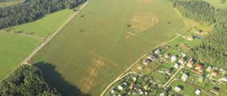
- Field work. This stage includes a geodetic survey, during which the area of the site is clarified and boundary signs are installed. All measuring work is carried out using professional equipment; relief features, soil type, and other features that are recorded on the site (depression, hill, presence of a natural or artificial reservoir) must be indicated. All recorded objects must be recorded on a plan on paper.
- Conclusion. This is the last stage, which includes the processing of the received information by specialists of the geodetic company, they also conduct a consultation with adjacent owners and clarify whether they agree with the measurements taken. Only after this is all the data transferred to an official document (cadastral passport), the adjustments made are confirmed by the seal and signature of the executive body.
All stages are carried out in strict sequence. As for coordination with neighbors, resolving this issue can take a long time. This process can also be divided into several step-by-step actions.
When measuring the boundaries of a local area, all types of objects present on it are taken into account Source megaprovokator.ru
Coordination with neighbors: important features
It is clarified that coordination with the owners of adjacent plots may take some time. It consists of several step-by-step actions:
- Neighbors receive a notification from the geodetic company, which is sent to the place of registration or residence. It can be sent by email, registered mail, published in a local newspaper (usually this option is advisable if the exact location of the owner of a neighboring plot of land is unknown) or the document can be issued in person against signature.
- The notice specifies the exact date on which the owner of the adjacent plot must appear at the geodetic company or wait for a representative of the company at home. During a meeting between the two parties, the engineer provides a plan of the measured area and clarifies whether the neighbor agrees with the changes. Typically, these meetings are held with at least three neighbors whose plots coincide with the one on which the survey was carried out.
- A day is set aside on which representatives of the company answer all questions from neighbors and carry out explanatory work. As a result, none of the adjacent owners should have doubts about the legality of the actions taken to change the boundaries.
- On the reverse side of the plan depicting the boundaries of the land plot, an act is drawn up, which indicates information about adjacent plots, their features are prescribed, and the exact area must be indicated.
- At the last stage, all neighbors who agree with the geodetic work carried out sign the act, after which the document is filed. The passports of persons who leave their signature in the cadastral documentation must be checked.
It is noted that a representative of the owner of an adjacent plot can also sign (the owner is sick, is abroad, other reasons), but only on the condition that he has an official power of attorney to carry out such activities.
Important! A drawing is a mandatory document, without which it is impossible to draw up an act and sign it. A document without graphic data can be easily challenged in court.
An example of an ideal site plan indicating all its features Source housevrn.ru
Plan of a land plot in the open steppe without accompanying objects Source zemvopros.ru
Changing boundaries after surveying
The question often arises of how to change the boundaries of a land plot after land surveying. This is possible in several cases: if the deadline established by law has passed or there are dissatisfied persons, or land survey documents were signed without their consent.
At the same time, no one except the owner can make a repeated application to the geodetic company. The owner will only need to provide evidence that the boundary change procedure is necessary. Find out what the justification may be in the section above.
The boundaries of a rectangular area on paper are highlighted with a red line if they were measured again Source: measurezemzem.rf
Finally
The boundaries of existing land plots may change. However, to officially establish new boundaries, a certain procedure must be followed.
At the same time, you need to be prepared for the fact that the owners of neighboring plots will express their objections to this matter.
You can learn about the practice of resolving disputes about establishing the boundaries of a land plot by watching the video:
See also Phone numbers for consultation November 26, 2021 kasjanenko 1222
Share this post
Discussion: 2 comments
- Faina says:
04/22/2019 at 05:14please let me know where there are standard agreement forms
Answer
- 5master5 says:
04/28/2019 at 11:55
I think that while the dacha amnesty period has been extended, we should definitely take advantage of securing the boundaries of our plot. That is, formalize land surveying and settle all ambiguities with neighbors. In the future, if you delay this matter, you shouldn’t expect anything good.
Answer
What to do if the land is owned, but there are no boundaries
It happens that a plot of land becomes owned by inheritance or a gift agreement. This outcome is possible due to the influence of various factors: loss of documents, incorrect transfer of ownership of the territory.
The owned plot should not remain without borders; it will then be impossible to sell it Source geroj-nashego-vremeni.ru
Such a phenomenon is a reason to urgently contact a geodetic company to put the site in order. After all, without precise boundaries, it is not possible to sell it, pass it on by inheritance and do other manipulations.
Important! In such a situation, there is a risk that the land surveying procedure will take more than 6 months.
Land surveying is also carried out for the purpose of correct installation of fences Source geomergroup.ru
If a body of water is found on the site during land surveying, it must be included in the plan Source estvaind.ru
Basic conditions
The procedure for increasing the territory is carried out in accordance with Federal Law No. 93, some provisions of which are called the law on dacha amnesty. This is a simplified scheme, which is allowed for plots acquired after 2001 since the introduction of the Land Code of the Russian Federation. The additional plot registered as a property under this scheme is called an extension.
The increase in area is regulated by Chapter 4 of the Land Code. The legislation establishes the concept of redistribution of territory. As a result, citizens have the opportunity to legalize the addition of a land plot occupied without permission or one that the citizen is only planning to annex.
Citizens who are owners of plots for individual construction, gardening, vegetable gardening and even agricultural purposes can apply for the procedure.
To carry out the procedure correctly, the following conditions must be met:
- The land must have the same territory as the main plot;
- It should not fall under public lands;
- The total size of the plot should not exceed the established standards.
Thus, in the Moscow region, the maximum size of a plot for individual housing construction is from 6 to 15 acres. The territory of the site cannot be expanded at the expense of roads, communications and other significant objects. In addition, it is impossible to add forest and coastal areas to the site.
An increase in area or so-called addition is possible at the expense of state or municipal territories not used for other purposes. Private land belonging to neighbors cannot be subject to this procedure. As a rule, these are small plots that are located in a dead end or surrounded by other plots with no access possible.
The size of the attached area is calculated individually, but it should not be more than 10% of the size of the main area. If the maximum area is exceeded, you will have to create a new plot through Rosreestr and buy it at the established cadastral value. To find out the exact limits, you must contact your local administration. This is due to the fact that each region sets its own standards.