Land Cadastral registration
0
The boundaries of each plot are established by land surveying. When studying the urban planning plan of the territory, the presence of red lines indicating the boundaries of public plots may become clear. Due to a plan change, such lines may run on private property. We will find out in more detail what consequences this will entail in the article.
Why is it important to know where the red lines are?
Specifying red lines significantly affects the ability to:
- providing a plot of land for private ownership;
When forming an allotment, it is necessary to take into account whether there are red lines running through it. Such public areas cannot be privatized;
- site development.
Design documentation submitted to obtain a building permit must be checked for the presence of red lines running through the site. At the same time, the presence of necessary setbacks from the boundaries of public areas is checked. If the conditions are not met, the building permit will be refused. Any development on the site where the red lines run will receive unauthorized status.
Therefore, when planning to purchase land and carry out construction, it is necessary to clarify whether red lines have been established there. You can find them out from the territorial planning documentation and the public cadastral map posted on the Rosreestr website.
Is it possible to find out the borders and coordinates of a storage unit only by its license plate number?
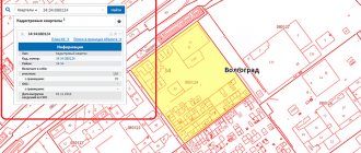
Plots of land that are located within the Russian Federation are subject to state cadastral registration. Each plot is assigned a cadastral number. It is presented in the format:
01:01:1000001:1, Where:
- 01 – code designation of the region;
- 01 - area;
- 1000001 – quarter;
- 1 – plot.
During the accounting process, the boundaries of the territory and its coordinates are determined. All interested parties, regardless of ownership, can obtain this information by cadastral number.
Principles for establishing red lines
In accordance with clause 2, part 3, part 4 of Art. 41 GRK red lines are established by the following documents:
- territory planning project;
- a territory surveying project, if a planning project has not been prepared or together with it.
Together with the town planning code, the Instruction developed and approved by the State Construction Committee dated 04/06/1998 No. 18-30 remains in force. It is still used when establishing special lines. The boundaries of public areas established by the documentation before the entry into force of the new Civil Code also apply, i.e. until August 2, 2019.
Boundaries within the red lines may change: moved or canceled, by decision of the local government, as well as in connection with the approval of the PPT or its land surveying in a new edition.
What is this data for?
The lack of information about the territory in the cadastre makes it impossible to register ownership of it, as well as to carry out civil transactions. Clarification of the boundaries of the memory may also be required in the following cases :
- dividing a large plot into several small ones or vice versa, combining territories into one;
- registration of the land plot for cadastral registration;
- the need to allocate the share of each owner when dividing property or entering into an inheritance (how to find out who the owner of a land plot is by its cadastral number?);
- resolution of disputes with neighbors regarding the delimitation of adjacent lands;
- collecting information about the land plot before its sale (about whether it is possible to sell land at cadastral value or lower and what the procedure and consequences of the transaction are, read here)
- detection of inaccuracies or erroneous information in documentation.
How to check or find out the cadastral number using the address
For such manipulations, there is a fairly convenient server that helps you find the cadastral number only by entering the address. To get complete information about the cadastral number, you should follow this algorithm:
- We go to the desired page of our website and fill out all the fields that are proposed in the forum, namely: region, locality, address. All parameters must be selected in the list that opens. By entering the first letters, the user will find exactly the address that is needed and indicated in the directory. The street and house are indicated, and information about the apartment is also available. You should also fill in her number to provide all the necessary user data;
- We click on the “Find” button, after which the service compares the Rosreestr data with the results that the search produces. The People's Map helps with this;
- If the user needs to fill out a report, then just click on the “Select object” item, read the data and click on the list of documents that the user needs for further use.
This is a fairly simple algorithm, thanks to which you can find out the cadastral number using the address. There is nothing difficult if you use the right servers. Some people do not understand how to use the “Rosreestr” of the Russian Federation, however, for such cases there are online services that are convenient and provide the necessary information quickly and easily. The land cadastral map is designed to solve such problems.
General concept
Turning to the Town Planning Code of the Russian Federation, we can define that red lines are symbols, the purpose of which is to clarify the boundaries of a land plot between public areas , as well as areas on which communication lines, pipelines, etc. are located.
Public areas may include streets, roads, beaches, embankments and all those places to which every citizen of our country has access.
Also, following the fifth chapter of the Town Planning Code, red lines should be displayed in the cadastral plan, in the planning plan and on various maps and diagrams.
For a land plot, when determining the red lines, not only the Town Planning Code, but also the Land Code are taken into account.
What are they needed for?
The key function of red lines is to delimit public and private areas. It is for this purpose that they were invented.
In what cases do they appear?
There are several reasons for their appearance:
- A case when an error is made when creating a project, which becomes apparent only after its registration.
- If the structures do not comply with the documents. This often happens due to illegal redevelopment.
- The emergence of new elements. This could be a railway or road, etc.
Are you afraid of mistakes that may occur during the land surveying process? Are you interested in existing error standards?
Find out how much is the permissible error when delimiting land!
Varieties
There are only 2 types of such symbols:
- Project red line.
- Existing red line.
The project red line is an element that does not yet have legal force and is conditional. This symbol corresponds to the boundaries of the land plot.
This variety is used to transfer the allotment diagram in order to indicate to the owner where to put the fence and where to make a small indentation.
The existing red line implies a legally binding element that is used to record and delimit a plot of land from:
- highways and highways;
- pipelines;
- railway;
- public areas;
- neighboring area;
- communication wires and power transmission.
The existing red line can separate both private and public property.
If there is an intersection with buildings
Quite often this situation occurs: there is a building built decades ago that is crossed by that same red line. Basically, such situations occur when streets are widened .
If you need to form the boundaries of the land in order to be able to operate the building, you will not be refused, since this is not a valid reason for purchasing this land.
From this we can conclude that if the red line does cross the building, this will not cause any problems .
How to view your home from satellite in real time
There are two main options for viewing your home: Bing.Maps is Microsoft's online mapping service, formerly known as Windows Live Maps and MSN Virtual Earth. Its capabilities include satellite display of maps, street view, 3D display for 60 cities around the world, plotting the optimal route and other features that are standard for services of this type.
The map shows only areas for which land surveying has been done (that is, the exact coordinates of the corners have been measured).
What is a conditional number and what is the difference from a cadastral number?
During the period of the Soviet Union, all lands belonged only to the state, and all organizations and individuals were only temporary tenants. In 1992, a new Land Code was approved. According to this document, all land plots were assigned a specific number.
But in 2007, changes were adopted that required innovations in cadastral registration. Therefore, it was decided that numbers before this period are usually called “conditional”. Based on such an identifier, the cadastral authority will not issue the necessary information, and the owner will not be able to fully manage his property.
The “conditional” cadastral number can be seen on old-style documents and in accounting tables.
How does liquidation take place?
If the owner of the land plot became aware of the cancellation of the cadastral number and its exclusion from the State Property Committee, this will mean that the plot was not properly legalized. To avoid unpleasant consequences, the owner of the land needs to register the plot with the Register as soon as possible in order to legitimize his rights. This procedure consists of several stages:
- Collect the necessary package of documents (passport, land survey plan, application). The list of documentation is not final and may be supplemented depending on the reasons for cancellation and the specifics of existing changes.
- With the collected package of documents, contact the register or MFC (documents can also be sent electronically to the State Services portal). Review of documents may take up to ten days; if necessary, center staff may request additional clarifying information.
- Based on the results of the check and completion of the entire process, receive an extract from the Unified State Register of Real Estate (you can learn about the form of this document and the information it contains from this article).
That is, the owner must re-register the land, since restoring data from the State Property Committee is impossible.
When going through this procedure, you must pay a state fee, the amount of which can range from 350 to 2000 rubles.
The cadastral number allows you not only to carry out various transactions with the land plot (sale, donation, etc.) without problems and consequences, but also, if necessary, you can use it to find out the fact of registration and various key information.
What do the colors on the cadastral map mean?
- A monolithic fill of a certain color (usually light green) with defined boundaries. The name of the park will be printed in the central part of the figure. Applicable at any scale.
- A miniature of the park, which reflects its internal structure - paths, arrangement of plantings, exits. Used on large-scale, approximate maps.
What is an archival copy of the BTI plan and the designations on it
Color tone is the quality of color corresponding to one of the spectral colors (red, green, blue, etc.). For monochromatic colors it is expressed by the wavelength of the corresponding radiation. Wavelength is an objectively measured quantity, color tone is a property of visual perception, i.e. subjective visual characteristic of wavelength.
- If you have drawn points, lines, polygons (areas) on the map, then the lines “select all objects”, “point 1”, “point 2” and so on (if there are several points) will appear in the “Draw” tool menu.
- To save this data (export) to a KML file, click on the “Upload to KML” button in the “Drawing” tool menu.
To find a site, you need to use the toolbar on the left of the map. To activate a tool, you need to click on it, after which a window for working with the tool will open on the right. In order to close this window, you need to click on the tool again.
Satellite photography
As mentioned above, a satellite cadastral map consists of many photographs taken from a satellite at different times and loaded onto the map.
The pictures were taken from a great height and, alas, you won’t be able to see a fence, a cat on the roof or grandmothers on a bench . So you'll have to be content with what you have.
But if you really need it, then there are special services that provide such services. There you can order a picture from a satellite or probe for a certain amount, as in the photo above. Here is one of such services.
This service provides a wide range of services related to space and aerial photography.