Violation of the boundaries of a land plot should be understood as a change in the initially established boundaries of the land plot .
Violation of boundaries does not necessarily have to lead to a decrease or increase in the area (although most often this is what happens).
It is possible that all areas will simply be evenly shifted to the side.
However, if this has not been agreed upon with the cadastral chamber, such a change will also be considered a violation.
Kinds
In fact, there are only 2 types of violations :
- Overlapping or crossing real boundaries on the ground;
- Overlapping borders in documents (registry error).
There are 4 reasons why the real boundaries of land plots may overlap on the ground:
- Error in information stored in the Unified State Register of Real Estate;
- Error of the responsible person when establishing boundaries;
- Unauthorized seizure of territory;
- Changes in the coordinates of the turning points of the site due to changes in the landscape.
What to do if the boundaries of a land plot are violated
All necessary evidence of illegal invasion of your property is available. You are ready to restore justice, regain your rights and go to court.
Important! It should be remembered that consideration of a claim in civil proceedings may lead to consequences that will be difficult to challenge in the future.
You may be able to defend your interests in court on your own. However, disputes over the boundaries of land plots are considered the most legally complex.
There are several difficult aspects to dealing with land surveying cases in court.
Compliance of available documents with the stated claims
Registration, re-registration and registration of land can take a long time. At the same time, legislation, land surveying and cadastral registration mechanisms, statuses and rights of site users, and the circle of persons who have the right to claim ownership of this plot are changing. All this affects the final legal assessment of the submitted documents. Only a professional lawyer specializing in land law can evaluate:
- whether all the necessary evidence has been collected;
- are there any errors in the documents due to which the claim will be denied or a decision will be made not in your favor;
- whether the available papers comply with current legislation, whether the necessary changes have been made to them, and whether they are properly certified.
Correct claim
The court makes a decision on the specific claim filed. If the application states one thing, but you intend to achieve other goals, only the fact stated in the application will be considered. The claim must clearly indicate what exactly is required:
- establish the boundaries of the land plot;
- determine boundary boundaries for the allotment;
- recognize ownership (possession or other right) of real estate or part thereof;
- remove a plot of land from illegal possession or part thereof;
- decide not to interfere with the use and ownership of land property.
Conducting a case in court
Knowledge of all the above legal nuances is required directly in the process of considering a claim, since it is necessary:
- competently construct your position and convey it to the judge;
- respond correctly to evidence presented by the opposing party and present the necessary counterarguments;
- operate with the provisions of codes, laws and regulations;
- provide additional evidence in a timely manner;
- appeal unfounded decisions.
It is safer and more expedient to use qualified legal assistance. We employ specialists who have many years of positive experience in the field of land law. You can receive one-time legal advice, entrust the collection of necessary documents for the court, entrust the protection of your interests in civil proceedings, and completely entrust the conduct of a case about a neighbor’s violation of the property line. The need for a lawyer's participation depends on the complexity of the dispute. Our task is to achieve the maximum result for the client at the lowest cost. Read more about land seizure in this article.
Dear readers! If you still have questions on the topic “The neighbor has violated the boundaries of the property” or have other questions, ask them right now - use the online consultant form or call us at 8(800)-350-30-02 (the call and consultation are free for all regions of Russia)!
Was the Recording helpful? No 147 of 177 readers found this post helpful.
Boundary Overlay
Boundary overlay is a shift of the actual boundaries of a site to one side , while the shifted boundary is superimposed on the adjacent site.
Because of this, not only a conflict arises between neighbors, but also problems arise with the registration of the plot .
EGRN will not register the plot as long as it overlaps with other plots (defined by paragraph 20 of Article 26 of Federal Law No. 218 of 2005).
One of the most frequently encountered examples of border imposition is the unauthorized seizure of municipally owned land .
For example, the owner of an extreme dacha plot will decide to expand his land and move the fence several meters towards the “unowned” land. After some time, the municipality will decide to allocate part of the same land for the expansion of the holiday village.
New plots can be cut based on the existing picture, that is, from the fence of the owner of the outermost plot. Thus, it turns out that all subsequent sections will be shifted 2 meters to the side.
If an error is discovered, owners of new plots will not be able to register their land until the boundaries are put in order .
The situation is complicated by the fact that within the shifted two meters there may be buildings, trees, communication objects (electrical panel, sewer well) belonging to another site. And if everything is done according to the law, then such objects must be dismantled and moved to where they should be located.
Imposing boundaries
In some cases, boundaries may overlap with already delimited areas.
There are several reasons for this:
- Verbal agreement between neighbors . Two owners of adjacent plots can agree among themselves to slightly modify the boundaries. For example, when one neighbor is ready to transfer part of his land to another. Such a transaction must be formalized by an easement. Without proper registration of the transaction, it will be declared invalid, and accordingly, one of the owners can at any time force the second to put the boundaries in order in accordance with the land survey. The same situation applies to aligning a curved border line between two adjacent areas.
- Unauthorized seizure of land. One of the neighbors may deliberately or unknowingly take away part of the land from an adjacent plot and install his own fence there. The situation is similar to the one described above. If a trial begins at the initiative of the second owner, the second owner of the adjacent plot will have to move the fence to its proper place.
- Error in data stored in the Unified State Register of Real Estate. Documents may contain erroneous information. For example, when a cadastral engineer carried out land surveying and submitted a site plan to Rosreestr, when in fact the boundaries were set incorrectly.
- Error when setting boundaries . As already indicated, when carrying out land surveying, an error may be made that will lead to the imposition of boundaries.
- Changes in terrain . When carrying out land surveying, turning points are often tied to natural reference points: a ravine, a hill, etc. Over time, the landscape may change (due to heavy rains, floods, earthquakes, etc.). Thus, the turning points of the site will be changed, which may lead to overlapping boundaries.
Pre-trial settlement
Pre-trial settlement is only possible if the owners of two adjacent plots are ready to cooperate with each other .
The first thing they need to do is order clarification of the boundaries of land plots.
According to paragraph 10 of Article 22 of Federal Law No. 218, clarification of boundaries occurs in compliance with the following features :
- The boundaries of the allotment are determined from the information specified in the documents of the owners, defining their right to own the land;
- If there is no such document or it does not contain the necessary information, the boundaries are specified in accordance with the document defining the boundaries of the site when it was formed (when the site was first registered);
- If this document is not available, the boundaries are determined in accordance with the established urban planning plan of the territory;
- In the absence of all the specified documents, the boundaries of the plots are determined based on the actual boundaries that have been observed between the plots over the past 15 years.
If both owners of adjacent land plots agree with the results of repeated land surveying (clarification of boundaries), they need to make appropriate changes to the Unified State Register of Real Estate .
To do this, you must fill out an application in the form established by Order of the Ministry of Economic Development No. 722 of 2013.
You will also need copies and originals of a number of documents.
The application must be accompanied by:
- A copy of a civil passport;
- Title documents for land;
- Cadastral extract, which displays incorrect information about the site;
- Corrected boundary plan.
According to paragraph 3 of Article 61 of Federal Law No. 218, an error in the Unified State Register must be corrected within 5 days from the date of receipt of the relevant documents by Rosreestr.
If the EGRN contains correct data on land surveying, there is no need to send a separate application there; to put the boundaries in order, the neighbors only need to agree on moving the fence .
Let's look at typical examples
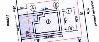
Example No. 1. Boundary dispute.
Example No. 1
If you are the owner of land plot No. 2 (the one whose surveying was done later), then you will have to either give up part of the land and determine your border in accordance with the boundary of land plot No. 1, or sue your neighbor.
Prospect of a boundary dispute
People often think that the winner in such a dispute will definitely be the one who was the first to enter data about their border into the cadastre. Meanwhile, this is not so. There are two well-known methods in practice to “move” the border of a neighboring area, the coordinates of which have already been determined:
- Claim for establishing (restoring) the border;
- Claim to correct a registry error (Article 61 of Federal Law No. 218-FZ). Until January 1, 2017, such an error was called a cadastral error. You can read about how a registry error differs from a technical error in the registry here (article by my colleague Olesya Pustova). But in such cases, it is usually a registry error, not a technical one. Take my word for it.
The result of satisfying any of these claims is the entry into the cadastre of those border data that the court considers correct. Even if the cadastre already contains other data.
When determining where the border should go, the court takes into account the following circumstances (Part 10, Article 22 of Federal Law No. 218-FZ):
- How the actual border has developed over the past 15 years . This takes into account the location of fences, buildings and even plants on the border that have existed for more than 15 years. This point when considering such disputes is perhaps the most important.
- agree on the disputed boundary during land surveying, or did they forget to ask him?
- The ratio of actual and documented areas of adjacent plots. By the way, this factor is the least important for the court. The court a priori proceeds from the fact that the actual area of the plot may differ from the area indicated in the title document, especially if the document is old.
By law, the court must also take into account (but usually does not take into account due to lack of necessary data) :
- How the border is described in the title documents for the plots (in old title documents there is usually no such information, but only data on the area and a vague diagram).
- How the boundary is determined surveying project (usually there is none, and if there is, then there is no information about the required area).
- How the boundary is determined by planning documents when creating plots (sometimes such documents can be found).
Example No. 2. Two different documents were issued for one site.
As a result, the following situation arose:
Example No. 2
She, according to my observations, is the heaviest. After all, there is only one plot, and the documents for it were issued twice. Both parties to the dispute are in good faith. Both suffered from a mistake by local administration land managers.
Here the parties will litigate fiercely, because in case of loss, everyone loses the plot completely. It is difficult to predict the outcome of the matter. Of course, the advantage goes to the one who was given the land first (and not the one who carried out the land survey first).
It will be necessary to take into account who owns the buildings on the site, whether the first owner’s statute of limitations on the stated claims has expired, and on what right the site was allocated to each of the parties. There may be other circumstances that the court considers important.
Example No. 3. We made a land survey and discovered that your plot completely falls within the boundaries of another, large plot, which is already registered in the cadastral register.
Example No. 3
In accordance with Letter of Rosreestr dated April 27, 2017 N 19-05455-SM/17, this situation is also called border crossing, although there is no direct crossing of lines. If one site is completely located inside another, then they must refuse to take into account the site whose surveying was done later (clauses 20, 21, 27, 43 of part 1 of Article 26 of Law No. 218-FZ).
Where do such situations come from?
Let's take the most common story. For some reason, buildings appeared on the territory of a certain large land user (factory, sanatorium, etc.) and became the property of other persons.
For example, an enterprise built houses for its employees and then transferred ownership to them. Citizens began to register the land for their properties and learned that their plots overlapped the large original plot. This situation is good for its lack of drama. A large land user, as a rule, is not against “cutting out” small pieces of land from his plot, but sometimes this can be difficult to do purely technically. For example, if a large land user does not own the land, but leases it. Then the division of the plot must be agreed upon with the public owner.
Another problem may be organizing access to small plots of public land. Without such access, a large initial plot cannot be divided (clause 26, part 1, article 26 of Federal Law No. 218-FZ).
In some cases, the problem is solved in operational mode. But sometimes it is still not possible to do without a trial. For example, if an enterprise or local administration does not meet citizens halfway. The outcome of the dispute can only be predicted on the basis of specific documents.
These are just the most typical stories. The chaos in the design of the land has existed for so long that we will continue to see its most bizarre manifestations for many years to come.
What to do in different cases
Error in USRN
The registry error can be corrected using the method described above :
- Owners of adjacent plots order clarification of boundary boundaries from a geodetic company and receive a corrected, correct boundary plan.
- The same owners fill out an application in the form established by Order of the Ministry of Economic Development No. 722 of 2013, and attach to it the drawn up boundary plan, their personal passport, cadastral extract and title documents for the land.
- The application is submitted to the MFC or the local branch of Rosreestr.
- Within 5 days after Rosreestr receives the documents, the responsible person corrects the registry error in the Unified State Register of Real Estate.
Land surveying error
Often, a land surveying error can be identified even during the approval of boundaries, when it turns out that the boundaries established by the cadastral engineer do not coincide with those defined by the boundary plan for the neighboring site.
In this case, the owner of the neighboring plot has every right to refuse to sign the boundary approval act .
To find out who is right, (in fact, another geodetic company) to establish boundaries
The list of cadastral engineers who have the necessary certificate to conduct cadastral activities can be found on the Rosreestr website.
If, on the basis of a repeated survey, it is confirmed that the cadastral engineer who carried out the first survey made a mistake, the owner of the plot can recover from him the entire amount of money spent by him on the first survey.
If the repeated survey confirms the results of the first, the owner of the plot will need to negotiate with the neighbor about the adjacent boundaries of the plots .
At the same time, if, as a result of surveying, there is an overlap with a previously registered land plot (the boundaries of which were determined incorrectly), it is first necessary to correct the registration error in the Unified State Register, otherwise Rosreestr will not register the new plot.
Unauthorized seizure
If a neighbor has deliberately or unknowingly taken away part of someone else’s plot, you must ask him to provide a boundary plan or other documents that may indicate the boundaries and area of his land plot. However, the neighbor himself is not obliged to do this.
In this case, it is necessary to order a survey of your plot, or, if a survey plan has already been established, clarification of the boundaries of the plot.
The survey carried out (clarification of boundaries)
must be agreed upon with the neighbor .
If he signs the document, it means that he recognizes the established boundaries, which obliges him to move the installed fence.
Otherwise, you must go to court.
To convince a neighbor to sign the act of coordinating boundaries, it is worth pointing him to Article 7.1 of the Code of Administrative Offenses.
The Code of Administrative Offenses determines that the minimum fine for land squatting is 5,000 Russian rubles.
If the neighbor loses the lawsuit, he will also have to pay legal costs .
Landscape change
In the event of a change in the landscape, which led to a change in the location of turning points, it is necessary to order clarification of the boundaries, on the basis of which changes should be made to the Unified State Register . The procedure for making changes is described above.
Signature on the fence
It is hardly possible to find a district court in the vastness of the country that would not consider the claims of neighbors who did not divide the hundred square meters. Some people are dissatisfied that a neighbor has taken literally centimeters of someone else’s land, while others have to be indignant at the neighbor’s fence being moved meters deep into their own territory. In any case, almost none of the parties to such a dispute is able to come to an amicable agreement and citizens go to the courts. But even there they do not always find the right articles to resolve land conflicts. Therefore, the determination of the Judicial Collegium for Civil Cases of the Supreme Court of the Russian Federation, which reviewed such a dispute, may be very useful to citizens who find themselves in a similar situation.
So, one citizen filed a lawsuit against his neighbor in his summer cottage. He was outraged that the “invader” moved his fence deeper into his property, seizing 4.8 meters of his territory. The plaintiff also asked the court to oblige the neighbor to dismantle his fence and move it back.
The district court, considering this dispute, proceeded from the fact that the plaintiff and defendant are the owners of neighboring plots of land, and the boundary between their plots was determined by the conclusion of a cadastral engineer.
So there are no violations.
The court also refused to oblige the neighbor to dismantle and move the fence, because this fence is located correctly - on the border indicated by the cadastral engineer. The appeal fully agreed with the decision of colleagues from the district court. So the case reached the Supreme Court. There they studied the verdict of the local courts and said that the decision was incorrect - the norms of the law were violated. These are the rules of law, as explained by the Supreme Court, that should be applied in such disputes.
According to the cadastral law, an interested person does not have the right to raise objections regarding the boundaries of a neighbor’s plot, if these are not common boundaries
There is a Federal Law “On the State Real Estate Cadastre” (N 221 of July 24, 2007). This law states that the “location” of the boundaries of land plots must be agreed upon with the so-called interested parties. This is done in cases where “as a result of cadastral work, the location of the boundaries of a land plot is clarified or the boundaries of adjacent plots, information about which is included in the state real estate cadastre, are clarified.”
The Supreme Court emphasizes that the subject of approval under the cadastre law is the determination of the boundaries of one plot, which are also the boundaries of neighboring acres and belong to someone whom the law calls an interested party. At the same time, the Supreme Court reminds, according to the same cadastral law, this interested person does not have the right to express his objections to the boundaries of his neighbor’s plot, if these are not their common boundaries.
Article 39 of the Cadastre Law states that the approval of boundaries is carried out with citizens who own adjacent plots of land. There are exceptions to this rule - they do not require approval of the boundaries of adjacent plots if the acres are in state or municipal ownership and are provided to citizens for lifelong, inheritable possession or permanent (indefinite) use. Land allocated to legal entities that are neither state nor municipal organizations is also not coordinated with neighbors. Also, no approval is required if state or municipal land is provided for indefinite use to a state-owned enterprise.
In our case, the district court established the fact that the dispute was about adjacent plots of the owners. The Law “On the State Cadastre” says that the approval of boundaries at the choice of a cadastral engineer can be carried out by inviting interested citizens to a meeting, or the boundaries can be agreed upon with each individual individually.
The Supreme Court reminded that the places where the boundaries will be drawn are usually agreed upon at a meeting of interested citizens, if we are talking about the territory of a settlement and its borders. But in this case, boundaries are not drawn within the village or town itself.
In our situation, the land survey was carried out by a cadastral engineer, and the customer for the work was one of the neighbors. They both knew very well that there was another one - an adjacent owner. But they did not agree on the border with him. And one more important point - the cadastral engineer established the customer’s border along the actual border, that is, he drew the land where the neighbor’s fence already stood. The Supreme Court emphasized that the cadastral engineer, having drawn the boundary between the plots along the fence, that is, according to the actual land use, could not help but know that this boundary did not coincide with the boundary in the documents.
From this, the Supreme Court concludes that the lack of agreement on the boundaries of the site may indicate the invalidity of the land survey. And he adds that in such disputes about the establishment of boundaries, the local court has the right to evaluate the actions of the cadastral engineer, even without a request from one of the parties. The demands made by the neighbor against the invader fall under Article 60 of the Land Code.
This article of the Land Code talks about such a way to protect one’s interests as restoring the situation that existed before a citizen’s rights to a land plot were violated.
As a result, the Supreme Court overturned all decisions and ordered the case to be reconsidered, but taking into account its clarifications.
By the way
A lawsuit over land could end in big problems. Thus, in Lipetsk, a dispute between neighbors over seized acres resulted in a criminal case against the plaintiff’s son, since the deputy chairman of the regional court was a party to this dispute. The matter turned out to be extremely scandalous. After the indignation of the country's president, he is now being dealt with by the Prosecutor General's Office.
Going to court
If it is not possible to resolve the issue peacefully, it is necessary to resolve the dispute through the courts. The claim must be filed in court at the location of the site .
Documentation
Before filing a claim, you need to prepare the following documents :
- A copy of the applicant's (plaintiff's) civil passport;
- Documents on the basis of which the owner owns the land: deed of purchase and sale, certificate of inheritance;
- Certificate of the owner of the land plot;
- I put my passport on;
- Current boundary plan;
- The plan drawn up when clarifying the boundaries (if any) and the final conclusion of the cadastral engineer expert;
- Cadastral extract from the Unified State Register of Real Estate about the established boundaries (even if it contains incorrect information);
- Certificates and documents confirming that the owner tried to resolve the issue without judicial intervention: a receipt for payment for the services of an independent examination and the conclusion of the same examination, a written refusal of the owner of the adjacent plot to coordinate the boundaries, etc.;
- Any other documents that may help in the investigation of the case.
In addition, the claim must be accompanied by a receipt for payment of the state fee for filing the claim. The amount of the state duty is regulated by subparagraph 1 of paragraph 1 of Article 333.19 of the Tax Code of the Russian Federation and its minimum amount is 400 rubles .
Statement of claim
As stated above, the claim must be filed in court, and if so, the specifics of its preparation are regulated by Article 125 of the Arbitration Procedure Code of the Russian Federation.
The general principle of filing a claim is as follows:
- Name of the court where the application is filed;
- Information about the plaintiff;
- Information about the defendant;
- Certificate number of the owner of the land plot;
- Time of land ownership;
- The main essence of the disagreement (the circumstances of the case);
- Information about attempts at pre-trial settlement;
- A list of claims and demands against the defendant with reference to specific legal acts;
- List of attached documents.
a statement of claim with an example form for filling it out can be found here.
Trial
If the claim is drawn up in accordance with the requirements of Article 125 of the Arbitration Procedure Code of the Russian Federation, then within 5 days from the date of receipt of the application the court makes a decision to initiate a case.
The period for preparing for the trial, as well as the period for conducting the case, is determined by the responsible judge depending on the circumstances of the dispute.
When considering a case in court, a decision can be made on the basis of the documents provided by the plaintiff and documents requested personally by the court.
If this is not enough, the court will appoint an independent land management examination , which will determine the exact boundaries of all disputed plots.
Making a decision
The court decision is binding on all interested parties .
So, if the claim is satisfied, the following happens :
- The defendant is required to move the fence to a specified distance. If any buildings or communications interfere with this, they must be demolished.
- The defendant is required to cover legal costs, including payment for the services of an independent land survey.
- Information on the newly established boundaries is transferred to Rosreestr, which must make changes to the Unified State Register if the data stored there does not correspond to reality.
- If the defendant is proven guilty of unauthorized seizure of land, he may be brought to administrative liability under Article 7.1 of the Code of Administrative Offenses of the Russian Federation.
If the plaintiff does not have a boundary plan on hand, where the real boundaries of the allotment are established, he must order its production from a geodetic company . After this, he needs to submit the boundary plan to Rosreestr to register the site and make changes to the cadastral passport.
How can I help:
- To make it clear. Form a step-by-step plan for further actions.
- If you can do without going to court, tell me where to go and with what documents .
- If there is mutual understanding with the owner of the plot on which your plot is superimposed, develop an agreement so that your plot will eventually be registered (this could be an agreement on the redistribution of land plots or simply coordinated joint actions to correct a registration error);
- If there is no mutual understanding, draw up a statement of claim to the court and develop a convincing and understandable position for the court.
- Represent your interests in court.
Court hearing
- If you are from another region and cannot find a land lawyer closer to you, help your lawyer in conducting a court case.
- If nothing can be done, tell you about it so that you do not waste energy and money on empty courts.
Result
: at best - formalized land rights. At worst, clarity and money saved.
Prices for my services:
- consultation by email with links to the law and judicial practice - from 10,000 rubles. (more details here)
- oral personal or telephone consultation - RUB 1,500/up to 1 hour (more details here)
- preparation of a claim, response or other document to the court regarding a land dispute - from 12,000 rubles. (more details here)
- representation in court in a land dispute from RUB 9,000. / 1 court day (more details here)
I am located in Chelyabinsk, but I work with clients all over Russia via the Internet.