An act of approval of the boundaries of a land plot is a document that is part of the boundary plan, containing the signatures of the consenting right holders of adjacent (neighboring) land plots in the boundaries according to the drawing indicated on the back of this act. As mentioned earlier, the purpose of this document is to prevent disputes between neighbors over the passage of the common border of a land plot and subsequent legal proceedings. The act of coordinating boundaries acts as a kind of “agreement” between neighbors on the location of the common border of the plots.
Files for download:
What is an act of approval of the boundaries of a land plot?
In essence, the act is documentary evidence that the territory has defined boundaries. Not only the land owner must sign the document. The owners of the surrounding territories must also sign here. Thus, they confirm the absence of claims to the boundaries of this site. You need to know that in the absence of this act, neither the developer nor private individuals have rights to this land. That is why it must be issued before construction work begins.
Who should be responsible for clarifying boundaries?
It is the owner of the land who should be interested in determining the boundary.
Cadastral survey is carried out under the following circumstances:
- allocation of land for construction;
- transfer of the site for use;
- land privatization;
- dividing the territory into several sections;
- the purpose of the territory has changed.
The need to clarify boundaries arises not only in the new area, but also in the territory that previously had boundary designations. Usually, special companies are involved in drawing up land management documentation, which clarify the boundaries, coordinating them with neighbors. At the same time, experienced surveyors and engineers determine not only the boundaries of the site, but also its configuration, size, area and other parameters.
( Video : “Coordination of the boundaries of a land plot | How to coordinate the boundaries with a neighbor if he is against it?”)
What is a land survey document?
The act of approval is the basis for establishing the exact contours of the property and the size of its area. This paper is intermediate in carrying out geodetic work and drawing up a boundary plan. Upon completion of the work, the survey report is stored in the survey file.
In essence, the act of approval and the act of land surveying are one piece of paper, on which, on one side, there is an approval of the boundaries of the land on a special form, and on the other, a drawing of this site with all the data about it.
After the preparatory stage, which is associated with collecting documentation, concluding an agreement with a company to perform geodetic work and notifying land owners, the land surveying stage begins.
When carrying out work at the very beginning, the specialist approves the contours of the site. During this procedure, all persons interested in the correct design of boundaries must be present. Therefore, you need to understand that when carrying out land surveying, you will need to obtain the consent of all neighbors .
Representatives of local authorities or municipalities are also present during the procedure. Also, if measurements are carried out on the territory of a gardening partnership, then the presence of the chairman or representative of the board of the partnership is mandatory.
Are you just planning to carry out the land surveying procedure? Wondering how much the whole process will cost?
Rules for calculating costs and the influence of various factors can be found here!
How does this process happen?
To clarify the boundaries, surveyors personally go to the area. Here special equipment is used to determine the boundaries, shape and other characteristics. Data from geodetic procedures are entered into the act. Then the owners of neighboring territories must confirm their consent by signing the deed. For designations, signs installed on the boundary are used. This usually happens in the presence of all the neighbors who signed the deed.
It should be remembered that without this document it is impossible to obtain a building permit from architectural authorities or the urban planning department. In addition, the owner of the land will not have the right to officially use the site. In short, the procedure for determining boundaries is as follows:
- the customer enters into an agreement to perform cadastral works;
- informing owners of neighboring plots;
- holding a meeting and drawing up an act;
- if any, filing and consideration of objections from neighbors;
- signing of the act by all interested parties.
The final stage is the installation of signs defining the border. These can be either signs or metal or wooden posts. As a rule, they are buried to a depth of 80 cm, and their height is about 1 m.
What is the procedure for agreeing on the act of location of land boundaries with neighbors and the administration under the new law?
Some changes have been made to the rules of the State Cadastre. But in official bodies this is considered a new law. The essence of the changes is that now it is simply necessary to coordinate the boundaries with the neighbors. Moreover, they must also sign the act.
Such innovations began to be used back in 2007. This is explained by the fact that one boundary can refer to several neighboring areas. Therefore, the presence of neighbors prevents violation of their property. In simple terms, the owner of one plot will not be able to “take away” part of his neighbor’s plot.
Particular attention should be paid to notifying interested parties. In fact, these are the owners of neighboring territories. Notice must be sent one month before the planned meeting. This is a requirement under the following circumstances:
- There are plots around that have owners;
- Owners of nearby territories have the right to inherit and own them for life;
- Users have perpetual rights to the site;
- Tenants who lease land from the state are also notified, and the lease agreement is drawn up for a period of more than five years.
Neighbors of these categories can be present during the land survey, either in person or send their legal representatives, for whom a notarized power of attorney is issued in advance. The law provides for methods that can be used to notify neighbors:
- written notice is delivered in person;
- You can notify by mail or via the Internet;
- publication in the media.
Neighbors need to be told when and where the meeting will be held. All neighbors must come not only with identification cards, but also with documents that confirm ownership. However, neighbors do not always participate in such an event. There may be various reasons for this:
- The neighbor received a notice, but did not come at the specified time. However, he did not express any complaints against the determination of the boundaries of the neighboring site. Thus, land surveying is carried out without his presence. Although the corresponding mark is placed in the act about this neighbor. You should also include a copy of the notice that was given to the neighbor. This will confirm that he knew about the date and time of the meeting.
- The initiator of boundary determination does not know how to contact the owner of the neighboring territory. In this case, the notice must be published in a local newspaper. It also needs to be posted on the city administration website. If the neighbor does not show up within a month, land surveying can be done without his presence.
- The land surveying procedure has already been carried out in all surrounding areas, which is documented. We can say that in this case the boundaries are determined by themselves. If neighbors do not make any claims, land surveying is carried out without their participation.
Papers for formalizing the agreement
Before drawing up a deed of agreement on boundaries, the land owner is required to collect a certain list of papers :
- passport of the owner of the storage unit;
- certificate of ownership, without which it is impossible to carry out any operation with the memory;
- papers indicating that the owner has rights to the territory: purchase agreement, certificate of inheritance, deed of gift, municipal decision on the provision of land;
- cadastral passport of the land territory;
- technical passport of all buildings located on this land property;
- cadastral plan with information about neighboring plots.
After the consent of the neighbors is obtained, you will need to draw up an application for the procedure, which is submitted to the cadastral engineer.
Within 30 days after receiving the application, the engineer must perform the following actions based on the submitted documents:
- create a preliminary site plan;
- make all the necessary topographic measurements;
- taking into account the measurements, make a final plan of the land;
- draw up special acts indicating the coordinates of turning points;
- install temporary boundary signs on the site.
On the day appointed for the meeting, the cadastral specialist shows the boundaries clearly , and if no one has any objections, then an agreement is signed.
An important document before establishing boundaries is to notify all owners of neighboring garden plots. This is stated in the Federal Law “On the State Real Estate Cadastre” No. 221, Article 39. Owners are informed about the conduct of geodetic work in person, by mail or through the media.
Requirements for the act of approving the boundaries of a land plot
At the top of the document you need to indicate the cadastral number. The total area of the territory is also indicated here. Additional information is provided below. For greater convenience, a table is used here. The following data is entered into it:
- horizontal position;
- marking boundaries;
- cadastral number of the neighboring territory;
- information about the parties who took part in determining the boundaries;
- Name of neighbors;
- option that was used to notify neighbors;
- signatures of interested parties.
The document also contains a table in which disagreements, if any, are entered. For example, the designated boundaries do not correspond to the land survey plan, or it runs through a neighbor’s property. Below is the exact method by which the objections were lifted. For example, this could be a trial or re-measurement. If there are no objections from neighbors, dashes are added to these tables. After filling out the document, it must be attached to the land survey file. Such a package of documents is transferred to Rosreestr. This is where the documentation remains for storage.
( Video : “What is the act of approving the boundaries of a land plot?”)
Sample consent of neighbors for land surveying
The notice must contain the following information:
- FULL NAME. cadastral engineer, organization data;
- address of the site whose surveying is planned;
- information about the customer of the work;
- date of collection;
- how can you get acquainted with the draft boundary plan;
- details to which objections can be sent;
- addresses of adjacent areas;
- a list of documents that neighbors should have with them.
Sample consent of neighbors for land surveying
Grounds for cancellation
There are legal grounds that allow you to cancel the legal force of a drafted act. Here it is worth considering the most common reasons:
- The neighbor is sure that his rights to own the land have been violated. In other words, the established boundaries reduced the area of his own property.
- It turned out that the document was signed by a person who is not the owner of the neighboring territory. He does not have such a right, so the act can be appealed and demand its cancellation.
- The neighbor suspects that the cadastral service employee made a mistake. And it doesn’t matter whether it was done intentionally or by accident. An incorrectly established boundary is a good reason for canceling the legal force of a document.
In all of the above situations, it is recommended to go to court. Naturally, you will need to present all available documents that will allow you to prove that the act was indeed drawn up incorrectly. The statement of claim should indicate the possible reasons for the incorrect determination of boundaries. By the way, it is recommended to go to court in situations where a neighbor refuses to sign a document without any explanation.
Under certain circumstances, you can do without neighbors. For example, if a neighboring plot is leased for a short term, the tenant cannot sign such a document. In some circumstances, a signature can be replaced by a document. For example, when the owner has lost the right to the land, and the new person has not yet managed to obtain rights to it. This is permitted in cases where the owner:
- seriously ill;
- declared incompetent;
- is in a correctional colony;
- died;
- declared missing without a trace.
In this case, the heir must submit a document confirming the fact that the owner is not able to personally sign the document. In general, you can do without approval in other situations:
- the site is adjacent to the state border;
- the area is surrounded by forest or river;
- there is a cliff, rocks or other natural obstacles along the edge;
- The land plot is surrounded by abandoned territory.
Validity period of the act
The law does not define a clear validity period for this document. It can be concluded that the act will be in force until this process needs to be repeated. The act is sent to the cadastral archive for storage. The owner of the territory can request it if necessary.
As for the approval itself, there are certain deadlines. As mentioned above, neighbors must be notified a month before the procedure for determining boundaries. Thus, the preparation period cannot be less than 30 days. Often this period takes one and a half months. You also need to take into account that if the cadastral company experiences a large influx of clients, you will have to wait your turn, and accordingly, the procedure may take a longer time.
Which neighbors need to coordinate boundaries with?
Owners of adjacent plots who have the right to sign an act of approval of the location of boundaries include:
- official owners of the site;
- citizens who have the right to lifelong inheritable ownership;
- persons who have the right of perpetual use;
- valid under the right of lease (for state-owned plots for a period of at least 5 years);
- representatives of the above persons acting by proxy.
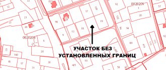
Border approval will not be required; if the site is adjacent to the territory of the state border, a body of water, or a cliff, then the contours on this side will not be established.
Cost of services
You need to understand that defining boundaries is a whole complex of work. Specialists with special equipment go to the site. Naturally, you will have to pay for these services. Practice shows that many geodetic companies do not charge fees for any individual services. It’s just that a standard fee is charged for the entire range of work. Today its size is 5-7 thousand rubles. Certain factors influence the cost:
- the status of the company you are contacting;
- locality;
- what category does the land belong to;
- area and shape of the site.
However, you need to understand that the fixed cost is taken only for standard rectangular plots. As a rule, their size is 8-10 acres. Typically, such areas are used for summer cottages. If the plot is too large you will have to pay extra. You also need to take into account that if the land has a complex shape, payment will be calculated based on the number of turns of the boundaries.
There are lands that belong to the elite category. This applies to territories located near Moscow and St. Petersburg. Here the cost of measurements is calculated separately. Practice shows that the cost of geodetic work in these regions is more than 30 thousand rubles.
What is it and when is it signed?
Coordination of the extreme boundary of the site is considered an element of land surveying, which determines the right and regulations for the use of the owners’ border areas. It is considered the result of boundary actions. In other words, this is a coordination of the location of the land with neighboring lands, taking into account the documents and not to the detriment of any of the land owners.
To carry out this procedure for establishing boundaries, you must contact the cadastral authorities. They carry out the official establishment of the actual boundaries of the site. An indispensable requirement for determining boundaries is imposed for the following types of land:
- To areas included in the cadastral register.
- On the lands where the work of cadastral specialists is carried out.
- In areas where there is a need to establish actual boundaries.
The approval process certifies the implementation of cadastral work and confirmation from the owners of adjacent land plots in the form of consent signatures in the document. After the boundaries have been detailed, the document drawn up by the cadastral specialist will already have legal force, as well as the definition of legal standards.