Until that time Each owner of a land plot must take care of property surveying.
The land surveying procedure consists of determining the boundaries of a site, measuring its actual area, agreeing on boundaries with the owners of neighboring sites and drawing up a land survey plan.
The procedure can be carried out free of charge, but only within the framework of special government programs and subject to certain circumstances. It will be easier and faster yourself or a company that has several engineers on staff.
How much the demarcation service will cost depends on how much work the engineer will actually have to carry out, how labor-intensive they will be and how much time they will take, as well as on the remoteness of your land plot from the office of the selected company.
How is land surveying carried out?
Surveying cannot be carried out without the involvement of specialists, since this procedure requires a license to conduct geodetic and cartographic activities. Therefore, you won’t be able to demarcate the area yourself.
And in order to correctly carry out this procedure and not get confused in its process, we, together with the cadastral engineer, Irina Gaisina, have prepared step-by-step instructions.
What does the procedure for drawing boundaries include?
The procedure for setting boundaries in situ must be negotiated with an engineer a month before it is completed .
Owners of all neighboring lands must be notified 30 days in advance about the time of the upcoming land survey. They will be required to review the prepared boundary plan and sign a document confirming that they agree to the provisions of the plan (in particular, the established boundaries).
The surveying procedure consists of the following steps:
- Preparatory . At this stage, the owner of the site collects the necessary documents and agrees to carry out land surveying with a suitable licensed company. The list of required documents includes an extract from the Unified State Register of Real Estate and a passport of the owner of the plot. If land surveying is being carried out for the first time, you will also need a document indicating the procedure for obtaining ownership of the plot, and a diagram of the location of the plot on the cadastral plan. In the absence of the latter document, the cost of land surveying will increase, since additional work will need to be done. This also includes written notification of neighbors about the upcoming land survey.
Basic . At this stage, a territory planning project is drawn up (more details here), the actual area of the demarcated plot is measured (more details about the procedure can be found in the next article), its boundaries are determined (read about the determination procedure here), the information obtained is agreed upon with the owners of neighboring plots.- Final . At this stage, the engineer draws up a land survey plan with a site diagram and coordinates it with the necessary government authorities, after which the client will be able to enter his site into the cadastral register.
You can find out more about what the land surveying procedure includes here.
When is land surveying not necessary?
If your case falls within the parameters of the so-called “dacha amnesty” (in force since 2006), land surveying may not be carried out. This applies to registration of rights to individual construction of housing, garages, cottages, gardening and horticulture, private household plots.
Sometimes land surveying is done in case the owner is afraid of future disputes with neighbors. They are often won by the one who first defined and documented the boundaries of his territory through land surveying. This situation is especially relevant for owners of garages and summer houses.
The procedure is required when combining or dividing several sections. It is also performed when registering a new property.
Advantages and disadvantages
Land demarcation, like any other procedure, has its pros and cons. The advantages include:
- After the land surveying procedure, many opportunities and actions with the property open up. You can easily carry out any transactions: sale, exchange, gift.
- Facilitation of procedures for transferring rights to third parties, registration of property rights, thereby increasing the likelihood of loan approval.
- Facilitation of obtaining all kinds of development permits.
- The end of possible disputes about the boundaries of territories with neighbors, since all boundaries are documented, the owners of neighboring territories confirm their agreement with the results of land surveying.
The disadvantages include:
- High cost of cadastral engineer services.
- Timing of the procedure. On average it takes from one to three months.
- The risk of incorrect preparation of documents by cadastral engineers.
- Sometimes the competence of municipality representatives in some issues is insufficient.
FAQ
In the process of searching for a contractor or performing work, questions may arise. Most of them are due to ignorance of the laws or incomplete study of the cooperation agreement. To minimize the occurrence of disputes and conflicts, it is recommended that you familiarize yourself with the frequently asked questions.
They may be as follows:
| Question | Answer |
| Is it possible to order a separate service - defining boundaries, drawing up a plan? | this is possible, but not advisable. The purpose of surveying is to enter data into Rosreestr, for which you need to provide a full package of documents |
| Is it necessary to register buildings on the site? | from 2021 this is a mandatory procedure. To save money and time, this service can be ordered in conjunction with land surveying |
| Is it necessary to set out the boundaries of the site (installation of pegs)? | no, this is done only at the request of the customer. But you will need to pay for it separately |
| Who is responsible for coordinating boundaries with neighbors? | This work should be done by a cadastral engineer. On the part of the owner, it is necessary to ensure the presence of neighbors during the procedure. |
Representatives of the company or a cadastral engineer can answer other, less important questions. You can also contact specialists from the Rosreestr branch, or send an electronic request on the official website of the organization.
What should a homeowner do with the plan?
When the geodetic company has issued a boundary plan to the property owner, he needs to submit the document to the local natural resources committee. After approval of the act, the applicant will be informed about this. To register a plot of land and obtain a new passport for it, you will have to pay a fee. It is also necessary to write an application, which will subsequently become the basis for obtaining a state certificate of the right to dispose of the plot.
A new cadastral passport is being developed on the basis of a boundary plan. After all formal procedures, the plot will be protected by law from encroachment, and its owner will be able to sell it or take other actions.
The procedure for approving the boundaries of the site
Separately, mention should be made of the procedure for agreeing on the boundaries of the site with neighbors. According to current legislation, during the land surveying process it is necessary to correlate the boundaries with the owners of adjacent plots. That is, they must confirm in writing that the boundaries are marked correctly.
Neighbors should be notified of upcoming geodetic work no later than two days before it takes place. In this case, the land management organization must send them notifications in the prescribed form. They can be delivered by mail or delivered by hand.
Upon determination of the boundaries of the territory, an act of establishing and agreeing on boundaries is drawn up. It is signed by the owner of the site, the owners of adjacent lands and the engineer who carries out the relevant work. The interests of neighboring land users can be represented by a third party on the basis of a power of attorney. A properly executed act is certified by the seal of the land management organization and the local administration.
If one or more neighbors do not want to sign the deed, then their refusal must be recorded in writing. Thus, the land user has the right to indicate in the document itself that he refuses to sign it and indicate the reasons. If he evades this, then the refusal can be recorded by another person, and the latter’s passport details should be indicated in the act. Neighbors can also express objections in writing regarding the information specified in the act. In any case, both the objection of interested land users and their refusal must be reflected in the text of the act itself.
Advice! If neighbors refuse to sign or object to the establishment of a certain boundary option, then the situation can be resolved administratively or judicially.
Is it possible to carry out land surveying in winter?
Land surveying can also be carried out in winter. This is explained by the specifics of the work. They are divided into two parts:
- Cadastral survey. It is performed using satellite equipment.
- Preparation of a boundary plan with boundaries highlighted. It is compiled using computer programs, based on information that was obtained after surveying by surveyors. Rosreestr data is also taken into account.
Since the survey does not require the coordination of underground communications (this applies to gas and water pipes, electrical networks), it is carried out faster. This differs from topographical work. In addition, it does not require elevation marks. Thanks to this, the presence of snow or slush on the ground does not in any way affect the accuracy of the data obtained when performing work. The only exception is when, due to huge snowdrifts, it is difficult for surveyors to determine where the dividing trenches between sections are located. But such difficult weather circumstances rarely occur.
Payment nuances
The basis for performing work is a signed contract. In it, in addition to the rights and obligations of the parties, payment is prescribed. Select the method of transferring funds - cash, to a bank card or current account. Each transaction must be recorded, receipts and receipts must be saved.
Possible terms for transferring funds:
| Indicators | Description |
| Full prepayment | disadvantage - the final cost can be formed only after land surveying has been completed. Often you have to make an additional payment or wait for the excess to be returned |
| Making an advance payment | the customer pays a certain part of the agreed amount - from 10% to 50%. This money is needed to compensate for the costs of preparing and performing the work. |
| Payment is made only after land surveying | This form of cooperation is rarely used due to the high risk of refusal of payment by the customer. The law does not prohibit providing such services without payment. This falls into the category of charity, which is rare for the land market |
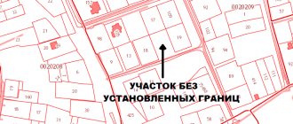
What does a boundary plan look like?
Confirmation of the completion of the entire procedure is the boundary plan (or file). The plan includes text and graphic parts. The boundary plan should display all measurements taken, data for the cadastre and acts for resolving controversial issues. The document includes the following:
- Initial information of the object.
- Information on all measurements taken on the site.
- Information on the formation or change of a land plot.
- A diagram showing the location of the object.
- Drawing of the site (its parts).
- Geodetic diagram of buildings.
- Additional documents (copy of media notice, copy of no-objection certificate).
Land surveying of public lands.
The main goals of conducting land surveying of public lands included in the SNT territory are the following:
Clarification of the boundaries of the plots, their area, as well as the configuration of the plots;
Reducing the risk of disputes arising regarding adjacent borders with neighbors or accusations of self-seizure of territory;
Ensuring the possibility of obtaining documents confirming ownership;
Protection of the rights of the owner in the event that illegal actions are noticed regarding the land in terms of encroachment on his property;
The possibility of legally increasing the area of the allotment by adding additional territories that do not have their own owner;
Obtaining a construction permit using a simplified scheme.
Map-plan of the boundaries of the protective zone.
Registration of reconstruction of a residential, garden house.
Extension of land plot for individual housing construction, private household plots.
Procedure for ordering a service
Read more about the procedure for ordering land surveying services in this article.
Cost of work
For residents of Moscow and the Moscow region who are individuals, the land surveying procedure for an average 6 acres costs approximately 10 thousand rubles or more.
Owners of plots in other regions can expect to spend an average of about 5 thousand rubles , depending on the prices of different organizations or engineers working as entrepreneurs.
Exact information on the cost of the service should be clarified with the direct contractor or cadastral engineer.
Where to order?
You can find out which organizations have a license to officially carry out land surveying, as well as find out basic information about cadastral engineers on the Rosreestr website in the “Register of Cadastral Engineers” section. It also indicates what percentage of boundary plans drawn up by engineers was approved by the necessary authorities.
Based on the above information, as well as the specialist’s pricing policy and the degree of his distance from your site, you can choose the most optimal option.
Read more about where it is better to order land surveying in this article.
Deadlines
In most cases, engineers will make all measurements within one day, then a project will be drawn up and agreed upon over several days. By collaborating with private organizations, you can independently choose a convenient date for a specialist visit. Full details on deadlines are included in this article.
After land surveying, your plot will be entered into the cadastral register, which will reduce the likelihood of further disputes with neighbors regarding the boundaries and area of the plots. In addition, making real estate transactions will become more convenient.
What determines the price of surveying?
Free land surveying is not always possible. In such cases, you still have to turn to the services of private commercial organizations. Their prices differ significantly from government organizations, but the range and speed of provision of services better suits the needs of clients. As a result, the price of services depends on:
- The region where the site is located and its distance from the regional center;
- The owner of the land contacted a private or public organization;
- The degree of implementation in the region of the free land surveying program under the state program;
- Price lists of local cadastral organizations, formed on the basis of supply and demand in the region;
- Land area;
- Promotions and discounts periodically provided by engineers;
- Experience of a cadastral engineer or how long the company has been in the market;
- The complexities of the geometric shape of the site, so it can crash into a neighboring plot, intersect with roads, ravines, or simply have a curving shape;
- Categories and purpose of the land plot (agricultural purposes, private housing construction, etc.);
- The volume of work carried out previously and the availability of land management and cadastral documents;
- Coordination of the boundaries of adjacent areas.
What documents are needed?
Clarification of the boundaries of a land plot is carried out on the basis of information contained in the title document for the land plot. Additionally, information specified in the documents that determined the location of the boundaries of the site when it was formed can be used.
If there are none, the clarification can be carried out in accordance with the boundaries that have existed on the ground for 15 years or more and are fixed using natural objects or objects of artificial origin, which make it possible to determine the location of the boundaries of the site. This may require:
— situational plans contained in technical passports of real estate objects (located on a land plot), which are prepared by the bodies of state technical accounting and technical inventory (BTI);
— forest management materials;
— planning and cartographic materials available in regional authorities of architecture, construction and housing, local authorities;
— documents on territorial planning of municipalities;
— projects for the organization and development of the territory of dacha, garden and vegetable garden non-profit partnerships.