In cities that are considered large, there is an acute question regarding the rights of ownership of the territory located around apartment buildings. In order to ensure that parking lots and playgrounds are not located on someone else’s property, the owners of residential premises are thinking about carrying out the land surveying procedure.
The regulations according to which the boundary procedure is carried out regarding the land plot located under an apartment building are prescribed in the law adopted at the federal level under number 78. This act is called “On Land Management”. [contents]
What does this give?
The need for land surveying arises in a situation where the owners of an apartment located in a multi-apartment building have as their goal the protection of their plots from the erection of illegal buildings on them.
To ensure that parking lots, public catering establishments and other objects do not appear on the territory located next to the house, it is necessary to promptly determine the territory that is considered adjacent to the house and establish its boundaries. This data must be recorded in documentary form.
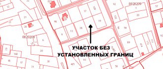
The concept of the local area of the Moscow Railway
On the allocated local land, the owners have the following list of possibilities:
- build elements related to landscaping, such as play areas, playgrounds for children, etc.;
- places intended for car parking may be fenced off;
- at the entrance to the territory related to the house, barriers may be installed;
- Part of the territory can be rented out under a rental agreement.
Sample boundary plan
It is worth paying attention to the fact that surveying the land plot on which the apartment building is located and entering information about it into the appropriate state register are the conditions for the house to participate in the capital repair program.
Advantages of land surveying under an apartment building
Every city dweller is pleased when not only the central streets, but also the courtyards of houses are kept clean. Well-maintained and green areas, the presence of children's playgrounds - all this undoubtedly attracts and pleases the eye. We leave the house every day, and it is much more pleasant for everyone to look at a well-groomed flowerbed and an organized parking place for cars than at uncleaned sidewalks and paths broken by cars. Management companies are created to keep houses clean and tidy. But they do not always fully cope with their responsibilities. The demarcation of the adjacent territory of the apartment building gives, firstly, the right to dispose of common property to residents at their own discretion (they can be landscaped, fenced off from unauthorized persons), and secondly, to prevent the placement of unnecessary objects in the yard.
What if land rights are not registered?
In a situation where the land surveying procedure has not been carried out, persons living in multi-apartment housing do not have the opportunity to use the land at their own discretion, and there is also no opportunity to protect the land from illegal developers.
If the required documentation is not available, the following may occur:
- On a plot of land that belongs to the local area, a structure with a temporary or permanent purpose can be erected. In this case, the consent of the apartment owners is not obtained. If the authorities have issued a permit for construction work, and also provided that the buildings comply with urban planning standards, such buildings cannot be demolished.
Results of land surveying - Companies performing management functions will not be able to carry out work aimed at improving the territory. Such work includes the repair of playgrounds and waste removal.
- If the rights to the land are not formalized, then the house cannot participate in various programs conducted by the state.
- A house separate from the land plot cannot be included in a program whose purpose is reconstruction and repair work. It follows from this that all work in this area is carried out at the expense of residents’ funds.
Registration in Rosreestr
In order for a residential building to be included in the state program of capital repairs and reconstruction of housing, it is necessary that information about the land be entered into the Unified State Register of Real Estate of the Unified State Register of Real Estate. We provide documents to Rosreestr:
- personal passport of the authorized representative;
- applications for state registration and registration in the Cadastral Chamber;
- a receipt for payment of the state duty (payment is collected from each shareholder);
- minutes of the meeting on the formation of the site;
- documents on the ownership of the residents of the house;
- minutes of the meeting indicating everyone's share in the collective property.
After registration, you receive a certificate of land ownership. The process of recognizing land as the property of residents is not simple and not very fast. But if you weigh all the pros and cons, then the registration of property will tip the scales. The advantages of such a decision are much more significant.
How to define boundaries
According to the current rules of law, the responsibility for carrying out land surveying of the territory located under multi-apartment housing is assigned to the municipal authorities.
In fact, when drawing up the budget, the area under consideration is taken into account last, so the authorities say that finances are not enough and the question of carrying out land surveying remains in limbo.
It is worth noting that the owners of residential buildings have the opportunity to take the initiative into their own hands and order boundary work themselves.
For this reason, it is worth saying that there is no point in waiting for action from government agencies if you can solve the problem yourself. According to civil law, persons who own premises have the opportunity to protect their rights in relation to the local area. The condition in this case is the availability of documentation of legal significance.
Regarding the formation of boundaries during boundary work on the land located under an apartment building, the following rules apply:
- on the site that is being formed, there should be one building, to which landscaping elements are adjacent;
- the boundaries cannot reflect passages, elements of residential areas that are connected by the road and street network;
- zoning must be observed, which takes into account actual land use (it is determined by municipal authorities);
- the boundaries of the allotted plot should not intersect with landscaping elements.
Features of definition and coordination
The boundaries in relation to the territory where the apartment building is located are reflected in the boundary documentation. They are indicated there during the procedure for obtaining a permit for construction work. If the specified act is absent, then the determination of boundaries is related to the determination of actual use.
Design algorithm
The municipal administration is entrusted with the functions of configuring the boundaries of the plot and approving its dimensions. At the legislative level, a formula has been developed that is used to calculate the size of the area of the adjacent plot.
If we consider the formula, we can come to the conclusion that the local land includes children’s playgrounds, the area located under the house, places for recreation, parking and games.
The precise determination of plot boundaries is carried out in accordance with the requirements included in land and town planning legislation. The listed acts define the rules in force regarding the calculation of the territory of the allotment. They are based on red lines. This rule applies to cases where natural boundaries and allotments are located adjacent to the plot.
During the work under consideration, the owners of residential premises will need to carry out a procedure for coordinating boundaries with the owners of buildings located on neighboring plots.
Zoning planning prior to land surveying is the responsibility of the municipality. When the land surveying process is completed, the decision regarding the use of the territory is made by all owners through a meeting.
Why do land disputes arise?
It often happens that strangers located other buildings on the site near the apartment building even before it was surveyed. In the presented situation, it is necessary to resolve the problems of their demolition. Typically, such buildings are erected without proper registration, but their owners can enter into a contract for renting a site with municipalities. In the presented situation, residents of apartment complexes need to challenge the administration’s right to charge rent from a plot located in their area.
Note: Land surveying makes it possible to demand the demolition of an illegally constructed building.
You can also resort to canceling the rental contract with the administration, and then entering into a new one with the owner of the house. The funds received after these manipulations should be used for the needs of the home.
There are also more complex situations when part of the plot of an apartment building is already registered in the name of an outside organization or person, and all the permitting papers are available. This situation cannot be avoided without a construction expert. On its basis, you can go to court. If the decision was not made in favor of the residents of the apartment building, it is possible to install an easement on the site, which will be based on the need to service the house or organize vehicle traffic. In this situation, apartment owners will have to pay rent.
Where and how to order?
It is worth noting that carrying out boundary actions regarding the local area is a complex process that requires the use of special equipment. The process is carried out in accordance with the standards established in legislative acts.
Organizations conducting geodetic activities have the right to produce design documentation. In this case, it is necessary that they have a special license. The list of such companies can be found in the municipal authorities.
All interactions with competent organizations on the issue under consideration are conducted by a person who has the appropriate powers, reflected in the minutes of the meeting of owners. Often the chairman of the partnership is chosen as a representative.
To order project documentation, you need to visit or otherwise contact the company carrying out such activities and submit an application for carrying out survey activities. The following must be submitted along with the application:
- a document by which the customer’s identity is verified;
- technical tasks;
- cadastral acts;
- boundaries are described.
Example of an application for land surveying
It is possible to draw up an agreement with the organization carrying out project activities, which specifies instructions regarding the request of the necessary acts by survey specialists. In this case, it is necessary to issue a power of attorney.
For this purpose, an authorized person draws up and submits an application. It indicates the authority to which the appeal is made. The personal data of the compiler is written down, a request regarding land surveying, you need to indicate the address where the house is located.
Title documents are indicated using details. The plot number recorded in the cadastre is reflected. It is indicated that the person agrees to pay for the work. At the end of the sheet there is a number and a signature.
Land management works
The approved land survey plan is the basis for carrying out land management work. To do this, the owners need to contact the design organization and conclude an agreement. This document is drawn up according to the rules established by civil law.
The contents of the document must include the following information:
- Date and place of signing, as well as registration number. It is installed by the design organization.
- Information about the contractor and the customer.
- Subject of the agreement. This section indicates the type and scope of work performed.
- Price and settlement procedure. The amount is indicated in words and figures. Payment is most often made by transferring funds to the account of the performer. At the same time, the use of cash is not prohibited.
- Rights, obligations and responsibilities of the parties.
- Contract time.
- The procedure for resolving emerging disputes.
- Bank details and signatures of the parties.
The agreement is drawn up in two copies, one for each of the participants. After signing the document, the design organization sends its engineer to the site. The specialist collects the necessary data using measuring instruments, as well as photo and video recording equipment.
Timing and cost
Preparation of boundary documentation is carried out by a specially authorized person within 2-4 months. More precise deadlines can be obtained during a personal visit to a competent organization.
The pricing policies of companies also vary and can vary from 10 to 30 thousand rubles. This is influenced by the size of the plot, its configuration, and the availability of the necessary documentation.
According to the law, authorities must pay for the procedure in question. In real life, residents often decide to pay for the boundary procedure themselves. The funds spent in this case will not be returned.