How to register the addition of a land plot in accordance with the Land Code
The Land Code does not contain such a concept - the addition of a land plot. Redistribution of land plots is commonly called redistribution. According to the general rules for the formation of land plots (Article 11.2 of the Land Code), there are several types of formation of new land plots:
- Allocation;
- An association;
- Redistribution;
- Chapter.
In the article we will not consider each of these types in detail, but we will talk in more detail about redistribution, or more precisely about how the addition of a land plot in 2021 occurs due to the area of adjacent lands, and how the size of a land plot can be legally increased.
How to formalize an agreement on the redistribution of land between owners
Step 1 - Assess the chances and risks
First, study the documents on the redistributed plots. Request information from the State Real Estate Cadastre in the form of an extract from the Unified State Register of Real Estate. The main thing is to find out whether the plots belong to the same municipality and confirm the fact of their contiguity. Only in these cases does it make sense to start the procedure.
If, during redistribution, one of the owners receives a reduced plot, he is paid compensation specified in the agreement. I recommend that you agree on this point in advance with all parties to the agreement.
Step 2 - conclude an agreement between the owners
Since several individuals are involved in the procedure for dividing a land plot between owners, all work begins with the conclusion of an agreement. If there is no such document, then this is a slightly different judicial procedure. The number of persons participating in redistribution is not limited by law.
An agreement on the redistribution of land plots between owners must contain the following information:
- Information about the owner of the land plot: full name, passport details, residential address;
- Data on the land plot undergoing redistribution: area, location, cadastral number, category of land, date and place of registration of rights to real estate, identification data of the certificate of registration of ownership;
- Data on new land plots transferred to the owners of previous lands. The same standard characteristics are indicated as for the previous sections. If several land units are transferred, then all information on each of them is provided.
.
I am ready to advise you free of charge by phone (24 hours a day, 7 days a week)
The call is free for all regions of the Russian Federation
New law on land acquisition 2021
Laws in the field of land management and cadastre have undergone active changes in recent years. The new law on the addition of land plots, effective in 2021, is a whole layer of rules affecting the formation of land plots. At the beginning of 2019, Federal Law 217 on horticulture came into force, changing the basic concepts and definitions of summer cottages. On June 17, 2021, a new law 150-FZ was adopted, amending the laws on cadastral activities and real estate registration (218-FZ and 221-FZ). The changes concern complex cadastral works: the procedure for carrying them out is simplified, while it remains possible to increase the land plot up to 10% of its total area if, during the complex cadastral works, it turns out that in fact the plot is larger than on paper. The State Duma is also considering a number of amendments to simplify the procedure for registering land plots and buildings (the dacha amnesty will be extended until 2022).
Only the owner can add additional acres to his plot. Tenants of land plots, as well as persons who own land plots for free use, do not have this opportunity.
How complex cadastral work is done
Since Federal Law 150 introduces changes to the procedure for complex cadastral work, let us clarify what kind of work this is and who carries out it. According to the law on cadastral activities, comprehensive cadastral work is carried out on the territory of an entire block in order to bring information about lands and buildings up to date. Carrying out complex cadastral work necessarily includes the surveying of all plots in the block. This work is carried out at the expense of the state budget and on the initiative of local authorities . Citizens are notified in advance of such work.
Sanctions for illegal land seizure
Cases of illegal seizure of land are established by Art. 7.1 Code of Administrative Offences. If fraudulent aspects are identified, the case may fall under the criminal code. With this option, the offense faces much more serious consequences than just a fine and seizure of the site. In the absence of fraudulent activity, the violator will most likely pay a fine. Its size depends on several factors:
- whether the plot is registered in the cadastral register;
- What is the estimated value of this plot of land?
Is it possible to trim the same section in several stages?
Let’s say there is a state-owned plot adjacent to the land you own, which is not registered in the cadastral register. Is it possible to make an addition to a state plot within 10%, and then repeat the procedure until the state land plot is completely “exhausted”?
Personally, I don’t see anything illegal in this. However, it is better to resolve this issue specifically on the spot and with a cadastral engineer. The owner of the land plot can determine the fate of this land plot in any way not prohibited by law, namely: increase, decrease, divide, allocate, donate, sell, etc. The only thing that should be taken into account is that the site being formed does not exceed the permissible area limits (see the PZZ of your municipality), and also corresponds to the type of its permitted use.
How to legalize the addition of a plot of land for free
Attaching a land plot to the main one is an increase in the size of the land plot at the expense of adjacent lands. Not every owner is aware that he can legally register an addition to a land plot and receive additional land ownership free of charge. How to legalize the cutting of a plot of land for free, you ask? In fact, the law allows the increase of a land plot by no more than 10% of its area at the expense of municipal lands. But there are also caveats. It is important that the land is not privately owned and under encumbrances; in addition, local authorities have the right to legally establish additional restrictions on the size of the addition of land plots. In any case, the registration of the addition of a land plot should be legalized by submitting the necessary documents to the Rosreestr authorities.
Reasons for refusal
At the stage of accepting documents, the administration rarely refuses to review them. Reasons for refusal may arise later. The owner should monitor the registrar's decision-making process and provide additional information in a timely manner.
Legalization of the new boundaries of the site will be refused due to:
- discrepancies between the information from the application and the submitted documents;
- lack of consent of neighbors and other interested parties;
- putting a new site up for auction;
- transfer of cuttings to commercial property on a leasehold basis;
- overestimated final area of the site
and other reasons that will accompany the refusal. If there is a discrepancy between the data in the documents, the situation can be corrected, and the application for joining the addition can be sent for registration again. In this case, a repeated payment of the state duty is provided.
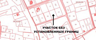
Important: Rosreestr will not legalize new boundaries if data about the site has not been registered. The registration procedure should be carried out as required by law, and it should begin with clarification of the data in the cadastral register. Only after the area being cut is registered is it possible to join it to the general territory.
What documents are needed to approximate a plot of land?
The desire to increase the land plot is not enough; action must be taken. To begin with, find out from the local authorities the nuances of restrictions on the size of the addition of a plot of land in your area, and what documents are needed for the addition of a plot of land in your municipality.
The main documents are:
- Application for cutting (redistribution)
- Agreement
- Extract from the Unified State Register of Real Estate
- Land surveying project or site layout diagram
- Title documents for land.
How to officially legitimize the expansion?
First of all, it is necessary to obtain ownership of the main plot, if this has not been done previously. It is possible to legalize an increase in the area of a land plot after setting boundaries and registering the main plot with cadastral registration. According to a simplified procedure, the following documents are submitted to Rosreestr:
- Passport;
- Statement of the established form;
- Cadastral passport for the plot;
- Document of title on the basis of which property is acquired (sale and purchase agreement, privatization deed, deed of gift, certificate of inheritance);
- Receipt for payment of state duty.
After registration, an extract from the Unified State Register is issued, which shows the ownership of a certain plot.
Geodetic works
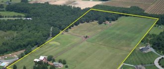
After receiving the property documents for the main plot, you need to carry out land surveying. For this purpose, a licensed cadastral engineer or employees of a geodetic company are invited. As a result, the owner receives a land surveying project and a layout plan for the expanded site.
The specialist must make sure that there are no claims to the territory by third parties and that it is not owned by another landowner. Measurements are taken and boundaries are set so that there is no overlap with neighbors' territory.
It is important to make sure that there is no conflict or disagreement on their part regarding the passage of borders. As a result, a boundary plan and an act of completion of work are prepared, in which the owners of adjacent plots, if any, must sign. If everything is in order, you can proceed with further paperwork.
Application to the administration
The owner must contact the administration responsible for the distribution of land in his area. You must submit an application and attach title documents for your site and a boundary plan. If the application is filled out incorrectly, does not correspond to information from the documents, or is submitted to the wrong authority, it will be returned within 10 days with an indication of the reason. If everything is correct, the issue of land allocation is considered within 30 days.
During this time, the municipality makes a decision on approving the site layout. The owner receives consent to conclude an agreement on the redistribution of plots in accordance with the approved boundary plan. Before the expiration of the 30-day period, a redistribution agreement is signed.
Changing the boundaries of the site
Next, the boundaries are clarified, for which it is necessary to complete the registration steps. Otherwise, at the official level, it will be impossible to be considered the owner and fully manage the new territory. To do this, the following documents are submitted to Rosreestr:
- Statement;
- Extract from the Unified State Register of Real Estate;
- Title document for land;
- Passport;
- Land surveying project;
- Layout of the expanded section;
- Positive decision of the administration to allocate a new territory.
Upon completion of the work, the applicant receives an extract from the Unified State Register of Real Estate with the new configuration of the site and area. In fact, you have to carry out the entire range of work at your own expense, including cadastral work. This is convenient for state and municipal authorities, since they do not have to spend budget funds, and taxes are received into the budget.
Payment amount
According to Art. 39.28 of the Land Code of the Russian Federation, the amount of payment for the added plot is established by state, regional or municipal authorities. It depends on the territory. To calculate the full payment, the indicators of cadastral value, total area and connection payment as a percentage of the cost are used.
You can find out the cadastral value yourself if the plot is in the real estate register. To do this, you will need a conditional or cadastral number and the exact address of the location. If you don’t have time to search for a site yourself in the database, you can send an electronic request to Rosreestr. In most cases, a small part of the unused plot is added, so about 15% of its cadastral value is paid.
Please note that payment for the increase in the plot is not allowed in installments or with a deferment. It is important to apply if you already have funds to purchase the plot.
Costs are significantly lower than market value for the following reasons:
- The site is usually expanded due to ownerless land;
- The occupied territory is fenced off long before official registration, which is actually considered squatting;
- Cadastral valuation is carried out according to a special algorithm, as a result of which the value is lower than the market value.
Despite the low cost, in many cases you have to pay for cadastral work. The cadastral engineer prepares a conclusion that may cost more than the attached plot.
Time limits for consideration of an application for subdivision of a land plot
The Land Code (Article 39.29) establishes the following deadlines for consideration of an application for the addition of a land plot:
- total period 30 working days
- extension of the period to 45 working days (if additional documents are needed)
- The deadline for returning an incomplete set of documents is 10 days .
After the application is accepted, an agreement is concluded that the municipality is not against increasing your land.
Increasing the area of land - is it free or for money?
There is an opinion that increasing the land plot can be done completely free of charge, but this is not so. It is only possible to obtain the adjacent lands for free, that is, they do not need to be purchased from the state, and the very registration of the new formation in the form of an enlarged land plot after the addition is a procedure that requires monetary costs. Indeed, in order to document newly created possessions, it is necessary to prepare a boundary plan. To do this, we enter into an agreement with a cadastral engineer, naturally on a paid basis. The newly created site must be coordinated and a ready package of documents must be submitted for registration to the MFC. All this time and money, but as a result you will receive a legally registered plot with an increased area.
You can find out the cost of cadastral works using a free service on the website - an online cadastral work calculator.
You can also find a catalog of companies in your region that provide cadastre services on the website.
Instead of a conclusion, or Putin’s opinion on the addition of a plot of land
Vladimir Putin allowed Russians to register surplus land. This benefits both the state and the ordinary citizen. By signing 150-FZ dated June 17, 2019 (the law came into force on September 16, 2019), the president thereby expressed his opinion on the appropriation of land plots and confirmed the need to simplify cadastral work, which, according to the deputy head of the cadastral chamber, Marina Semenova, will have a positive impact on land owners. The registered plots will now officially be the property of citizens - which will increase revenues to the treasury through land taxes, and citizens, in turn, will be able to own plots not only in kind, but also legally.
Grounds for refusal to redistribute land
The grounds for refusal to conclude an agreement on the redistribution of land plots are the inconsistency of the submitted application with cases of redistribution of land plots, which are provided for by law:
- lack of consent of third parties, stated in writing, if the cut-off area is burdened with their rights, for example, a mortgage from a bank that requires approval from it; on the cut-off site there is a building or structure, an object of unfinished construction, owned by the municipality or the state, or owned by citizens or legal entities;
- the cut-off area refers to municipal or state lands withdrawn from circulation or limited in circulation; the cut-off area refers to lands reserved for state or municipal needs;
- for the cut-off area, a decision has been prepared to hold an auction with the publication of a notice of the holding and preliminary approval for its provision has been completed and the validity period of the decision has not yet expired; another application for preliminary approval for its provision has already been submitted for the cut-off area, but decisions have not yet been made either in agreeing and approving the layout scheme, or in refusing (as many like to say, “whoever stood up first, got his slippers”);
- the area of the cut-off plot will increase the area of the one formed by its merger with the main one, exceeding by more than 10% the established size of the maximum areas of land plots; the cut section cannot be considered as an “additive” and must be formed as an independent one;
- the boundaries of the main area to which the extension is planned require clarification, that is, if the main area is not demarcated; inconsistency with the layout of the land plot.