All articles
67637
2009-03-13
When selling real estate, a subject may encounter a technical or registry error. The presented material will tell you how to correct the error in the location of the boundaries of a land plot on the cadastral map, in which cases your participation is required and in which it is not.
Manipulations carried out with square meters and land require the preparation of an accompanying package of documents. The owner must present an extract from the Unified State Register of Real Estate . The certificate displays information about real estate, land, owner, and procedures carried out with real estate.
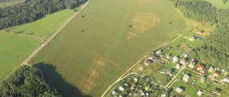
You can find a plot on a cadastral map, but the plot is not always displayed, which leads to a number of problems. The reason lies in a cadastral error.
Types of errors
In order for the site to be displayed on the cadastral map , the owner needs to invite a land management specialist who carries out land surveying and draws up a technical plan. Based on the technical plan, representatives of the registration authority register the object for cadastral registration.
If a cadastral error is detected in the location of the boundaries of the land plot, other coordinates will be displayed on the map.
There are several types of errors, they are divided into technical and registry. Each species has its own subspecies.
Among the main cadastral errors of a land plot, the following should be highlighted:
- Irregularity of boundaries. By opening a thematic map, the subject may notice that its boundaries are superimposed on the neighboring area. Before correcting deviations from the norm, you need to obtain the consent of your neighbors and make sure that they have no complaints. This type refers to registry errors made by the engineer when entering data. To correct this, re-surveying is carried out.
- Incorrect boundaries of several memories. One area overlaps the adjacent one and the adjacent one is also displayed incorrectly. Correction of a cadastral error of a land plot is carried out using repeated land surveying (with the consent of all participants/neighbors).
- Neighbors do not agree with the established boundaries. When inaccuracies are discovered, it is not always possible to obtain the voluntary consent of neighbors to change the data. In this case, the owner needs to contact the courts; court representatives will cancel the existing decision to conduct the land survey.
- The satellite gives the wrong picture. If a cadastral error in the location of boundaries is associated with a shift in satellite photographs, all boundaries, not just one specific one, will be displayed incorrectly (outside their boundaries). There is no need to take any action; the coordinates in the documents are indicated correctly.
Important! If all the information is displayed correctly on a public map, but in fact the plot is larger, this is classified as illegal legalization. The owner may be held administratively liable for illegal actions. His actions are assessed as self-capture.
The first step to correcting the error is to order an extract from the Unified State Register of Real Estate to determine the exact boundaries and confirm ownership. You can order an electronic certificate on the official website: rosreestor.online
After carrying out the above manipulations, documents with new entered data are sent to the registration authority. It takes three to five business days to correct the error, depending on who made the inaccurate data.
What documents will be required
A specific list of documents required for the clarification procedure is not contained anywhere. However, you should collect all the documents that you have.
At a minimum, the following documents must be prepared:
- cadastral extract;
- cadastral passport;
- certificate of ownership or other document certifying the right of an interested person to the site;
- address order.
It is worth immediately noting that the packages of documents for submission are different in each specific case. It all depends on what right the plot belongs to a citizen or organization, what type of permitted use, and location features. It also happens that some land documents have to be ordered from the archive, which means spending additional time on this, etc.
Therefore, in order to know exactly what documents are needed to carry out the procedure in question, it is easier to immediately seek advice from a specialized organization where cadastral engineers work.
They will be able to carry out the entire range of work and will issue a ready-made document to confirm this.
Technical
Technical errors include typos made by employees of the Federal Service for State Registration, Cadastre and Cartography. To correct inaccuracies, you need to contact the registration authority. This type of inaccuracy includes:
- Typos.
- Incorrect numbers.
- Missing number of digits.
- Incorrectly entered address information.
- No information (incomplete information).
Government agency employees request archival data, compare it with available information, and make changes.
Procedure
If there is no cadastral passport for the land plot and a boundary plan, then the procedure for clarifying the boundaries of the plot is as follows:
- Collecting the necessary information and preparing documents;
- Choosing a surveying company;
- Initial inspection of the site by a cadastral worker;
- Concluding an agreement with the selected company;
- Carrying out boundary work on the site;
- Analysis of collected data;
- Approval of a preliminary map of the site;
- Drawing up the final boundary plan;
- Registration of the boundary plan in the cadastral chamber.
When preparing the above documents, it is important to find additional ones that contain any information about previously established boundaries. This may also be a technical plan of already constructed structures indicating their coordinates.
When choosing a geodetic company, you need to pay attention to the availability of the appropriate license, as well as the reputation of the company. The cadastral employee of the company must be on the federal list of cadastral engineers presented on the Rosreestr website.
First, a company employee inspects the site and studies the provided
documents, after which the customer and the company representative discuss the price and enter into an agreement, and also sign an act on the cadastral work.
Next, the cadastral engineer goes to the site with the necessary tools to take measurements; work on the site can last up to two weeks.
The cadastral engineer carries out the following actions on the site:
- Inspection of natural boundaries;
- Primary measurement of border lengths;
- Photographing the territory;
- Soil inspection;
- Installation of control points (pegs);
- Measuring the height of hills and/or the depth of lowlands;
- Clarifying measurement.
It is important to remember that before a specialist leaves for the site, it is necessary to notify neighboring users about the upcoming work to clarify the boundaries.
After the measurements have been taken and a number of necessary calculations have been carried out, the cadastral engineer provides a preliminary map of the site to the customer for approval. It is also necessary to agree on the newly defined boundaries with interested parties - co-owners of the customer’s plot and neighboring land users.
In the absence of claims from interested parties, the cadastral engineer draws up a final boundary plan for the site, which consists, in accordance with Part 5 of Art. 22 Federal Law “On State Registration of Real Estate”, in two parts:
- Graphic;
- Text.
The graphic part contains an image of the site plan indicating the new boundaries and places of passage/passage through the site under a public easement.
Interested parties must sign an act of approval of the boundaries of the land plot, which is located on the back of the graphic part of the final boundary plan.
After this, the agreed boundary plan is submitted to the state real estate cadastre for review and final approval, during which members of the review commission can make requests to the archives and check the authenticity of documents.
If violations are detected, the cadastral authority refuses to approve the final boundary plan indicating the reason.
The reasons may be:
- Incorrectly provided data;
- Incomplete package of documents;
- Detection of errors in the cadastral engineer’s calculations;
- Detection of the fact of overlapping boundaries;
- Inadmissible approach of borders to the red lines of the territory;
- Violation of a public easement.
To eliminate the overlap of boundaries or violation of the easement due to clarification, a court hearing may be required; other cases can be corrected by the applicant or cadastral engineer.
In case of successful approval, the customer receives a boundary plan with precisely defined boundaries, on the basis of which he can issue a cadastral passport for the land plot in the future.
It is important to remember that if information about the area of a land plot is entered into the Unified State Register of Land Registers, then the specified area cannot be less than that indicated in the Unified State Register of Land Registers by more than 10%, according to clause 3 of Art. 42.8 of the Federal Law “On Cadastral Activities” No. 221. Also, the area of the allotment with specified boundaries cannot exceed the maximum established sizes for lands of a given type or 10% if such limits are not established.
How to fix it yourself
If you decide to personally deal with the elimination of inaccuracies, you need to understand how to independently correct the error in the location of the boundaries of the site.
All actions in several steps - filling out an application and submitting it to the government agency.
In order for the information to be corrected, you need to apply to the Federal Service for State Registration, Cadastre and Cartography. A neighbor who needs to obtain reliable data about the adjacent plot can also submit an appeal (before this, you need to order an extract from the Unified State Register of Real Estate ).
The application is submitted in writing in accordance with the procedure established by law. Experts recommend that you carefully fill out clause 3.1.2, which states where the error was made. After preparing the application, the application and package of documents are submitted to the registration authority.
If an adjacent one was superimposed on your area, you can eliminate the inaccuracies yourself. If an adjacent plot is placed on your plot, either contact the registration authority (if the neighbors are not against making adjustments) or through the court, if the neighbors refuse to make adjustments.
What is boundary clarification?
In essence, this is a set of actions by a cadastral engineer to determine the boundaries of a site as a result of land surveying.
The document obtained as a result of these works will be the basis for
introduction of new boundaries into the State Property Code by an authorized body (Rosreestr).
In other words, clarification is necessary when the cadastral register does not contain information about the specific location of the land plot in the cadastral register.
However, such a plot has an assigned cadastral number, passport and plan, that is, it is registered and registered.