Purchasing or receiving a plot of land as a gift is an extraordinary and wonderful event in the life of absolutely every person. But we will not touch on this process in particular, but will look in more detail at the overall picture in this area.
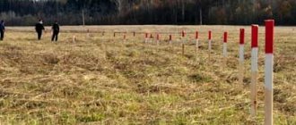
After determining the area, shape of the site, placing boundary markers, and, of course, the official registration of the account, the stages of planning and then surveying the territory of the land begin.
So what are the planning and land surveying projects, the procedure for their approval and cost, you will find out by reading the material provided.
Territory planning documentation
When starting large-scale construction work or reconstruction, the developer is required by law to prepare documentation on the planning of the territory:
- territory planning project
- territory surveying project
A territory planning project is prepared when the formation of new construction projects (houses, schools, kindergartens and other infrastructure) in the aggregate is required, as well as when linear objects are located (highways, power grids, water supply, etc.). A land surveying project is needed to determine the boundaries along the perimeters of land plots or red lines. However, the main part of the territory planning project will be the land surveying project. That is, to put it simply, the planning project also includes land surveying. The land surveying itself can also exist in the form of a separate project. Before you begin preparing projects, you should collect a number of documents:
- decision of local authorities on the preparation of the project
- terms of reference for the project
- contract for design work
- master plan
- land use rules in the area of the facility
- topographic survey
- extract from town planning regulations, zoning maps, etc.
Purpose
PPT and PMT are used in preliminary preparation for work at a pre-selected location.
Moreover, the documentation can be used both on newly allocated development sites and on territories with developed infrastructure.
When a developer undertakes any actions on an empty site, it is necessary to take into account the soil structure and the likelihood of construction with a variety of features. Otherwise, it is impossible to maximally load the provided land area with capital buildings.
In addition, the most important nuance is the combination and harmony of styles, as well as the combination and proper distribution of new buildings with pre-built architectural and urban planning structures.
The general multifunctional organization of construction activities, in addition to the formation of projects for individual purposes, is the most important component.
But, unfortunately, in large cities, in pursuit of the “long ruble”, local municipal authorities turn a blind eye to flagrant violations of the quantity and quality of developments. In this regard, in the megacities of our country, today, extremely high requirements are placed on PPT and PMT, not only to comply with all standards for the construction of new buildings, but previously made mistakes and shortcomings are taken into account and corrected in order to recreate former architectural ensembles.
Also, the documents under consideration will not only come to the rescue in controversial issues regarding the division of land plots. For example, when determining the boundaries of use of a plot of land using markings, the division of common shared property occurs.
Why do you need a territory planning project?
Before developing the territory, any developer knows that all actions without approval may be considered illegal. In order not to encounter prohibitions or demolition of unauthorized buildings, you need to prepare a draft layout of the territory. Let's look at how the planning and land surveying project is carried out step by step:
Stage 1. Development
Owners who are beginning the grandiose construction of buildings, structures, and facilities are interested in developing documentation for territory planning and land surveying. According to the law, the authorized person must apply for permission, or rather, for a decision on the preparation of a territory planning project.
Stage 2. Preparation
Preparation of a territory planning project involves a series of cadastral works and engineering surveys. These are not only documentary, graphic images, but also works on the ground. To prepare projects, you should contact specialized organizations. Not every cadastral engineer will undertake work of such volumes. Preparing a project for planning and land surveying involves collecting documentation, preparing new drawings, and coordination with government agencies.
Stage 3. Statement
When a territory planning project is developed and prepared, it must undergo an approval procedure. But before the project is approved, the administration issues a resolution to hold public hearings and makes it public. Only in some cases (for example, when preparing a project for land surveying in SNT or ONT) hearings are not required by law. After the hearings, if no one has any objections, the planning project is approved by local administrative authorities.
Step-by-step instructions for preparing PMT and PPT:
There are two options for preparing these projects: contacting the administration or a commercial campaign. In general, the algorithm of stages will be the same for PPT and PMT, since these documents are closely interrelated.
Contacting the administration is possible if the local municipality can offer such services.
- An application is submitted to an authorized person.
- Attached are the following documents:
- certificate of ownership;
- a sketch of the general plan of the land (plus a communications diagram);
- cadastral extract for the plot;
- extract on the presence/absence of permanent buildings;
- topographic plan (with communications).
- Based on them, the preparation of the project begins, where attention is paid to:
- soil structure;
- architecture;
- environmental friendliness of work;
- technical support;
- development results.
- If the decision is positive, then a technical specification is drawn up and cadastral manipulations are carried out.
- PPT and PMT are being developed.
- The PMT is agreed upon with the electric grid and water utilities at public hearings.
Everything is done for free. Completion period: within two months.
Contacting a special company is necessary when the administration has refused an application for projects. Then an agreement is concluded with an architectural company. In this case, the list of documents is identical, only the sketch can be excluded from the General Development Plan. All other actions are similar to administrative ones.
The period can be one month, the cost depends on the scope of work and the contract.
Distinctive features of the planning project and the territory surveying project:
We found out that both the planning project and the land surveying project are prepared in relation to a district or linear object, and also that the planning project contains both the land surveying project and other information, that is, it is considered more detailed. Now let’s determine how a planning project differs from a land surveying project:
Layout project:
- applies to a territory developing as a complex
- prepared for extended objects (power lines, roads, water supply)
Land surveying project:
- prepared in order to establish clear boundaries on land plots; this is done if there is a need to change the red lines (indents).
Features and composition of the territory planning project and the land surveying project for a linear facility
Linear objects, be it a road, an electrical network or a gas pipeline, have a significant length. When preparing planning projects for a linear facility, approvals are required from Rosnedra, cultural authorities, and the Department of Natural Protective Environment. Often, linear facilities lie in several municipal districts, so permits must be obtained not only at the local level. Depending on the type of linear object, graphic drawings are prepared, where existing and planned data are indicated with symbols. Also, for the construction of linear facilities, a permit for short-term land use is required.
Features of the planning and land surveying project for a street or neighborhood
Planning and land surveying projects for built-up areas and streets must strictly comply with urban planning standards. The projects take into account such parameters as transport, engineering infrastructure, water supply, sewerage, drainage, heat supply, telephone installation, electricity supply, economic and technical equipment, and protection of natural resources. The attached drawings should reflect communal, linear objects, landscaping elements, existing and planned buildings and structures.
Content
PPT and PMT have the nature of standards in accordance with the work performed.
The structuring of projects is similar with minor exceptions, and in order not to repeat ourselves, we will analyze the material using the example of PMT. It contains cartographic and text data, the latter of which is based on a special table with a scrupulous description of the information provided, indicating the most important points in defining the architecture and other components.
This table includes :
- contents of the document;
- basic provisions;
- general and specific solutions for the formation of cartographic and text information;
- text and cartographic parts, which occupy a large part due to the various sections and chapters;
- list and information on the area of emerging sites;
- type of permitted land use corresponding to the planning projects.
The title page, with the provided information about the performer, as well as a brief structure of the content, makes up the first page of the document. In addition, a project can contain one or more applications.
Mapping of design. It should be reproduced both in paper form (in duplicate) and on electronic media, from where it is easier to copy that part of the site that is relevant at the moment and reflects the real state of affairs for the period of operation of the PMT. If necessary, new information is applied to the map manually, always in blue, in compliance with all regulations consistent with the requirements of the project.
What documents should I prepare for land surveying of SNT and ONT?
In order to register common shared ownership in a garden plot, according to Law 217-FZ “On Gardening and Vegetable Farming” (came into force on January 1, 2021), it is also necessary to prepare and approve documents on the planning of the territory. The documentation must first be approved by members of the horticulture or horticulture industry; for this purpose, a decision is made by the general meeting of the SNT (ONT). Moreover, in order to establish the boundaries of garden plots, it is enough only to prepare a project for land surveying; for SNT, a project for planning the territory is approved and prepared (clause 4 of Article 23 217-FZ).
Why are PPT and PMT needed?
These projects are used for:
- Preparation for construction work;
IMPORTANT. These documents can be used not only on empty land, but also on areas with established infrastructure.
- Planning construction in conditions of already erected capital buildings;
- Determining the boundaries of use of shares of a land plot in common shared ownership;
- Alienation of the encumbered part of the site, delimited from the general territory;
- Resolving disputes about land boundaries.
These two documents are so mutually dependent that when creating one of them, the need to create the other follows.
Legislative framework for the planning and land surveying project
The planning of the territory is regulated by Chapter 5 of the Town Planning Code. In addition, laws, orders, regulations and other by-laws have been adopted to develop planning and land surveying projects. At the local level, administrative regulations apply. For example, in the Moscow region, when preparing a planning and/or land surveying project, the norms of Resolution No. 884/39 of December 4, 2018 are used, which clearly outlines the procedure and rules for contacting local authorities for the preparation of planning and land surveying projects.