Zones with special conditions for the use of territories (hereinafter referred to as ZOUIT) are territories within the boundaries of which a certain legal regime is formed in accordance with the legislation of the Russian Federation.
Federal Law No. 340-FZ and No. 342-FZ dated August 3, 2021 “On amendments to the Town Planning Code of the Russian Federation and certain legislative acts of the Russian Federation” introduced significant adjustments regarding the classification of zones with special conditions for the use of territories (hereinafter referred to as ZUIT) to land management objects and the procedure for entering such security zones into the Unified State Register.
The establishment of special zones is confirmed only through the adoption of an appropriate decision by the authorized body or on the basis of litigation.
Consequences of the absence of a security zone in the Unified State Register of Real Estate
Failure to timely enter a land plot into the cadastre (USRN) is fraught with both financial losses for the land owner and the threat of a serious accident on the site. A person planning to carry out repair work on the territory will not know about the features of the zone, since he will not be able to find relevant information about it in the Unified State Register of Real Estate. In this case, all losses are borne by the owner of the site.
The responsibility to establish a sanitary protection zone on the territory of enterprises lies with industrial organizations.
You have received a notification that your site is included in a zone with special conditions for the use of territories
- the content of this restriction;
- registry number;
- individual zone designation;
- details of the act of the body that made the decision to establish such a zone.
The extract from the Unified State Register of Real Estate regarding the restriction of rights arising in connection with the location of the land plot within the boundaries of the ZOUIT indicates:
The lack of information about the ZOUIT or its untimely entry into the Rosreestr database can provoke an emergency during construction work and operation of the facility. The owner of the land may lose his buildings or endanger the lives of people.
Types of ZOUIT
Zones with special conditions for the use of territories are divided into several main groups:
| Security zones of gas distribution networks | Security zone of electrical networks | Security zone of heating networks |
| Main pipeline zones | Communication object zones (fiber-optic lines, fiber-optic lines) | Cultural zones |
| Water and fish protection zones, flood zones | Natural objects | Sanitary protection zones |
ZOUIT - what is it and how can a land owner find out about existing restrictions
In 2008, the concept of “Zones with special conditions for the use of territories (ZOUIT)” was introduced into the Town Planning Code of the Russian Federation. And in 2018, a new Chapter XIX “Zones with special conditions for the use of territories” was introduced into the Land Code of the Russian Federation.
ZOUIT are installed for the following purposes:
1) protection of the life and health of citizens;
2) safe operation of transport, communications, energy facilities,
national defense and state security facilities;
3) ensuring the safety of cultural heritage sites;
4) environmental protection, including protection and preservation
natural healing resources, preventing pollution, clogging,
siltation of water bodies and depletion of their waters, preservation of habitat
aquatic biological resources and other animal and
flora;
5) ensuring the defense of the country and the security of the state.
Art. 105 of the Land Code of the Russian Federation establishes the following types of ZOUIT:
1) zones for the protection of cultural heritage sites;
2) protective zone of a cultural heritage site;
3) security zone of electric power facilities (power grid facilities
farms and facilities for the production of electrical energy);
4) railway security zone;
5) roadside strips of highways;
6) security zone of pipelines (gas pipelines, oil pipelines and
oil product pipelines, ammonia pipelines);
7) security zone of communication lines and structures;
airfield area;
9) area of the protected object;
10) zone of a protected military facility, security zone of a military facility,
prohibited and special zones established in connection with the placement
specified objects;
11) protective zone of a specially protected natural area
(state nature reserve, national park,
natural park, natural monument);
12) security zone of stationary observation points
environment, its pollution;
13) water protection (fish protection) zone;
14) coastal protective strip;
15) district of sanitary (mountain sanitary) protection of health-improving areas, resorts and natural medicinal resources;
16) zones of sanitary protection of sources of drinking and domestic water supply, as well as those established in cases
provided for by the Water Code of the Russian Federation in relation to
underground water bodies of special protection zone;
17) flood and flood zones;
18) sanitary protection zone;
19) restricted area of the transmitting radio engineering facility,
being the object of capital construction;
20) security zone of points of the state geodetic network,
state leveling network and state gravimetric network;
21) observation zone;
22)security zone with a special legal regime;
23) fishery protection zone of Lake Baikal;
24) fishery reserve zone;
25) zone of minimum distances to highways or industrial
pipelines (gas pipelines, oil pipelines and oil product pipelines,
ammonia pipelines);
26) security zone of a hydropower facility;
27) security zone of metro infrastructure facilities;
28) security zone of heating networks.
All ZOUIT can be grouped into 2 blocks:
1) ZOOIT, which arose by virtue of federal law (water protection (fish protection) zones, coastal protective strips, protective zones of cultural heritage sites);
2) ZOUIT, which arose in compliance with specialized requirements (the procedure for their establishment is determined by the Decrees of the Government of the Russian Federation).
There are several ways to find out whether your land plot is included in the ZOUIT:
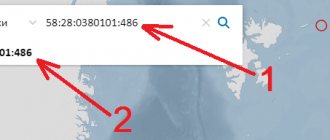
1) Find the property of interest on the Public Cadastral Map. Include the layer “Zones with special conditions for the use of territories.” To do this, select the “card management” menu in the upper left corner. It is worth considering that the map will display the zones registered in the Unified State Register of Real Estate. If the boundaries of the zone are not included in the Unified State Register of Real Estate (and the majority of such zones), checking using the public cadastral map will not yield anything.
2) Another way is using the Public Cadastral Map - in the upper left corner you need to click on the “all objects at a point” tab, and click on the PCC with the mouse within the boundaries of the land plot of interest. A window will appear that displays information about the plot, including the territorial zones within the boundaries of which the land plot is located. This window also displays the registration number, by clicking on which you can find out the type of territorial zone, type, registration number, cadastral district, as well as the date this information was entered into the Unified State Register of Real Estate.
3) Information about ZOUIT can be on regional or municipal maps. For example, in Moscow there is an “IAIS OGD” card. To see zones with special conditions for the use of territories on it, you need to enable the “territories with special requirements” layer. In the Moscow region there is an alternative source of such information - Geoportal.
4) Order an extract from the Unified State Register of Real Estate. The method is very unreliable, since most territorial zones are not included in the Unified State Register of Real Estate and information about ZOUIT simply will not be reflected in the extract.
5) View land use and development rules. Land use and development rules are the main urban planning document. They contain maps of zones with special conditions for the use of territories. In Moscow there are 8 separate maps for each district (and 5 more classified ones), in the Moscow region there is a separate map for each municipality. In this way, you can, for example, see whether a site in the Moscow region falls into the sanitary protection zone.
6) Get a fresh urban planning plan for the land plot. This method is the most reliable. The GPZU will contain maximum information about territorial zones. GPZU is formed on the basis of current information from government bodies. Much of this information has not been published anywhere. The owner can receive a GPZU through a public service. You can apply for GPZU on the “Public Services” portal.
It is worth noting that when exercising his right to dispose of a land plot, the owner is obliged to indicate information about the land plot. Thus, Rosreestr, when registering the transfer of ownership and if information about the ZOUIT is not indicated in the Sale and Purchase Agreement, suspends such transactions with reference to clause 1, Article 37 of the Land Code of the Russian Federation and to clause 1 of Art. 432 of the Civil Code of the Russian Federation. The issue is often resolved by concluding an additional agreement indicating all existing restrictions regarding the subject of the purchase and sale agreement.
Today, information about ZOUIT is located in the information databases of various departments; the process of creating a unified database about ZOUIT has not been completed. It can be argued that only after the creation of a unified database about ZOUIT and its integration with the Unified State Register of Real Estate, copyright holders will be able to accurately and accurately learn about the restrictions that apply to their property. In the meantime, owners have to collect information on their own, and the possibility of not finding reliable data on restrictions in the form of ZOUIT is quite high today.
Preparatory stage
At the preparatory stage, a text and graphic description of the location of the object in relation to which it is necessary to form a security zone is compiled, its area and boundaries are determined. For this purpose, information from the Unified State Register of Real Estate is analyzed, materials from the Unified Electronic Cartographic Basis are used, and other cartographic material and remote sensing materials are collected. Geodetic survey is carried out with coordination of objects.
Based on the results of the work, a technical report is drawn up containing:
- list of land plots in the buffer zone (if available);
- USRN information;
- situational plan for the location of objects (objects around which a security zone is established: gas pipelines, cultural objects, plants, factories, etc.);
- catalogs of coordinates of the established security zone;
Zones with special conditions for the use of territories (ZOUIT)
- Size of the study area;
- Allotment form;
- Type of zone whose boundaries need to be determined;
- Terrain characteristics;
- Is topographical surveying required?
- Project implementation timeframe.
Sanitary rules and standards “Zones of sanitary protection of water supply sources and drinking water pipelines. SanPiN 2.1.4.1110-02"
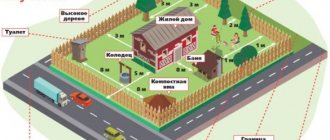
It would be justified, for example, to prohibit the construction of a retail outlet near a gas station. Since, if an explosion occurs, then the death of both the seller and buyers is likely.
As for the land plot, it is possible to clarify its area, cadastral number, cadastral value , category, status, date when it was registered, cadastral engineer
who performed the work on this site, the site plan and data on the cadastral quarter where the site is located.
Registration of a security zone
Based on materials prepared in advance, a catalog of coordinates of the boundaries of security zones is compiled and a plan is prepared.
The plan of the boundaries of the protective zone is drawn up in a form combined with a cartographic basis and displays:
- boundaries of the security zone;
- boundaries of natural objects and objects of artificial origin (if the location of individual parts of the boundaries of protective zones is determined through the location of these objects);
- necessary designations;
- symbols used;
- selected scale.
At the same time, a decision of the executive authority of the constituent entity of the Russian Federation is requested to approve the boundaries of the security zone and to receive a confirming document on entering information about the security zone into the Unified State Register of Real Estate.
Security zone of an overhead low-pressure gas pipelineZOUIT on the Rosreestr map; what does this mean, scope of application of the concept
We are talking about parks, nature reserves, lakes, as well as cemetery areas, various pipes, highways, communal buildings (which bear inscriptions such as “Flammable”), fishery protection zones and fishery protected areas, and electrical substations. In fact, these are all those objects that are classified as state property.
Thanks to a public map, it is possible to study any site online, find out its location within the boundaries of nearby territories, determine the coordinates of its borders or the distance from it to another object. A separate pop-up window is provided to display all data (if this data is included in the cadastre).
Its location is the official website of Rosreestr.
ZOUIT on the Rosreestr map - what is it? (read more…)
So, the owner of such an object (for example, the owner of a functioning old large radio installation) has the right to allow the construction of a residential building in the area located near it. No one will guarantee that the next owner will not begin to demand the demolition of the structure due to the installation of equipment of greater power.
Procedure for using ZOUIT
Owners of plots with a special legal regime can freely use and dispose of them within the framework established by law, taking into account the restrictions imposed. ZOUIT precisely imply some restrictions: this is the specific order of their use, based on the imperative principle.
These zones are located in areas within the boundaries of which a special restriction regime has been introduced. This may be a ban on the placement of objects that harm the environment, a ban on construction, and others. Restrictions depend on the type and purpose of the zones.
ZOUIT on the cadastral map and on the ground are indicated by special information type signs . In accordance with the Code of Administrative Offenses of the Russian Federation, administrative liability is provided for their unauthorized transfer, damage, or liquidation.
All types of ZOOIT must be recorded and reproduced on all maps.
Specifics of ZOUIT
The limits of an area with a special legal regime are determined by rules, which are based on special regulations.
The allocation of sites takes into account various factors:
- the possibility of combining different types of modes of use in one zone;
- placement of functional zones and indicators of their development in accordance with the current Master Plan.
Goals of ZOOIT
Land management of areas with certain conditions is carried out for:
- creating an environment for the operation of transport, industrial, radiation, energy, nuclear hazardous facilities, as well as storage facilities for hazardous substances;
- human safety;
- protecting landscapes from pollution;
- protection of cultural heritage, natural and archaeological complexes;
- sustainable functioning of ecosystems.
Signs of ZOUIT
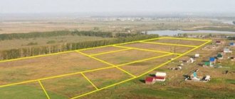
Zones with special conditions of use are subject to description and inclusion in the state cadastre . They are created on the ground and adjacent to the objects in relation to which they are formed.
In relation to zones with intensive care units, rules for visiting and staying are provided. Their area may not coincide with the parameters of the objects for which they were created. Their boundaries are much wider.
If they coincide, there must be instructions in the regulatory act on the formation of the site. The object of protection or protection must have its own boundaries. Their area is not included in the ZOUIT.
Exceptions
ZOUIT on the Rosreestr map should be distinguished from other areas with restrictions. They may have different educational goals.
For example, areas with a special legal regime do not include specially protected lands, forests and other areas where the object of protection forms one whole with it.
Specially protected areas also include:
- bosom;
- Earth;
- Flora and fauna;
- water bodies.
Protection does not apply to each of them individually, but collectively.
Protective forests are considered by analogy . Essentially, it is a complex of trees and shrubs. The object of protection is not specific plantings, but the entire area on which the forest is located.
In order to determine which zones are territories with special conditions of use, it is necessary to contact the State Cadastre, which provides for mandatory registration of such lands.
What information is available to citizens when using the public cadastral map?
Procedure for using a cadastral map
Let's list them point by point:
- Information about the property: its cadastral number, address, cadastral value, state registration date, encumbrance, area and other data. Data is also provided about the specific body of Rosreestr, in whose service area the property of interest is located. You should contact it if you find any inaccuracies in the data displayed on this resource. You need to remember: you can get acquainted with the listed information if the property is registered with Rosreestr, and information about it is included in the State Cadastre.
- About the unit of administrative-territorial division : name, type, name of the region/region, the number of municipalities included in it, the total number of settlements.
- ZOUIT on the Rosreestr map: you can find out about its type, get acquainted with the description, details of documents establishing boundaries.
- If necessary, by turning to the map, you can get acquainted with satellite images of the area, digital topographic maps and orthographic coatings.
Main stages
Cadastral activities to determine boundaries and establish the area of territories with special operating conditions are divided into the following stages:
- Preparation - the contractor studies the documents provided for the land, draws up a research plan and schedule, and draws up an estimate for the customer;
- Field stage - the contractor goes to the site and carries out the necessary measurements of the memory. also at this stage, the cadastral engineer conducts a topographic survey of the area, prepares a diagram of the site and determines its area;
- Office - production of a catalog of zone coordinates and a graphic description of the territory. The document must include information about the coordinates of boundary signs, a decoding of symbols, and the scale used;
- The final stage is the transfer of documents to the Russian Register and entering information into the state organization’s database. the date of establishment of the ZOUIT coincides with the date of entry of the account into the cadastral chamber.
How are ZOUIT zones determined?
- The Government, based on the Resolution, decides to determine the specified zone. Next, the Government appoints local and regional authorities responsible for the procedure for recognizing the special status of ZOUIT.
- The Resolution specifies an exhaustive list of documents on the basis of which the legal status of the zone is regulated. Performers, represented by local self-government bodies, are required to be guided by the specified list.
- The interested party (this is most often a subordinate Ministry) develops information, legal, technical, descriptive part of the use of the zone according to the ZOUIT classifier and transmits the information to local authorities.
- To determine the exact status of the zone, comprehensive cadastral work is envisaged. Cadastral engineers receive from local authorities all the necessary documentation and technical specifications for preparing and determining the status of the ZUIT.
- Upon completion of the cadastral work, the authorized authorities issue an order establishing the status of the ZOUIT.
- After all documents have been prepared and approved, the zone with the new status of ZOUIT will be registered in Rosreestr.
