In this article:
- The essence of topographic survey
- Traditional types of topographic survey
- Modern methods of topographic survey
- 2 main directions of topographic survey
- 4 stages of topographic survey
- 10 factors influencing the cost of topographic survey services
- Risks of poor-quality topographic survey
- Independent topographic survey
- Validity period of survey results
Topographic survey is necessary in many cases. But the most common, of course, is the situation when construction is planned on a particular plot of land. Without a topographic survey, work on the construction of the facility simply cannot begin.
But it is not enough to simply understand why this procedure is needed. It is also advisable to understand the types and methods of topographic survey, of which there are a considerable number. And for each specific case, using a very specific method is more suitable.
The essence of topographic survey
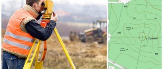
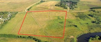
Topographic survey is a set of works that are carried out for geodetic research in various fields. It is in demand in design, construction, landscape design, and land management. Topographic survey of the selected area is carried out by a surveyor. During it, he determines the relative plan-height location of terrain points, buildings and linear objects.
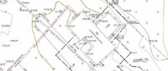
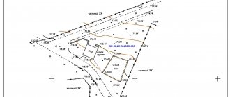
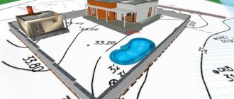
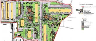
When the topographic survey is completed, the customer receives a topographic plan - a detailed picture of the land plot of interest on a reduced scale, on paper or in electronic form. All objects that are on the site are reflected in the topographic plan by conventional signs indicating elevations and contour lines. A topographic plan can be ordered from any geodetic company.
So, topographic survey is needed in order to get a picture of the layout of a specific land plot. Therefore, its natural result is a topographical plan, on which the customer sees all the buildings, trees, roads, cable routes, pipelines, sewage systems - everything that is located on the site itself and underground within its boundaries. Using a topographic plan, you can determine the actual dimensions of all objects, the distance between them and analyze the terrain.
Topographic surveys are done in many different types and variations. In this case, various techniques and devices are used. What factors determine which type of topographic survey will be used? First of all, it depends on the expected volume of work, the feasibility of labor costs and how accurate the result needs to be obtained. We will talk about this in detail below.
People often think that topographic surveying is a service that is only in demand by construction firms, electricity, gas and water suppliers, and companies that need to build a building. However, they are wrong. You will need topographic survey if you own a plot of land, even if it is small, whose area, for example, is 40 square meters. What is it for? In order to obtain a topographic plan that will clearly show the boundaries of your site. If you suddenly have a territorial dispute with neighbors or problems with utility services during communications, a topographic plan will help you defend your case and avoid claims.
Topographic survey of the area is performed if:
- The land plot needs to be connected to engineering and technical communications, water, gas, electricity, a heating network or telephone connection.
- Redevelopment of communications is required.
- Documents are being prepared to obtain permission to build a house.
- Do you want to buy a plot of land or rent it?
- A project is being developed for the construction of a building on the site or the reconstruction of an existing structure.
- It is necessary to tie the building under construction to the area.
- Landscaping work required.
- You have to enter into a legal battle related to land and real estate.
Situations in which topographic survey is necessary
Obtaining a building permit
Here, photography will be required during the construction of capital buildings for housing and other needs , for example:
- warehouses;
- elevators;
- industrial and technical buildings.
Land surveying must be carried out before the start of construction and, on its basis, a project for the development zone must be prepared, including the building in the urban planning plan of the locality. The result is coordination of the new building in the context of the erected buildings and existing architectural solutions. Read about filling out the GPZU here.
Preparation of a survey project
The design of the development zone is carried out on the basis of the availability of a topographic document , which acts as a geological basis. Here, the buildings planned for construction are plotted on the existing land survey plan (see how to obtain it). Or an internal land survey is established for a plot that has been registered under a single cadastral number and is not subject to division. As a result, the planned ones appear on the memory diagram:
- buildings or structures;
- conditional boundaries of development zones;
- conditional boundary lines.
Sometimes such a document is used to establish encumbrances on part of the land plot.
Conducting communications
This procedure requires drawing up a situational plan for power supply or gasification of the plot . Here, in addition to the existing buildings within the site and beyond, transport lines are indicated, as well as the exact location:
- electrical wiring;
- gas pipes or other, in accordance with the application.
Such work is carried out in strict compliance of the manufactured circuit with the real state of affairs, requiring the utmost care in measurements and calculations. As a result, the customer receives a situational plan, which indicates the location of the electrical or gas infrastructure in the area where the charger is located.
Making cuts
This type of survey allows for a free increase in the site up to 10% of the total area (Article 60 of the Land Code). Or – the purchase of adjacent ownerless lands from the administration.
You can read the text of Article 60 of the RF Land Code below.
When carrying out geodetic work, a new site takes over the old territory. The topographic plan shows the initial and subsequent structure of the land.
Reorganization of the storage facility
This procedure is carried out only by land surveying. Surveyors measure the total area of the merging areas into one, highlighting its boundaries along the perimeter. Or they divide one plot into a specified number of them, taking into account the norms established for this procedure.
Customers are provided with topographic documentation containing information about the old and newly formed site.
Read more here about the allocation of a share in kind of a land plot from the common shared property.
Other types of work
In addition to what is indicated, orders that are less common in everyday life, but still occur, arise. For information, please note that topographic survey is also required :
- When developing a master plan for the development of a settlement or designated area.
- Monitoring the profitability of planned work using geodetic measurements and calculations.
- Improvement of the territory of a settlement or local area.
- Forest cutting, allocation of forest area for logging.
- Survey work - drilling wells in accordance with geodetic measurements.
Traditional types of topographic survey
Land surveying comes in many different forms and usually depends on the scale of the job.
- Tree survey allows you to determine the exact number of trees on the site and their location relative to each other and other objects. It is ordered if you want to plan landscaping.
- Ultra-close-up photography allows you to most accurately determine the location of all buildings and objects on the site and their coordinates. It is carried out on a scale of 1:200. This type of topographic survey is performed if you need to arrange construction sites.
- “Pyatisotka” is used if you need detailed drawings and master plans of utilities that affect the site. It is performed on a scale of 1:500.
- Topographic survey on a scale of 1:2000 is used for various settlements, in particular, neighborhoods and villages. With its help you can get a detailed plan of a large plant or plant.
This is interesting!
“Business plan for the construction of a cottage community”
More details
Types of topographic survey are also distinguished depending on the technological process. They are as follows:
- Tacheometric
This type of topographic survey is very popular. It is based on the use of modern electronic total stations. This type of topographic survey is used for laying power lines, pipelines, road construction and bridge construction. The result of this topographic survey is a plan at scales of 1:500, 1:1000 and 1:2000. It displays the terrain in similar detail.
- Theodolite
This type of topographic survey uses a goniometric geodetic instrument called a theodolite. Recently, theodolite survey has also used a light-range finder attachment or a total station. Theodolite surveying is performed if the customer needs situational site plans or area maps at a scale of 1:2000, 1:5000, 1:10,000.
- Phototheodolite
This type of topographic survey is an improved method of theodolite survey. When performing phototheodolite photography, a special phototheodolite device is used. It combines a theodolite with a high-precision precision camera. Phototheodalite surveying is in great demand because with it, labor costs for field work are significantly reduced, since the bulk of the work is transferred to office data processing. Such topographic survey can be carried out in hard-to-reach areas, for example, in the mountains or swamps. Its results are highly accurate.
- Surface leveling
Surface leveling is carried out if it is necessary to perform topographic survey of an open area of terrain with measured relief. It allows you to create a vertical layout and accurately calculate the volume of required earthworks on a large scale (from 1:500 to 1:5000). Leveling helps to obtain a detailed image of the terrain and the contours of the situation. There is one important condition: the height of the relief section must be in the range of 0.1 ÷ 0.5 m. Leveling the surface is done using a leveling geodetic altimeter. Surveyors need it to measure the elevation of objects on the horizontal line of sight. Typically, when leveling a surface, the square and highway methods are used.
- Menzulnaya
This type of topographic survey is carried out using a device called a mensula. It consists of a table made of Cypregel, a drawing tablet and a tripod. With such a survey, a topographic plan can be drawn up directly on the study area. However, these days this method of topographic survey is considered outdated and is rarely used. The fact is that with periodic surveys it is impossible to use automated computer technology to collect and process data.
- Bussolnaya
Topographic survey of this type is carried out using rangefinders and compass. These are special devices that allow surveyors to obtain information about horizontal angles on the ground.
- Sonar
As the name implies, such topographic survey is used when it is necessary to obtain data on the state of the bottom of any reservoirs. This is done using sonar.
- Aerial photography
Aerial photography is used in many industries, for example, in urban planning, agriculture, cartography, and during cadastral work. Such topographic survey allows you to obtain the clearest images of the area, on the basis of which orthophotomaps are created. It is carried out using drones and unmanned aerial vehicles, on board of which surveyors place high-precision aerial cameras.
- Combined
With the combined method, aerial photography is carried out in conjunction with one of the ground-based types of topographic survey. As a rule, combined surveying is performed if data from flat terrain is needed. Aerial photography tells about the situational features of a land plot, and ground photography tells about its relief. Combined surveying allows you to create extremely accurate topographic plans and maps of the area.
Features, content and purpose of topographic maps
This type of map is created to meet the needs of the national economy and state defense. Geodetic topographic work allows you to study and evaluate the area in detail.
Topographic maps show the following data:
- mathematical elements of cards;
- strong points;
- hydraulic structures;
- settlements;
- road network;
- industrial, socio-cultural and agricultural facilities;
- relief;
- borders, etc.
Modern methods of topographic survey
Lidar aerial photography
This topographic survey is carried out using airborne laser scanning. It allows you to obtain high-precision digital terrain models and coordinates of laser reflection points, even if the site is located in a forest, under the canopy of trees. As a result of lidar aerial photography, three-dimensional grid models of terrain and objects, 3D models of buildings and built-up areas are created. It is needed to conduct an inspection of electrical facilities, inventory the land and property complex, monitor forests and large engineering facilities. For example, lidar aerial photography makes it possible to monitor the state of open-pit mining.
This is interesting!
“Technical regulations in construction: requirements and standards”
More details
Terrestrial laser scanning
Terrestrial laser scanning is a separate type of topographic and geodetic work. It is carried out using the same measurement principles as airborne laser scanning. Terrestrial laser topographic survey is used if you need to obtain detailed plans and create three-dimensional models of territories of several tens of hectares. It allows you to study in detail the characteristics of bridges, overpasses, overpasses, overhead communications, find out the diameter of pipes and where their diameters change on overpasses, and establish the linear dimensions of objects. Terrestrial laser scanning provides high density and accuracy of laser reflection points for geodetic research. As a result, the shooting detail is at a higher level.
Ground-space topographic survey
Ground-space topographic survey is a very promising type of geodetic research these days. With such topographic surveys, GPS satellite navigation systems, or Global Positioning System, are used. In GPS systems, special artificial earth satellites play the role of precisely coordinated moving reference points. Based on their position, the three-dimensional coordinates of characteristic points of the terrain are determined by the ground method using GPS receivers. This type of topographic survey is being improved and developed. It is expected that in the near future, surveyors will give preference to ground-based surveying over traditional types of topographic surveys.
Thermal photography
Thermal photography is the registration of electromagnetic radiation from objects in the thermal infrared region of the spectrum and its presentation in the form of an image. Thermal radiation receivers find it and convert it into an image that shows the differences in temperature of different objects located in the area under study. Such topographic surveys are carried out at any time of the day.
Thermal imaging examination
This type of topographic survey is a type of thermal control. A thermal imager is used as a measuring device during this process. It detects thermal radiation and displays a temperature image on its display. A thermal imager allows you to see objects and phenomena that cannot be seen with the naked eye. This is the peculiarity of this type of topographic survey.
GPR sensing
This topographical survey of the area is carried out using georadars. These are very powerful geophysical tools that help researchers obtain a lot of information in a short time. They operate down to a depth of 5 meters with a resolution of 20 centimeters. The purpose of ground penetrating radars in this case is to determine the presence of fluctuations in the density of the medium under study when constructing a georadar profile. Thus, with this type of geodetic research, underground communications are detected, even if they do not have a temperature contrast. GPR sensing allows you to obtain a detailed and reliable picture when analyzing different areas at different depths.
The topographic survey methods that we talked about differ in many ways: in the specifics of the work, and in what kind of equipment is used, and for the purposes of their application. But at the same time, all of them were developed in order to conduct geodetic research and build topographic plans of land plots displaying the objects located on them.
Carrying out topographic survey work
These works consist of three stages, in which topographic survey is the basic point, carried out only on the ground. In general, cadastral work consists of the following:
- Preparatory stage , at which technical specifications for surveyors are drawn up. An extract is ordered from the State Property Committee, and the information received is used to develop a preliminary plan. On its basis, work is carried out on the ground.
- Work on the ground - direct topographic survey with analysis of the information received and carrying out calculations.
Turning points are recorded with signs, and their coordinates are transferred to paper. Read more about the coordinates of turning points in our other article. - The desk stage is the use of the obtained data in the preparation of a finished topographic document that meets the customer’s goals. Preparation of a cadastral report, with the transfer of an electronic version to Rosreestr.
Each stage of work is provided with appropriate methods of carrying out and calculations, as well as the necessary tools. Responsibility for their implementation rests with a cadastral engineer who has a license to conduct them.
Risks of poor-quality topographic survey
You might think that it would be easier to carry out a land survey yourself rather than hiring surveyors. Or at least look for organizations that have low prices for such work. However, such a decision will be your mistake. If the topographical plan of the land is not done correctly, it can cause a lot of problems for you.
If you apply for topographic survey to a company that does not have the appropriate permits and special modern equipment, you risk getting:
- not very accurate measurements;
- incorrect data processing (if the company has unlicensed software);
- topographic plan that has no legal force (if the company does not have SRO approval and a license).
This is interesting!
“Stages of construction of a cottage village: where to start and what to consider”
More details
So, if you try to save money on a land survey, there's a good chance you'll have to re-order it. No wonder there is a saying: “The miser pays twice.”
What equipment is used when performing topographic surveys?
Carrying out topographic work involves the use of a tachometer. This equipment is necessary for measuring structures that have lightly loaded and flat facades. Tachometers are used before the start of reconstruction and restoration work. This device is also necessary for surveying constructed structures and apartment buildings as part of geodetic support.
It is also impossible to imagine field topographic work without levels, theodolites, scales, route finders and navigation systems.
Independent topographic survey
To solve important issues and tasks, topographic surveys should be carried out only by certified specialists who have special measuring equipment. A topographic plan will have legal force only if it is drawn up and certified in accordance with legal requirements.
But, if you need to make minor changes to your plot (lay paths, dig an artificial pond), you can manually draw up a plot plan and make the necessary calculations.
To organize your own topographic survey, you will need a heavy hammer, 1.5-meter wooden stakes, a level or laser pointer, a 30-meter tape measure and some long ropes.
Wooden stakes will need to be installed in the corners of the site (these will be the base points) and a rope will be stretched between them. Make sure that it does not sag and that the attachment point is at a height of a meter from the ground. The building level will help determine the exact position. Then take a tape measure and measure the distance from the ground to the stretched rope. Mark the result obtained on the site drawing.
Download the area plan from the Rosreestr website and compare it with the results of your research, taking into account the scale of both maps.
Place the objects that you are going to add to your site taking into account the red lines.
Please keep in mind that your DIY survey results are only approximate. They do not give you the official ability to build any buildings on the site.
Ordering rules
Geodetic and cadastral survey of a land plot is offered by various geodetic companies. You must contact the organization that is located at the location of the land plot itself.
When contacting specialists, you must provide them with data about the site, documents for land surveying and proof that the customer is in fact the owner of the territory. You must have your passport with you.
Is it possible to carry out topographic surveys yourself?
To save a significant amount of money, people prefer to carry out topographic surveys themselves. This process is allowed by law, but people do not have the necessary equipment to actually obtain accurate information about the site and its parameters.
The process of self-conducting topographic surveys is divided into stages:
- the location of the desired piece of land is copied from the satellite map;
- copy the site plan on the Rosreestr website;
- boundary lines are drawn on the map, for which it is important to mark with them the boundaries of a certain territory belonging to the citizen;
- the required scale is established;
- planned development is indicated, and it is important to take into account all the standards and requirements for this process.
This procedure is considered complex and specific, so if a person does not have special skills and knowledge, then it is almost impossible to cope with it on their own. To do this, you must not only have the necessary qualifications, but also have expensive equipment. Therefore, such a document will not be accepted by the administration or other institutions.
Important! Although it is practically impossible to use such a plan for official purposes, it can be drawn up for your own use to correctly mark buildings or other areas on the site.
Cost of topographic work
The cost of this process varies significantly in different regions, since the pricing policy of companies, the list of services offered to each customer are taken into account, and other factors also influence the price.
The highest prices for topographic surveys are set in the capital and St. Petersburg:
- if the size of the plot does not exceed 10 acres, then the cost of cadastral work varies from 10 to 20 thousand rubles;
- if there is a building on the site, the size of which does not exceed 200 m, then the boundary design will be drawn up for approximately 9 thousand rubles;
- for the installation of each turning point it costs approximately from 2 to 6 thousand rubles;
- if it is planned to lay utility networks on the territory, then approximately 6 thousand rubles will be taken for the SPOZU.
Important! The above prices may vary significantly in different regions, and they also depend on the size of the plot and its other parameters.
Thus, topographic survey may be required to solve many problems. It must be carried out exclusively by professional specialists, and various works with land plots can be carried out on its basis. The cost of its implementation may vary depending on the size of the territory and its other parameters.
You can see how geodetic work and topographic surveys are carried out in practice in this video:
Validity period of survey results
We will also tell you a little about how long the data obtained during topographic survey will be valid. In legislative acts you can find information that they are valid for two years. But this is not very correct information. Even if more than two years have passed since the survey, you do not need to order it again if the site has only changed slightly. But you will need surveyors to sign an act confirming the accuracy of your topographic plan.
However, keep in mind that even when a topographic survey was carried out recently, its results may become unreliable if the topography of the site suddenly changes by more than 35%. Then new research will have to be carried out to obtain correct measurement data.
Nuances of carrying out topographic surveys of the earth
In order to correctly and economically conduct a topographic survey of the land, you should know some important points when placing an order:
- Specify the boundaries of the territory as accurately as possible, which will help avoid paying for extra land and make the shooting better.
- Since geodetic equipment provides millimeter accuracy, it should be understood that the more accurate the work, the longer it will take. It is quite possible that field work will go quickly, but data processing in the office may take more than one day, so you should order topographic surveys in advance.
- You need to contact those companies that have a license to carry out geodetic work. Non-licensed performers are cheaper, but their documentation will not be accepted by any approval body.
- You should clearly know for what needs the topographic survey is being done; the correct design of future buildings and the preparation of documentation depend on this.
- The choice of the correct scale should be discussed with a specialist, since each type of work uses its own option.
- You cannot schedule topographic surveys in winter, because it is cheaper, the quality of work does not improve and is accompanied by some risks: strategically important objects and features of the land plot may be hidden under the snow; relief display may be inaccurate due to soil freezing; The winter landscape is very different from the summer one. Therefore, it is recommended that all filming be carried out in the summer to reduce the above risks.
- It should be remembered that geodesy records the size of the territory and transfers it to a topographic plan, while geology studies the composition of the soil, and ecology studies vegetation, climate and other natural conditions.
