In order for warmth to come into your home, you need to collect a lot of documents. In particular, you should immediately prepare a situational plan of the land plot for gasification, even at the initial stage of collecting the necessary papers.
At first glance, this is just another fuss and red tape, but this is one of the most important parts of planning a gas pipeline to your building.
And everything is not so scary, we will tell you in detail how and where to make this document and at what stage of gasification you will need it.
What is a situational plan of a land plot?
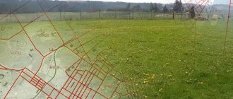
A situational plan of a land plot is a graphical diagram of a land plot and the surrounding area, made from above.
If you imagine a bird's eye view of the site, it can be considered a situational plan. The boundaries of the site itself should be visible, as well as its connection to a specific area. In addition, the situational plan indicates all objects adjacent to the site: roads, utility networks, public transport routes. The buildings marked on the plan must be accompanied by information about the date of construction, include street names, house numbers and the number of floors.
A situational site plan linked to the territory is obtained together with a copy from the general plan and is used for:
I am ready to advise you free of charge by phone (24 hours a day, 7 days a week)
The call is free for all regions of the Russian Federation
- Real estate transactions, when you need a complete understanding of the parties about the object and the surrounding area;
- Utility connections (electricity and gas);
- Planning the construction of a house and transferring the plan to the local administration;
- Reconstruction of historical monuments and determination of foundation displacements.
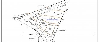
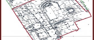
Sample situation plan of a land plot
Information displayed in EPROM
This requires concise entry of all information that is significantly related to the site, as well as to the purposes of drawing up the document. If it is compiled for the presentation of real estate for sale, the main information reflects the infrastructure into which the plot is included, as well as the location of objects within its boundaries.
The most significant information is:
- cadastral and technical characteristics of the land plot;
- information about the owner - customer;
- information about the contractor;
- location of the boundaries of the memory;
- location of capital facilities within the site;
- others, including outbuildings;
- infrastructure outside the site boundaries.
Objects schematically located on the plan outside the site must correspond to buildings and structures located in the real space of the designated territory.
Among them:
- residential buildings;
- transport links;
- sidewalks;
- shopping centers, industrial buildings, etc.
Each object must be marked, indicating the address and name, if it belongs to public types of buildings. Transport connections require the indication of bus routes.
How to get a situation plan by cadastral number
Using the cadastral number of a land plot, you can easily obtain a situational plan in person. The service is provided free of charge. The execution time is no more than 3 days. The basis for refusal is the lack of necessary documents. If extradition is refused, you can appeal the decision in a pre-trial (out-of-court) manner.
To do this, you need to come to the nearest branch of the MFC “My Documents” with the following documents:
- An application in which you need to correctly indicate the cadastral number of the property (you will receive the form and sample on site);
- Passport of a citizen of the Russian Federation;
- An extract from the Unified State Register of Real Estate, in which you are indicated as the owner or tenant of the land plot.
Please note that in Rosreestr an extract from the Unified State Register costs 350 rubles (700 rubles for legal entities). If you want to get information cheaper, I recommend ordering a certificate through Quick Documents - this way you will receive a document for only 250 rubles. The order is completed within a day, the official data is from the Unified State Register of Russian Registers of Rosreestr.
Certificate from the Unified State Register of Real Estate, which I recently ordered through Quick Documents
Reasons for obtaining a plan
In order to obtain the specified plan, no special grounds are required other than the requirements of the owner. The owner of the land plot has the right to order work at his own discretion. If the authorized body provides this service, it is obliged to accept the application.
However, the owner’s position must be based on established standards:
- Submission of an application by the owner or representative in person, on the official website of the founder or by mail.
- Attachment of relevant documentation.
- Preliminary land surveying, with registration of lands for cadastral registration.
In case of unlawful refusal to perform this service, the customer has the right to file a complaint against the contractor.
Where to get a situation plan for gasification
In order to ensure gas supply to a home, gas supply services must be provided with a situational plan linked to the territory on A4 paper. Contact the gas service at your place of residence - they will explain which organization should issue a situation plan for your specific area.
To apply, you only need the exact coordinates of the site. If there are no such coordinates, then there are two more ways:
- Seek help from a specialized architectural organization that can take spot measurements and draw up a plan on a scale of 1:2000;
- Make a situational plan yourself. You can take, for example, high-resolution satellite images as a basis. We will return to the question of how to draw up a situational plan of a land plot for free. However, I recommend that you notify the organization for which you intend to prepare the document in advance of your intention to compile it yourself.
Important points for the customer
The possibility of refusal should be taken into account. In the absence of information about the site, a cadastral passport, or clearly established boundaries, specialists must issue a reasoned refusal to register it. Similar consequences are possible when contacting specialists from a private organization.
A copy of the document - the situational plan must be attached to other documentation for gasification of the site. The validity period corresponds to the planned time of work. When ordering gas work on a turnkey basis, drawing up a situation plan may be included in the total cost of services.
Where to get a situation plan for electrical networks
The situational plan for electrical networks is issued by the local administration. If there are no diagrams of energy-receiving capacities on the plan, they should be plotted by performing a topographic survey on a scale of 1:2000 or 1:500. The difference between such a situational plan will be that it must be certified by the performing surveyor, as well as the head of the inventory and cadastre service. In some cases, the plan must be agreed upon with the district architectural organization and local administration.
The situation plan for connecting electricity should show:
- A plot of land with existing boundaries;
- All buildings on the site, including utility and temporary ones;
- All power lines that provide electricity to each building to an external source of power supply;
- Types of protective equipment, grounding, brands, diameters and cross-sections of cables and wires, metering devices, points of connection to the network and design currents of internal and external circuits;
- Specification of electrical equipment, including materials and products.
What is this?
SP is a diagram on which the location of a plot of land and all stationary objects located on it is plotted. The mapping of the area is carried out in relation to the existing planning system of the settlement, which includes a city, urban settlement, district, gardening partnership, etc.
Such a plan is a preliminary document, which is drawn up on the basis of a topographic and geodetic survey and serves for the further preparation of engineering and architectural projects based on it.
SP sample
Some persons who have not been involved in the preparation of such documentation accept topographic survey and joint venture as one and the same document. In fact, the SP differs in that it does not have indications that indicate the relief of the area displayed on it, unlike topographic surveys.
It is also worth noting that such a plan is not a planning organization diagram for a land plot.
Outwardly, it is somewhat similar to such a document, but unlike it, it contains additional data, which includes the passage and location of communications available in a given area, which have been previously agreed upon with the organizations directly operating them.
The scheme will be required in certain situations when preparing documentation regarding a site or performing a list of actions with it, which includes:
- Drawing up an act that is required when carrying out the procedure for approving the boundaries of the site. This action is performed in the case when transactions are made on the plot (purchase and sale, registration of deed of gift, etc.), as well as before drawing up a cadastral passport in relation to this plot;
An example of an act of agreeing on the location of the boundaries of a land plot - Preparation of documentation for carrying out work related to design and survey work. Similar work may take place during the construction of new real estate;
- When reconstructing structures, to carry out such an action, it is mandatory to obtain permission to perform a certain amount of work, and such permission is given only if there is a joint venture;
- If the need arises to study the area and plan the location of the house that will be located on the site in question. In addition, a similar action may be required during the construction of other permanent buildings, which may include other household items. structures and other permanently installed objects.
When drawing up such a document, it is imperative to take into account the purpose for which it is being drawn up, since depending on the purpose, the information displayed on it will differ somewhat.
Thus, when forming schemes on the basis of which gasification of objects will be carried out in the future (it does not matter whether they are just being built or are already being reconstructed), it is necessary to indicate the intended source of gas (connection point with the supplied communications), as well as in what time it is planned to complete the design, so is the construction itself.
If it is necessary to draw up such a document due to the installation and installation of electricity supply to real estate, then in such a situation, indicate information about all buildings available on a particular site. In addition, external electrical supply lines passing through the site are displayed. Separate information is provided on grounding systems, as well as on internal networks of each individual building.
Example with explanation of objects
In general, plans contain the following information and images of the following objects and stationary objects:
- Address of the site in relation to which the plan of the adjacent territory is displayed;
- Orientation of the terrain relative to the cardinal directions;
- Display of buildings located on the territory, belonging to the categories of residential, industrial, and public. All available structures are described with information on the number of storeys, as well as the main technical characteristics;
- Objects that are the least distant from the described area, which will be sources or used for supplying energy carriers and resources. These include water, gas, electricity;
- Highways, roads, as well as transport structures, which are passing railway tracks, bridges and tunnels;
Example of a site plan - Plantings of greenery, in particular, bushes, trees and even a lawn growing on the territory;
- Objects located in close proximity and which are unfavorable, for example, garbage dumps;
- Objects located close to the site, which are favorable in their characteristics;
- Zones that belong to places of special protection (power lines, railway tracks, industrial facilities, gas stations, etc.);
- All installed utility networks;
- Data provided by the customer and contractor regarding buildings or structures.
The SP containing such data consists of several parts, each of which carries a certain amount of text or graphic information:
- The diagram itself is a graphic representation of objects, plantings, communications and planned changes;
- Description. This part indicates the main parameters of structures;
- Insolation analysis. It serves to indicate data on the illumination of the territory by technical means.
According to regulatory legislation, the provision of this type of site plan is carried out by specially authorized government bodies.
If the work will be carried out by a commercial organization, first of all you need to make sure that it has the appropriate license to draw up such plans.
When contacting third-party organizations without such permission, you must understand that although a plan may actually be drawn up, it will not be recognized as valid and its use for carrying out work or preparing further documentation regarding the site is not possible.
How to download a situational plan of a land plot for free
It often happens that the customer tries to cope with the preparation of the document himself. People are trying to download a ready-made situational plan of a land plot by cadastral number online for free and print it. But I want to warn you that government resources are not available for free - plans on a scale of 1:2000 and larger are classified and can only be obtained by personally contacting the authorized body.
Possible solutions:
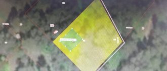
- Use aerial photos from Yandex or Google maps resources and independently draw the boundaries of the required area. It is difficult to achieve the required accuracy using this method. Most organizations do not accept such situational plans, but they can be used, for example, for commercial presentations or for their own needs;
- You can also use the website of a public cadastral map, but the plan will again be based on aerial photographs, which cannot always be used to prepare a plan;
- Develop a situational plan independently on a computer using special programs. This option will practically not differ from the plan prepared by professional surveyors, but requires technical skills. I propose to dwell on it in more detail.
Preparation and receipt
The preparation of a situation plan can be ordered from the administration (land service or architectural department) or a private geodetic company (if there is one in the settlement). In any case, this service is paid - the price depends on the need for a specialist to visit the site. In addition, the cost varies depending on the municipality (more expensive in the center).
In a geodetic office or land management service
The advantage of this method is that specialists are familiar with the topic and have the necessary data at hand. In addition, the sitplan is prepared in a special program - surveyors know how to work with it.
To place an order for topographic survey, you will need documents for the site and additional papers, depending on the situation:
- Calculation of gas requirements.
- Construction permit.
- Boundary plan.
If a document is needed not just for familiarization, but for drawing up a specific work plan, especially for gasification or installation of electrical networks, the accuracy and relevance of the information is important. In this case, it is recommended to contact specialists; if possible, choose a performer based on real reviews and recommendations.
How to draw up a situational plan of a land plot yourself
Step 1 - download the SAS.Planet program
On the website https://sasgis.ru/sasplaneta/ download the SAS.Planet program for free. With its help, you can pull almost any cartographic and satellite maps from the Internet in the form of source data. Since data sources are constantly updated, in addition to the installation file, you will have to download and install ZMP packages that ensure stable operation with updates to open data sources.
I am ready to advise you free of charge by phone (24 hours a day, 7 days a week)
The call is free for all regions of the Russian Federation
Step 2 - setting up and selecting a map source
SAS.Planet makes it possible to save any section of a satellite image into a file with the resolution required for the situational plan. For the resulting snapshot file, there are several binding options for MapInfo. The public cadastral map of RosReestr can be obtained with a resolution of 3-5 cm per pixel.
But you need to keep in mind that all sources of maps on the Internet (Yandex, Google, 2GIS, RosReestr) produce a raster exclusively in the transverse Mercator projection, and a cadastral map is a local coordinate system in the Gauss-Kruger projection with an exact indication of the central meridian and displacements along north-east. Therefore, for small areas of the situational plan, you can use manual snapping and rotate the image by a small angle without raster transformation. This will give some error, which can be corrected based on the results of geodetic surveying on the ground.
Step 3 - Raster Transformation in GlobalMapper
To avoid geodetic surveying, you can use precise mathematical referencing. Then a high-resolution raster will provide an accuracy of 0.5-2 meters on the plain and 3-5 m on rough terrain. To do this, you will need to transform the raster using the georeference file obtained from SAS in the GlobalMapper program.
Using a datum (PRJ), you can obtain a correctly transformed raster with an accurate georeference file already in the local coordinate system, and then load it into MapInfo. In this case, it becomes possible to even detect gross errors in geodetic surveying.
Why do you need a general site plan?
The scheme is actually a map of future development. When developing a master plan for your site, our master planners take into account:
- relief features and surrounding buildings;
- the possibility of access roads and transport links;
- what facilities will be built in a specific area;
- what communications will be connected to the objects, how to ensure their correct connection (sewage, gas, electricity, water);
- what work needs to be done to bring the scheme to life.
The document will provide information not only about the capital construction project, but also about the landscaping work (in particular, about green spaces, the location of sidewalks, and street lighting). The plan takes into account fire and sanitary safety requirements. Facilities will be located at a safe distance from each other to prevent the spread of fire and protect the health of people living or working in a certain area.
Definition of concepts and legislative regulation of the issue
A situational plan is a special diagram of a plot of land where there are boundaries of the given territory, its location, neighboring buildings, transport accessibility and direct survey of the territory.
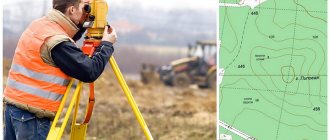
basis for its compilation is a special topographic survey.
This document is not a site planning diagram, since in addition to direct photography it contains a lot of important information. Contains information about the location of various utilities on the territory. Instructions regarding the correct use of these networks are included, for which the plan must be coordinated with communications services.
It is not allowed to use this document as a basis for the construction or design of various structures.
Its preparation is regulated by various norms of the Town Planning Code of the Russian Federation :
- Art. 48 of the Civil Code contains information about the possibility of obtaining a document not only from the administration of the city where the site is located, but also from special commercial organizations, therefore the administration has the right to refuse to issue the document to the applicant;
- Art. 48 clause 4 describes that all work related to the safety of living on a certain plot of land must be carried out exclusively by specialists who not only have the necessary skills, but have also received the appropriate license;
- clause 4 art. 48 additionally contains information about the possibility of independently drawing up a plan, but such a document cannot be considered as an official source of information.
Thus, the situational plan contains a lot of useful information , and it is certainly drawn up in accordance with the information contained in the Civil Code of the Russian Federation.
