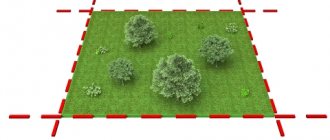
In what cases is it possible to clarify the location of the boundaries of a land plot?
Clarifying the location of the boundaries of a land plot is a set of works and procedures aimed at establishing and legally securing the boundaries of the plot with determining the coordinates of the characteristic (turning) points of the boundaries with standard accuracy.
In accordance with the Law on State Registration of Real Estate (Federal Law of July 13, 2015 No. 218-FZ “On State Registration of Real Estate” (Registration Law)), clarification of the boundaries of a land plot is the state cadastral registration in connection with a change in the description of the location of the boundaries of the land plot and (or) its area. Such clarification is not associated with the formation of new land plots during the separation from a land plot or the division of a land plot, in which the converted plot remains within the changed boundaries.
The location of boundaries can be clarified only in relation to a land plot, information about which is included in the Unified State Register of Real Estate (USRN), provided that such information does not comply with the requirements established by law for describing the location of the boundaries of land plots (Requirements for accuracy and methods for determining the coordinates of characteristic points of the boundaries of the land plot, approved by order of the Ministry of Economic Development of Russia dated March 1, 2016 No. 90). In other words, clarification is allowed not only if there is no information in the USRN about the location of the boundaries of the land plot, but also if their location does not meet the established accuracy requirements.
So, clarification of the location of the boundaries of a land plot is possible in the following cases:
- if there is no information in the Unified State Register of Real Estate about the coordinates of characteristic points of the boundaries of the land plot;
- in the event that the coordinates of the characteristic points of the boundaries of a land plot contained in the Unified State Register are determined with an accuracy lower than the standard accuracy of determining the coordinates for lands of a certain purpose (for example, in the absence of information on the standard accuracy of determining the coordinates of the characteristic points of the boundaries of a land plot in the Unified State Register);
- in the event that the information contained in the USRN about the coordinates of any characteristic point of the boundaries of the land plot does not allow one to unambiguously determine its position on the ground (for example, the USRN contains several values for the coordinates of the specified characteristic point);
- when correcting a registration error in the USRN information about the location of the boundaries of a land plot (for example, in the case of crossing the boundaries of land plots or the description of the location of the boundaries of a land plot contained in the USRN does not correspond to the title document, the document on the formation of the land plot or the actual position on the ground in the absence of a violation of land legislation - unauthorized occupation of land plots);
- by a court decision that has entered into legal force.
The specified circumstances are the basis for performing relevant cadastral work and state cadastral registration on the basis of prepared documents.
In order to avoid land disputes with neighbors, involuntary violation of land legislation, and not to encounter other negative consequences of unidentified boundaries of a land plot, we recommend that you carry out timely work to clarify the location of the boundaries. First, make sure that information about your land plot is included in the Unified State Register and the description of its boundaries needs clarification. You can do this yourself or with the help of experienced specialists of our project - order an “OBJECT PASSPORT” and within 1-2 days you will receive all the necessary information along with recommendations in one document.
Article 22 of the Federal Law of July 13, 2015 No. 218-FZ “On State Registration of Real Estate” defines the Requirements for the boundary plan: 1. The boundary plan is a document that is drawn up on the basis of the cadastral plan of the relevant territory or an extract from the Unified State Register of Real Estate about the corresponding land plot and in which certain information entered into the Unified State Register of Real Estate is reproduced, and information about the land plot or land plots being formed, or about part or parts of the land plot, or new information about the land plot or land plots necessary for entering into the Unified State Register of Real Estate is indicated or land plots.
2. The boundary plan shall indicate: 1) information about the land plot or land plots being formed in the case of cadastral work, which results in the preparation of documents for submission to the rights registration authority of an application for state cadastral registration of the land plot or land plots; 2) information about a part or parts of a land plot in the case of cadastral work, which results in the preparation of documents for submission to the registration authority of rights of an application for state cadastral registration of a part or parts of a land plot; 3) new information about a land plot or land plots necessary for entering into the Unified State Register of Real Estate in the case of cadastral work, which results in the preparation of documents for submission to the rights registration authority of an application for state cadastral registration of a land plot or land plots. 3. If, in accordance with federal law, the location of the boundaries of land plots is subject to mandatory approval, the boundary plan must contain information about such approval. 5. The boundary plan consists of graphic and text parts. 6. The graphic part of the boundary plan reproduces information from the cadastral plan of the corresponding territory or an extract from the Unified State Register of Real Estate about the corresponding land plot, and also indicates the location of the boundaries of the land plot or land plots being formed, or the boundaries of a part or parts of the land plot, or the specified boundaries of land plots , access to newly created or modified land plots (passage or passage from public land plots), including through the establishment of an easement. 7. The text part of the boundary plan shall indicate information about the land plot or land plots necessary for entering into the Unified State Register of Real Estate, including information about the geodetic basis used in the preparation of the boundary plan, including points of state geodetic networks or reference boundary networks, as well as in the case established by part 3 of this article, information on the approval of the location of the boundaries of land plots in the form of an act of agreement on the location of such boundaries. 8. The location of the boundaries of the land plot is established by determining the coordinates of the characteristic points of such boundaries, that is, the points of change in the description of the boundaries of the land plot and dividing them into parts. 9. The area of a land plot, determined taking into account the requirements established in accordance with this Federal Law, is the area of a geometric figure formed by the projection of the boundaries of the land plot onto a horizontal plane. 10. When clarifying the boundaries of a land plot, their location is determined based on the information contained in the document confirming the right to the land plot, or in the absence of such a document, based on the information contained in the documents that determined the location of the boundaries of the land plot when it was formed. If there is no information in the documents about the location of the boundaries of the land plot, their location is determined in accordance with the territory surveying project approved in the manner established by the legislation on urban planning activities. If there is no information about such a land plot in the approved land surveying project, its boundaries are the boundaries that have existed on the ground for fifteen years or more and are fixed using natural objects or objects of artificial origin that make it possible to determine the location of the boundaries of the land plot. 11. The boundaries of a land plot should not cross the boundaries of a municipal entity, except if an error reproduced in the Unified State Register of Real Estate is identified in determining the location of the boundaries of such a municipal entity in the document on the basis of which information was entered into the Unified State Register of Real Estate. The boundaries of the land plot should also not cross the boundaries of a populated area, except if an error reproduced in the Unified State Register of Real Estate is identified in determining the location of the boundaries of such a populated area in the document on the basis of which information was entered into the Unified State Register of Real Estate. The boundaries of the land plot should also not cross the boundaries of territorial zones, forest districts, forest parks, with the exception of the case of the formation of a land plot for geological exploration of subsoil, development of mineral deposits, placement of linear objects, hydraulic structures, as well as placement of reservoirs and other artificial water bodies or a case of detection of an error reproduced in the Unified State Register of Real Estate in determining the location of the boundaries of the territorial zone. At the same time, the intersection of the boundaries of a land plot with the boundaries of municipalities, settlements, territorial zones, forest districts, forest parks means: 1) the presence of a common point or points of the boundaries of the land plot and the boundaries of the municipal formation, settlement, territorial zone, forest district, forest park, which are formed as a result of the location of one or more characteristic points of the boundaries of a land plot outside the range of the mean square error in determining the characteristic points of the boundaries of a municipality, settlement, territorial zone, forestry, forest park; 2) the location of at least one of the contours of the boundaries of a multi-contour land plot outside the boundaries of the corresponding municipality and (or) settlement or territorial zone. 12. The boundary plan is prepared in the form of an electronic document and signed with an enhanced qualified electronic signature of the cadastral engineer who prepared such a plan. The boundary plan, if provided for in the contract, is also prepared in the form of a paper document, certified by the signature and seal of the cadastral engineer who prepared such a plan, for transfer to the customer under the contract. 13. The form and composition of information on the boundary plan, requirements for its preparation, as well as requirements for accuracy and methods for determining the coordinates of characteristic points of the boundaries of a land plot are established by the regulatory authority. The form and composition of the land survey plan information, the requirements for its preparation are established in the Order of the Ministry of Economic Development of Russia dated December 8, 2015 No. 921 “On approval of the form and composition of the land survey plan information, the requirements for its preparation. The boundary plan is prepared in the form of an electronic document in the form of an XML document, certified by an enhanced qualified electronic signature of the cadastral engineer who prepared such a plan, and is issued in the form of files in XML format, created using XML schemas and providing reading and control of the submitted data. XML schemas used to generate XML documents are considered to be put into effect after two months from the date of their placement on the official website of the Federal Service for State Registration, Cadastre and Cartography on the Internet at the address: www.rosreestr.ru . When regulatory legal acts that establish the form and requirements for the preparation of a boundary plan are changed, the Federal Service for State Registration, Cadastre and Cartography changes the XML schemas, while providing the possibility of public access to the current current version and previous (no longer relevant) versions on the official website. The means of an enhanced qualified electronic signature of a cadastral engineer must be certified in accordance with the legislation of the Russian Federation and are compatible with the means of a qualified electronic signature used by the Federal Service for State Registration, Cadastre and Cartography, its territorial bodies, and the state institution subordinate to it. Information on the requirements for compatibility, a qualified electronic signature key certificate, and ensuring the ability to confirm the authenticity of an enhanced qualified electronic signature of a cadastral engineer is posted on the official website. Sections related to the graphic part of the boundary plan, the Certificate of Approval, as well as documents prepared on paper, which, in accordance with the Requirements, are subject to inclusion in the Appendix, are drawn up in the form of electronic images of paper documents in the form of PDF files, signed by an enhanced qualified electronic signature of the cadastral engineer who prepared the boundary plan. The electronic image of the document must provide visual identity to its paper original on a scale of 1:1. The quality of the submitted electronic images of documents should allow you to fully read the text of the document and recognize its details. If a paper document consists of two or more sheets, an electronic image of such a paper document is generated in the form of one file. To scan documents, you must use full color mode with a resolution of 300 dpi. If the legislation provides for the preparation of a document to be included in the Appendix in the form of an electronic document, such a document may be included in the Appendix in the form of an electronic document. An electronic document issued by a government body, local government body, or organization to be included in the Appendix is certified by an enhanced qualified electronic signature of an authorized official of such government body, local government body, or organization, and an electronic document prepared by an individual is certified by an enhanced qualified electronic signature. signature of such individual. The boundary plan is also prepared in the form of a paper document, if this is provided for in the contract. The boundary plan, prepared in the form of a paper document, and the Approval Certificate are certified by the signature and seal of the cadastral engineer who prepared such a boundary plan and the Approval Act. Unfilled details of sections of the text part of the boundary plan in the form of a document on paper are not excluded; in such details the sign “-” (dash) is indicated. The boundary plan is drawn up in the form of one document in the following cases: as a result of the division of one original (changed) land plot, one or several land plots are formed at the same time; as a result of the allocation of a share (shares) in the right of common ownership, one or several land plots are formed at the same time; as a result of the redistribution of several original land plots, several land plots are formed; as a result of the redistribution of a land plot and lands, a land plot is formed; simultaneously, a land plot (land plots) and parts of a land plot (land plots) are formed, or simultaneously with the formation of land plots, information about the existing parts of the original land plots is specified; several parts of one land plot are formed simultaneously; at the same time, the location of the boundaries of the land plot is clarified and information about parts of the land plot is clarified, or a part (parts) of the land plot is formed; as a result of the transformation of a land plot (land plots), one or more land plots are simultaneously formed and as a result of such cadastral work, the description of the location of the boundaries of adjacent land plots has been clarified, including in connection with the correction of an error in the location of the boundaries; at the same time, the location of the boundaries of several adjacent land plots is clarified, including in connection with the correction of an error in the location of their boundaries; simultaneously with the formation of a land plot or clarification of part of the boundaries and (or) change in the area of the land plot, the location of the boundaries and the area of the adjacent land plot (adjacent land plots) are clarified and (or) changed. If in order to form land plots it is necessary to carry out cadastral work to clarify the location of the boundary of the original land plot, the following are drawn up: a boundary plan to clarify the location of the boundary of the land plot and a boundary plan for the formation of land plots. In the event of the formation of several land plots from lands in state or municipal ownership, the boundary plan is drawn up in the form of a separate document in relation to each land plot being formed. The boundary plan is drawn up on the basis of information from the Unified State Register of Real Estate about a certain land plot, building, structure, unfinished construction project, other object that is firmly connected to the land, that is, the movement of which is impossible without disproportionate damage to its purpose, and (or) information about a certain territory, for example in case of formation of land plots from lands in state or municipal ownership, or clarification of the location of the boundaries of land plots. To prepare the boundary plan, cartographic materials are used, including the cartographic and geodetic fund, and (or) land management documentation stored in the state fund of data obtained as a result of land management. The documents specified in this paragraph or their copies are not included in the Appendix. In cases provided for by federal laws, the following are used to prepare a boundary plan: 1) urban planning zoning documents (land use and development rules); 2) regulatory legal acts establishing maximum (maximum and minimum) sizes of land plots; 3) documentation on territory planning (territory planning projects, territory surveying projects), territorial planning documents; 4) documents that determine (have determined), in accordance with the legislation of the Russian Federation, the location of the boundaries of the land plot (land plots) upon its formation, including the layout of the land plot or land plots on the cadastral plan of the territory, decisions providing for the approval of the layout of the land plot or land plots on the cadastral plan of the territory, decisions on preliminary approval of the provision of land plots, decisions on approval of a territory surveying project, an approved territory surveying project, a decision on the seizure of a land plot and (or) a property located on it for state or municipal needs; 5) projects for the organization and development of territories of horticultural, gardening or dacha non-profit associations of citizens, projects for the redistribution of agricultural land and other agricultural lands, approved in the established manner; 6) forest management materials and design documentation of forest areas approved in the established manner; 7) decisions on the provision of land plots, other documents on rights to land plots; judicial acts that have entered into legal force; 9) other documents provided for by law. When performing cadastral work on the allocation of land plots on account of the share(s) in the right of common ownership of a land plot from agricultural lands, a boundary plan is prepared taking into account the requirements of Federal Law of July 24, 2002 N 101-FZ “On the turnover of agricultural lands ": 1) a project for land surveying, a decision of the general meeting of participants in shared ownership of a land plot of agricultural land on approval of the specified project, a list of owners of the resulting land plots and the size of their shares in the right of common ownership of such land plots (during cadastral work in relation to a land plot formed on account of a share or shares in the right of common ownership of a land plot of agricultural land on the basis of a decision of the general meeting of participants in shared ownership of this land plot); 2) a project for surveying land plots, documents confirming the approval of a project for surveying a land plot (during cadastral work in relation to a land plot allocated as a share or shares in the right of common ownership of a land plot from agricultural lands in the absence of a decision of the general meeting of participants in shared ownership for this land plot on approval of the land surveying project).
The procedure for determining the location of the boundaries of a land plot when clarifying them
The procedure for determining the location of the boundaries of a land plot when clarifying them is established by the Registration Law (Article 10, 22 of the Registration Law), as well as the Requirements for the preparation of a boundary plan (clause 70 of the Requirements, approved by Order of the Ministry of Economic Development of Russia dated December 8, 2015 No. 921).
Thus, in accordance with the Registration Law, when clarifying the boundaries of a land plot, their location is determined based on the information contained in the document confirming the right to the land plot, or, in the absence of such a document, based on the information contained in the documents that determined the location of the boundaries of the land plot during its formation. If there is no information in the documents about the location of the boundaries of the land plot, their location is determined in accordance with the territory surveying project approved in the manner established by the legislation on urban planning activities. In turn, if there is no information about such a land plot in the territory surveying project, its boundaries are the boundaries that have existed on the ground for 15 years or more and are fixed using natural objects or objects of artificial origin that make it possible to determine the location of the boundaries of the land plot (Part 10 of Art. 22 of the Registration Law).
Thus, today the legislator, in order of priority, determines the following methods for establishing the boundaries of land plots:
- establishing boundaries based on information contained in a document confirming the right to a land plot;
- establishing boundaries based on the information contained in the documents that determined the location of the boundaries of the land plot when it was formed;
- establishing boundaries in accordance with the approved territory surveying project;
- establishing boundaries in accordance with actual land use (borders that have existed in the area for 15 years or more and are fixed using natural objects or objects of artificial origin).
Read more…
Natural objects are terrain objects that arose without human participation due to natural phenomena (for example, folds of terrain, edges of ravines and other landscape elements), which make it possible to identify the border of a land plot (including with the help of cartographic material), and objects of artificial origin are objects that located on the surface of the earth, created by human labor, for example, fences, walls of buildings and other structural elements of a delimiting nature.
In the absence of documents specified in the Law on Registration of Real Estate and determining the location of the boundaries of land plots in accordance with actual land use, the cadastral engineer can use the following documents (letter of Rosreestr dated 02.16.2016 No. 19-00221/16):
- maps (plans), which are the cartographic basis of the state real estate cadastre, and (or) photographic plans of the area at a scale of 1:5000 and larger, confirming the actual location of the boundaries of land plots on the ground for 15 years or more (cartographic materials);
- information confirming the location of the land plot, in the form of cartographic materials on a smaller scale;
- land management documentation stored in the state fund of data obtained as a result of land management;
- forest management materials, design documentation of forest areas;
- planning and cartographic materials available in regional authorities of architecture, construction and housing, city, town, and rural local governments;
- documents on territorial planning (including tablets) of municipalities (territorial planning schemes for municipal districts, master plans for settlements, master plans for urban districts);
- projects for organizing and developing the territory of a horticultural partnership;
- situational plans contained in the technical passports of real estate objects located on such land plots.
The list of documents that can be used to clarify the location of land boundaries is quite extensive and is not exhaustive.
In cases where the above documents are used in the preparation of a boundary plan, in the section of the boundary plan “Conclusion of a cadastral engineer”, in the form of a coherent text, a justification should be given for why these particular documents were used, as well as a justification for the location of the specified boundaries of the land plot, containing, for example:
- description of specific objects of artificial and natural origin that secure the boundaries of the land plot on the ground (type of object, for example, a brick fence, building wall, fence, road, ditch, ravine, etc.);
- information substantiating the existence of the boundary of a land plot on an area for 15 years or more (for example, the date of creation of a gardening or vegetable farming partnership, the date of a map (plan), photographic plans of the area, with the use of which the boundaries of the land plot were determined) (clause 70 of the Requirements for the preparation of a boundary plan ).
Incorrect or absent argumentation to justify the location of the boundaries of the land plot in the section “Conclusion of the cadastral engineer” is the reason for Rosreestr to make a decision to suspend the implementation of the state cadastral registration of changes in the USRN information about the land plot on the grounds provided for in clause 7, part 1 of Art. 26 of the Registration Law.
When preparing a boundary plan in connection with clarifying the location of the boundaries of a land plot, the name and details of the documents used to determine the location of the boundaries of the land plots must be indicated in the “Initial Data” section of the boundary plan.
If cartographic materials are used to prepare the boundary plan, including cartographic and geodetic funds, and (or) land management documentation stored in the state fund of data obtained as a result of land management, such documents or copies thereof are not included in the Appendix of the boundary plan .
Copies of other documents used to determine the location of boundaries are subject to inclusion in the Appendix of the boundary plan. In this case, the Appendix may include extracts from these documents or copies of their individual components, including fragments of graphic images containing information (details, marks) about the approval of the document (21, 22, 25 Requirements for the preparation of a boundary plan).
Rosreestr dated January 29, 2021 N 14-01147/ [email protected]
FEDERAL STATE REGISTRATION SERVICE,
CADASTRE AND CARTOGRAPHY
LETTER
dated January 29, 2021 N 14-01147/ [email protected]
The Department of Methodological Support and Analysis in the Field of Registration of Rights and Cadastral Registration of the Federal Service for State Registration, Cadastre and Cartography, having considered the appeal, reports.
Paragraphs 44, 45 of the Requirements for the preparation of a boundary plan, approved by the currently valid order of the Ministry of Economic Development of Russia dated December 8, 2015 N 921 (hereinafter referred to as the Requirements), establish that:
a description of the fixation of a point in sections of the text part of the boundary plan is indicated in relation to new points of the boundaries of land plots (parts of land plots), as well as existing points of the boundaries of land plots (parts of land plots), the location of which is clarified as a result of cadastral work, if such points are fixed long-term objects (for example, a concrete pylon);
a description of the passage of part of the boundaries of the land plot in sections of the text part of the boundary plan is indicated if parts of the boundaries of the land plot coincide with the location of the external boundaries of natural objects and (or) objects of artificial origin, including linear objects, information about which is contained in the Unified State Register real estate (hereinafter referred to as EGRN).
Based on the specified standards:
a description of the fixation of a point in the details “Information about the characteristic points of the border of the specified land plot with a cadastral number” of the section “Information about the specified land plots” of the boundary plan is indicated if it is fixed by a long-term object. At the same time, the Requirements do not establish the need for information about such a long-term object to be available in the Unified State Register;
a description of the passage of parts of the border of a land plot in the details “Information on parts of the border of a specified land plot with a cadastral number” of the section “Information on specified land plots” of the boundary plan is indicated while simultaneously meeting the conditions - these parts of the border coincide with the location of the external boundaries of natural objects and (or) objects of artificial origin and information about these objects is contained in the Unified State Register of Real Estate. Moreover, if during cadastral work in relation to the corresponding land plot, the cadastral engineer established the presence of a registry error in the USRN information about the specified objects, the relevant information (including the results of the necessary measurements) should be contained in the section “Conclusion of the cadastral engineer.”
It should be noted that the location of the boundaries of a land plot, when specified in accordance with Part 10 of Article 22 of the Federal Law of July 13, 2015 N 218-FZ “On State Registration of Real Estate” (hereinafter referred to as the Real Estate Law) and paragraph 70 of the Requirements, is determined by:
based on the information contained in the document confirming the right to the land plot;
based on the information contained in the documents that determined the location of the boundaries of the land plot when it was formed (in the absence of a document confirming the right to the land plot);
in accordance with the boundaries that have existed on the ground for fifteen years or more and are fixed using natural objects or objects of artificial origin that make it possible to determine the location of the boundaries of the land plot (if there is no information in the documents about the location of the boundaries of the land plot).
Thus, the location of the boundaries of a land plot, when clarified, should be determined by the relevant documents or, in the absence of those, by their existence on the ground for fifteen years or more and secured using natural objects or objects of artificial origin.
Clause 70 of the Requirements provides for the inclusion in the section “Conclusion of the cadastral engineer” of a boundary plan, in which, in the form of a coherent text, the justification for the location of the specified boundaries of the land plot is provided, containing, for example:
description of specific objects of artificial origin that secure the boundaries of the land plot on the ground (type of object, for example, a brick fence, the wall of a building);
information justifying the existence of the border of a land plot in the area for fifteen or more years (for example, the date of provision of the land plot to a horticultural or vegetable gardening non-profit partnership, other non-profit organization created by citizens for gardening, vegetable farming and summer cottage farming before 01/01/2019, or organizations under which non-profit organizations were created (organized) for citizens to conduct gardening, vegetable gardening and summer cottage farming, using such land plots, date of the map (plan), photographic plans of the area, using which the boundaries of the land plot were determined).
Taking into account the above, if in relation to the border of the specified land plot there is no fixation on the ground using natural objects or objects of artificial origin, confirming their existence on the ground for fifteen or more years, their location, it seems, should be determined by the documents specified in Part 10 of Article 22 of the Law on real estate, paragraph 70 of the Requirements, in particular, confirming the right to a land plot, determining the location of its boundaries upon formation.
Head of Department
methodological support
and analysis in the field of registration
rights and cadastral registration
Y.V.KUNITSYNA
Simultaneous clarification of the location of the boundaries of adjacent land plots
When carrying out cadastral work to clarify the location of the boundaries of a land plot, intersections of the boundaries of the area being specified with the boundaries of adjacent plots, information about which is included in the Unified State Register, may be identified. Such situations may be related:
- with the presence of a registry error in the USRN information about the location of the border of the adjacent plot common with the land plot being specified, established with sufficient accuracy. In other words, the USRN information about the location of the boundaries of adjacent land plots does not correspond to their actual location on the ground;
- with a discrepancy between the coordinates of characteristic points of the border of an adjacent land plot and the accuracy requirements established by law (Requirements for accuracy and methods for determining the coordinates of characteristic points of the boundaries of a land plot, approved by Order of the Ministry of Economic Development of Russia dated March 1, 2016 No. 90). That is, information about the coordinates of characteristic points of the border of an adjacent plot is determined with an accuracy below the standard for lands of a certain purpose, or information about the standard accuracy is not available in the Unified State Register of Real Estate.
The presence of identified intersections of the boundaries of land plots is the basis for suspending the state cadastral registration of the land plot in respect of which cadastral work was carried out (clause 20, part 1, article 26 of the Registration Law).
Elimination of intersections can be carried out by clarifying the location of the boundaries of adjacent plots simultaneously with clarifying the location of the boundaries of the plot that is the object of cadastral work. In this case, the boundary plan is drawn up in the form of one document, including in connection with the correction of a registry error in the USRN information about the location of the boundaries of adjacent areas (clause 20 of the Requirements for the preparation of a boundary plan).
The procedure for simultaneous clarification of the location of the boundaries of adjacent land plots both in the event that, during cadastral work, a registry error is identified in the USRN information about the location of the border common with the land plot being specified, established with sufficient accuracy, and in the event that the coordinates of the characteristic points of the border of the adjacent land plot are determined with accuracy that does not meet the established accuracy requirements is defined in Part 2 of Article 43 of the Registration Law.
According to the specified procedure, if during state cadastral registration in connection with clarification of the location of part of the boundaries of a land plot, which is at the same time a common (adjacent) part of the boundaries of other plots, and (or) a change in the area of the plot, it is necessary to make changes to the USRN information about land plots adjacent to it , Rosreestr, simultaneously with the implementation of cadastral registration, makes appropriate changes to the information of the Unified State Register of Real Estate on the location of borders (parts of borders) and (if necessary) the area of the specified adjacent land plots.
The application of the provisions of this procedure makes it possible to eliminate not only the reasons that impede the implementation of state cadastral registration of the land plot that is the object of cadastral work, but also to correct registry errors in the USRN records, which leads to an increase in the quality and reliability of the USRN data.
Due to the fact that when making changes to the Unified State Register of Real Estate in the manner established by Part 2 of Article 43 of the Registration Law, criteria for determining the permissible scope of such changes are not established (changes in the “location of the borders and area of an adjacent land plot” or a change in the “location of parts of the borders of an adjacent land plot” plot"), this issue is resolved by the cadastral engineer when performing cadastral work based on the terms of the contract and specific circumstances.
Depending on the specific situation, the cadastral engineer determines the location:
- or individual parts of the border of an adjacent land plot, common with parts of the boundaries of the plot that is the object of cadastral work, including in connection with the correction of a registry error in the location of such parts of the border;
- or the entire border of an adjacent land plot (all characteristic points of its border), including in connection with the correction of a registry error (letter of the Ministry of Economic Development of the Russian Federation dated November 6, 2018 No. 32226-VA/D23i).
When clarifying the location of the boundaries of adjacent plots at the same time as clarifying the location of the boundaries of the plot that is the subject of cadastral work, submission to Rosreestr of an additional (separate) application for amendments to the Unified State Register of Real Estate information about the adjacent land plot is not required.
Read more…
You should also consider:
- If during cadastral work the location of the boundaries of a group of land plots adjacent to each other is clarified or changed, then when submitting documents to Rosreestr by the owner of the land plot - the object of cadastral work or the owner of the land plot in relation to which all plots are adjacent, one application for state cadastral registration is drawn up changes that indicate the cadastral numbers of all land plots, the location of the boundaries of which is simultaneously clarified or changed (with the exception of a forest plot in the case provided for in Part 1 of Article 60. 2 of the Registration Law);
- If during cadastral work it is necessary to change the location of the boundaries of a land plot not adjacent to the object of cadastral work and information about this is included in the boundary plan, then in relation to the non-adjacent land plot it is necessary to submit to Rosreestr the owner of such a land plot a separate application for its cadastral registration in connection with the change basic information about it.
How to draw up a boundary plan to clarify a land plot
If you use the Polygon: Boundary Plan program, then a boundary plan to clarify a land plot can be drawn up very quickly and simply.
Do you have any doubts? Try it, there are not many secrets: all of them are immediately visible if you look at the program window. Nothing superfluous and everything at hand, let's get started!
To create an electronic XML document, proceed according to the following plan:
1.
Start with the main thing - select the “
Updated
” tab and import data from the cadastral extract about the land plot (in the “Open” button menu, select the “Import State Property Committee information” command, select the extract file , click OK in the next window).
As a result, many details of this tab will be filled in, including existing coordinates, boundaries, cadastral number and more. 2.
Fill in the specified coordinates of the area being specified, its parts, and contours.
To do this, it is convenient to copy coordinates using the Copy – Paste buttons (you can also import new coordinates from files or directly from MapInfo). Only refined coordinates will be transferred to the XML file. Separate the coordinates of the parts with a line indicating the part, for example, 19:05:010203:123/chzu1 (if the part is newly formed) or 19:05:010203:123/1 (if the part is registered with the State Property Committee). 3.
Place the cursor in the boundaries table and click the “Calculate / Fill” button - the table will be automatically filled.
Between the contours in all tables, lines with contour designations will be added, for example, 19:05:010203:123(1), if they were not there. 4.
Calculate the table “* Information about circuits...”, if the circuit is new, then leave the “Circuit Account Number” column blank.
5.
Calculate the resulting area of the land plot and its error (all calculations in the program are performed in the same way: you need to place the cursor in the
orange
and click on the “Calculate / Fill” button).
6.
Calculate table of details 5 last - it will be filled in automatically.
Using the “Edit” button you can specify “* Restriction of real rights” (this is mandatory for parts). If restrictions are not set, then by default “Other restrictions (encumbrances) of rights” and “not registered” are filled in. 7.
To clarify the boundaries of adjacent land plots, it is not necessary to fill out Table 6, but for each adjacent plot, fill out a separate tab “Clarified” (click the “Add section” button), where you enter only the cadastral number of the adjacent land plot, the coordinates of the specified fragments of boundaries in the table of details 1 (both updated and previously existing coordinates must be filled in) and check both the boxes “Upload section into an electronic document” and “Upload this section as information about clarifying the border of an adjacent land plot.”
When clarifying the boundaries of adjacent memory zones, in the case of adding new points to the border of an adjacent memory zone, it is necessary to place new points between two existing (refined) points. If the coordinates of the common boundary do not change, then there is no need to clarify adjacent memory locations. 8.
Go to the “Title Page” tab and fill out information about the customer, and then click the “Fill” button below and enter information about the cadastral engineer, fill in the details “* Date of cadastral work”.
9.
Add the “XML” section, fill in the “Information Type” from the list, as well as information about the sender (it is necessary to fill in the name and date of upload), about the recipient (filling in is optional).
In order not to fill out the information, you can use the “Calculate / fill out” button if the field is orange. 10.
Click on the “Upload to XML” button and the XML document will appear on the screen.
If errors were detected or there are suspicions of errors (warnings), an error log will be displayed. Carefully study the messages, correct the entered data and upload the electronic document again in the same way. 11.
In the XML document window, click the “Sign an electronic document” button if an electronic digital signature certificate is installed on your computer.
12.
On the XML tab in the “Attach files to zip archive” table, select the files that need to be attached to the boundary plan (these are files of copies of documents in jpg, tiff, etc. format).
They can be pre-signed with an electronic signature. 13.
Click on the “Create zip archive” button - the program will offer to copy the archive to a flash drive, or open the folder in which the archive was created.
This file can be submitted to the cadastral registration authority. Attention:
one
one boundary plan ; the number of adjacent plots is not limited.
The exception is single land use. To prepare a boundary plan in printed (paper) form in the Polygon: Land Plan program, you must also fill in the sections that are not output in the XML document: 14.
Fill out the list of application documents on the “Contents” tab.
15.
Fill out the “Initial data” section, where you can immediately calculate the table of the list of documents (the documents will be copied from the application table).
16.
The “Measurements” section provides calculations for all tables - you do not have to enter formulas and calculate errors in the position of points and areas - they are calculated automatically.
17.
Fill out the cadastral engineer’s report.
Graphic sections of the land plan can also be quickly prepared in the Polygon: Land Plan program, for this: 18.
Copy the coordinates of the points from the text sections of the plan (Copy – Paste, or using the “Calculate / Fill” button).
19.
Select symbols, line types, colors.
You can select the same color or sign by simply copying it in the table. 20.
In the diagram, you can show additional connections between points; to do this, select in the 2nd table the starting and ending points that need to be connected, the line type, and to sign the distance, put “+” in the “Sign distance” column.
21.
You can add a raster background; to do this, select a raster (in the “Open” button menu, select “Insert raster from file”), point the mouse at two points on the raster one by one, enter their real coordinates.
22.
Calculate the scale of the drawing.
23.
The “View Graphics” button will help you see the drawing. When viewing a drawing, you can select points, lines, and change their symbols.
Finally, go to the Contents tab and calculate the page numbers and total number of pages. Print the boundary plan from the first section to the last. Several “Refined” tabs can be printed in one document if you check them in the window that appears after the “Print in Word...” command. You can also use the free Writer program in OpenOffice for printing.
Any questions?
- User's Guide – contains complete information on working with the program.
- Forum on our website https://pbprog.ru/forum.
- The technical support service will always help, send your questions to the address, or ask them by phone 8 (8332) 62-81-43.
P.S. Batishchev, head of the software center, developer of the “Polygon: Land Survey Plan” program