Cadastral works. Definition of the concept
Cadastral work is work performed in relation to real estate, as a result of which the preparation of documents is ensured, containing information about such property necessary for the implementation of state cadastral registration of real estate (Part 4 of Article 1 of the Law on Cadastral Activities).
Cadastral work is carried out in relation to real estate objects subject to cadastral registration in accordance with federal law (Part 4.1 of Article 1 of the Law on Cadastral Activities):
- land plots;
- buildings;
- structures;
- premises;
- unfinished construction projects;
- parts of land plots;
- parts of buildings;
- parts of structures;
- parts of premises;
- other real estate objects subject to cadastral registration in accordance with federal law.
- We also recommend: Land surveying. Cadastral works. Coordination of boundaries. Is land surveying necessary?
Who carries out cadastral work?
Cadastral engineer . Cadastral work, as a general rule, is carried out by a cadastral engineer (Part 1 of Article 35 of the Law on Cadastral Activities). A cadastral engineer is an individual who is a member of a self-regulatory organization of cadastral engineers. A cadastral engineer can be a member of only one self-regulatory organization of cadastral engineers (Article 29 of the Law on Cadastral Activities).
FSBI "FKP Rosreestra" (Federal State Budgetary Institution "Federal Cadastral Chamber of the Federal Service for State Registration, Cadastre and Cartography"). In clause 1.2 of the Regulations approved by the Order of the Federal State Budgetary Institution "FKP Rosreestr" dated July 25, 2017 N P/263, it is stated that the cadastral chamber can perform:
- cadastral work in relation to real estate objects that are in state and municipal ownership, land plots for which state ownership is not demarcated, ownerless real estate;
- cadastral work for the purpose of carrying out cadastral registration of changes in connection with the correction of registry errors in the description of the location of the boundaries of land plots;
- complex cadastral works under state and municipal contracts.
Cadastral registration in 2021
All real estate properties must undergo the cadastral registration procedure in 2021. Otherwise, no transaction with such an object can be carried out, be it purchase/sale or donation.
By entering information about an object into the Unified State Register of Real Estate, the state confirms the fact of its existence.
At the same time, today it is not enough to register an object with cadastral registration; as a rule, this happens simultaneously with the registration of rights to it. Those. simultaneously with the definition of a specific thing, the establishment of rights to it must occur. A mark of rights allows the owner to legally dispose of his property.
If the rights to the object are not registered, it will be removed from the cadastral register. Current legislation provides for a separate case in which a property is registered in the cadastral register without subsequent registration of rights - this is a land plot of a temporary nature. Moreover, after a year, if the rights to it are still not registered, the plot is automatically removed from the cadastral register.
Contract for cadastral works
To carry out cadastral work, it is necessary to conclude a contract for its implementation. Such an agreement can be concluded:
1) with a cadastral engineer registered as an individual entrepreneur (Article 32 of the Law on Cadastral Activities). Please note that other persons, including cadastral engineers working for an entrepreneur under an employment contract, do not have the right to perform cadastral work;
2) with a legal entity (organization) in which the cadastral engineer is an employee (Article 33 of the Law on Cadastral Activities). Such an organization must have at least two employees - cadastral engineers.
Subject of the contract for cadastral works
By virtue of the norms of paragraphs 1 and 2 of Article 36 of the Law on Cadastral Activities, under a contract for the performance of cadastral work, the “cadastral engineer” (individual entrepreneur or legal entity) undertakes to ensure the implementation of cadastral work on the instructions of the customer of these works and to transfer documents to him for submission to the authority registration of rights, and the customer of these works undertakes to accept the specified documents and pay for the cadastral work performed.
A contract for carrying out cadastral work may contain a condition on the obligation of the cadastral engineer to submit documents prepared as a result of performing cadastral work to the rights registration authority in the manner established by the law “On State Registration of Real Estate”.
Carrying out cadastral works
Part 4.2 of Article 1 of the Law on Cadastral Activities states that when carrying out cadastral work, the cadastral engineer:
- determines the coordinates of characteristic points of the boundaries of a land plot (part of a land plot), the coordinates of characteristic points of the contour of a building, structure, parts of such real estate objects, the coordinates of characteristic points of the contour of an unfinished construction object. To do this, a cadastral engineer goes to the area and carries out field work (measurement and survey of the area, fixing all turning points on the area, etc.);
- determines the area of the property and performs a description of the location of the property;
- coordinates the location of the boundaries of the land plot.
In addition, during cadastral work, the location of a building, structure or unfinished construction object on a land plot can be additionally established by means of a spatial description of the structural elements of the building, structure or unfinished construction object, including taking into account the height or depth of such structural elements.
Subjects of cadastral activities
Such work is performed by cadastral engineers. Previously, in order to have the right to carry out cadastral work and to be a cadastral engineer, it was necessary to have a qualification certificate. Since July 2021, the requirements for cadastral engineers have changed. Now such an individual can be an individual who is required to be a member of one of the self-regulatory organizations of cadastral engineers (hereinafter referred to as SRO KI). You can become a member of SRO KI only if the following conditions are met:
- 1) having citizenship of the Russian Federation;
- 2) the presence of higher education in a specialty or area of training, the list of which is approved by the Ministry of Economic Development of the Russian Federation, or the presence of higher education in specialties or areas not included in this list, in the presence of additional professional education under a professional retraining program in the field of cadastral relations;
- 3) have at least two years of experience as an assistant cadastral engineer (internship);
- 4) passing a theoretical exam confirming the presence of professional knowledge necessary for carrying out cadastral activities;
- 5) the absence of punishment in the form of disqualification for violation of the legislation on state cadastral registration of real estate and cadastral activities, provided for by the Code of the Russian Federation on Administrative Offences, in accordance with a court decision that has entered into legal force;
- 6) the absence of an outstanding or unexpunged conviction for committing an intentional crime;
- 7) availability of a valid contract of compulsory insurance of civil liability of the cadastral engineer (in the amount of at least 2.5 million rubles).
In addition, a mandatory condition for joining SRO KI is also the absence of restrictions associated with the exclusion of a cadastral engineer from SRO KI. Thus, you cannot apply for membership in SRO KI:
- 1) within two years if the cadastral engineer was expelled for one or more reasons, including: - violation of the mandatory conditions of membership in SRO KI, which include: compliance with the established conditions for accepting an individual into SRO KI, compliance with requirements for implementation and organizing cadastral activities, making contributions established by SRO KI,
- - adoption during a calendar year by the cadastral registration body of decisions to refuse to carry out cadastral registration of land plots that are associated with a boundary plan prepared by a cadastral engineer, a map-plan of the territory (as well as cadastral documents in relation to real estate objects other than land plots) and the total the number of which is 25 percent or more of the total number of decisions, provided that at least twenty such decisions were made,
- — adoption over the last three years of the cadastral engineer’s activity by the cadastral registration body of ten or more decisions on the need to eliminate cadastral errors in information related to an error made by the cadastral engineer when determining the location of the boundaries of land plots or the location of buildings, structures, premises, unfinished construction objects,
- — failure of the cadastral engineer to carry out cadastral activities (failure to submit to the cadastral registration body a boundary plan, technical plan, survey report, map-plan of the territory prepared by the cadastral engineer) for three years,
- — failure by the cadastral engineer to submit acts of approval of the location of land boundaries to the cadastral registration authority;
Another limitation is that if a cadastral engineer was excluded from SRO KI due to his submission of false documents when accepted into SRO KI or was declared incompetent or partially capable by the court, then he does not have the right to apply for membership in SRO KI.
It should be noted that for persons who had valid qualification certificates of a cadastral engineer as of 07/01/2016, transitional provisions are provided:
- — the right to carry out cadastral activities along with cadastral engineers until December 1, 2021;
- — to be included in the membership of the SRO KI, it is not necessary to undergo an internship or pass a theoretical exam;
- — the requirement to have the necessary education does not apply until January 1, 2021.
According to the new requirements, to confirm the professional knowledge necessary to carry out cadastral activities, the national association SRO KI organizes a theoretical exam: an examination commission is created, an automated information system is designed and implemented, test tasks are developed and approved in accordance with the exam program approved by the Order Ministry of Economic Development of Russia dated July 28, 2016 No. 406 “On approval of the theoretical exam program confirming the presence of professional knowledge necessary for carrying out cadastral activities.” According to this document, the program includes four sections, each of which contributes its share to the overall structure of questions:
- 1. Real estate (20% of the total number of questions);
- 2. Cadastral activities (50% of the total number of issues);
- 3. Maintaining the state real estate cadastre and carrying out state cadastral registration (20% of the total number of issues);
- 4. Implementation of state registration of rights to real estate and transactions with it (10% of the total number of issues).
For example, section 2 “Cadastral activities” includes the following topics:
- 1. Cadastral engineer. Forms of organization of cadastral activities.
- 2. Grounds for performing cadastral work. Contract agreement for the implementation of cadastral works.
- 3. Representation. Power of attorney.
- 4. National Association of Self-Regulatory Organizations of Cadastral Engineers.
- 5. Self-regulatory organizations in the field of cadastral activities.
- 6. State register of self-regulatory organizations of cadastral engineers.
- 7. Insurance of civil liability of the cadastral engineer.
- 8. Conditions for membership and exclusion of a cadastral engineer from a self-regulatory organization.
- 9. Internship for applicants to obtain the qualification “cadastral engineer”.
- 10. Result of cadastral activities (land survey plan, technical plan, survey report).
- 11. Land management, town planning, forest management and other documentation used when performing cadastral work.
- 12. Land management objects and other objects, information about the boundaries of which is subject to inclusion in the state real estate cadastre.
- 13. State geodetic network, support boundary networks. State coordinate system, local coordinate system.
- 14. Determination of the coordinates of characteristic points of the boundaries of land plots, contours of buildings, structures, unfinished construction objects on land plots.
- 15. Determination of real estate areas.
- 16. Restoration on the ground of the boundaries of land plots and the contours of buildings, structures, unfinished construction objects on land plots according to the coordinates of characteristic points of such boundaries and contours.
- 17. Accuracy of determining the coordinates of characteristic points of the boundaries of land plots, contours of buildings, structures, unfinished construction objects on land plots.
- 18. Elimination of inconsistencies in the location of land boundaries.
- 19. Complex cadastral works.
- 20. Measuring instruments. Methods for processing measurement results.
- 21. Coordination of the location of land boundaries.
- 22. Determining the location of the premises within a floor of a building or structure, or within a building or structure, or within the relevant part of a building or structure.
- 23. Appealing decisions to suspend cadastral registration.
- 24. Responsibility for violation of the legislation of the Russian Federation regulating the implementation of cadastral activities.
- 25. Responsibility for violation of the legislation of the Russian Federation in the field of personal data.
- 26. Responsibility for disclosure of information constituting state secrets.
The procedure for conducting the exam, the formation and work of the examination commission, the procedure for appealing the exam results are established by the national association SRO KI with the approval of the Ministry of Economic Development. The results of the exam are posted on the official website of the national association no later than three days after it is held.
Cadastral work is carried out in order to collect complete information about a plot of land. The information received is subject to entry into the Rosreestr database, which allows you to obtain a certificate of ownership.
The main characteristics of the site will help in future real estate transactions. Qualified specialists should be invited to carry out cadastral work.
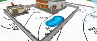
During the procedure, cadastral engineers carry out all the necessary measurements and calculations, determine the coordinates of the boundaries and the layout of the premises located on the site. All this is necessary so that the owner of the plot can obtain a cadastral passport.
Result of cadastral work
As a result of cadastral work, one of the following documents will be prepared (Article 37 of the Law on Cadastral Activities):
1) boundary plan , if work was carried out in relation to a land plot or part thereof (Part 1 of Article 22 of the Law on State Registration of Real Estate);
2) technical plan - in relation to buildings, structures, premises, parking spaces, unfinished construction projects and a single real estate complex. Such a plan is also drawn up in relation to parts of such objects (Part 1 of Article 24 of the Law on State Registration of Real Estate);
3) an inspection report , if a building, structure, premises, parking space or unfinished construction site has ceased to exist. Such a document confirms the death or destruction of an object (Part 1 of Article 23 of the Law on State Registration of Real Estate).
These documents will be prepared electronically. This is a general rule. If a plan (inspection report) in paper form is additionally required, then a condition for this should be provided for in the contract (Part 12, Article 22, Part 2, Article 23, Part 12, Article 24 of the Law on State Registration of Real Estate).
Such documents can be placed by the cadastral engineer for temporary storage in the electronic storage of Rosreestr. In this case, they do not need to be submitted for cadastral registration. It is enough to indicate in the application the identifying document number (Parts 3, 4 of Article 20 of the Law on State Registration of Real Estate).
- We recommend: Cadastral value. Definition, procedure, goals. How to find out the cadastral value?
- Administrative claim to challenge the results of determining the cadastral value
- Is pre-trial dispute resolution required when challenging the cadastral value?
Types of cadastral works in relation to land plots
The main purpose of cadastral work is the need to make a new entry in Rosreestr for a specific land plot to display all the information on it. Based on the results of such activities, a cadastral plan is drawn up, which is subject to registration in the State Cadastre.
After completing all the work and entering all the necessary data into the registers, the citizen who initiated the cadastral work in relation to the land plots has the opportunity to register ownership rights.
The passport must contain the following information:
- diagram of the site;
- cadastral number of the allotment;
- exact area of land;
- site address;
- category of land, permitted types of use;
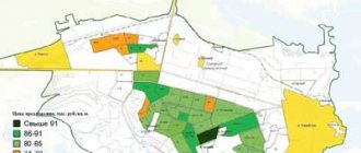
- price after cadastral valuation;
- date of registration of the site for cadastral registration;
- compliance of the location of borders with legal norms.
After the cadastral passport is issued, the land owner also receives an extract with the following data:
- what encumbrances exist on the land plot or its parts;
- indication of the exact coordinates of the site boundaries (turning points);
- exact location of boundary lines.
Such a passport must meet all the criteria that are prescribed for it in the legislation. If this document does not contain the necessary information, then registration of property rights may be refused.
If it is discovered that incorrect data has been entered into the state cadastre, then it must be destroyed, after which cadastral work is carried out to obtain true information about the plot of land.
The list of cadastral works includes the following types of activities:
- identification of all owners of a certain land plot;
- drawing up allotment layouts;
- coordination and execution of cadastral or contour survey work;
- description of the contours of the allotment;
- justification from a legal point of view of the right to the emergence of new plots of land;
- clarification of the boundaries of the site;
- clarification of the coordinates of the allotment boundaries;
- land surveying and formation of a land survey plan.
If all the work has been carried out, a cadastral number can be assigned to the land plot, which is recorded in the passport.
How the procedure works
Cadastral work in relation to land plots is carried out according to a certain scheme.
It includes the following actions:
- organizational work;
- carrying out planning work;
- field actions;
- desk work.
A sample urban development plan for a land plot for 2021 must be signed by a representative of the cadastral chamber.
Who has the pre-emptive right to purchase a land plot - see.
The organizational stage includes the preparation of information about the site, the collection of all necessary data and documentation. The commission visits the site and coordinates the project with the owners of neighboring sites.
The planning stage includes activities to formulate the project. At this time, the customer enters into an agreement with the contractors and approves the completed project.
The field stage is carried out at the site location. At this time, topographic and geodetic work is carried out. For these purposes, specialized equipment is used.
At this stage, the coordinates of the points of contact between the boundaries are established, as well as the characteristics of the contours of construction objects, if any, are located on the site.
At the stage of desk work, the data obtained during the research is processed, as well as the preparation of a boundary plan containing complete information about the current and adjacent areas.
After complete completion of cadastral work, specialists must draw up a territorial survey report. At this time, you should collect all the documents that are needed to register the site with the cadastral register. The land survey plan must be agreed upon with all land owners.
Surveying
Land surveying is complex work that is carried out directly on the territory of the land plot.
The legislation states that in order to carry out the work, the interested person must write an application. Land surveying takes place in several stages, which begin with preparatory work and end with the preparation of a survey plan.
Only those companies and specialists who have received a license to carry out such activities can carry out such work.
Land surveying is carried out in order to obtain an official document about the boundaries of the site, and therefore to give its existence legal significance.
Sample application for land surveying
Requirements for conducting
The basis for drawing up a boundary plan is considered to be a cadastral map or an extract from Rosreestr with the necessary information about the construction project. If there is no such document, then it will be impossible to register the plot of land for cadastral registration.
Such documentation should include two parts. The first one is textual. It must contain accurate data about the site (coordinates, exact size, delineation of boundaries and an agreement with the owners of adjacent plots).
The graphic part contains cartographic materials, plans for the location of the site and its boundaries.
The technical plan provides an even more detailed description of the real estate. It is necessary if there are buildings on the site.
The survey report must be drawn up by a cadastral engineer after he has inspected the site. This should be done in cases where the territory needs to be divided, united, or confirms the fact that it has ceased to exist.
Who is eligible
Only those engineers who have passed the appropriate certification in state or municipal authorities can carry out cadastral work. This can be either an employee of the Federal Cadastre or a specialist engaged in private practice. In the latter case, the customer of the work must enter into an agreement with the engineer.
Starting from 2021, only qualified specialists have the right to carry out cadastral work. There are also certain rules for registering such companies. Now, to obtain a license, such an organization must employ at least 2 highly qualified specialists.
Information about cadastral engineers can be found on the State Register website.
Complex cadastral works
Complex cadastral work - cadastral work that is carried out simultaneously in relation to all located in the territory of one cadastral quarter or the territories of several adjacent cadastral quarters (Part 1 of Article 42.1 of the Law on Cadastral Activities):
- land plots, the description of the location of the boundaries of which in the Unified State Register does not comply with the requirements of the Law on State Registration of Real Estate;
- land plots, the formation of which is provided for by the documents specified in Part 6 of Art. 42.1 of the Law on Cadastral Activities. For example, in relation to forest plots, such work is carried out only if their formation is provided for by the approved design documentation of forest plots (clause 4, part 6, article 42.1 of the Law on Cadastral Activity);
- buildings, structures, as well as unfinished construction projects, information about which is contained in the Unified State Register of Real Estate.
Complex cadastral works are not performed in relation to:
- linear objects (clause 3, part 1, article 42.1 of the Law on Cadastral Activities);
- land plots that are the subject of agreements on the integrated development of the territory (Part 5 of Article 42.1 of the Law on Cadastral Activities);
- land plots located within the boundaries of the territory in respect of which an agreement on the development of a built-up area was concluded (Part 5 of Article 42.1 of the Law);
- land plots that are the subject of an agreement on the development of the territory for the purpose of building standard housing (Part 5 of Article 42.1 of the Law);
- land plots that are the subject of an agreement on the comprehensive development of the territory for the purpose of building standard housing (Part 5 of Article 42.1 of the Law);
- land plots located within the boundaries of the territory in respect of which an agreement on its comprehensive development has been concluded at the initiative of the right holders of land plots and (or) real estate located on them (Part 5 of Article 42.1 of the Law);
- land plots located within the boundaries of the territory in respect of which a decision was made on the integrated development of the territory on the initiative of a local government body (Part 5 of Article 42.1 of the Law).
If such work has been carried out on the territory of a cadastral quarter, it is not permitted to perform it again (Part 4 of Article 42.1 of the Law on Cadastral Activities).
Complex cadastral work is carried out simultaneously in relation to all located on the territory of one or several adjacent cadastral blocks (Part 1 of Article 42.1 of the Law on Cadastral Activities): land plots, the description of the location of the boundaries of which in the Unified State Register of Real Estate does not meet the requirements of the Law on State Registration of Real Estate; land plots, the formation of which is provided for by the documents specified in Part 6 of Art. 42.1 of the Law on Cadastral Activities.
For example, in relation to forest plots, such work is carried out only if their formation is provided for by the approved design documentation of forest plots (clause 4, part 6, article 42.1 of the Law on Cadastral Activity); buildings, structures, as well as unfinished construction projects, information about which is contained in the Unified State Register of Real Estate. Such work is not performed in relation to: linear objects (clause 3, part 1, article 42.1 of the Law on Cadastral Activities); land plots listed in Part 5 of Art. 42.1 of the Law on cadastral activities, in particular areas that are the subject of agreements on the integrated development of the territory. If such work has been carried out on the territory of a cadastral quarter, it is not permitted to perform it again (Part 4 of Article 42.1 of the Law on Cadastral Activities). Why are complex cadastral works carried out? As a result of the implementation of complex cadastral work (Part 2 of Article 42.1 of the Law on Cadastral Activities): the location of the boundaries of land plots is clarified; the location of buildings, structures and unfinished construction objects on them is established (specified), information about which is contained in the Unified State Register of Real Estate; the formation of land plots on which buildings (including apartment buildings) and structures (except for linear objects) are located is ensured; the formation of public land plots is ensured, including streets, embankments, and public gardens; Correction of registry errors in information about the location of the boundaries of real estate is ensured. Based on the results of such work, a map-plan of the territory is prepared, which contains the information necessary for entering into the Unified State Register of Land Registers about land plots, buildings, structures, unfinished construction objects located within the territory where such work was carried out. Based on the approved map-plan of the territory, information is entered into the Unified State Register of Real Estate (Article 42.4 of the Law on Cadastral Activities, Clause 7, Part 2, Article 14 of the Law on State Registration of Real Estate). How are complex cadastral works carried out? The basis for carrying out complex cadastral work is a state or municipal contract (Article 42.3 of the Law on Cadastral Activities). The customer of complex cadastral works is the authorized local government body of the municipal district (urban district), and in the cities. Moscow, St. Petersburg and Sevastopol - their executive authority (Part 1 of Article 42.2 of the Law on Cadastral Activities). The performers of complex cadastral work are cadastral engineers - individual entrepreneurs or cadastral engineers - employees of a legal entity (Article 42.3 of the Law on Cadastral Activities). Other persons, including cadastral engineers working for individual entrepreneurs under an employment contract, are not entitled to perform such work. Cadastral engineers must be members of the SRO (Part 1, Article 29, Articles 32, 33 of the Law on Cadastral Activities, clause 7 of the Letter of the Ministry of Economic Development of Russia dated May 27, 2019 N 16648-VA/D23i). The cadastral chamber can also carry out such work (clause 1.2 of the Regulations approved by Order of the Federal State Budgetary Institution “FKP Rosreestr” dated July 25, 2017 N P/263). Complex cadastral work is carried out in the following order (Part 1, Subclause 4, Part 2, Article 42.6, Part 1, Article 42.10 of the Law on Cadastral Activities): the contractor develops a draft map-plan of the territory; the conciliation commission agrees on the location of the boundaries of land plots; the customer approves and submits the plan map to Rosreestr. How is a draft map-plan of a territory developed? At this stage, the performer of the work, including (Part 2 of Article 42.6 of the Law on Cadastral Activities): receives or collects the necessary documents with initial data. In particular, the contractor receives information from the Unified State Register of Real Estate, the address register, archives of local governments, the information system for supporting urban planning activities and other systems (Part 4 of Article 42.6 of the Law on Cadastral Activities); notifies the copyright holders of real estate objects in respect of which complex cadastral work is being carried out about the beginning of their implementation; submits to Rosreestr an application to enter into the Unified State Register of Information about the email addresses and (or) postal addresses of the copyright holders of the objects in respect of which complex cadastral work is being carried out; submits to Rosreestr applications for entering into the Unified State Register of information about previously registered real estate objects, information about which is not in the Unified State Register or the rights to which arose before the entry into force of the Federal Law of July 21, 1997 N 122-FZ and have not been terminated and the state cadastral registration of which has not been carried out ; prepares a draft map-plan of the territory. The requirements for the plan map are established in Art. 24.1 of the Law on State Registration of Real Estate. Its form and Requirements for its preparation are approved by Order of the Ministry of Economic Development of Russia dated November 21, 2016 N 734. How is the location of the boundaries of land plots agreed upon? Coordination is carried out if, as a result of cadastral work, the location of the boundaries is clarified (Part 1, Article 39, Part 13, Article 42.10 of the Law on Cadastral Activities): the land plot in respect of which these works were carried out; adjacent land plots, information about which is included in the Unified State Register of Real Estate. The boundaries are agreed upon by a conciliation commission. After the work of the conciliation commission, the contractor draws up a draft map-plan of the territory in the final version (clause 6, part 2, article 42.6 of the Law on Cadastral Activities). We believe that the contractor transfers this document to the conciliation commission, and it sends it to the customer for approval (see Part 19 of Article 42.10 of the Law on Cadastral Activities). How is a territory map approved and submitted to Rosreestr? The contractor presents to the customer (clause 5, part 2, article 42.6 of the Law on Cadastral Activities): a draft map-plan of the territory for consideration and approval; information about objects identified within the boundaries of the territory where complex cadastral works are carried out, specified in Part 4.1 of Art. 42.1 of the Law on Cadastral Activities (if any); information on the possibility of forming land plots on the territory of complex cadastral works, provided for in Part 4 of Art. 42.8 of the Law on Cadastral Activities (if any). If the boundaries have been agreed upon, then the draft plan map in the final version and the necessary documents for approval of the plan map are sent to the customer by the conciliation commission (Part 19, Article 42.10 of the Law on Cadastral Activities). The customer of complex cadastral works approves the map plan of the territory and sends it to Rosreestr (clause 3, part 1, part 8, article 42.6 of the Law on Cadastral Activities, part 3, article 19 of the Law on State Registration of Real Estate). How should the property owner proceed when carrying out complex cadastral work? The work contractor sends notices to the copyright holders of real estate objects in respect of which complex cadastral work is being carried out to the addresses contained in the Unified State Register of Real Estate (if available) (Part 2 of Article 42.7 of the Law on Cadastral Activities). In addition, you can find out about the start of work, in particular, on the website of Rosreestr and on the website of the bodies commissioned by which complex cadastral work is carried out (Part 1, Article 42.7 of the Law on Cadastral Activities). The detailed information procedure is given in Art. 42.7 of the Law on Cadastral Activities. Copyright holders can, in particular: 1) within 30 working days from the date of publication of the notice, provide the contractor in writing (Part 6, Article 42.7 of the Law on Cadastral Activities): information about the address and (or) email address of the copyright holder. For example, if the address has changed or it is more convenient to receive information by mail, the address of which is not in the Unified State Register of Real Estate; duly certified copies of title documents for previously registered real estate objects, information about which is not in the Unified State Register of Real Estate, or the rights to which arose before the entry into force of the Federal Law of July 21, 1997 N 122-FZ and have not been terminated and the state cadastral registration of which has not been implemented; 2) require the contractor to indicate on the ground the location of the boundaries of the land plots in accordance with the prepared draft map-plan of the territory. The contractor must do this free of charge (Part 5 of Article 42.6 of the Law on Cadastral Activities). Please note that when the location of the boundaries of a land plot is clarified, its area may change. However, the law establishes minimum and maximum parameters for a possible reduction or increase in the area of the site. In particular, as a general rule, the area of a land plot as a result of clarification of boundaries can be reduced by no more than 10% compared to that indicated in the Unified State Register. If the area of a plot has decreased by more than 10%, information about such a plot is included in the map-plan of the territory only with the written consent of the copyright holder with the results of comprehensive cadastral work. Such consent is included in the annex to the map-plan of the territory (Part 5 of Article 42.8 of the Law on Cadastral Activities). Without such consent, the implementation of state cadastral registration is suspended (clause 32.1, part 1, article 26 of the Law on State Registration of Real Estate); 3) require the cadastral engineer directly performing complex cadastral work to confirm his authority. The cadastral engineer is obliged to submit, in particular, a certified copy of the state or municipal contract and an identification document (Part 7, Article 42.6 of the Law on Cadastral Activities). Rights holders of real estate objects in respect of which complex cadastral work is being carried out cannot interfere with the implementation of complex cadastral work. Moreover, they are obliged to provide the executor with access to real estate (Part 6, Article 42.6 of the Law on Cadastral Activities).
The result of complex cadastral work
As a result of carrying out complex cadastral work (Part 2 of Article 42.1 of the Law on Cadastral Activities):
- the location of the boundaries of land plots is specified;
- the location of buildings, structures and unfinished construction objects on them is established (specified), information about which is contained in the Unified State Register of Real Estate;
- the formation of land plots on which buildings (including apartment buildings) and structures (except for linear objects) are located is ensured;
- the formation of public land plots is ensured, including streets, embankments, and public gardens;
- Correction of registry errors in information about the location of the boundaries of real estate is ensured.
Based on the results of such work, a map-plan of the territory is prepared, which contains the information necessary for entering into the Unified State Register of Land Registers about land plots, buildings, structures, unfinished construction objects located within the territory where such work was carried out. Based on the approved map-plan of the territory, information is entered into the Unified State Register of Real Estate (Article 42.4 of the Law on Cadastral Activities, Clause 7, Part 2, Article 14 of the Law on State Registration of Real Estate).
Legislative aspect
The legislation defines complex cadastral work as an activity that is carried out on all sites located within the cadastral quarter at the same time.
These areas include:
- plots, information about which in the Unified State Register of Real Estate does not comply with the law regarding the location of their borders (Law No. 218-FZ);
- territories occupied by public facilities (squares, embankments, boulevards, streets), if their placement was approved by resolutions of the town planning commission;
- objects of completed and unfinished construction, if the rights to such activities are given by Law No. 218-FZ.
When performing complex cadastral work, the following goals are pursued:
- more precise designation of allotment boundaries;
- the location of construction projects on land plots is established;
- the formation of new land plots on which buildings are located, including residential buildings (with the exception of linear objects);
- formation of a plot of land allocated for common use;
- errors that were made in the registry are corrected.
To carry out complex cadastral work, there is a certain procedure. It is allowed to repeat the procedure for the cadastral quarter.
Layout of the land plot