February 24, 2019
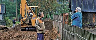
Land disputes are one of the most difficult categories of cases for an ordinary citizen, while at the same time being one of the most pressing. Neighborhood conflicts over land sometimes last for years, resulting in several courts, enormous costs and a lot of frayed nerves, especially if both sides neglect legal assistance.
What to do if it is not possible to coexist peacefully with your neighbors, and a dispute over land issues turns into a serious conflict? Article 64 of the Land Code directly establishes that all land disputes are subject to judicial review. The law, however, does not prevent neighbors from reaching an agreement amicably, but such an outcome of the case is only possible with the participation of experienced lawyers on both sides who are able to convey to the disputing parties all the destructiveness and burdensomeness of the judicial conflict.
If one of the parties categorically does not make concessions, the only way out will be a trial.
How does a land dispute begin?
A neighbor's land dispute is not always a claim over a tomato bush planted between them. Conventionally, we can distinguish the following types of land conflicts that may arise among people living nearby:
• Seizing your neighbor's land. Intentionally or due to an error in documents, one of the neighbors “appropriates” part of the land plot belonging to the adjacent landowner. Each side considers itself to be the only right, and the truth will only have to be sought in court, especially if something has already been built on the captured land;
• Conflict when agreeing on boundaries. Article 39 of the Federal Law “On the State Real Estate Cadastre” (N 221 of July 24, 2007) establishes that the location of the boundaries of land plots must be agreed upon with interested parties. This is necessary in cases where, as a result of cadastral work, the location of the boundaries of a land plot is clarified or the boundaries of adjacent plots, information about which is included in the state real estate cadastre, are clarified. It also happens that neighbors live for years without problems, but they arise when trying to legalize the ownership of land by one of the owners. According to the documents, it may well turn out that someone is using land that is not theirs.
• Violation of sanitary and fire control requirements. For any building, be it a barn or an outdoor toilet (especially for it), there are quite strict requirements prescribed in SNiPs. If one of the neighbors violated them by placing the building too close to the border of another land user, then the problem will only have to be resolved in court.
When land surveying is the cause of conflict
Most often, conflicts arise when land surveying is ordered by one of the neighbors or jointly (for example, when owning a residential building and a plot of land in common shared ownership).
It is during land surveying that the following problems are identified that can inevitably lead to conflict:
1. Errors in cadastral documentation, including cost. If the cadastral documentation contains inaccuracies, this can lead to both a change in boundaries and an increase in land tax for one or both owners. Another feature: during cadastral registration, no one finds out the position of neighbors, which often leads to erroneous data entry.
2. Contradiction of factual circumstances with those in the documentation. Incorrect boundaries, erroneous location of buildings, objects not put into operation or erected without permission - all this is revealed during land surveying and becomes the subject of conflict between neighbors.
3. A neighbor’s opposition to measurements or unauthorized seizure of part of the territory with the creation of obstacles to cadastral engineers during land surveying. Here, as in the cases listed above, if an agreement is not reached, the parties will have to go to court.
What is trespassing?
Violation of land boundaries is an erroneous or deliberately dishonest attitude of one land owner towards another land owner. It is considered a violation of property rights protected by the state on the basis of Article 35 of the Constitution of the Russian Federation, Chapter 17 of the Civil Code, Chapter 3 and Chapter 4 of the Land Code.
Recognition of land survey as invalid can be made to any title owner from among:
- owners;
- owning on the basis of permanent (perpetual) use;
- those who own on the basis of lifelong inheritable ownership;
- tenants;
- municipal and federal authorities.
Most of the violators include citizens who own adjacent plots of land and use the border of the land plot at their own discretion, causing damage to their neighbors through their actions. Sometimes such cases include the actions of persons who encroach on adjacent territory that is in joint use and belongs to the municipality.
How to resolve a land dispute between neighbors: step-by-step instructions
Before the conflict comes to court, the parties (or at least one of them) try with all their might to resolve it on their own. Sometimes this does not make any sense and it is better to immediately start preparing a claim, but in some cases you can achieve protection of your rights without going to trial.
1. Determining your position and causes of the conflict
Understand what your or your neighbor's complaint is and what it involves. If there is an error in the documentation, request the correct document, if possible. A cadastral error, for example, cannot be corrected with a simple request - you will still have to go to court.
In cases where the cause of the conflict is personal interest or “working on principle,” take an interest in legal information and first consult with a lawyer. Ideally, a written opinion from a lawyer. If the subject of dispute is only the boundaries of the site, conduct a joint survey that will help establish or restore them.
2. Sit down at the negotiating table
It is better to start resolving any conflict with negotiations. Abstract from emotions and try to calmly, without swearing, talk about the causes of the problem and options for solving it. Explain to your neighbor that escalating the conflict and bringing it to court is fraught not only with significant expenditure of time and money, but also with a not always predictable result. Provide your lawyer's arguments as support.
3. Involve the municipality in resolving the dispute
Each municipality has a number of different departments and commissions that can help resolve the dispute.
For example, the administrative commission monitors the implementation of regional laws, landscaping rules and other norms, and therefore can hold a neighbor accountable for any violations - for example, storing building materials on the boundary of the plot in front of the neighbor's house.
The land department of the city government (the department itself and the positions of its employees may have different names), responsible for considering complaints from citizens on land management issues, can give a written opinion on your appeal regarding the conflict.
Almost always, specialists will go to the site, inspect problem areas and give their recommendations for resolving the dispute.
Alas, unlike a court decision, even the conclusion of municipal authorities based on the law is not unconditionally binding on the conflicting neighbor. If all else fails, get ready for trial!
Is it possible to challenge land surveying?
In case of dishonest actions of the owner who draws the boundaries of the land plot by land surveying, it is permissible to file a claim in court. In this case, the culprit may be either the owner of the adjacent land plot or the cadastral engineer who committed the violation.
The algorithm of actions is as follows:
- File a formal complaint with the geodetic company that carried out the survey, or with the State Committee for Land Survey at the location of the site.
- At the place of application, submit an application with a request to correct a cadastral error or other violations that infringe on the civil and property rights of the plaintiff.
- If the injured person receives a negative official response, go to court on its basis.
- If no official document is forthcoming, then it is permissible to file a claim one month after the application.
- Apply to the district court with an application, collecting the required documents and paying the fee.
- In court, act against the guilty person, who may be a cadastral engineer.
- If the court makes a positive decision, based on this, demand the restoration of the borders. otherwise, it is permissible to file an appeal.
Based on a positive court decision, a new survey will be carried out . For a successful outcome of the case, you will need to collect reports from independent experts, who can be cadastral engineers from other geodetic companies, or submit a corresponding request to the State Property Committee department.
Reasons for disagreement
Neighboring land users refuse to sign the boundary approval act when they do not agree with the location of the boundaries determined by the cadastral engineer.
This may happen for the following reasons:
- Changing the current boundaries after the measurements taken;
- The presence of the fact of imposing boundaries;
- Contradictions in the work of cadastral engineers hired by neighbors;
- The desire of the parties to increase the area of their plots;
- The presence of a dispute between heirs when dividing the land plot into shares;
- Errors in the work of the geodetic service.
Between neighboring plots that are not separated by a passage or driveway (especially in gardening communities), the border usually exists in the form of a symbolic fence or a stretched mesh, on both sides of which plants are planted.
Even a slight shift of such a boundary can lead to the need to carry out work to dismantle the installed mesh and other inconveniences.
This can be avoided by mutual agreement of the parties, but if the customer of the work or the interested party decided in principle to establish boundaries accurate to the centimeter, disagreements cannot be avoided.
When inheriting one piece of land by several heirs,
boundary work to divide the plot into separate plots, the areas of which are proportional to the shares of the heirs, and disputes arise when determining the location of new boundaries between the newly formed plots, especially when there is an uneven distribution of buildings and plant crops on the inherited plot.
If the newly measured boundaries turn out to be superimposed on the boundaries of a neighboring area as a result of various reasons, for example, errors in calculations, then this also leads to disagreements.
Time limits for consideration of an application for subdivision of a land plot
The Land Code (Article 39.29) establishes the following deadlines for consideration of an application for the addition of a land plot:
- total period 30 working days
- extension of the period to 45 working days (if additional documents are needed)
- The deadline for returning an incomplete set of documents is 10 days .
After the application is accepted, an agreement is concluded that the municipality is not against increasing your land.
Land survey disputes - procedure
To survey the property, the owner is obliged:
- contact a geodetic organization and conclude an agreement with it on carrying out the necessary land surveying work;
- notify the owners of all plots with which his lands do not have a boundary (their presence is a prerequisite, since they are required to express their oral or written consent to the boundary).
Arriving cadastral engineer:
- measures the area of the site;
- records the obtained values in the survey report (the document is signed by the surveyor, the owner of the site, neighbors, representatives of local authorities).
After the specialists leave, the owner contacts the organization’s office to issue him a land survey plan. It takes up to 30 days to develop it. The customer is notified in advance of the deadline for drawing up the document at the stage of the boundary procedure.
Having collected this package of documents, the owner submits it to the State Register for registration.
If the boundaries of the property are changed after the documents have been submitted and all changes have been made, the survey will be carried out again. If the owner does not do this, he will not be able to exercise his right to use the site. It will be difficult to sell, lease legally, as well as perform any manipulations requiring official registration with such land, since its actual status will not be determined (there is no boundary).
Land control of unauthorized land seizure
Supervision in the field of land legal relations falls within the competence of the bodies of Rosreestr and its territorial departments. Issues of squatting are referred to the activities of state inspectors for the use and protection of lands of the corresponding territorial entity.
Inspections are usually carried out on the basis of plans that are subject to agreement with the prosecutor's office. This applies not only to organizations and individual entrepreneurs, but also to individuals who are land owners.
The inspections are caused by the need to confirm the presence of offenses in the land sector in the municipality. Certain individuals and officials are assigned the corresponding administrative responsibility for the exploitation of someone else's land in the absence of the necessary title documentation for the site.
Unauthorized seizure of territories, as a rule, occurs due to the lack of appropriate measures for land control from the municipality, and leads to administrative liability. To avoid penalties, contact the local administration and register the rights to the exploited land in the manner prescribed by law.
The procedure for conducting an inspection by land control
The basis for an inspection by land control authorities is a statement of squatting of land that does not belong to the violator.
The inspection order must contain the following information:
- offender, his place of residence;
- location of the land and its unique number according to the cadastre;
- who is authorized to carry out this inspection;
- purpose of the procedure. In these circumstances - state land supervision over the exploitation of land ownership by a specific person on the basis of an application received from a citizen;
- the objectives of the event are to comply with the norms of land law, regulations on the protection of land plots and land use;
- the subject of the procedure is the implementation of regulations for the exploitation of land holdings, enshrined in the norms of state and municipal legislation;
- deadlines for completing the inspection;
- designation of the legal basis of the event.
Notifying the person for whom the procedure is planned about the inspection
The chief state inspector for the use and protection of land or a person replacing him is obliged to notify the citizen in respect of whom the inspection will be carried out about the upcoming event. The notice and a copy of the order regarding the planned inspection are sent to the place of residence of the person concerned by registered mail with return receipt requested or by other possible means.
State land supervision consists of several stages, which are as follows:
- planning an event based on an application submitted by a citizen;
- issuing an order to verify compliance by persons with the requirements of land legislation;
- coordinating the unscheduled inspection with the prosecutor's office (if necessary);
- execution of the procedure, preparation of inspection results.
How to legalize the addition of a plot of land for free
Attaching a land plot to the main one is an increase in the size of the land plot at the expense of adjacent lands. Not every owner is aware that he can legally register an addition to a land plot and receive additional land ownership free of charge. How to legalize the cutting of a plot of land for free, you ask? In fact, the law allows the increase of a land plot by no more than 10% of its area at the expense of municipal lands. But there are also caveats. It is important that the land is not privately owned and under encumbrances; in addition, local authorities have the right to legally establish additional restrictions on the size of the addition of land plots. In any case, the registration of the addition of a land plot should be legalized by submitting the necessary documents to the Rosreestr authorities.
How to register the addition of a land plot in accordance with the Land Code
The Land Code does not contain such a concept - the addition of a land plot. Redistribution of land plots is commonly called redistribution. According to the general rules for the formation of land plots (Article 11.2 of the Land Code), there are several types of formation of new land plots:
- Allocation;
- An association;
- Redistribution;
- Chapter.
In the article we will not consider each of these types in detail, but we will talk in more detail about redistribution, or more precisely about how the addition of a land plot in 2021 occurs due to the area of adjacent lands, and how the size of a land plot can be legally increased.
Documentation
To install a boundary post and avoid a dispute over the boundary, you need:
- documents on ownership and right to use land;
- passport of the person who expressed a desire to carry out land surveying;
- application (submitted to a company licensed to conduct geodetic measurements);
- cadastral passport (if you don’t have it on hand, an extract from this document can be a replacement);
- boundary plan;
- a certificate confirming the presence or absence of public communications in the intervening territory (water supply, gas pipe, telephone cable may cause a dispute).
The specific list of papers depends on the region, the nature of the boundary dispute, and the economic purpose of the plot to be demarcated.
Note! In order not to return to the controversial issue of boundaries in the future, special boundary signs (poles) are installed between nearby areas. It is illegal to independently move boundary markers in any direction. If this happens, then the land surveying procedure will have to be repeated (moving the boundary post is a reason for a dispute in court on the issue of land surveying).
Boundary plan and project
Issues of determining the area of an allotment and its ownership are under the control of regional executive authorities. Responsible for issues of land management and land resources.
Employees of these authorities issue a technical passport to the owner, determine the boundary plan and draw up an act of control over their safety. They do not resolve land survey disputes, but they make every effort to ensure that they do not arise.
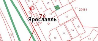
A boundary plan is a document that indicates the exact dimensions and boundaries of the property, lists access roads, as well as engineering buildings of public importance.
The boundary plan is the basis for compiling the cadastral register and is presented in the form of text and graphic drawings. It is being developed by an organization that the property owner has entrusted with geodetic surveying.
Data about the land survey site (size, boundaries, access routes, presence of water supply, gas pipe, etc.) are included in the land survey plan only after the land survey project has been approved. Work in the field of land surveying is carried out by a cadastral engineer, guided by the current norms of the legislation of the Russian Federation.
The main law regulating land surveying issues is currently Federal Law No. 78-FZ dated June 18, 2001 (as amended on July 13, 2015) “On Land Management” (as amended and supplemented, came into force on 01/01/2016).
After drawing up the design part of the boundary plan, the engineer submits it for review and further approval by the owner. If there are several of them, then the boundary draft, in order to avoid a boundary dispute, is sent for approval to everyone who has a property interest.
As soon as the owner has signed the boundary project, he has the right to apply for a certificate of ownership of the property with all the changes made. New information about land surveying is entered into the cadastral register, where it is stored until subsequent changes are made.
The land surveying procedure is carried out only if documents are available.
To avoid quarrels with neighbors, they are informed about the upcoming measurement of the land area no later than 7-8 days before the survey engineer appears on the site. Having received such a notification, the neighbor is deprived of the opportunity to start a land survey dispute based on his lack of information about the upcoming land survey.
Dispute resolution methods
Methods for resolving boundary disputes with neighbors can be divided into two groups:
- Pre-trial;
- Judicial.
Often, disagreements that arise can be resolved through an amicable agreement with neighboring land users, and for this it is important to establish the cause of such disagreements.
The main methods of pre-trial settlement include:
- Settlement agreement;
- Contacting the prosecutor's office;
- Conducting an independent examination;
- Contact the owner of the leased plot.
If the reason for the disagreement is clear and the neighbor who refuses to sign the boundary agreement puts forward territorial claims, then in some cases it makes sense to make concessions, while weighing the consequences of litigation and the feasibility of the neighbor’s demands.
It is important to clearly understand who has the legal right to disputed boundaries.
Carrying out an additional independent examination will help convince interested parties that a court decision will only confirm the calculations made, and the parties will only waste time.
In the event of participation in a boundary dispute between interested parties who are tenants of neighboring plots, then contacting the land owner for a signature in the approval act will help solve the problem, since the owner of the plot has a preferential right to resolve land disputes compared to the tenant, especially when such owners are state or municipal authorities.
Sublease of a land plot is possible unless prohibited by the lease agreement. Do you need to convert residential premises into non-residential ones? Here we have explained in detail how to do this correctly.
What is the program for relocating communal apartments from St. Petersburg and is it still in effect? Find out about this in our article.
What documents are needed to approximate a plot of land?
The desire to increase the land plot is not enough; action must be taken. To begin with, find out from the local authorities the nuances of restrictions on the size of the addition of a plot of land in your area, and what documents are needed for the addition of a plot of land in your municipality.
The main documents are:
- Application for cutting (redistribution)
- Agreement
- Extract from the Unified State Register of Real Estate
- Land surveying project or site layout diagram
- Title documents for land.