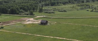
Briefly about boundaries, turning points and coordinates
The boundaries of a land plot are determined using geodetic equipment. Each point has its own coordinate, which is calculated by measurements on the ground and subsequent processing of the device data.
Thus, all turning points of a land plot, whether there are 4, 5 or 10 of them, have their own digital designation and are contained in the Unified State Register of Real Estate extract.
In order to quickly find out where the boundaries of the desired area are located by coordinates, you need to order the service: “Placement of boundaries in nature” - this service is provided by geodetic and cadastral companies for a fee.
Let's consider several ways to search for the boundaries of a site by coordinates yourself, using the available data and tools.
How to find out coordinates using Google Maps
The easiest way to find out Google coordinates is using the desktop version of maps. This can be useful if you need to send some point from home.
To do this, go to maps.google.ru. It will instantly detect your location and show it at the bottom of the page.
If you need the coordinates of any other point, then find it on the map and click: the data will appear below again.
Coordinates from the USRN extract x and y
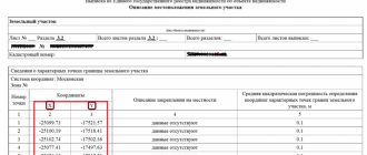
If you order an extended EGRN extract for a land plot, then in section 3.2 of the extract we will see information about the characteristic points of the boundaries of the land plot in the form of a set of numbers.
The coordinates in the Unified State Register are contained in the local system (in our example, the coordinate system is Moscow).
Is it possible to find the boundaries of the site yourself, knowing these coordinates and how to do it?
Interpretation of the format
Most modern online maps present latitude and longitude as decimals - in the "degrees, fractions of degrees" format. After the comma, 5-6 characters are indicated for accuracy of definition.
For example, 23.135435 -82.412522.
Note the presence of a negative value. In this case it is interpreted as:
- “+” in latitude indicates the northern hemisphere, “-” – the southern hemisphere;
- “+” in longitude is the eastern hemisphere, “-” is the western hemisphere.
You can also find coordinate records in the format “degrees, minutes, seconds” (example – 41°24’12.2″N 2°10’26.5″E) and “degrees, minutes and fractions of minutes” (55°38.288’N 37°28.816 'IN).
How to find a site by xy coordinates on a map
If you have data from a local coordinate system, then most likely you received it from an extract, which means you have a cadastral number for the land plot. Using the cadastral number, it is easy to determine where exactly the plot is located - you just need to enter it into the search engine of the public cadastral map and you will see not only the location of the land plot, but also its description (address, category of land, cadastral value, area, etc.)
But, if you only have coordinates, then the situation is more complicated.
To find a site using X, Y coordinates, they should be converted to geographic coordinates. To do this, there are a lot of free and paid services for converting coordinates from one system to another on the Internet.
However, keep in mind that the recalculation (especially the free one) will be approximate and the data of such coordinates may have a range of plus or minus a couple of meters, or even more.
If you have the cadastral number of the plot, then you can find its geographical coordinates on the same public page - we wrote detailed instructions on how to do this in a separate article.
In short, move the cursor over the corner of the land plot of interest and click the mouse - the search engine will display the geographical coordinates. See photo below.
It sounds intimidatingly difficult, but in fact everything is done with 3 touches of the screen of your mobile device.
Almost every mobile phone has a GPS module.
You just need to turn it on with one touch.
On my phone, GPS is enabled in the top menu.
Then we launch the downloaded KadastrRu application.
The application displays a map that you can navigate, zoom in and out.
I usually, while still in the office, write down the cadastral numbers of land plots that are located next to the vacant plot of land that interests me.
Then, having arrived at the area, I indicate the number of the neighboring site in the search bar of the KadastrRu application.
CadastreRu immediately loads the area around the land plot whose cadastral number I entered into the search.
Then all that remains is to activate the GPS button in the application with just 1 touch.
The GPS button in the application is a circle with dashes, similar to an optical sight. Displayed in the upper right corner, above the zoom in and out buttons.
After activating GPS, a blue dot begins to pulsate on the map of the KadastrRu application, which shows my location.
Depending on the selected scale, the pulsating point on the application map reacts to movement in literally 5-10 steps.
That is, you can see how a point on the Public Cadastral Map moves when moving on the ground.
Walking around the perimeter of a free plot of land, I see my own location on the Public Cadastral Map on my mobile phone.
In other words, while on a plot of land, you can see your location relative to other plots of land, the boundaries of which are reflected on the public cadastral map.
While moving around the area, you can observe in real time how the point showing your location moves on the public cadastral map.
Thus, taking as a guide the boundaries of someone else’s land plot, which is displayed on the Public Cadastral Map, it is possible to determine on the ground the exact location of the vacant land plot.
Now I don’t have to speculate about the real location on the ground not only of a free plot of land, but of any plot of land.
The need to navigate by the stars also disappeared.
For me, searching for available land has become easier, more interesting and more productive.
And in conclusion, it is worth mentioning one more useful property.
The KadastrRu application can calculate the area of the land plot you have found.
By simply touching the screen, you can set several arbitrary points on the Public Cadastral Map and the application will immediately show the area of the contour.
By placing dots around the found plot of land, you can immediately determine its exact area.
In other words, having found a free plot of land, you can immediately calculate its area on the ground in 10 seconds.
Knowing the area of a plot of land immediately on the ground can be very important if the plot is not very large in size.
For example, you want to get a plot of land to build a house.
At the same time, you know that according to the Land Use and Development Rules of your locality, the minimum area of land for individual housing construction cannot be less than 4 acres.
Having found a small plot of land on the ground, you can immediately determine its area, and understand whether it is worth filing an application for this plot or whether it is pointless, because the plot turned out to be less than 4 acres.
If the size of the land plot exceeds 4 acres, then you can independently prepare a plot diagram for preliminary approval of the provision of land.
In addition to calculating the area, the KadastrRu application can calculate the distance between two arbitrary points.
Measuring distance on the ground can be very useful, because very often you need to find out:
- exact distance between adjacent areas,
- the distance between the boundaries of your site
- or you need to measure the length of the access road to the site.
KadastrRu copes with these tasks easily.
I hope you found the article useful.
Let me remind you that after you have found a free plot of land, you need to act correctly and thoughtfully, because administration officials, unfortunately, are not eager to give you free land.
Step-by-step instructions will help you act easily and correctly, pushing through bureaucratic refusals, because it contains the secrets of obtaining land plots in modern conditions.
How to determine the coordinates of a plot of land using a smartphone
We have all been using GPS navigation for a long time. However, it is worth understanding that telephones operate on a simplified system and do not always reflect the area as it really is. Surely you have encountered at least once the fact that the navigator periodically “goes stupid” and gets lost on the road. The same thing happens when you try to find the desired coordinate on the ground.
In phones, cell towers are usually used to improve accuracy; in fact, this leads to an error of several meters. Of course, if the plot measures tens of hectares, then this deviation is negligible, but if you want to know the area or boundaries of a plot of 5-6 acres, then the difference in fact will be colossal.
If you still decide to use your phone and use it to determine the coordinates, then use a navigation program - save or write down the geographic coordinates of each point on the ground, and then using these coordinates, find the location of the site on the public cadastral map and make sure whether the actual boundaries coincide with borders of the map.
How to find out coordinates on Yandex.Maps
One of the universal tools suitable for all operating systems. You can download the application from Google Play or the App Store.
Log into the application, having previously turned on the geo-positioning mode. Allow cards to access it. After this, the application accurately determines the location. Finding out the coordinates on Yandex is easy: just click on the dot and they will appear below. Using the icon to the right of the coordinates, you can copy and forward them.
How to determine the boundaries of an allotment by coordinates
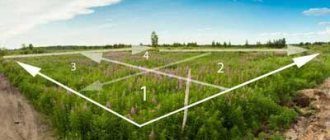
The coordinates of the plot allow you to obtain information not only about the territorial location of the land plot. With their help, you can determine the actual perimeter of the allotment boundary. Based on these data, the result of land surveying work is established.
If no survey was carried out
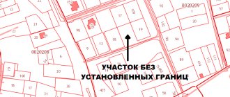
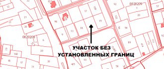
Depending on the circumstances of a particular situation, land surveying was not carried out for some areas. In this case, the boundary of the site and other data about it will not be displayed on the map.
In order for the land to be included in the register, the owner or other interested party must comply with all the requirements established to resolve such issues:
- an application is submitted to the territorial department of the cadastre, the subject of which is a request to establish the coordinates of the site;
- all necessary documentation is prepared;
- payment for all procedures and receipt of survey results.
In case of disputes
If disputes arise between owners regarding the boundaries of certain plots, they can be resolved by concluding an individual agreement between the parties. If consensus cannot be reached, the interested party may file a claim in court.
During the trial, information about the actual location of the border of adjacent areas will be clarified and a procedure for re-landmarking will be prescribed. A court decision that has entered into force is final and cannot be appealed.
According to the documents
The boundaries of the plots are determined by studying documents containing information about the perimeter of neighboring land plots. Taking into account these data, a conclusion is drawn about what the boundary of the claim area will be.
Work carried out on the ground is carried out on the basis of information obtained from documents. The cadastre worker relies on it when calculating the base points of the land perimeter.
Learn more about GPS coordinates
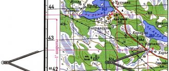
Latitude is divided into 180 degrees. The equator is located at latitude 0 degrees. The North Pole is at a latitude of 90 degrees, and the South Pole is -90 degrees.
Longitude is divided into 360 degrees. The Prime Meridian, which is located in Greenwich, England, has a longitude of 0 degrees. From this point a distance is measured to the East and West, extending 180 degrees East and −180 degrees West.
Minutes and seconds are smaller increments of degrees. They allow you to obtain more accurate coordinates. Each degree is equal to 60 minutes, and each minute can be divided into 60 seconds. Minutes are indicated by an apostrophe (') and seconds by double quotation marks ().
How to get coordinates in Google Maps app
You can also get GPS coordinates from the Google Maps mobile app on your mobile device. It works on both Android and iPhone, but the steps are slightly different for each.
If you 're using Android , you'll see the coordinates at the very top of the screen.
- Open the Google Maps app and select and hold a location until you see a red pin.
- Look in the search box at the top of the screen to find the coordinates.
If you 're using an iPhone , you'll find the coordinates at the bottom of the screen when you open location information.
- With the Google Maps app open, select and hold the point on the map where you want to place the red pin.
- Select the top of the information map at the bottom of the screen to display location details, including coordinates.
- Select and hold coordinates to copy them.
